
Rain was expected increase to rate of a third of an inch per hour across the Los Angeles region Saturday, as the steady overnight drizzle was expected to ratchet up several notches, the National Weather Service said at midmorning.
Up to a third of an inch of rain per hour was expected at midday, and even harder rain was deemed likely Saturday night.
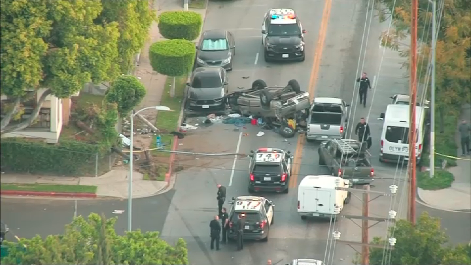
CHP Officer Ed Jacobs said there were 264 crashes on L.A.-area freeways and roads in CHP jurisdiction areas between 5 a.m. and 9 a.m Saturday, compared to just 48 during that same time period last week.
Watch commanders at the sheriff's Crescenta Valley station said experts are closely monitoring the Paradise Valley area -- along Ocean View Boulevard and on Briggs Terrace -- for any possible flooding. Word was passed to residents by a multi-agency task force that about 2.6 inches of rain was likely, which is below the threshold for flooding.
That area was hard-hit last year, when a huge boulder plugged a storm basin's drain and sent a muddy slurry of brushfire debris down the canyon. That basin, and most of the dozens of others near the Station Fire area, have been cleared in advance of this year's wet season. Meteorologists said the approaching big low-pressure system will have several impulses of unsettled weather, which will activate heavier rain from the stream of warm, wet air moving in from subtropical waters off Hawaii. Southern California is thus expected to be continuously rainy through Monday, and another storm may hit Wednesday.
Overnight, steady rain soaked the Southland at a moderate rate. The official gauge at Los Angeles International Airport captured .14 inches in the 12 hours ending at 8 a.m., and .13 fell at the downtown station at USC.
A station in the hills above Zuma Beach captured .78 inches of rain, and Tonner Canyon near Diamond Bar received .59 inches. The Clear Creek Ranger Station north of Mount Wilson measured .46 inches, and Van Nuys got .38 inches in that period.
Local
Get Los Angeles's latest local news on crime, entertainment, weather, schools, COVID, cost of living and more. Here's your go-to source for today's LA news.

County flood experts warned that this weekend's storms will leave 2.6 inches of rain in the Station Fire area, and 2.4 inches of rain in the hills above Malibu that burned four years ago.
That may not be enough to cause hills to move, but the slow and steady rain will saturate fire-denuded or otherwise vulnerable canyon and foothill neighborhoods below mountains left bare by the 2009 Station fire, leaving them vulnerable when the heaviest storm arrives Tuesday night, the NWS said.
In the San Fernando and San Gabriel valleys and surrounding foothills, the NWS issued a flash flood watch, effective Saturday through Sunday evening. The major roads traversing the Angeles National Forest, except for Angeles Crest Highway, were closed in advance of the storm and are expected to stay closed until early Sunday at least.
The region could get a breather on Monday, but several more inches of rain -- an additional 3 inches or more along the coast and perhaps double that in the foothills and mountains -- are forecast for Tuesday and Wednesday. Winds will be out of the south and southwest.
In trouble spots, such as La Canada-Flintridge, where the roads are lined with K-rails to divert mud and water flows, residents along Ocean View Boulevard and other flood-prone roads were urged to move their cars off the road.
Because the storm is tapping into relatively warm moisture over the ocean, snow will fall only on the highest peaks in the San Gabriel and San Bernardino ranges. Rain is predicted at elevations of about 8,000 feet and below.
