Earth as Art: USGS Images Capture Dramatic Landscapes From High Above
•
New images offer dramatic perspectives on mountains, deserts, rivers and other landscapes that make up Earth.
20 photos
1/20
USGS
Brilliant images from high above are part of the USGS's Earth as Art collection.
2/20
USGS
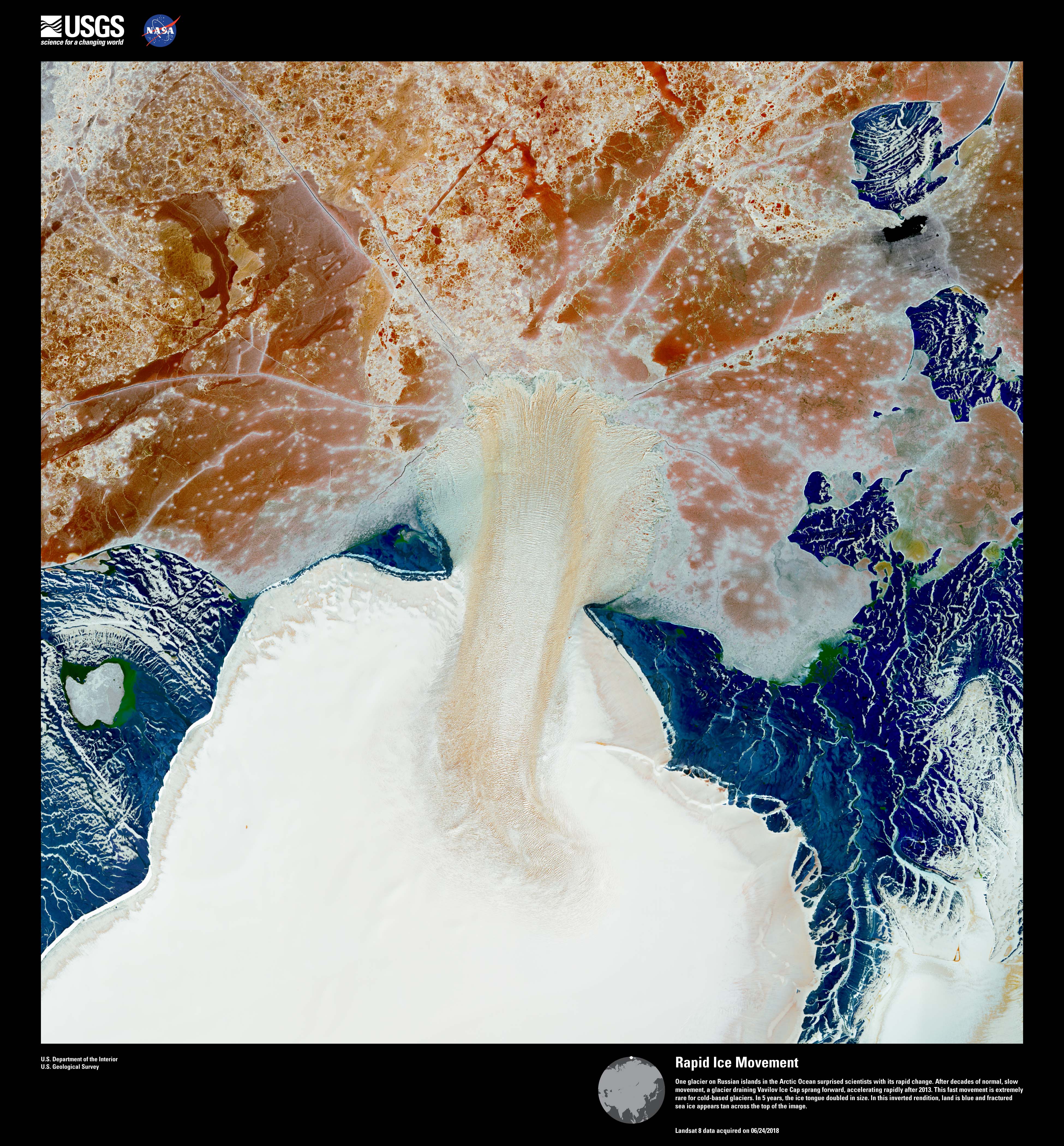
This image of Russian islands in the Arctic Ocean shows an ice tongue jutted out from a glacier. The tongue doubled in size over five years. Land is blue and fractured sea ice appears in tan, making for what looks like a tree growing out of a snowy landscape.
3/20
USGS
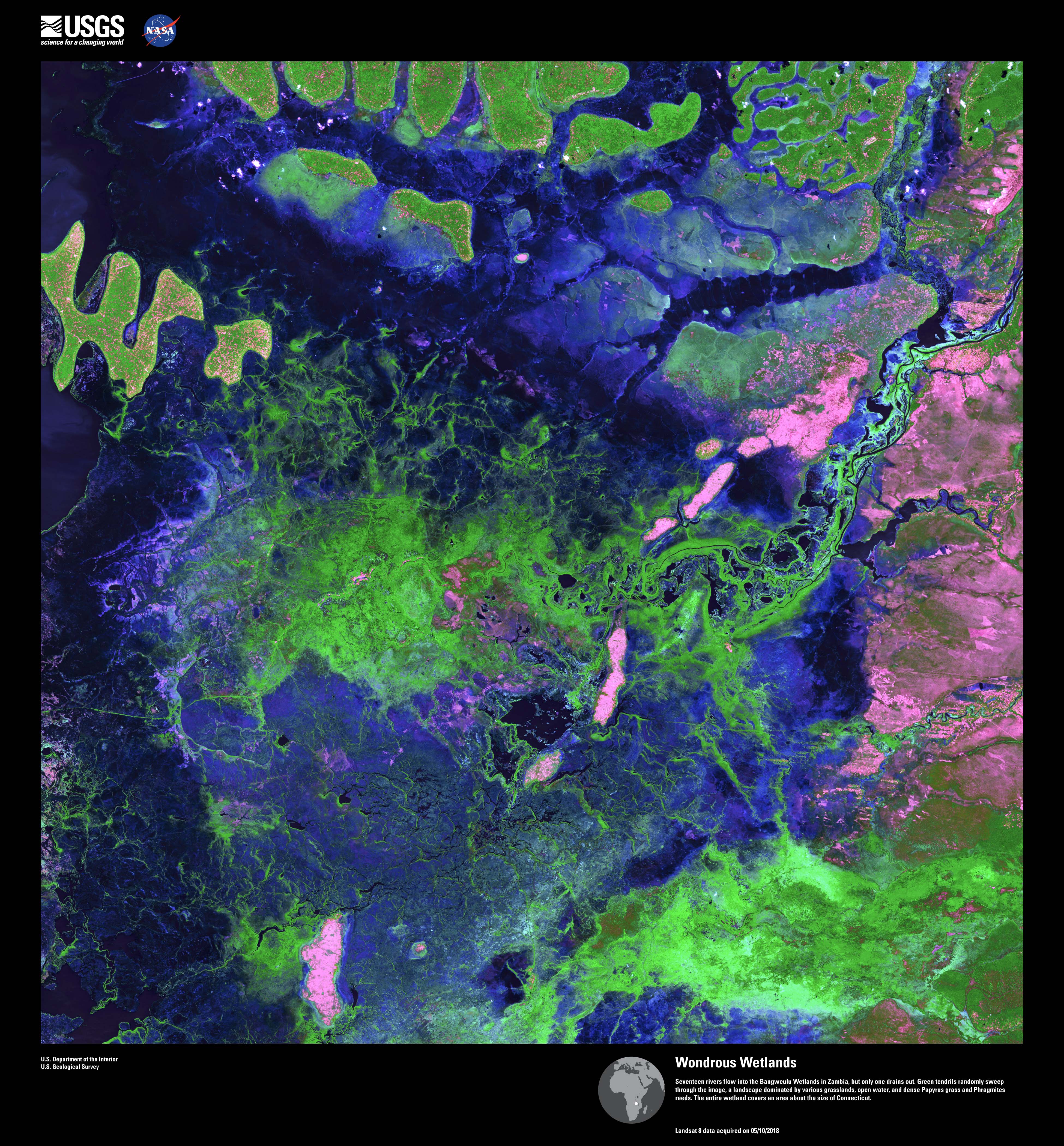
There are 17 river flowing into this wetlands area in Zambia that's about the size of Connecticut. It's a landscape of grasslands, water, Papyrus grass and Phragmites reeds.
4/20
USGS
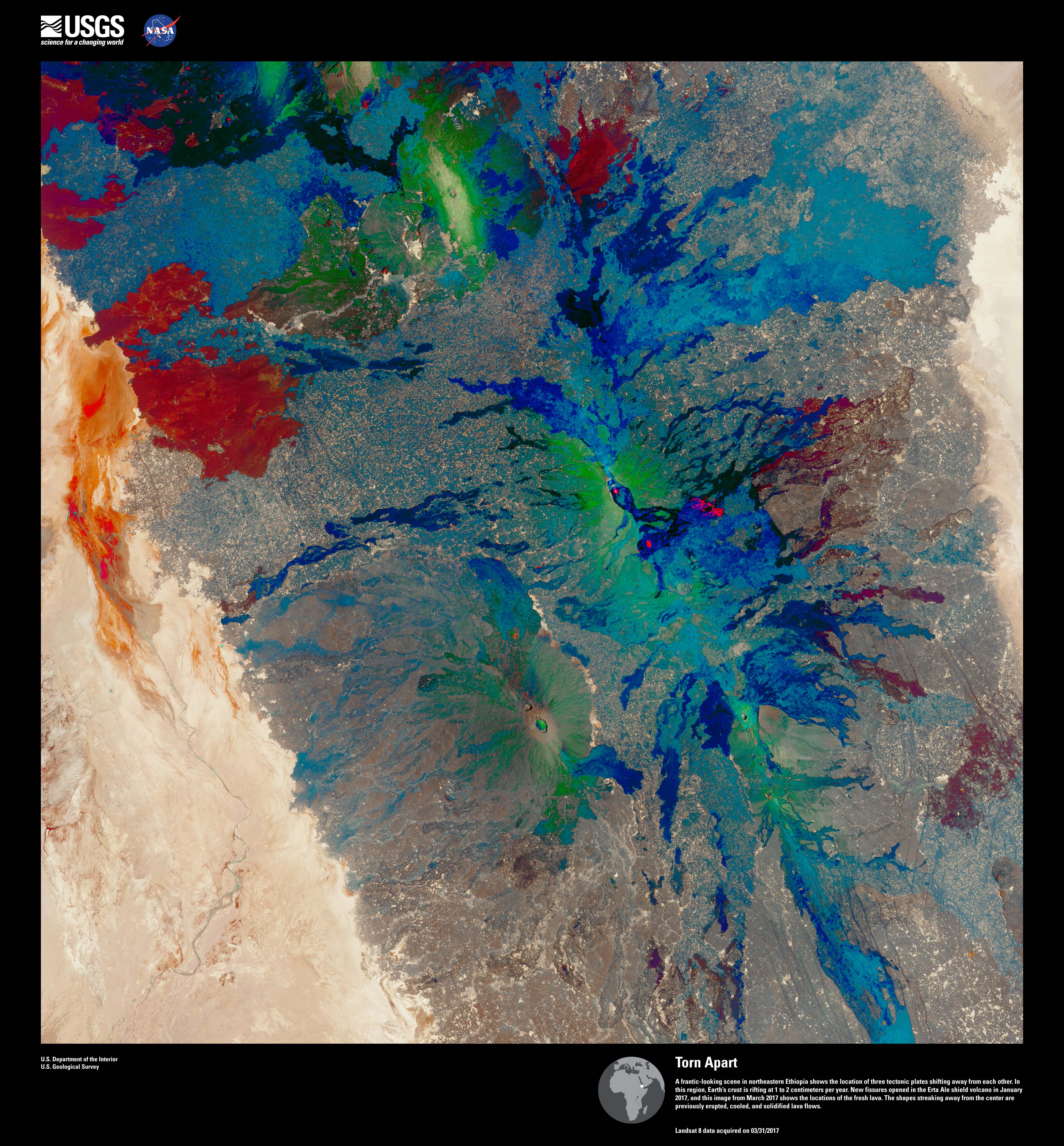
Why is this image called Torn Apart? You're looking at three tectonic plates shifting away from one another in northeastern Ethiopia. New fissures developed in a volcano here in January 2017. This image shows fresh lava.
5/20
USGS
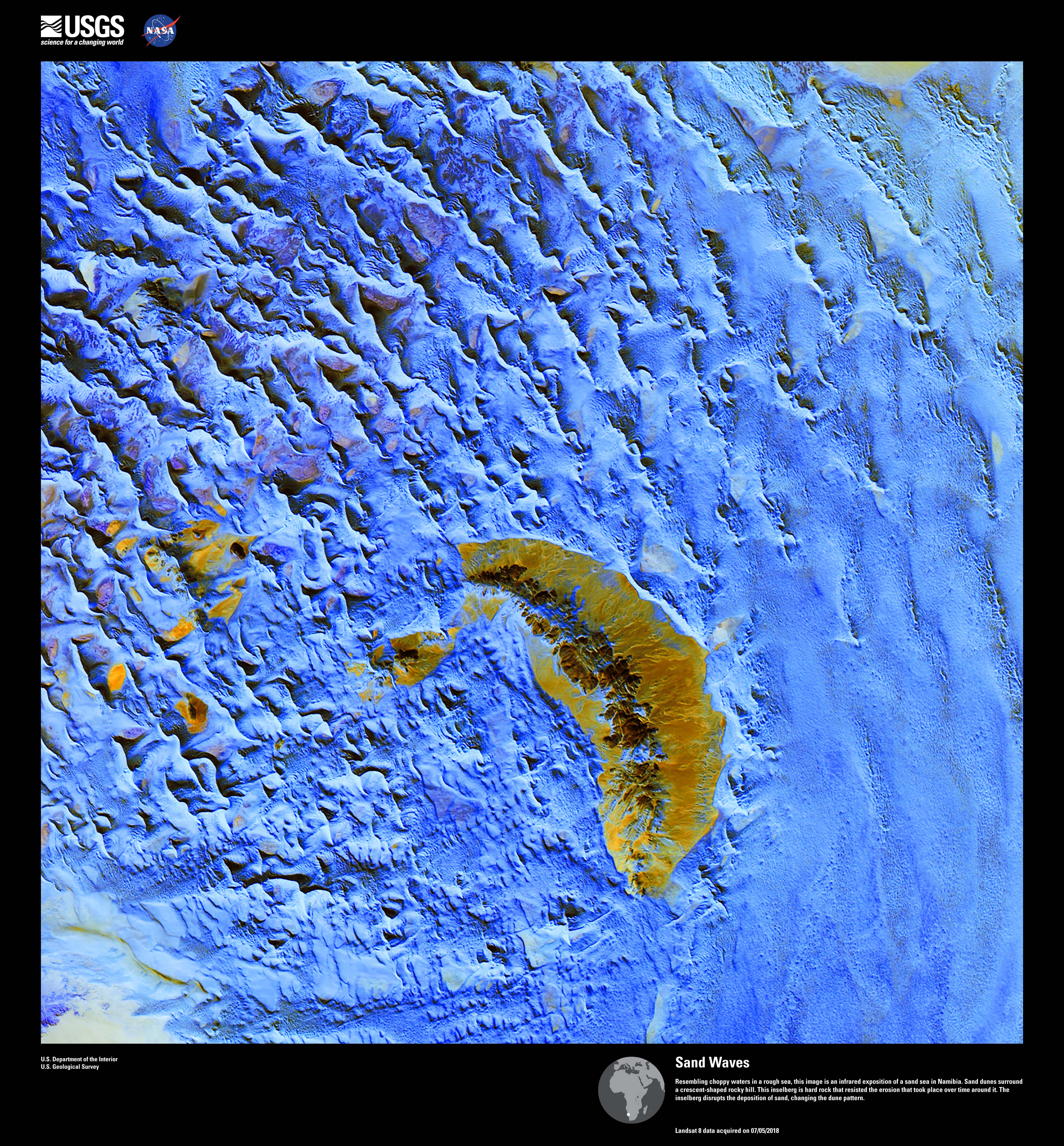
It looks like an island in the ocean, but this infrared image actually shows a sand sea in Namibia. Those are sand dunes surrounding the crescent-shaped hill.
6/20
USGS
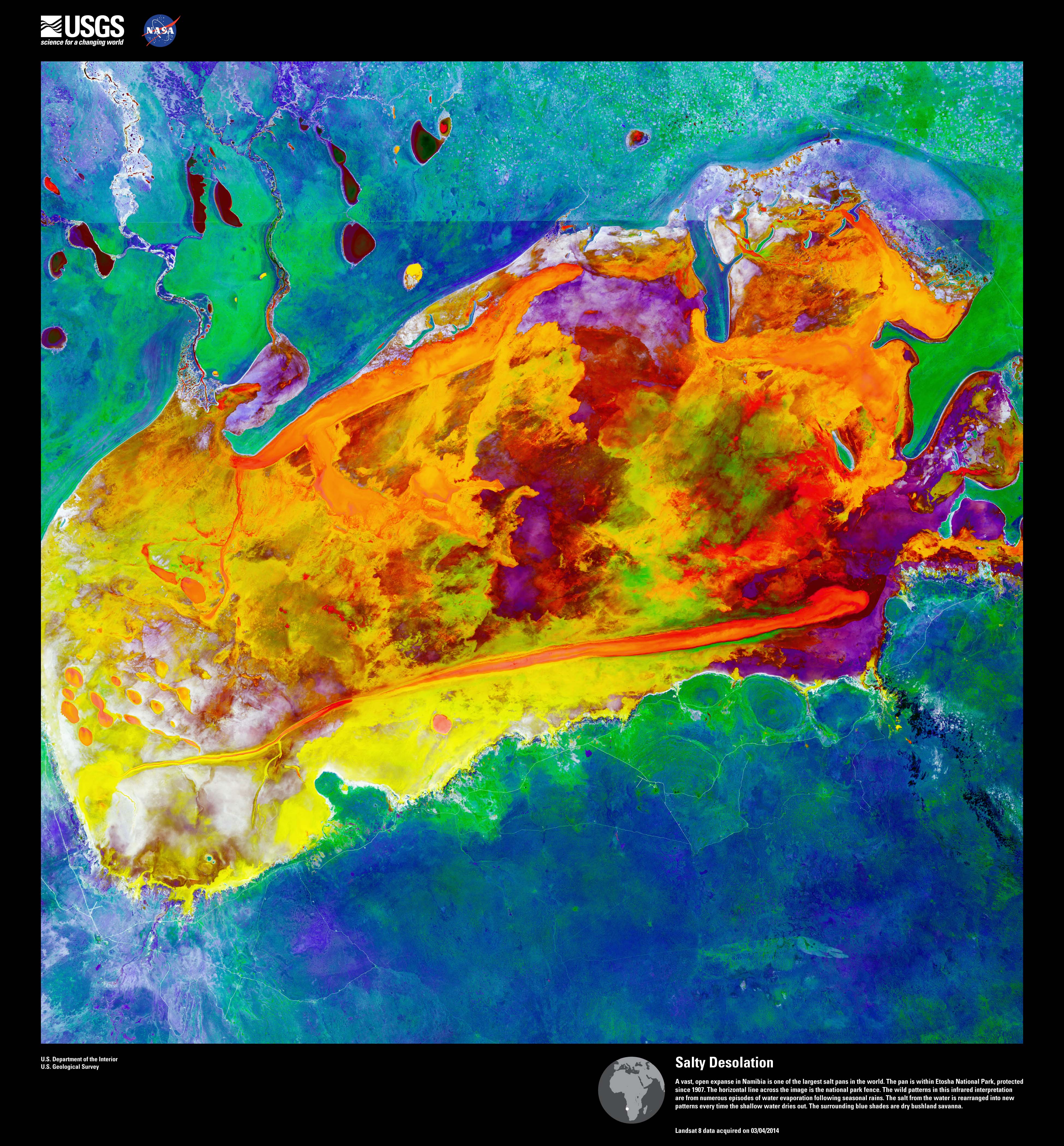
Located in Namibia, this is one of the largest salt pans in the world. The infrared image shows dry bushland savanna in blue shades. The other colors represent water evaporation following seasonal rains.
7/20
USGS
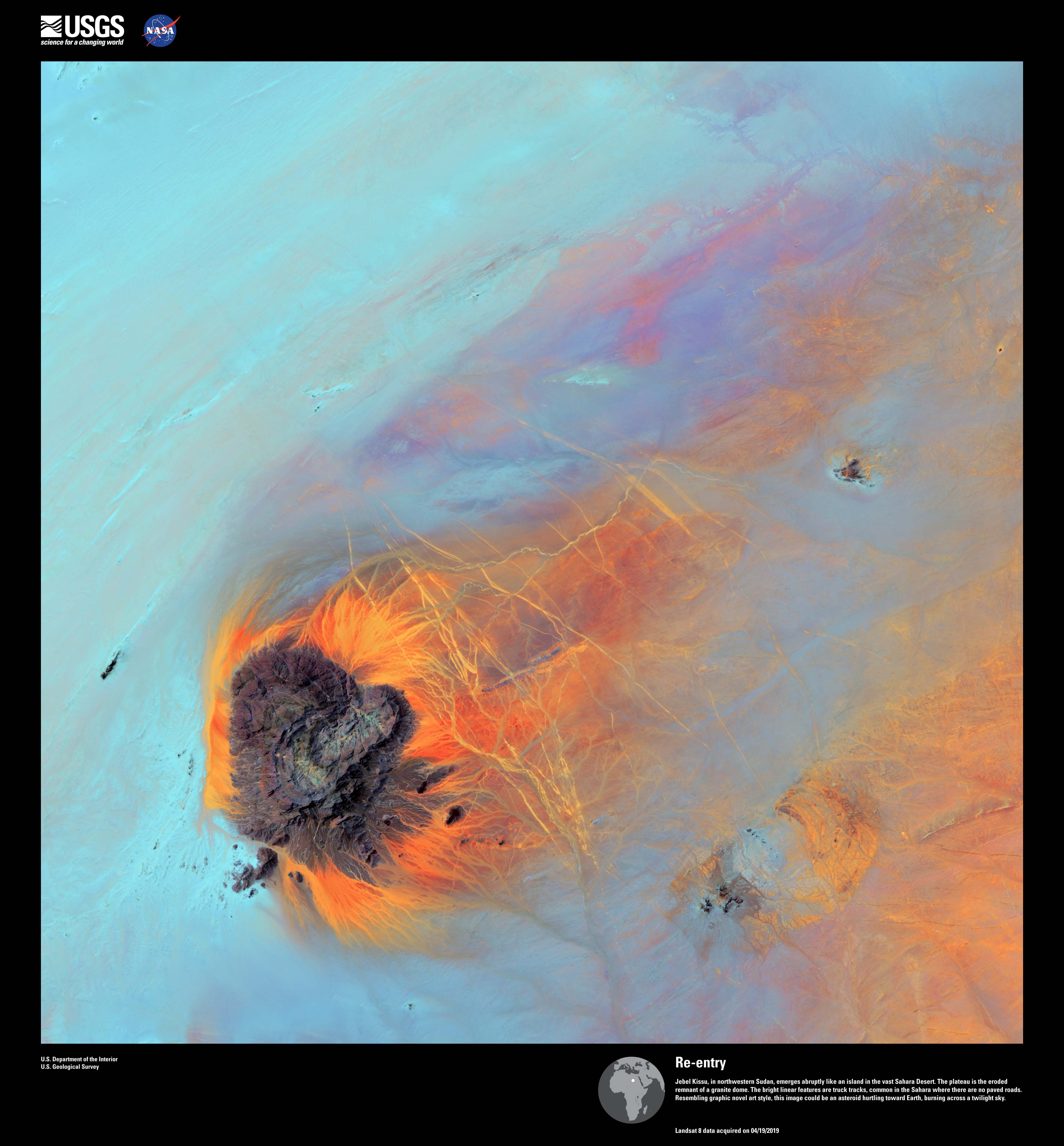
What looks like a island surrounded by water -- or maybe an asteroid hurtling toward Earth -- is actually the eroded remains of a giant granite dome in northwestern Sudan. Those bright yellowish lines are truck tracks.
8/20
USGS
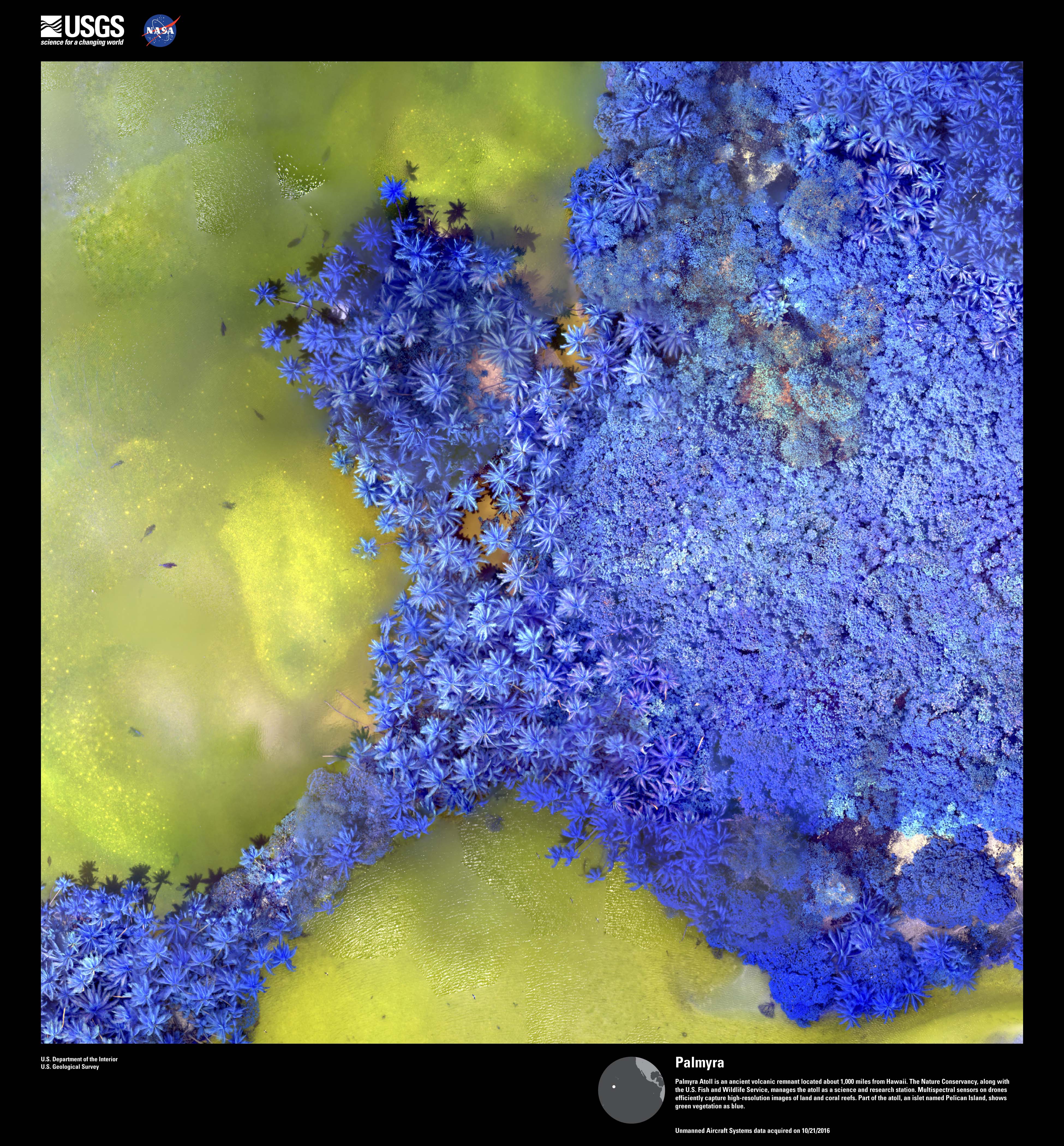
The is Palmyra Atoll, an ancient volcanic remnant about 1,000 miles from Hawaii. It's a science and research station. This drone image shows land and coral reefs. Green vegetation is seen as blue in this image.
9/20
USGS
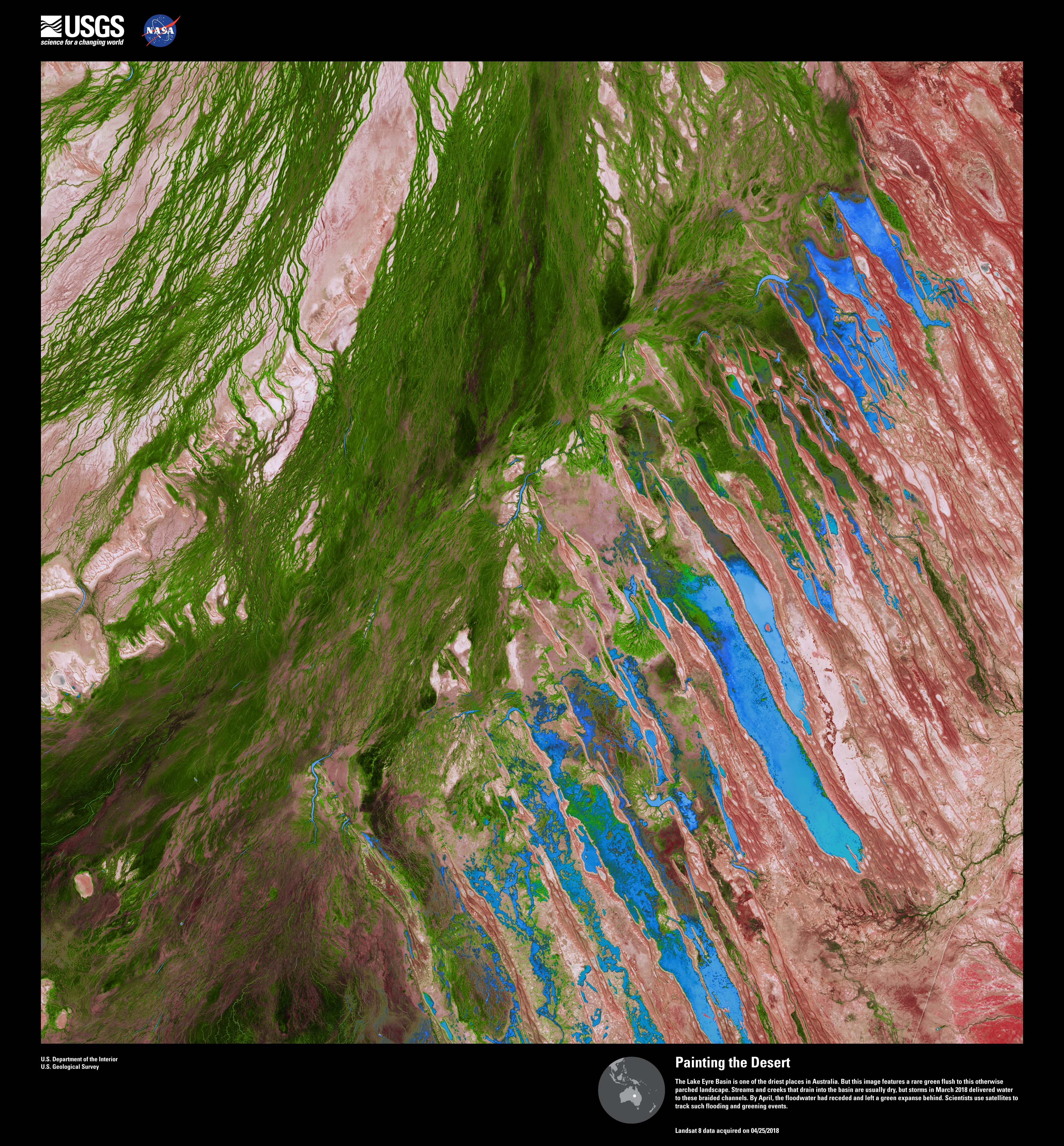
This is the Lake Eyre Basin, one of Australia's driest locations. So what's that lush green patch of land? March 2018 storms drenched the region, leaving behind a large patch of vegetation.
10/20
USGS
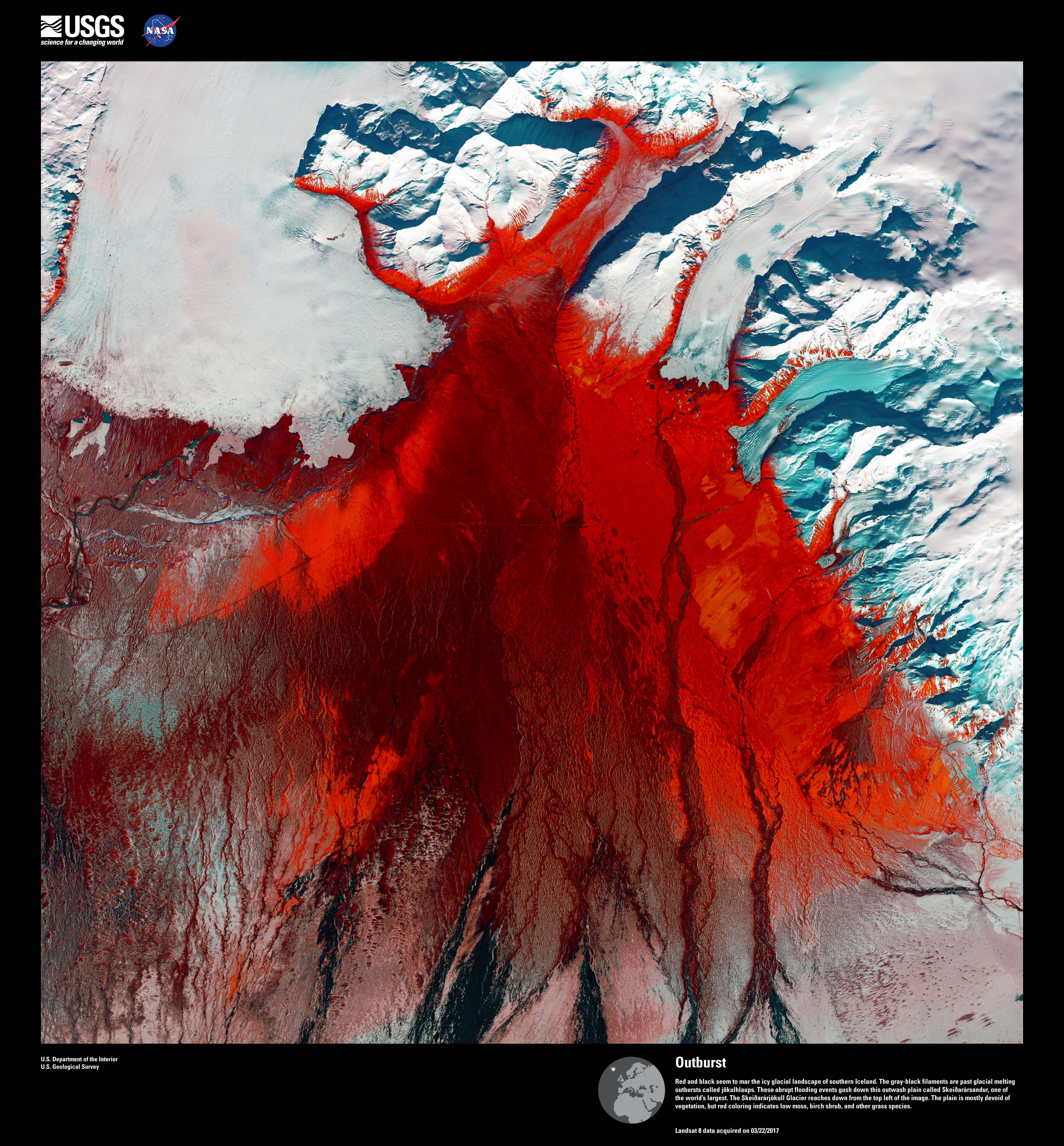
This image shows the glacial landscape of southern Iceland. The red color represents low moss, birch shrubs and other types of grass.
11/20
USGS
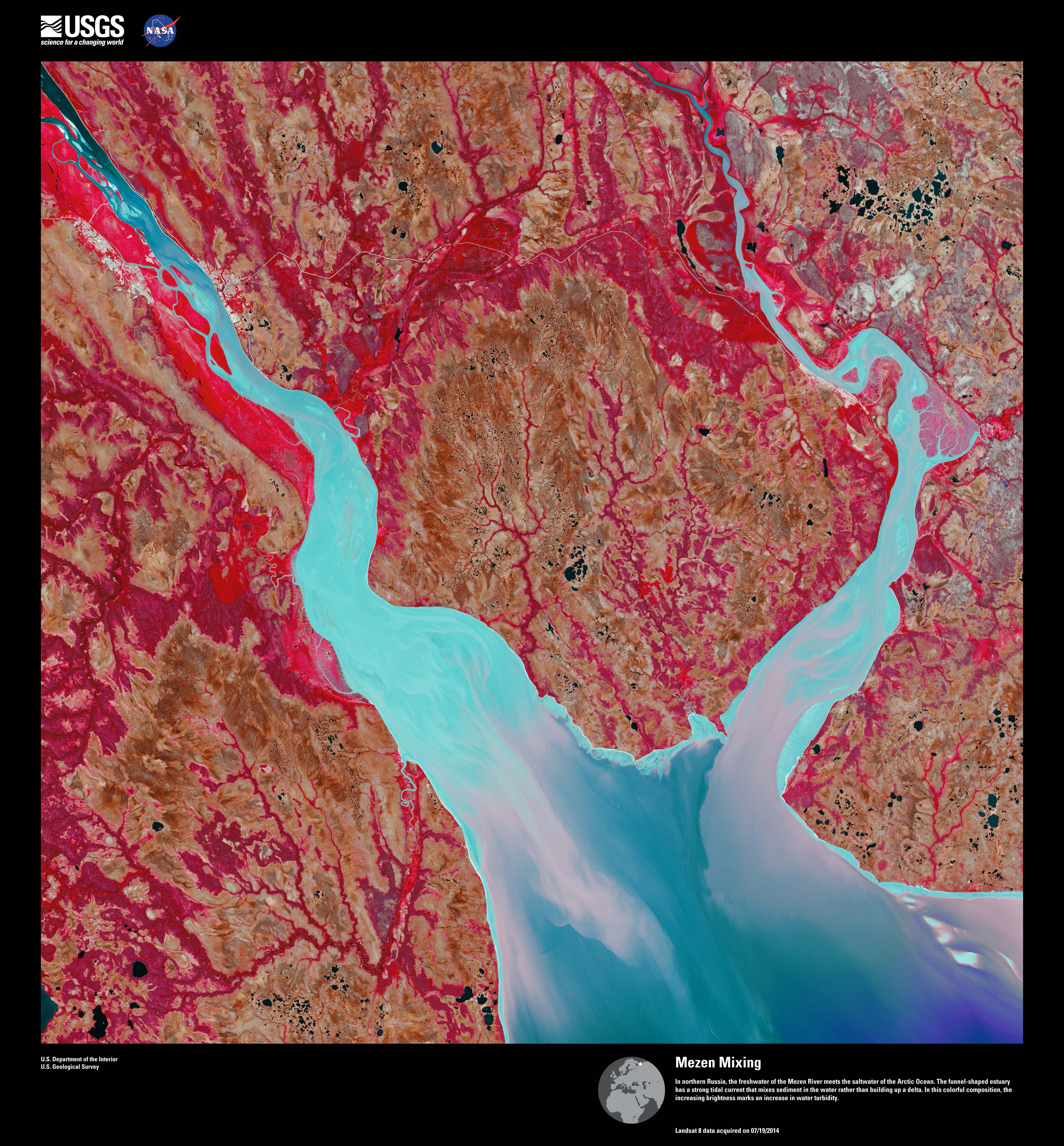
The Mezen River meets the Arctic Ocean in this image above northern Russia. A strong tidal current in this funnel-shaped estuary mixes sediment.
12/20
USGS
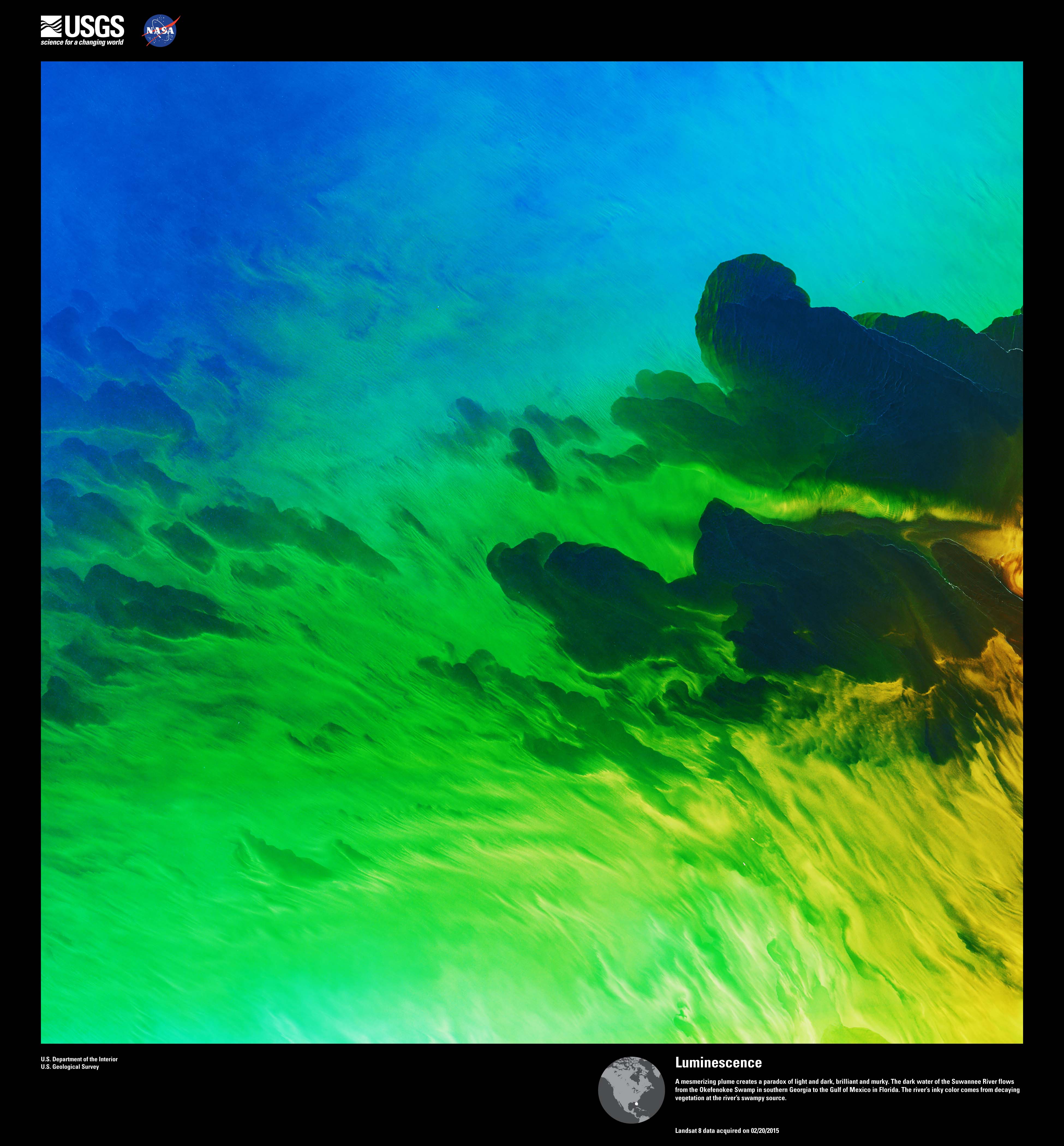
Murky clouds appear to flow into the brilliant greens and blues in this image that shows dark water of the Suwannee River flowing from the Okefenokee Swamp in southern Georgia to the Gulf of Mexico. Decaying vegetation gives the river water that inky color.
13/20
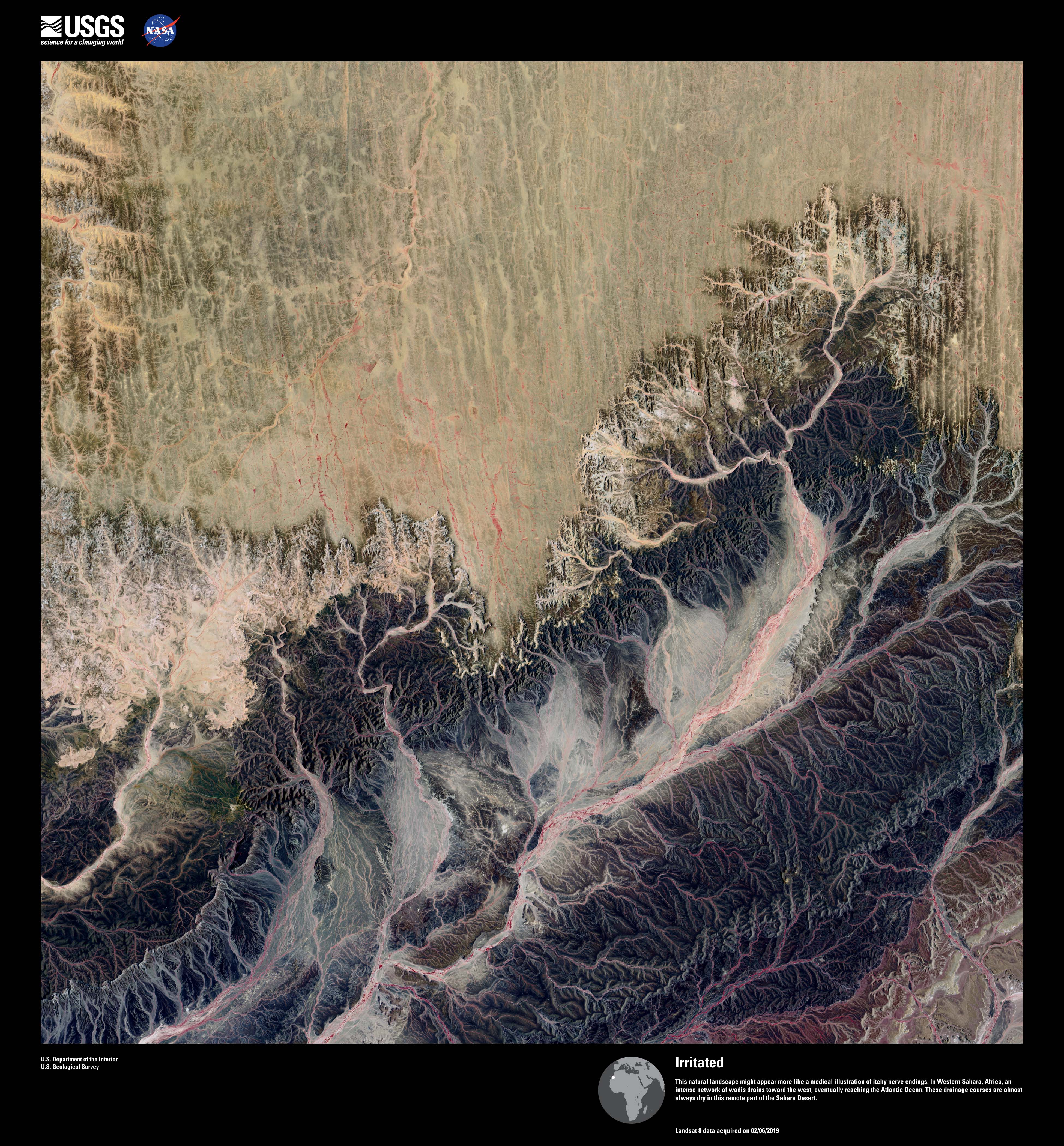
USGS
What look like nerve endings are actually valleys and ravines in the Western Sahara. Those tendril eventually reach the Atlantic Ocean, providing drainage routes.
14/20
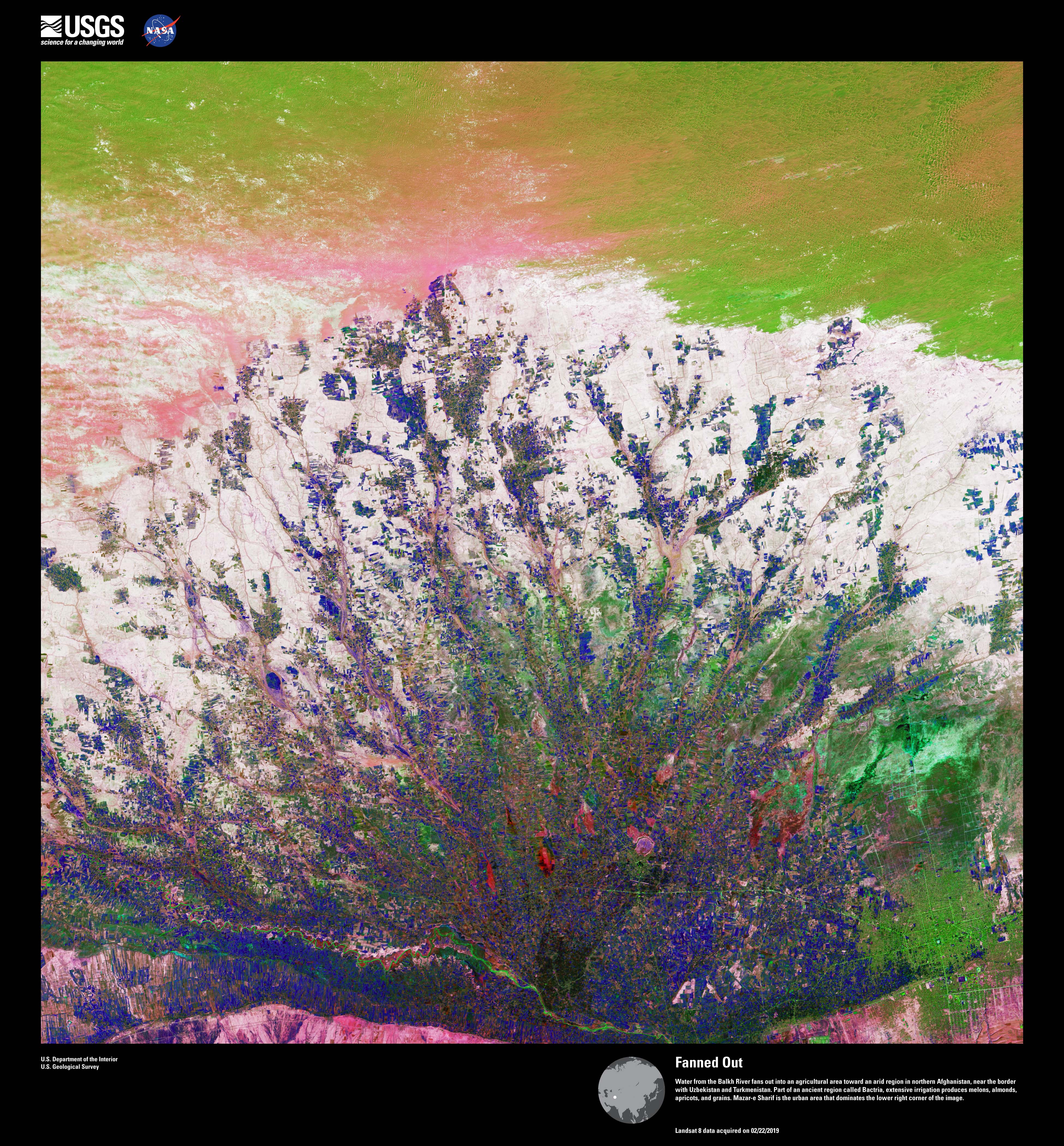
USGS
This image above an agricultural area in northern Afghanistan shows water from Balkh River as it fans out over the landscape. In the lower right, you can seen the urban region of Mazar-e Sharif.
15/20
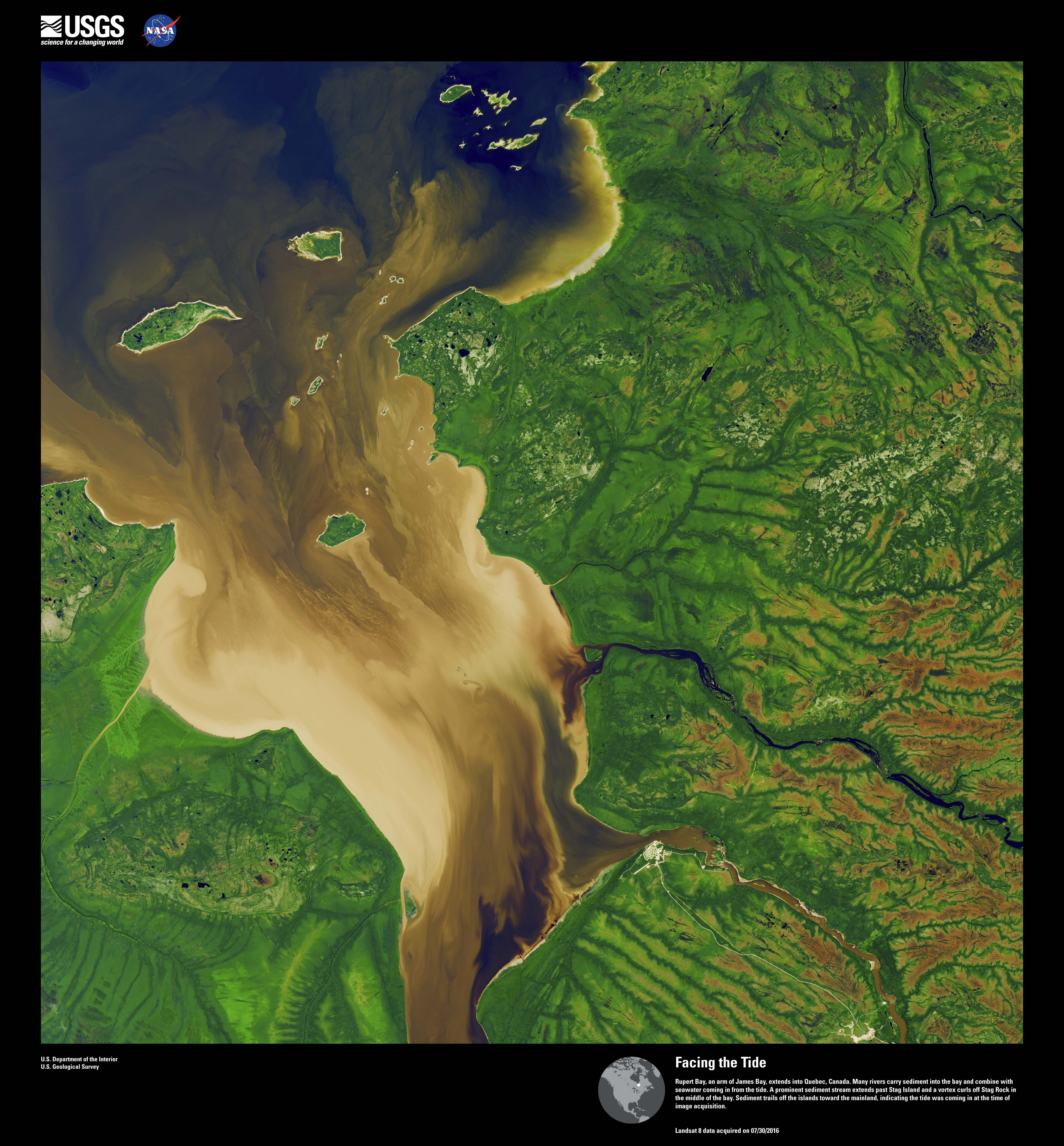
USGS
Do you see a face? This is Rupert Bay in Canada. That's sediment being carried into the bay combining with seawater. In the middle of the bay is Stag Rock.
16/20
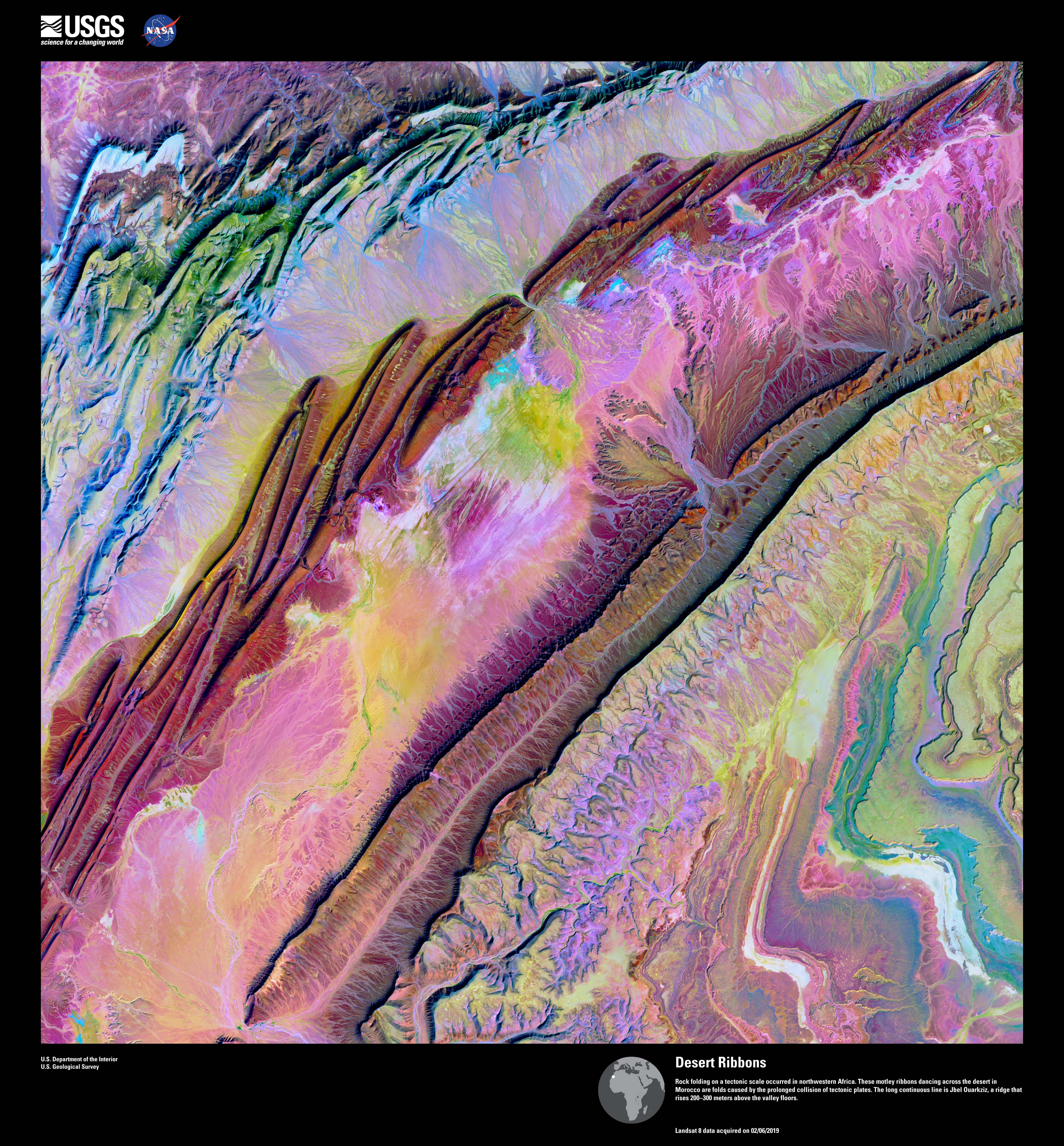
USGS
When tectonic plates collide, this is what you get. This image above northwestern Africa shows rock folding due to the collision of tectonic plates.
17/20
USGS
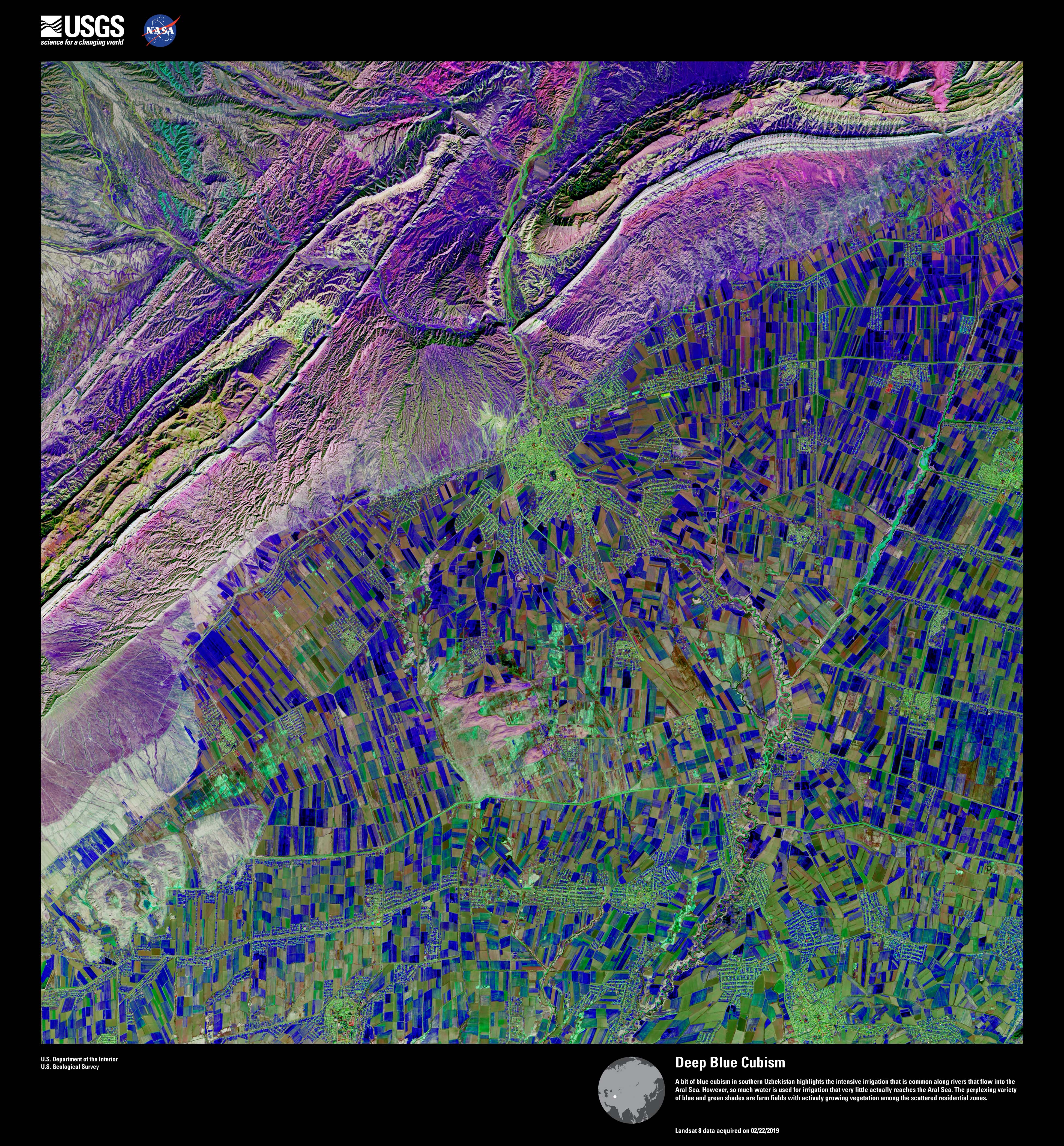
The blue and green shades in this image show farm fields with growing vegetation in southern Uzbekistan. Aggressive irrigation is common in the region, so much so that very little water actually reaches the Aral Sea.
18/20
USGS
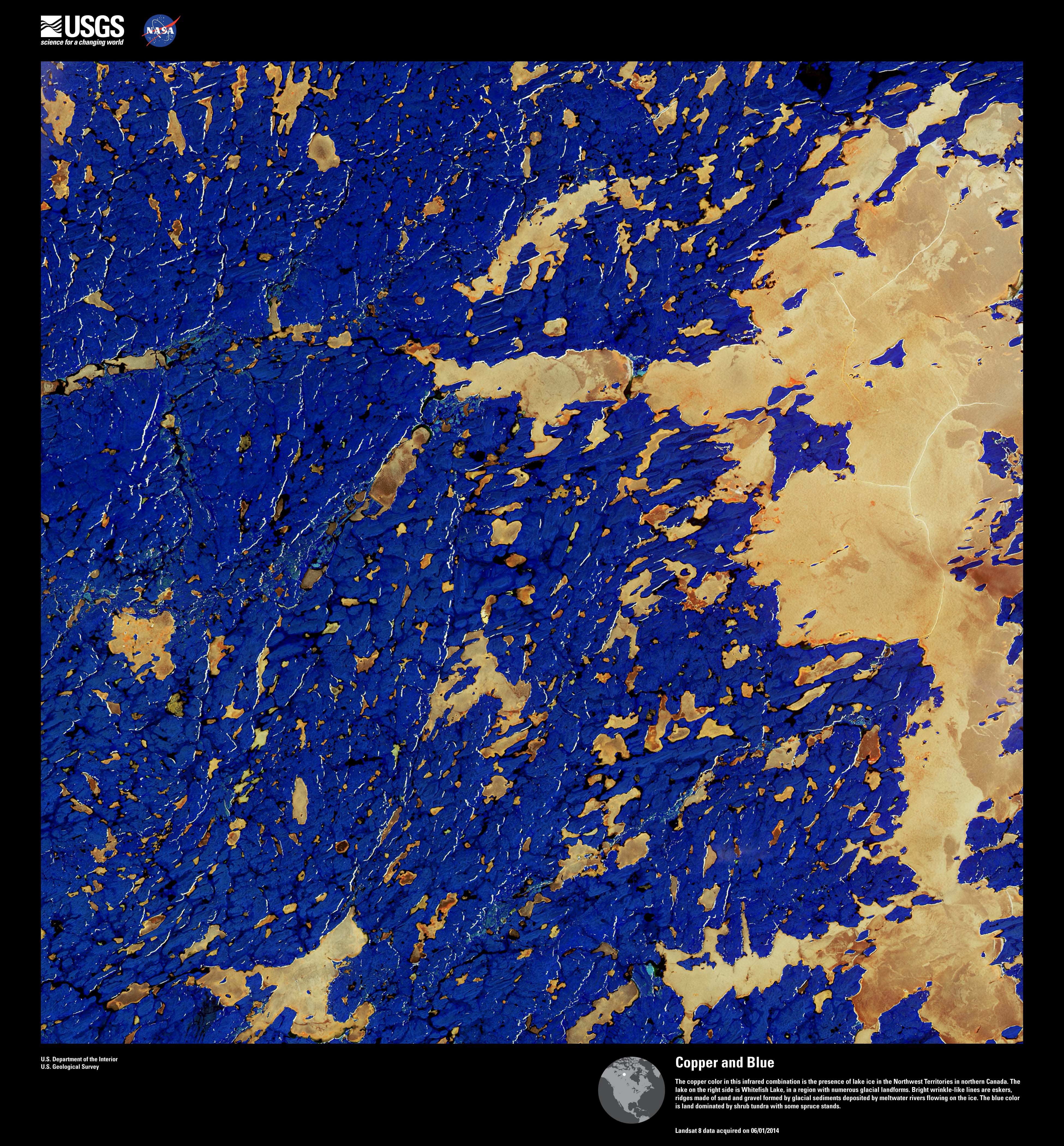
Lake ice, depicted in a copper color, is pictured in this image above northern Canada. That's Whitefish Lake on the right. The blue color is land, mostly shrub tundra and spruce trees.
19/20
USGS
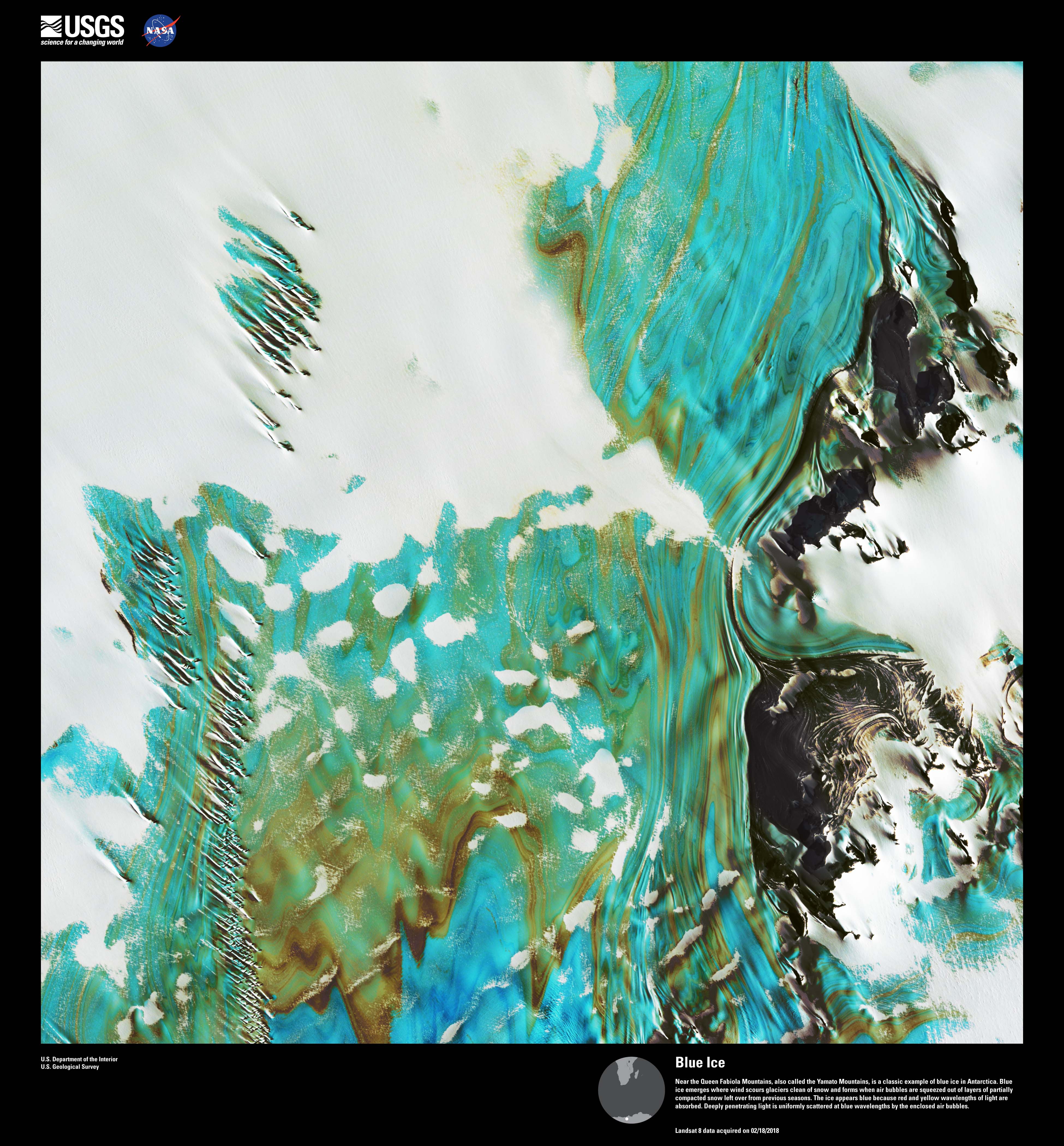
This image shows blue ice in Antarctica. Wind scours snow from glaciers and air bubbles are squeezed from layer of leftover snow from past seasons, leading to the formation of blue ice.
20/20
USGS
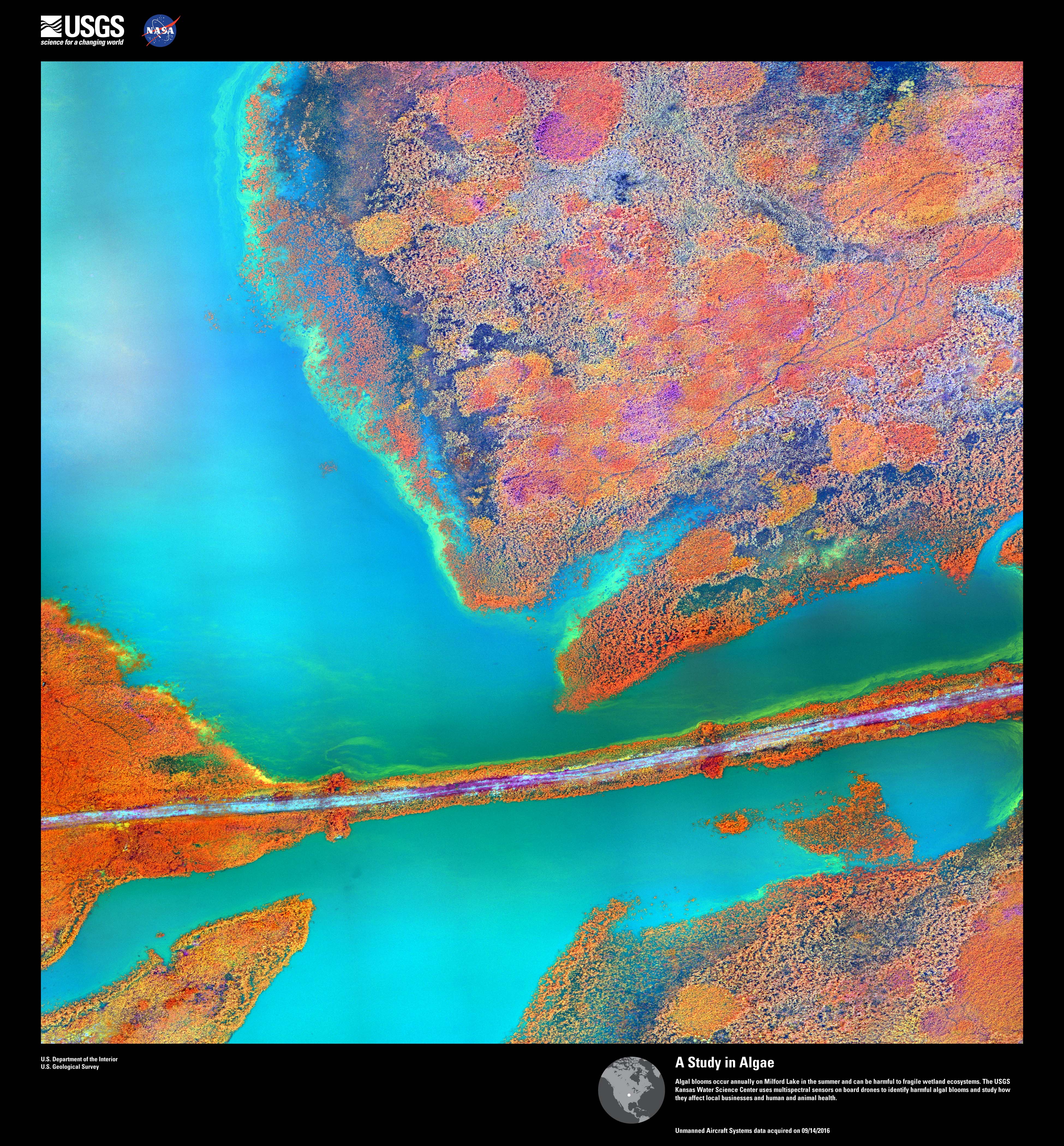
This is Milford Lake in Kansas, where infrared drone images are used to detect harmful algal blooms.