
The Bobcat Fire, one of the largest fires in Los Angeles County history, grew Tuesday night to 112,053 acres and is 17% contained.
"Strategic firing operations will continue this evening from Mt. Wilson down to the Redbox Road as favorable weather conditions allow," the U.S. Forest Service reported.
Reduced winds, lower temperatures and higher humidity reduced fire activity Tuesday. Warmer and drier conditions were expected Wednesday and Thursday, with southwesterly and upcanyon winds, according to the National Weather Service.
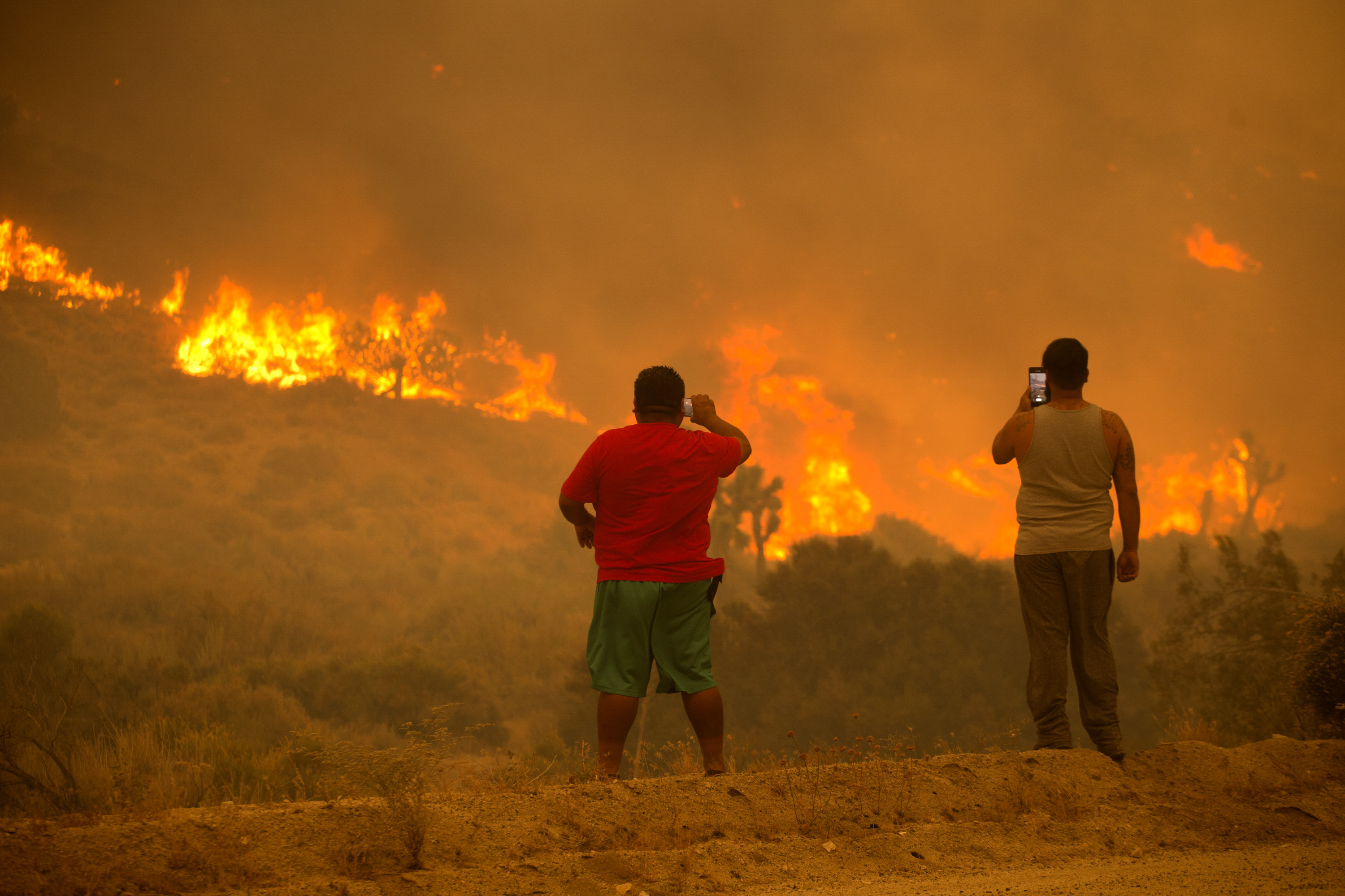
The fire, which is burning in the Angeles National Forest and threatening communities in the Antelope Valley and San Gabriel Valley foothills, has destroyed or damaged 29 structures, with authorities fearing the number could rise to 85.
Information was not available regarding how many of the burned structures were homes. That assessment was expected to be completed by Wednesday.
"Crews aircraft and equipment worked through the evening picking up (hot) spots and securing the lines,'' the Angeles National Forest said in a statement Tuesday morning.
The fire has burned more acres than the Woolsey Fire of 2018, which burned 96,271 acres, the Los Angeles County Fire Department said Tuesday. The Station Fire in 2009 burned 160,577 acres.
The fire came down from the Angeles National Forest into Cima Mesa, Juniper Hills, Pearblossom and Devil's Punchbowl on Friday and damaged some structures, Vince Pena of the Los Angeles County Fire Department said Monday evening.
"We're still currently aggressively assessing the damage from that," Pena said.
The Nature Center at the Devil's Punchbowl Natural Area was burned by the fire, Los Angeles County parks officials said. The area is closed until further notice.
"Firefighters will focus on the SW and NE corners of the #BobcatFire today," the ANF tweeted at about 9 a.m. Tuesday. ``Expect to see smoke plumes and aircraft north of Mt. Wilson as crews engage in strategic firing operations.''
The U.S. Forest Service reported Tuesday afternoon that the defensive firing operation was ``going well at Mt. Wilson. They're using aerial ignitions to increase the buffer between HWY 2 near Barley Flat to Big Tujunga Road."
Evacuation orders remained in place for residents: Evacuation List
A smoke advisory was extended through Wednesday warning of unhealthy air in the San Gabriel Mountains, and for sensitive individuals in the San Gabriel Valley, Santa Clarita Valley and Antelope Valley.
"It is difficult to tell where smoke, ash or soot from a fire will go, or how winds will affect the level of these particles in the air, so we ask everyone to remember that smoke and ash can be harmful to health, even for people who are healthy," said Dr. Muntu Davis, health officer for Los Angeles County.
"If you can see smoke, soot, or ash, or you can smell smoke, pay attention to your immediate environment and take precautions to safeguard your health. These precautions are particularly important for children, older adults, and people with heart or lung diseases."
PHOTOS: Bay Area Sky Turns Orange and Yellow As Smoke Blankets Region
A total of 1,556 personnel were assigned to the fire as of Tuesday evening.
A closure order has been issued for national forests in Southern California, including the Angeles National Forest.
The Bobcat Fire erupted on Sept. 6 near the Cogswell Dam and West Fork Day Use area northeast of Mount Wilson and within the Angeles National Forest. The cause remains under investigation. Full containment is not expected until Oct. 30.
