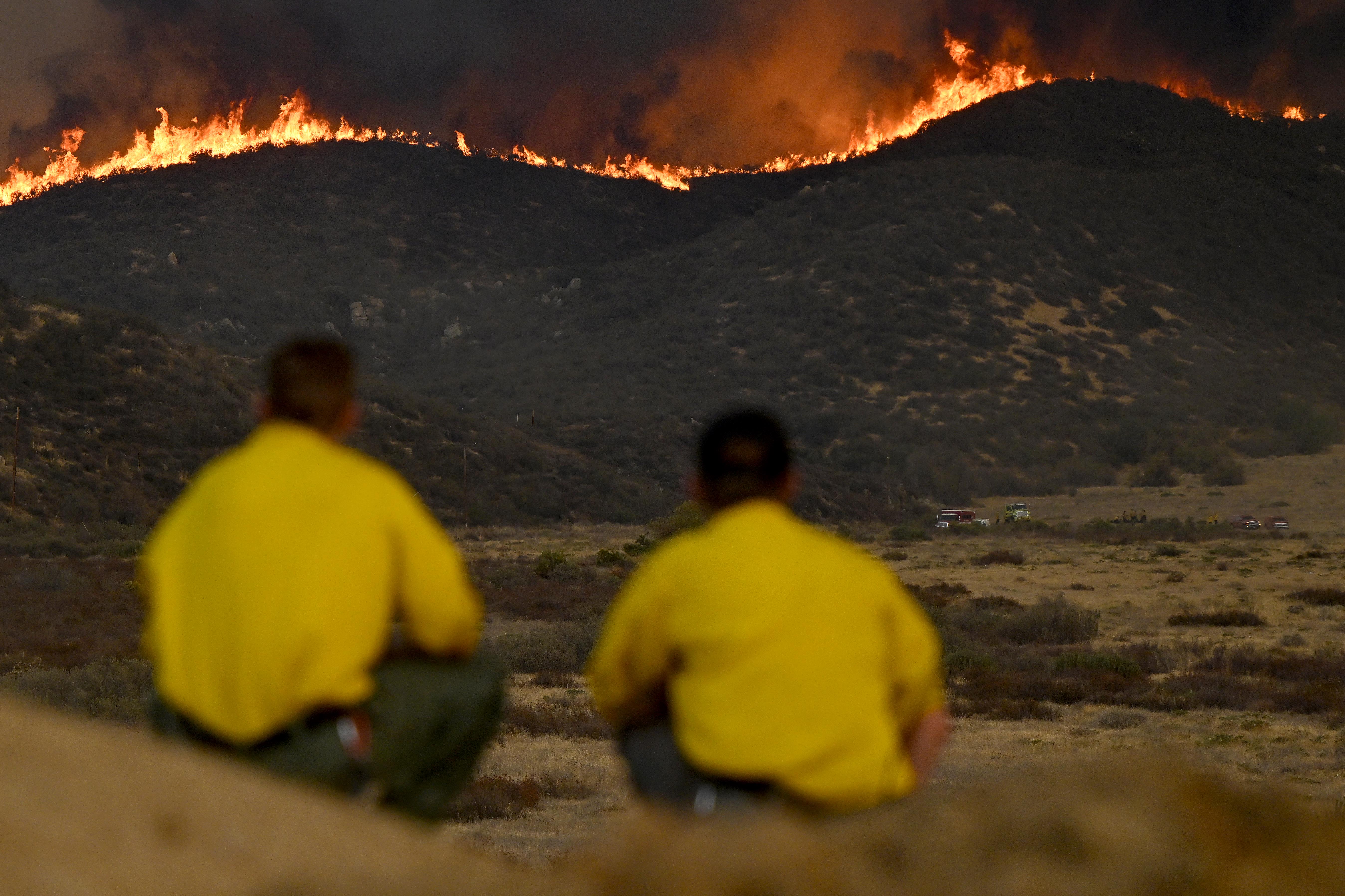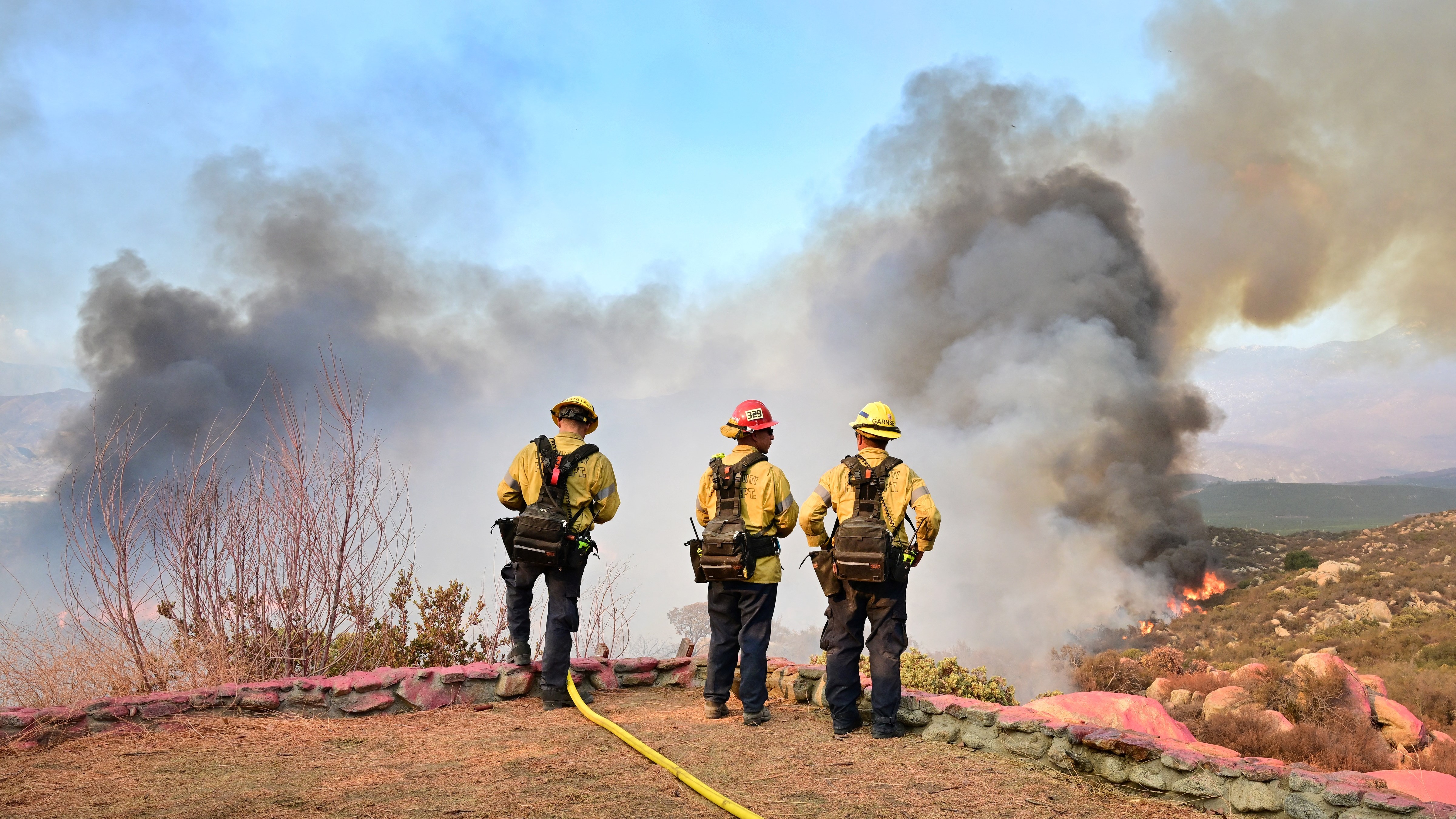
As of Thursday night, the Fairview Fire near Hemet has scorched over 27,319 acres of Riverside County and remains only 5% contained.
With two people already dead due to the wildfire and the flames that have been spreading rapidly since the fire was first reported on Monday afternoon, officials are trying to keep nearby residents safe.
The unified command in charge of fighting the Fairview Fire has put out a list of locations under evacuation orders, where residents must leave as soon as possible, and another list of locations under evacuation warnings, where residents should be prepared to go at any moment if conditions worsen.
Take a look at areas under evacuation orders and warnings below.
Get Southern California news, weather forecasts and entertainment stories to your inbox. Sign up for NBC LA newsletters.
Evacuation Orders:
- South Thornton Avenue,
- North of Polly Butte Road,
- West of Fairview,
- East of State Street,
- South of Thornton Avenue,
- North of Polly Butte Road,
- West of Fairview Avenue,
- East of State Street,
- East of State Street,
- West of Fairview,
- South of Stetson Avenue,
- North of McSweeny Parkway.
- East of State Street,
- West of Fairview Avenue,
- South of Stetson Avenue,
- North of McSweeny Parkway.
- South of McSweeney Road to North of Cactus Valley, to the end of that street,
- East of State Street,
- South of Stetson Avenue.
- North of Cactus Valley Road,
- West of Fairview Avenue, Bautista Canyon Road,
- South of Stetson,
- North of Two Streams Fork Trailhead, Bautista Canyon Road,
- South of Stetson,
- North of the Two Streams Fork trailhead
- Thomas Mountain Ridge South to Cactus Valley to Bautista to Forest Boundary,
- South of Cactus Valley Road,
- North of Minto Way,
- North of Red Mountain Road,
- West of US Forest Service Boundary and East of Sage Road,
- East Red Mountain Road and Cahuilla Mountain to USFS,
- South Minto,
- South Red Mountain Road,
- West Stanley Road,
- North Stanley Road,
- West of Wilson Way,
- South of Highway 74,
- East of Fairview Avenue,
- North of Stetson Road,
- South of Minto Way,
- South of Red Mountain Road,
- West of Stanley Road,
- North of Stanley Road,
- East of Sage Road
- South of Diamond Valley Lake,
- East of Washington Street
- North of Borel Road,
- East of Rancho California Road
- East of Anza Road
- North of Temecula Parkway (Highway 79)
- Northwest of Highway 371,
- West of Springbrook Road.
Evacuation Warnings:
- South of McSweeney Road,
- North of Cactus Valley all the way to the end of Cactus Valley Road,
- Bautista Canyon Road,
- South of Stetson,
- North of Two Streams Fork Trailhead,
- South of Highway 74 to Thomas Mountain, West of Mountain Center,
- North of Cactus Valley,
- Anza North Highway 371 to Forest Boundary,
- South of Cactus Valley,
- East of Sage Road, North of Red Mountain Road,
- West Bautista Canyon,
- South Cactus Valley Road,
- North Minto way,
- North Red Mountain Road,
- West of Forest Boundary,
- East of Sage Road,
- East Red Mountain Road,
- Cahuilla Mountain US forest service boundary,
- South of Minto Way,
- South of Red Mountain Road,
- West of Stanley Road,
- North of Stanley Road,
- East of Sage Road,
- West of Fairview,
- South of Highway 74,
- North of Stetson,
- East of Soboba Street,
- East of Fairview,
- North of Hwy 74,
- South of San Jacinto Riverbed,
- East of Wilson
- East of Sage Road,
- West of Reed Valley Road
- West of the Forest Service boundary,
- South of Stanley Road,
- North of Wilson Valley Road,
- East of De Portola Road,
- West of Sage Road,
- North of East Benton Road,
- South of Diamond Valley Road,
- South of Rawson Road,
- East of Washington Street,
- North of Borel Road,
- East of Rancho California Road,
- East of Anza Road,
- North of Temecula Pkwy (Highway 79),
- Northwest of Highway 371,
- West of Highway 74,
- West of Highway 74,
- North of 371,
- East of Springbrook Road,
- South of US Forest Service Boundary.