February 1971: The Magnitude-6.5 San Fernando Earthquake Shakes Southern California
By Jonathan Lloyd ••
On Feb. 9, 1971, the deadly San Fernando Earthquake rattled Southern California, leaving more than 60 people dead and causing more than $500 million in property damage.
Also known as the Sylmar Earthquake, the magnitude-6.5 quake was reported on a Tuesday at about 6:01 a.m. Its origin was in the foothills of the San Gabriel Mountains north of Los Angeles, but shaking was felt across a widespread part of the San Fernando Valley.
Both the Veteran's Administration Hospital and Olive View Medical Center in Sylmar were severely damaged, accounting for many of the deaths. Much like the Northridge Earthquake 23 years later, the quake also tore apart freeway overpasses.
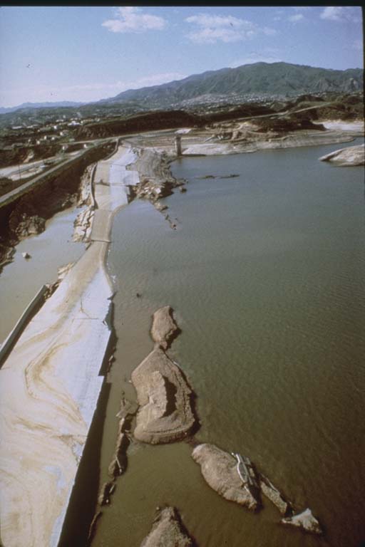
But the threat of disaster didn't end when the shaking stopped. There was fear of an imminent collapse of the Van Norman Dam, which held more than 3.5 billion gallons of water just northwest of San Fernando. Part of the dam crumbled in the quake, and more damage was reported with each aftershock. Residents along the 405 Freeway were evacuated for days until the dam was shored up and determined to be safe.
The aftermath led to major changes for building construction and the Alquist-Priolo Act. It bans construction on active faults in California.
Below, a look back at the 1971 Sylmar Earthquake.
21 photos
1/21
USGS
These photos show the aftermath of the 1971 San Fernando Earthquake.
2/21
USGS
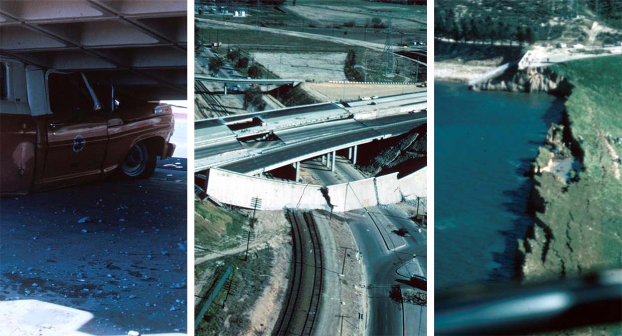
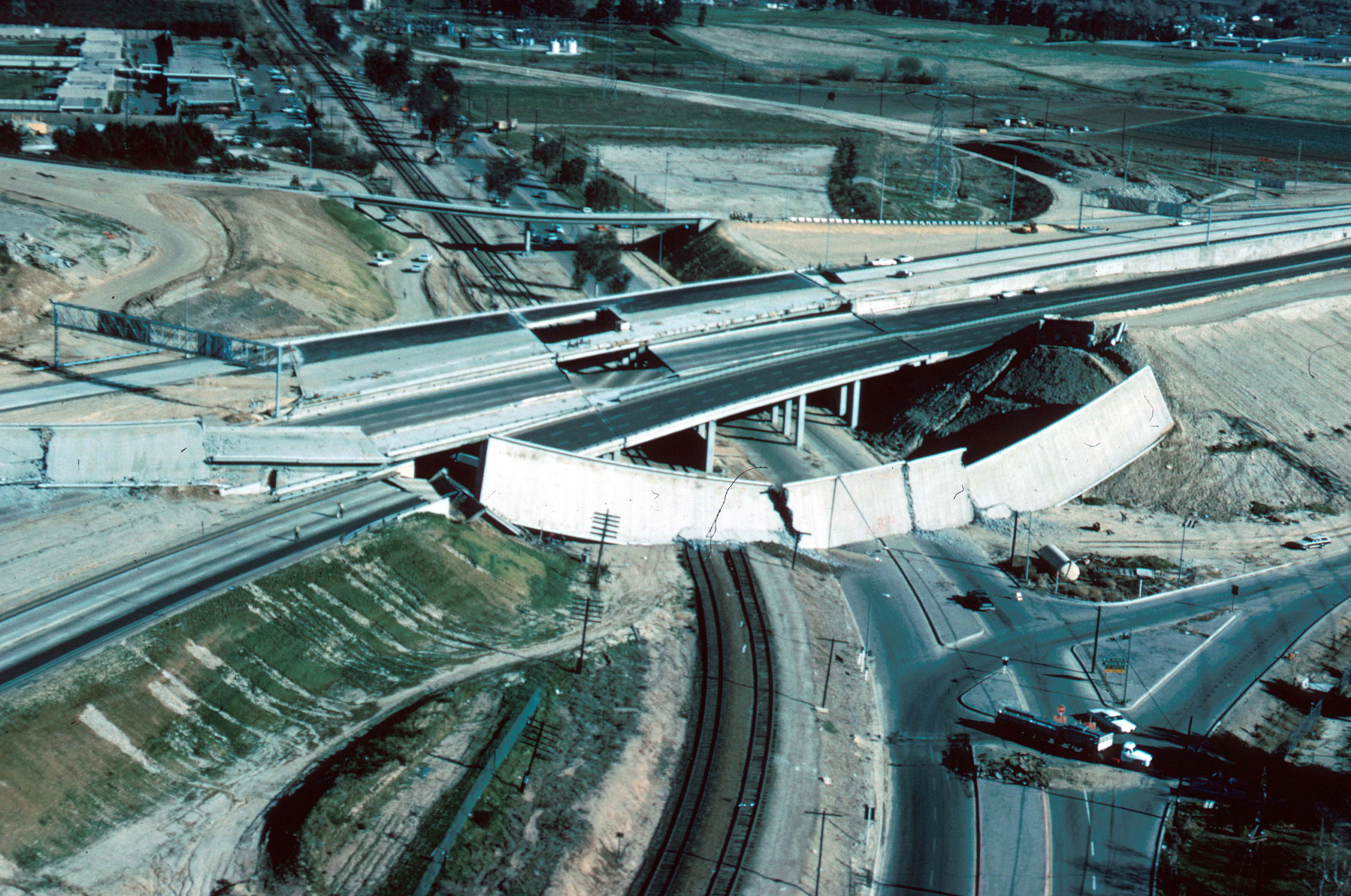
A damaged section of freeway overpass is pictured following the 1971 San Fernando Earthquake.
3/21
USGS
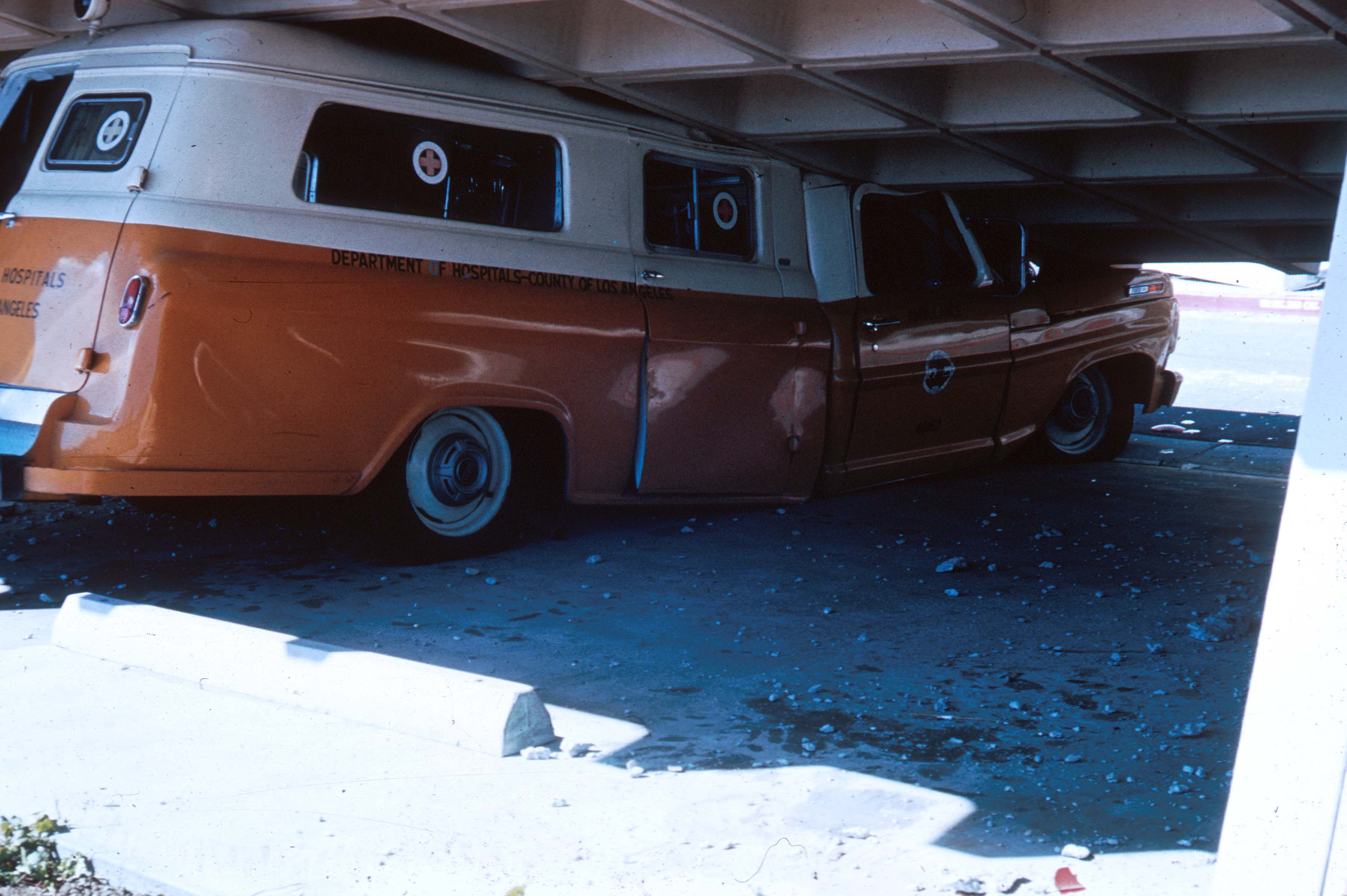
An ambulance was crushed by the collapse of the Olive View Medical Center in Sylmar during the 1971 San Fernado Earthquake.
4/21
USGS
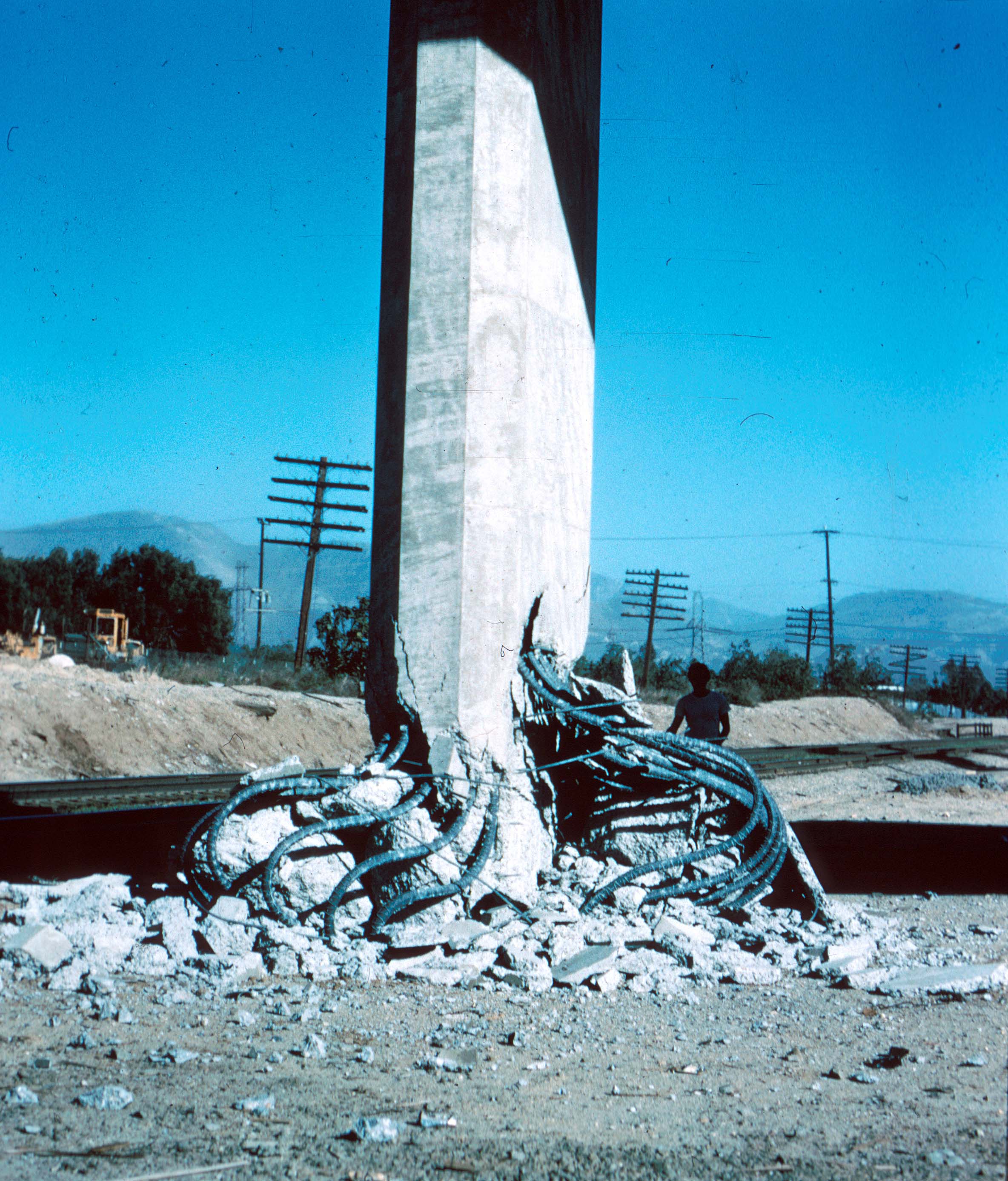
A damaged steel-reinforced support for the 5 and 14 freeway overpass was damaged in the 1971 San Fernando Earthquake.
5/21
USGS
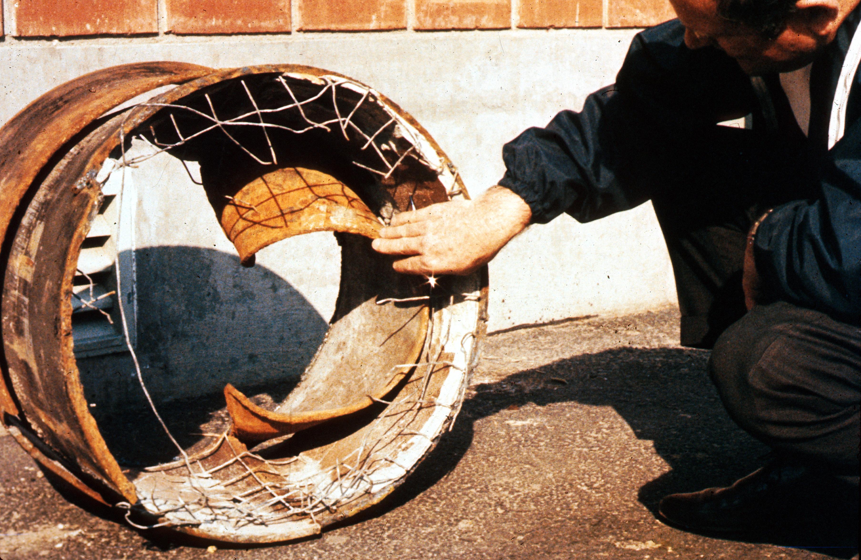
This image shows a damaged section of the Van Norman Reservoir pipeline. Notice the popped bolts at the bottom of the frame.
6/21
USGS
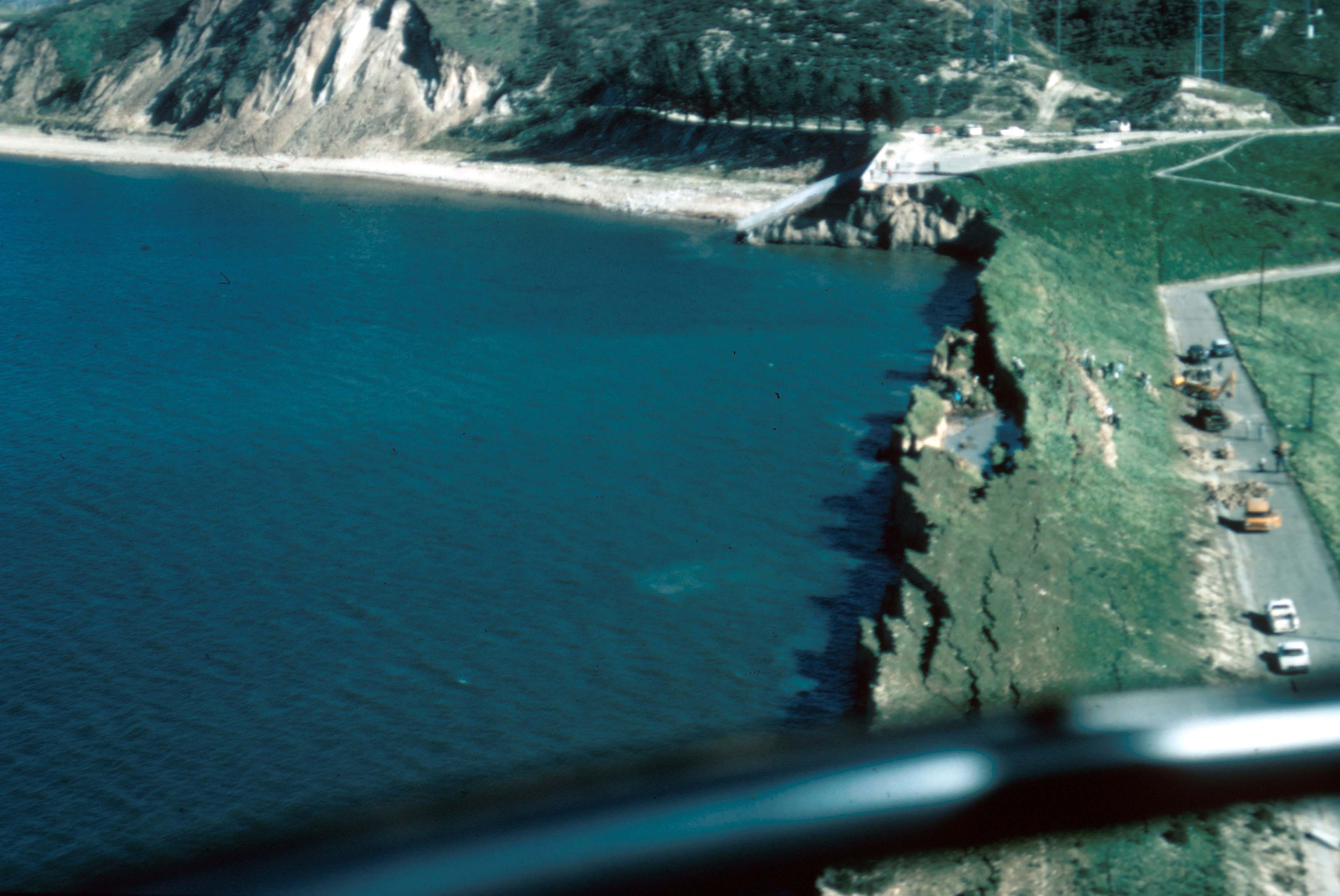
This aerial view shows a collapsed section of the lower Van Norman Dam after the 1971 San Fernando Earthquake.
7/21
USGS
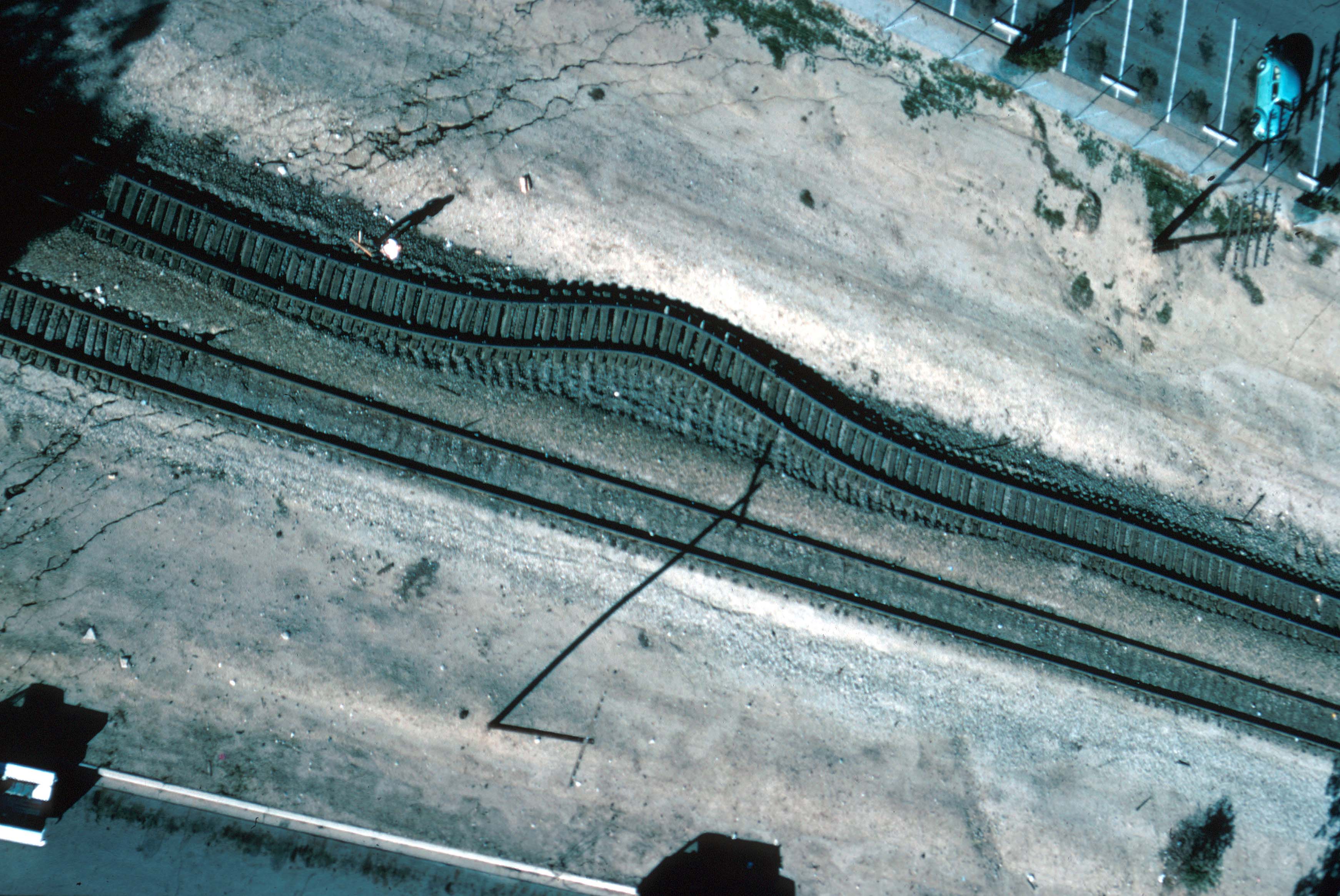
An aerial view of displaced railroad tracks in Sylmar after the 1971 San Fernando Earthquake.
8/21
USGS
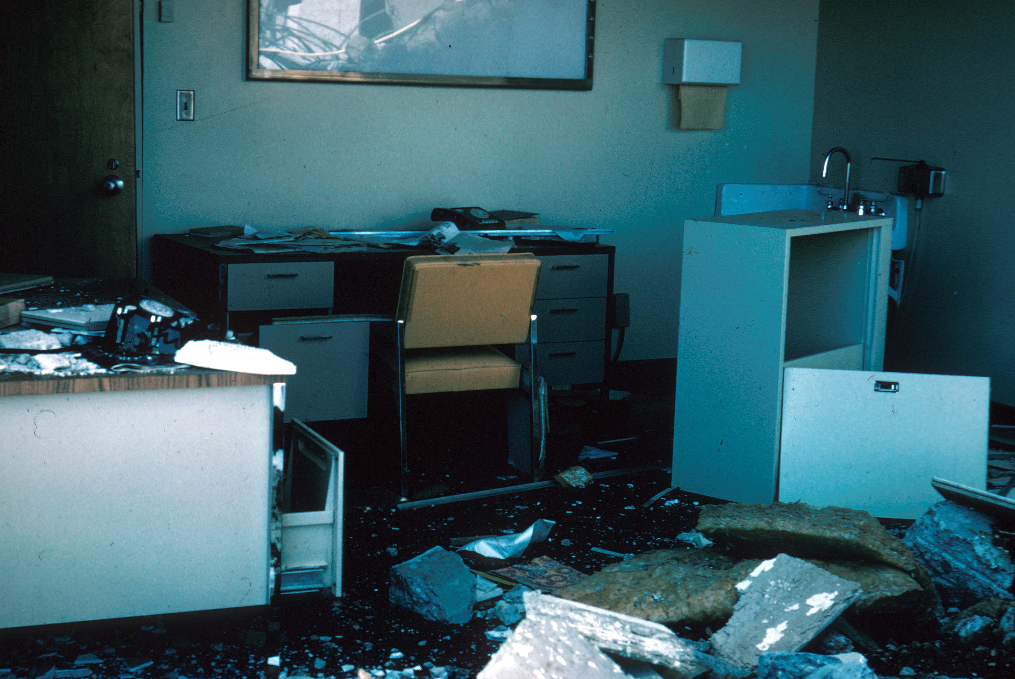
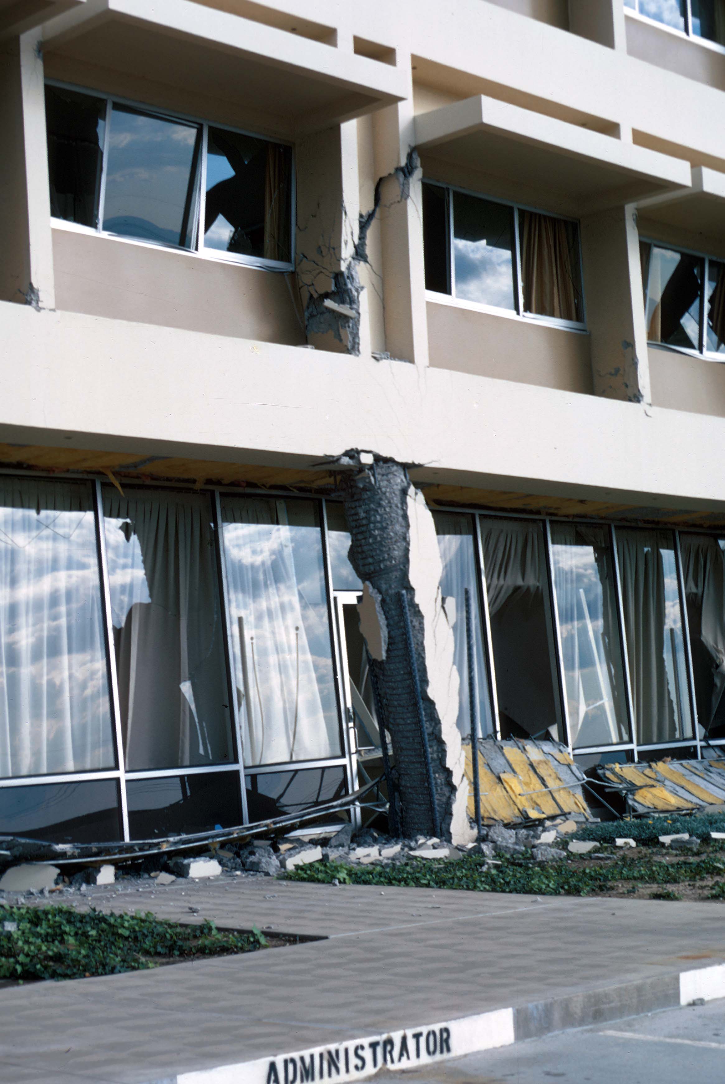
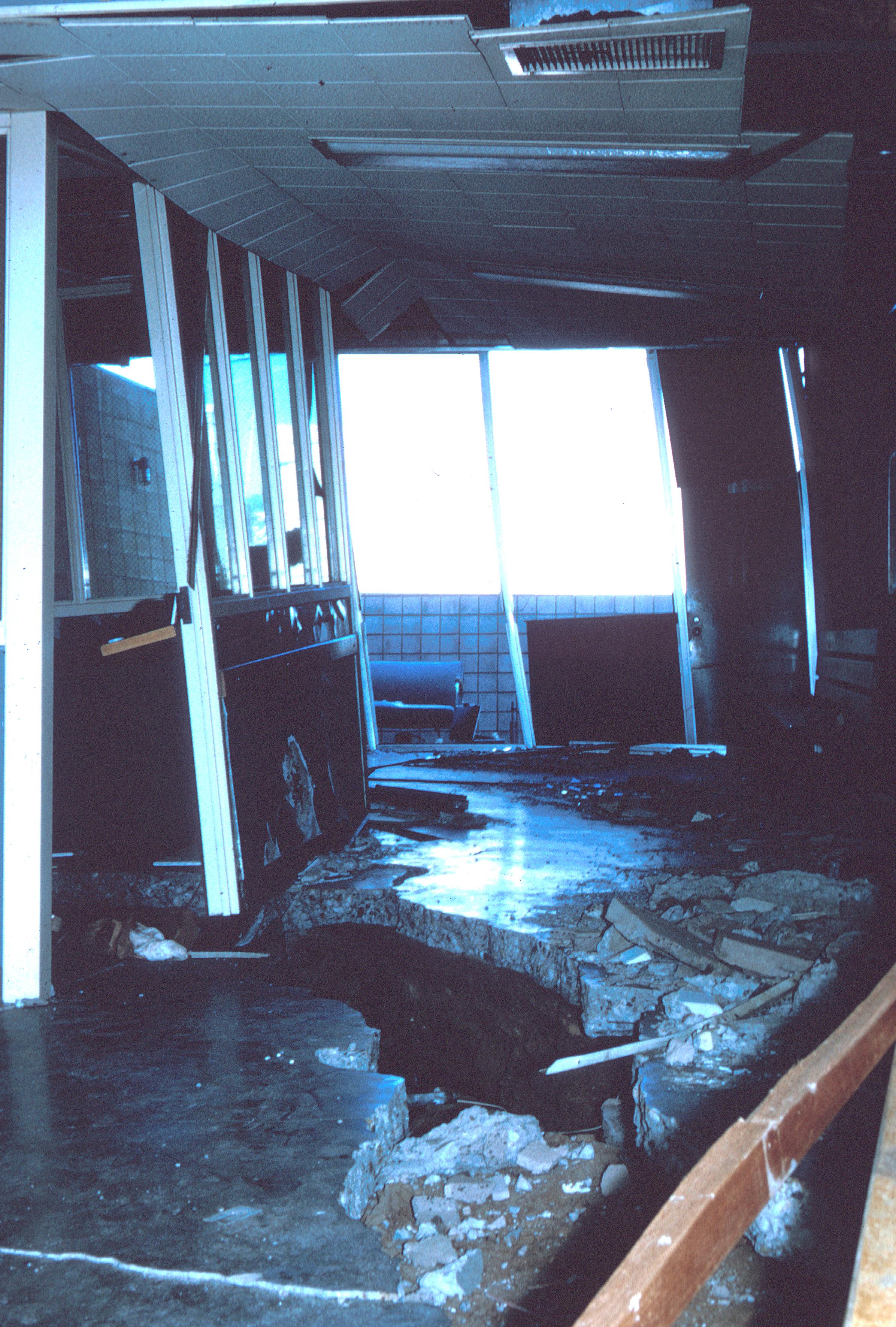
A view inside Olive View Medical Center after the 1971 San Fernando Earthquake.
9/21
USGS
This photo shows damage at Olive View Medical Center following the 1971 San Fernando Earthquake.
10/21
USGS
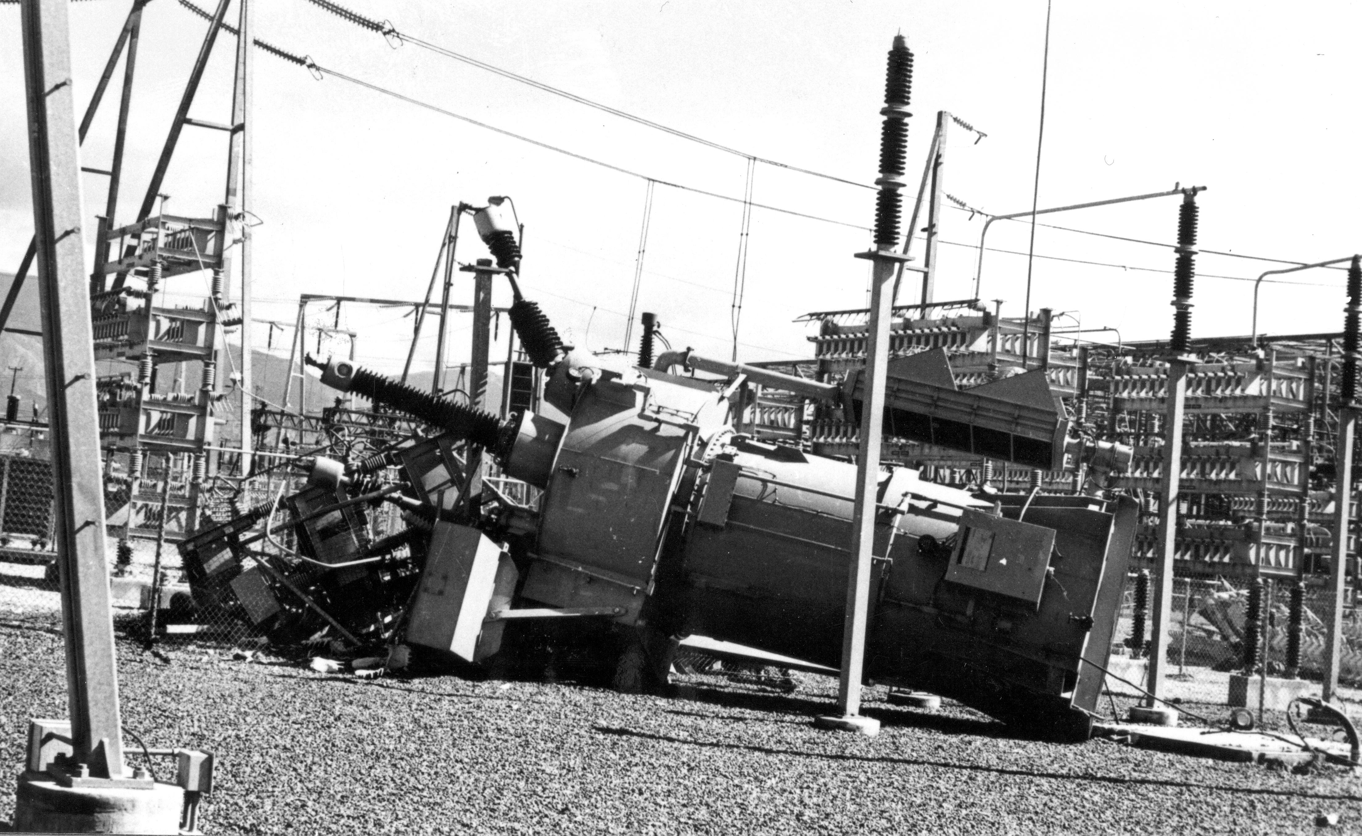
Electrical equipment was damaged in Sylmar in the 1971 San Fernando Earthquake. Power to more than 600,000 customers was disrupted.
11/21
USGS
A view inside the Los Angeles County Juvenile Facility in Sylmar, where shaking caused a crack in the girls dormitory.
12/21
USGS
The 1971 San Fernando Earthquake damaged a pipe on the Maclay Reservoir outlet line in Sylmar.
13/21
USGS
14/21
USGS
This view is looking northeast at the Sylmar Converter Station above the Van Norman Dam after the 1971 San Fernando Earthquake.
15/21
USGS
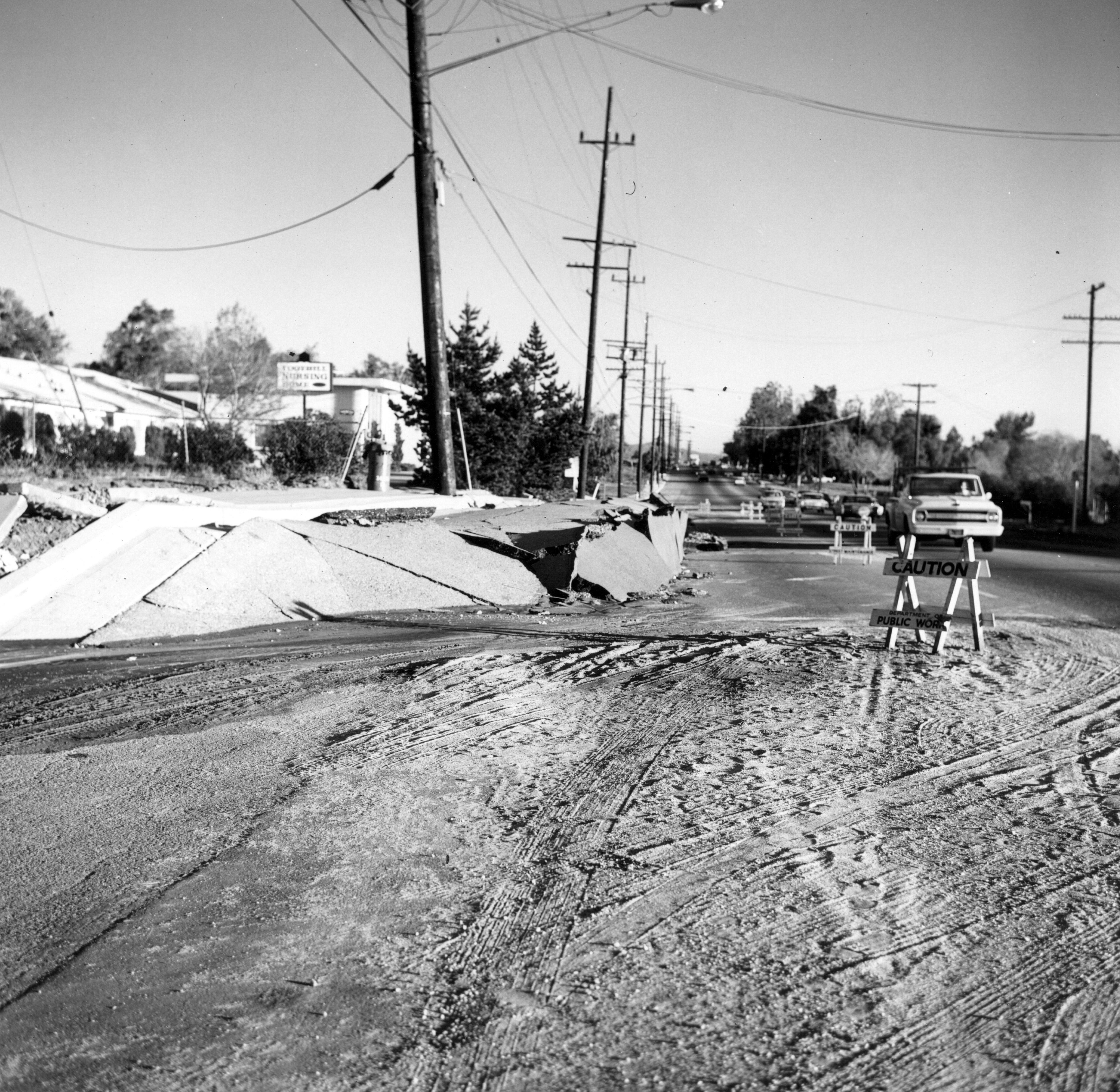
A view outside the Foothill Nursing Home in Sylmar following the 1971 San Fernando Earthquake.
16/21
USGS
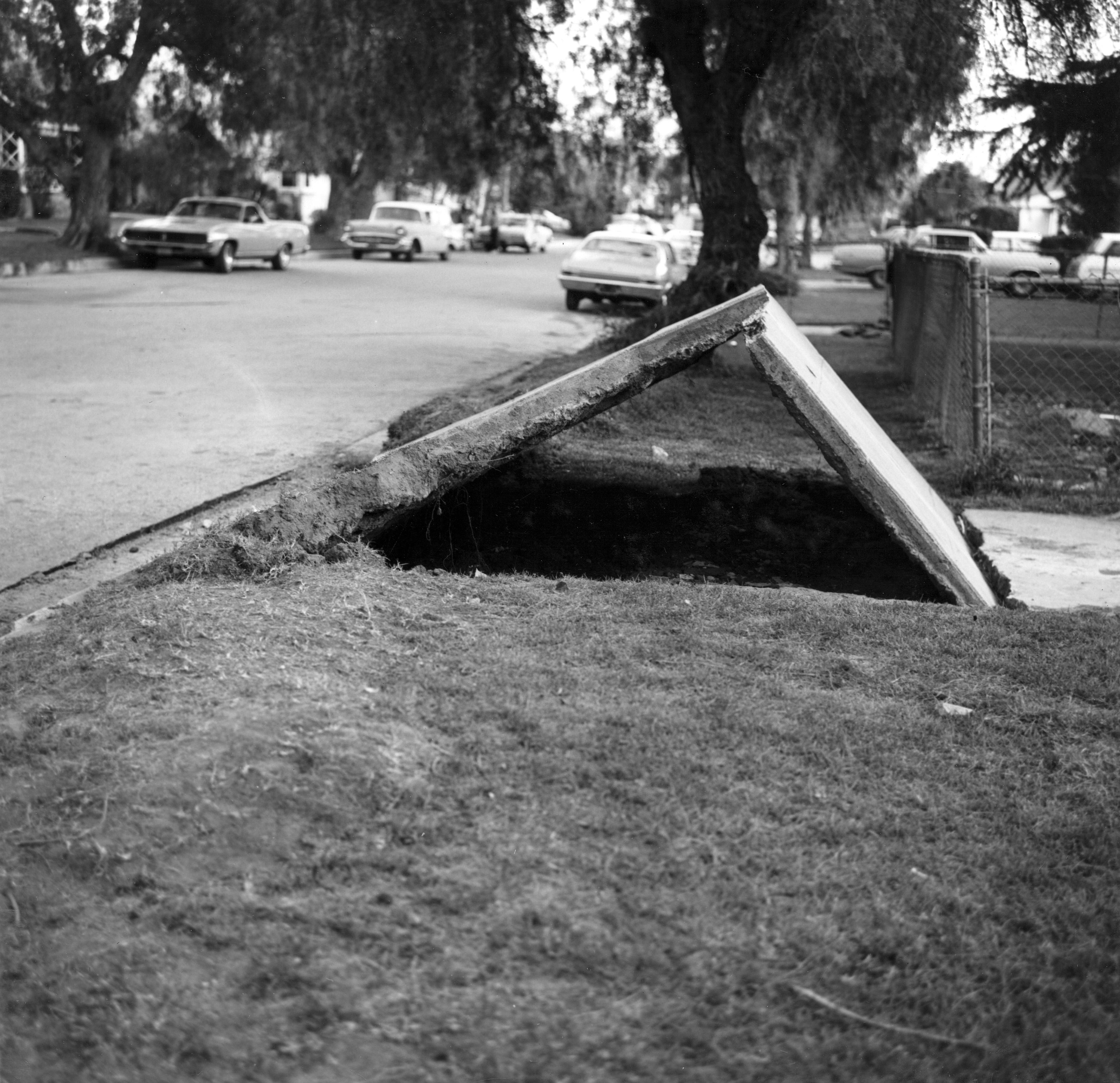
A driveway slab was lifted in the Sylmar area during the 1971 San Fernando Earthquake.
17/21
E. Leyendecker, USGS
A view of the Van Norman Dam after its partial collapse in the 1971 Sylmar Earthquake.
18/21
USGS
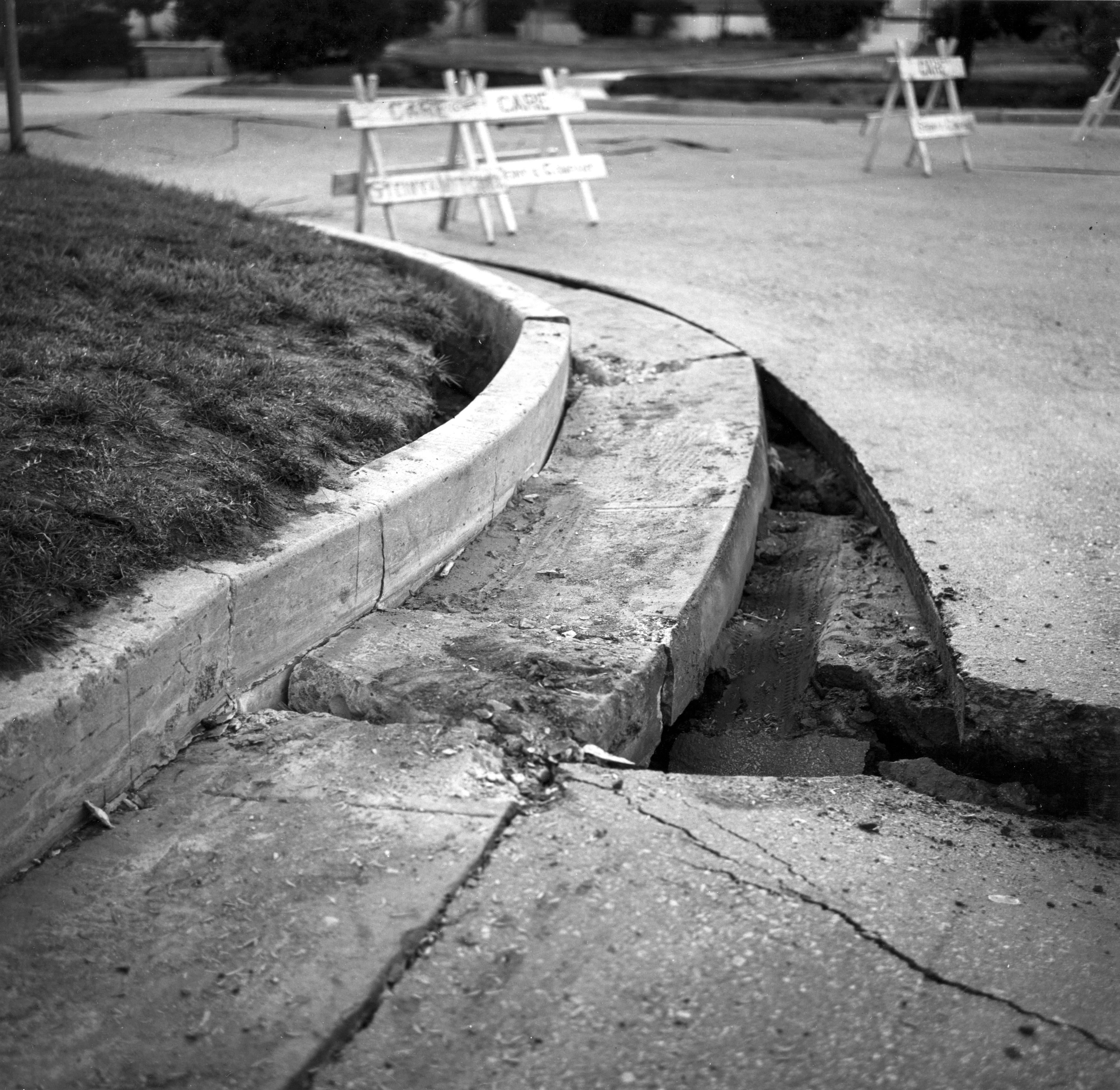
Damaged pavement and curbing is pictured in Sylmar following the 1971 San Fernando Earthquake.
19/21
USGS
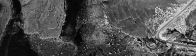
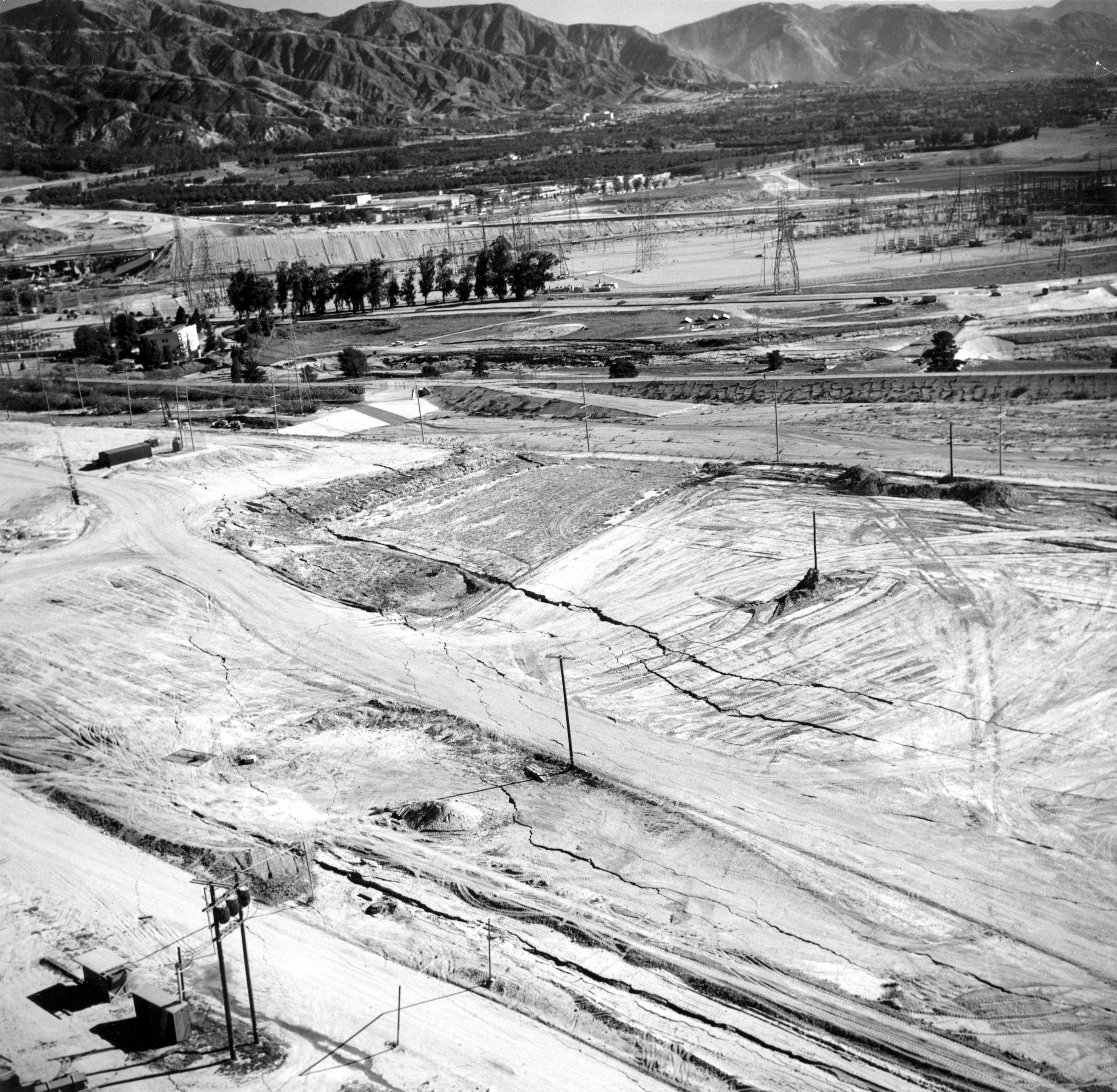
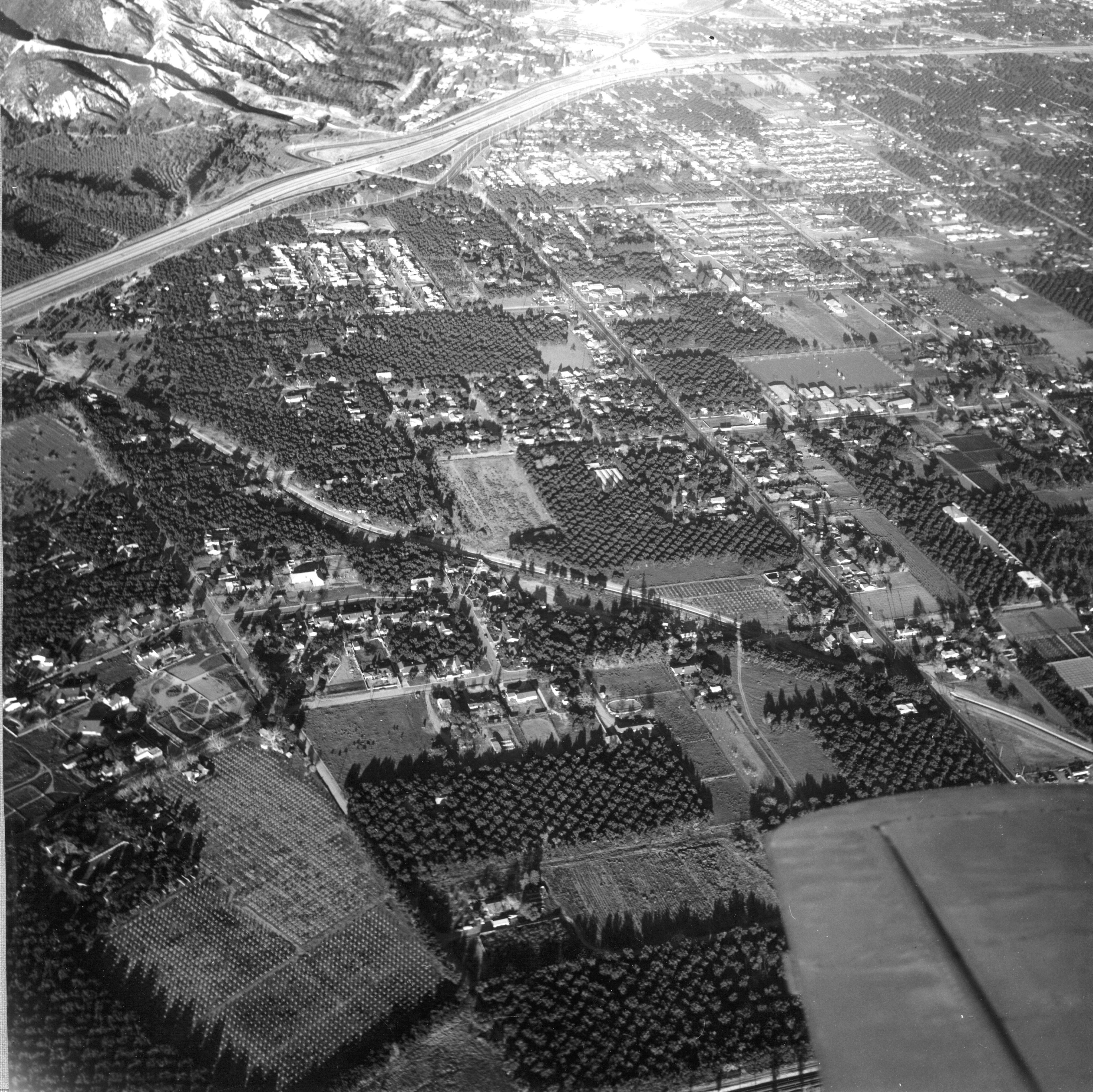
This aerial photo shows a housing development northeast of Shinsaw Avenue and Hubbard Street in the Sylmar area. Many homes in the area were damaged in the 1971 San Fernando Earthquake.
20/21
USGS
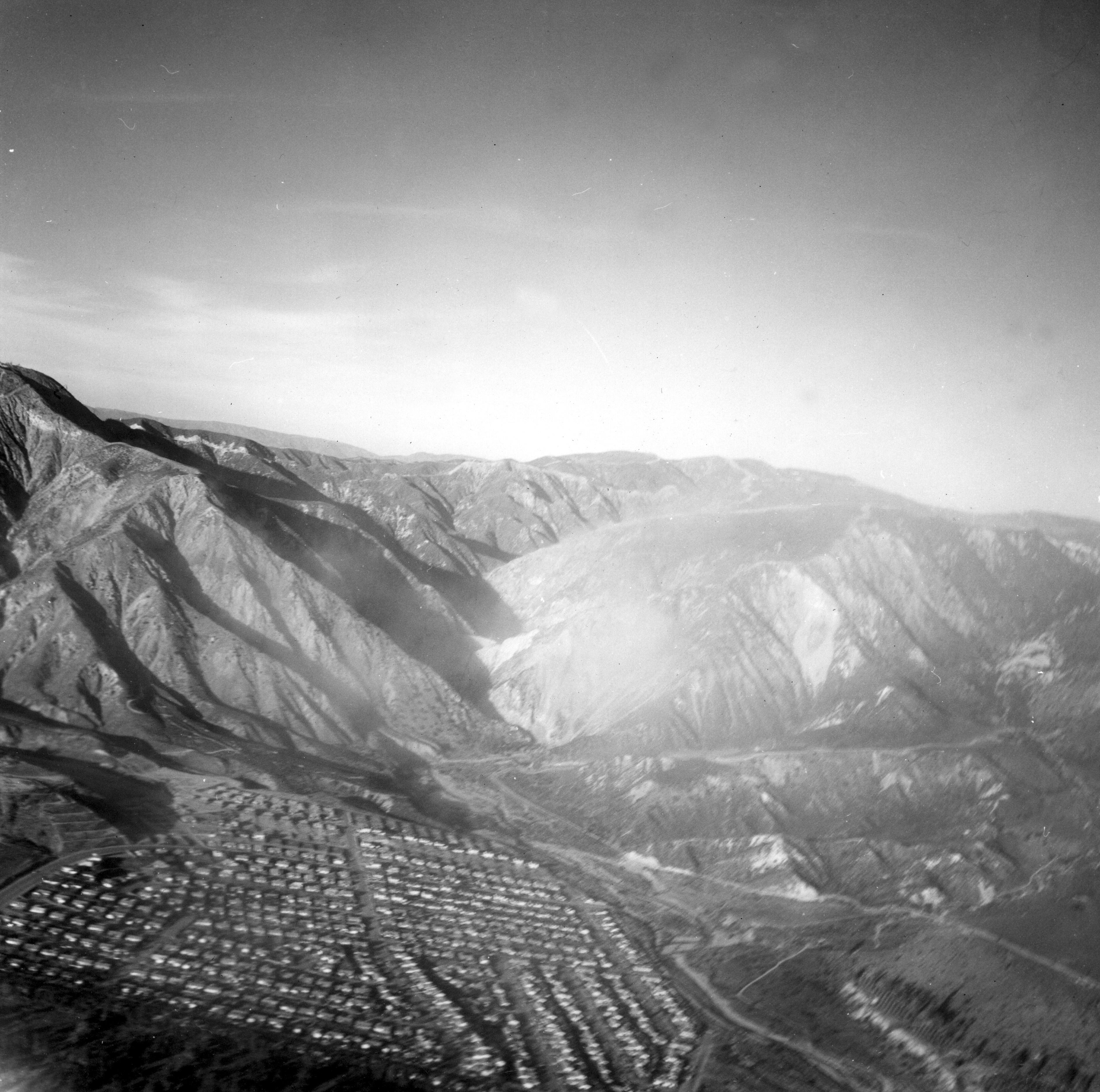
A view of the northern Sylmar area showing the 210 Freeway under construction. Olive View Hospital is in the upper part of this photo.
21/21
USGS
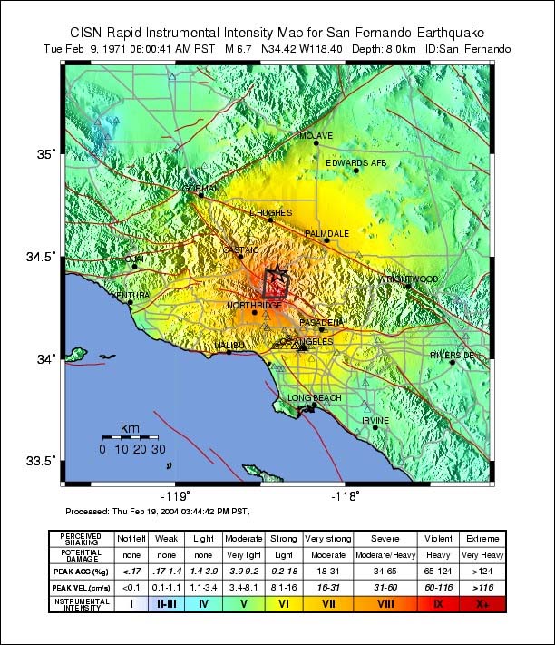
This map illustrates widespread shaking from the 1971 San Fernando earthquake in Southern California.