
California has entered one of the most dangerous times of the year for wildfires.
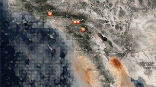
Use the map above to see where fires are burning. Zoom in on the orange flame symbols to see active fire perimeters. Click on the symbol for size and containment updates.
You also can click the play button at the bottom of the map to view an animated 48-hour smoke forecast.
