
The Thomas fire started Dec. 4 in Ventura County. Fanned by strong and shifting wind gusts, the fire grew quickly during its first 24 hours and eventually became the largest wildfire on record in California.
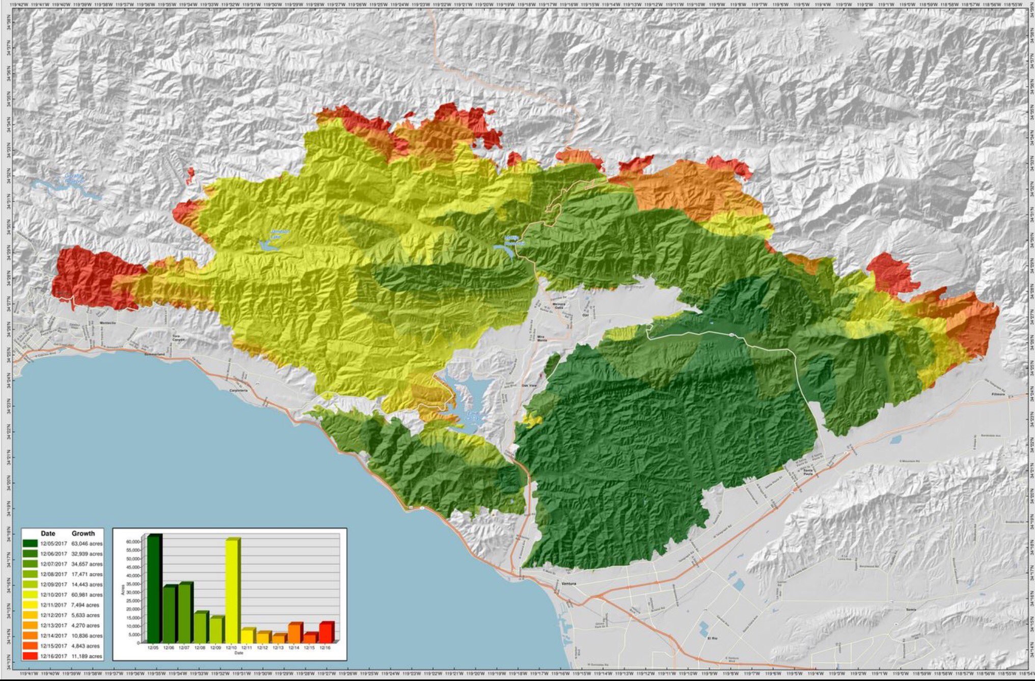
The map above shows the fire's progression through Dec. 20. It quickly burned more than 63,000 acres through Dec. 5. Dark green shades indicate the first days of the firefight. The fire then flared up Dec. 10, burning nearly 61,000 acres.
As of Dec. 19, the fire burned more than 271,000 acres in Ventura and Santa Barbara counties. It grew to nearly 282,000 acres and was contained Jan. 12.
Note: Click on the map or click here to see a larger view.
