
NASA satellite images illustrate the dramatic difference before and after February's storms in Southern California's mountains.
The storms triggered a rare blizzard warning in the Ventura, Los Angeles and San Bernardino county mountains. Images taken Feb. 10 and Feb. 26 from NASA's Landsat 9 satellite show the stark difference in snowfall in the San Gabriel Mountains north of Los Angeles.
Communities at high elevation received several feet of snow, up to 8 and 9 feet in some areas. Lower elevations, like Mount Wilson, Lockwood Valley and Frazier Park, received between 1 and 3 feet.
Get Southern California news, weather forecasts and entertainment stories to your inbox. Sign up for NBC LA newsletters.
Some communities at even lower elevations saw a few inches.
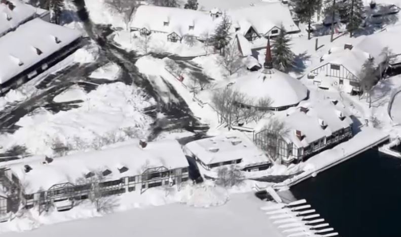
In San Bernardino County, many communities are still digging out from the historic snowfall.
At Lake Arrowhead Village, snowbanks surrounded a block of stores. Plow crews cleared a parking lot at a Stater Bros., one of the few places in the area where residents can stock up on supplies.
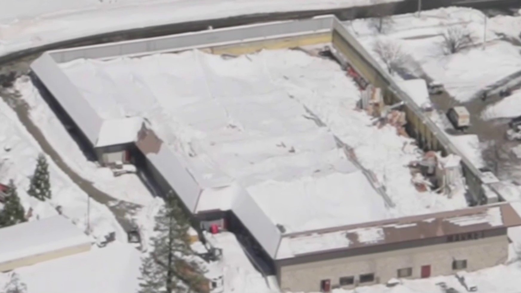
The roof of a grocery store in Crestline collapsed Wednesday under the weight of snow that piled several feet high.
Gov. Gavin Newsom on Wednesday proclaimed a state of emergency in San Bernardino and 12 other counties to support disaster relief by making state agencies and aid available and asking for federal help in clearing and repairing highways. The governor announced that the state was bringing in more snow plows and road crews to help clear roads and he authorized the California National Guard to mobilize for disaster response if needed.
