Photos: A Look Back at the 1928 St. Francis Dam Disaster
•
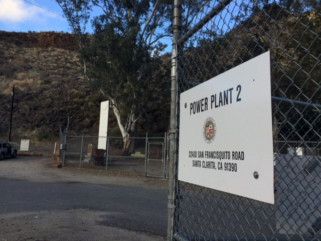
A memorial next to San Francisquito Power Plant No. 2 on San Francisquito Road is dedicated to the more than 450 victims of the March 12, 1928 St. Francis Dam disaster.
22 photos
1/22
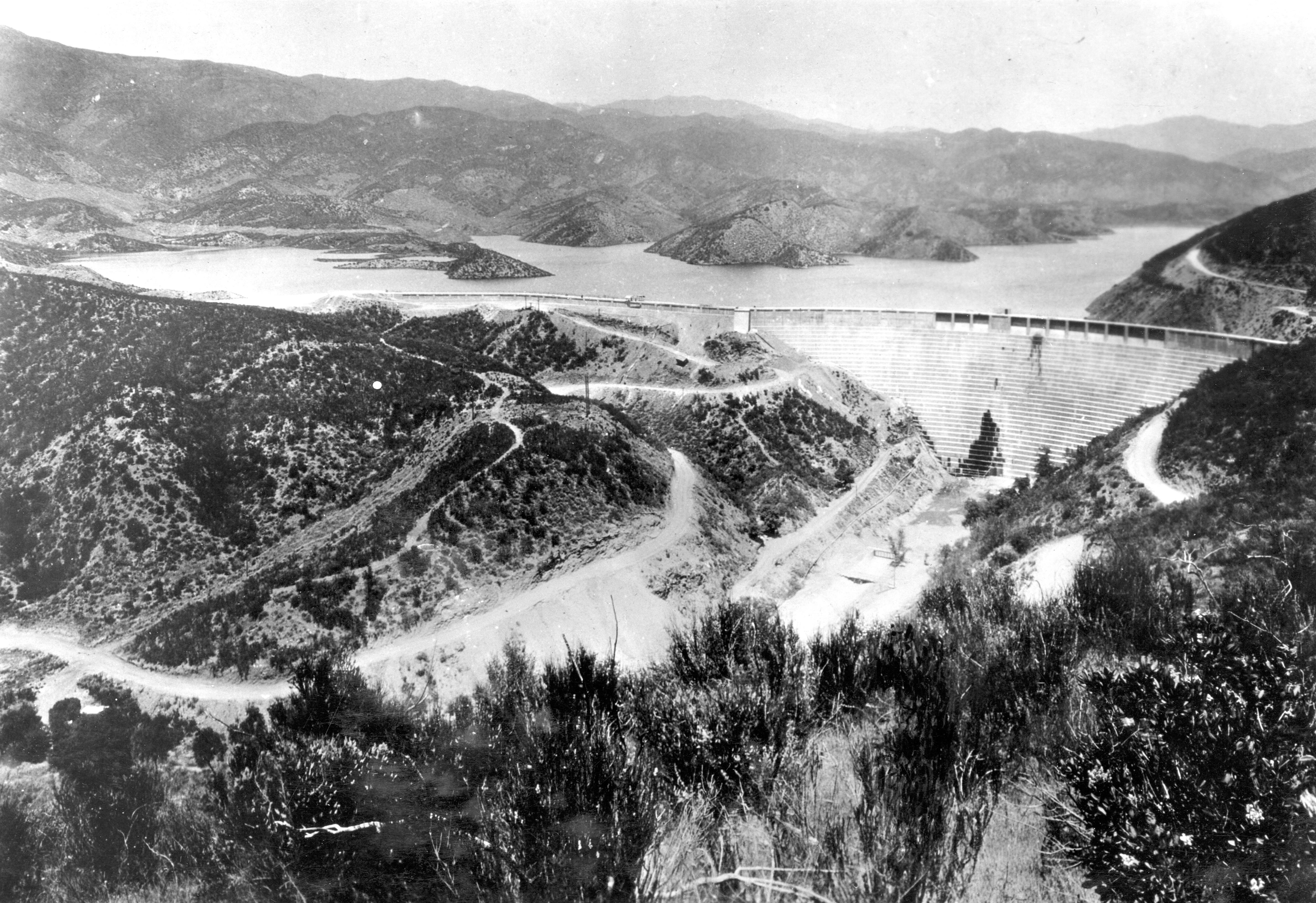
USGS/Photo courtesy of the Los Angeles Bureau of Power and Light
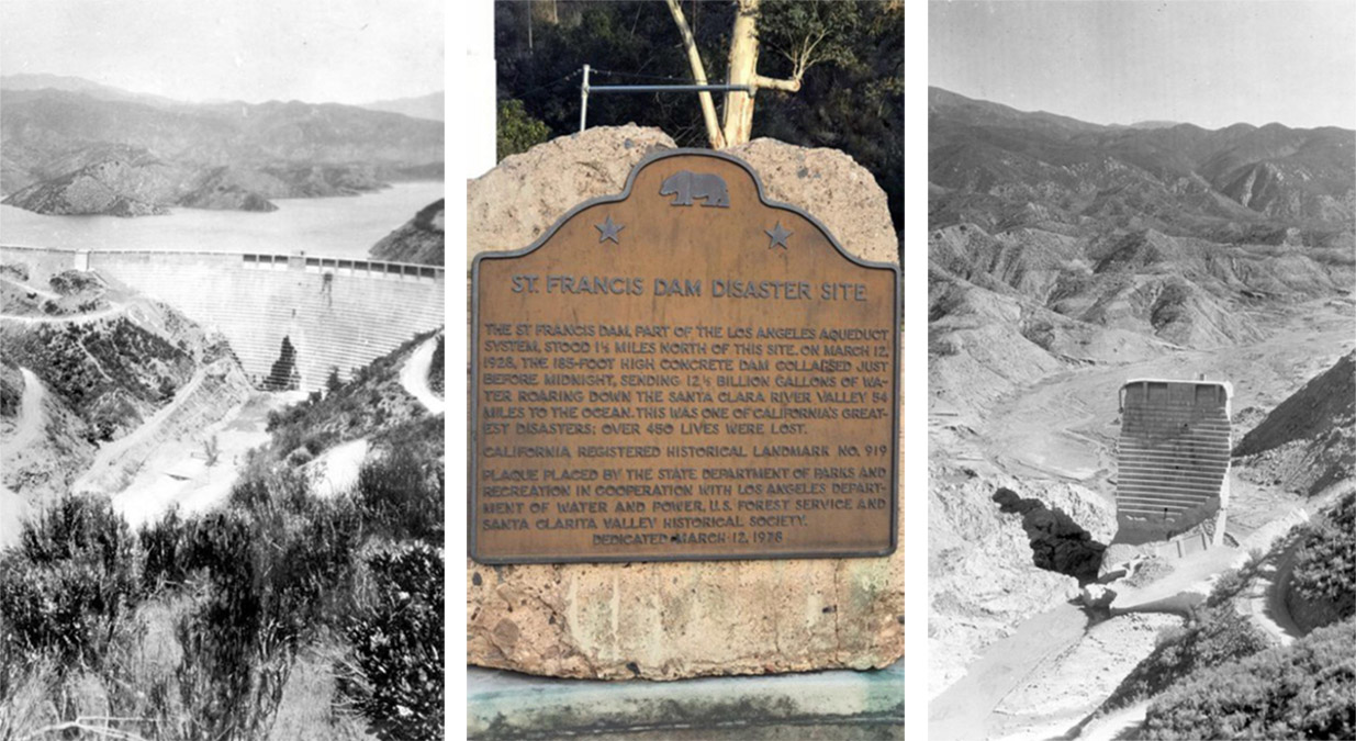
A view of the St. Francis Dam north of Los Angeles before the 1928 disaster that left more than 450 people dead.
2/22
ASSOCIATED PRESS
This aerial view shows the broken water barrier of San Francisquito Canyon, Ca., after the St. Francis Dam burst on March 13, 1928. The dam's reservoir of 12.5 billion gallons of water poured down the narrow canyon, carrying nearly hundreds to their deaths. (AP Photo)
3/22
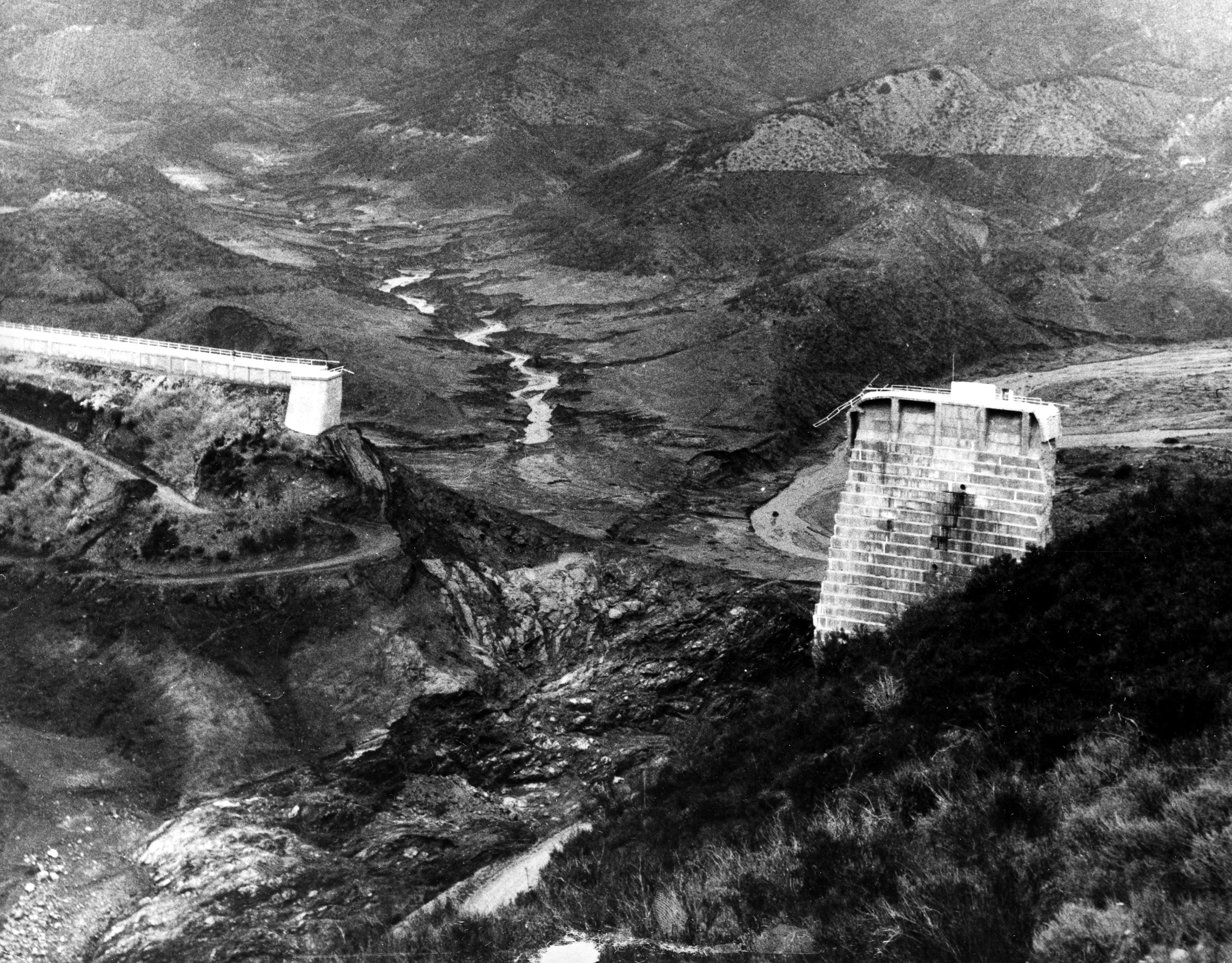
USGS/
This photo provides a view downstream toward the former location of the west abutment of the St. Francis Dam. The photo was taken March 17, 1928, nearly a week after the dam's collapse.
4/22
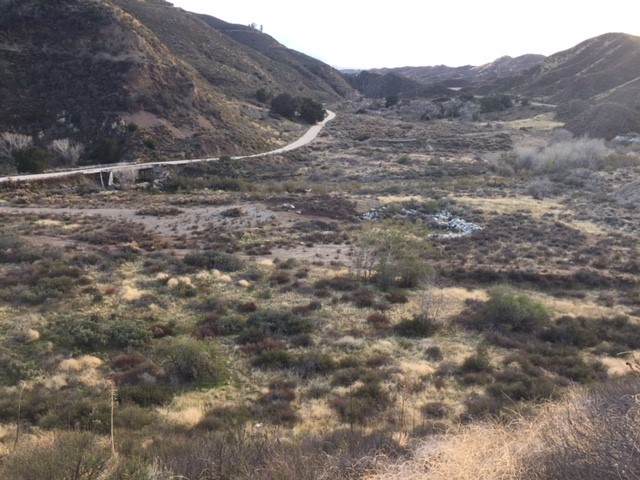
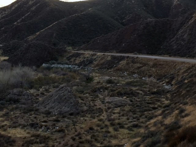
Jonathan Lloyd/KNBC-TV
A view of San Francisquito Canyon, site of the March 1928 St. Francis Dam collapse. the dam site is about a half-mile north of a victims memorial off San Francisquito Canyon Road. The site can be located by looking for mostly buried strips of concrete. Photo taken March 2018.
5/22
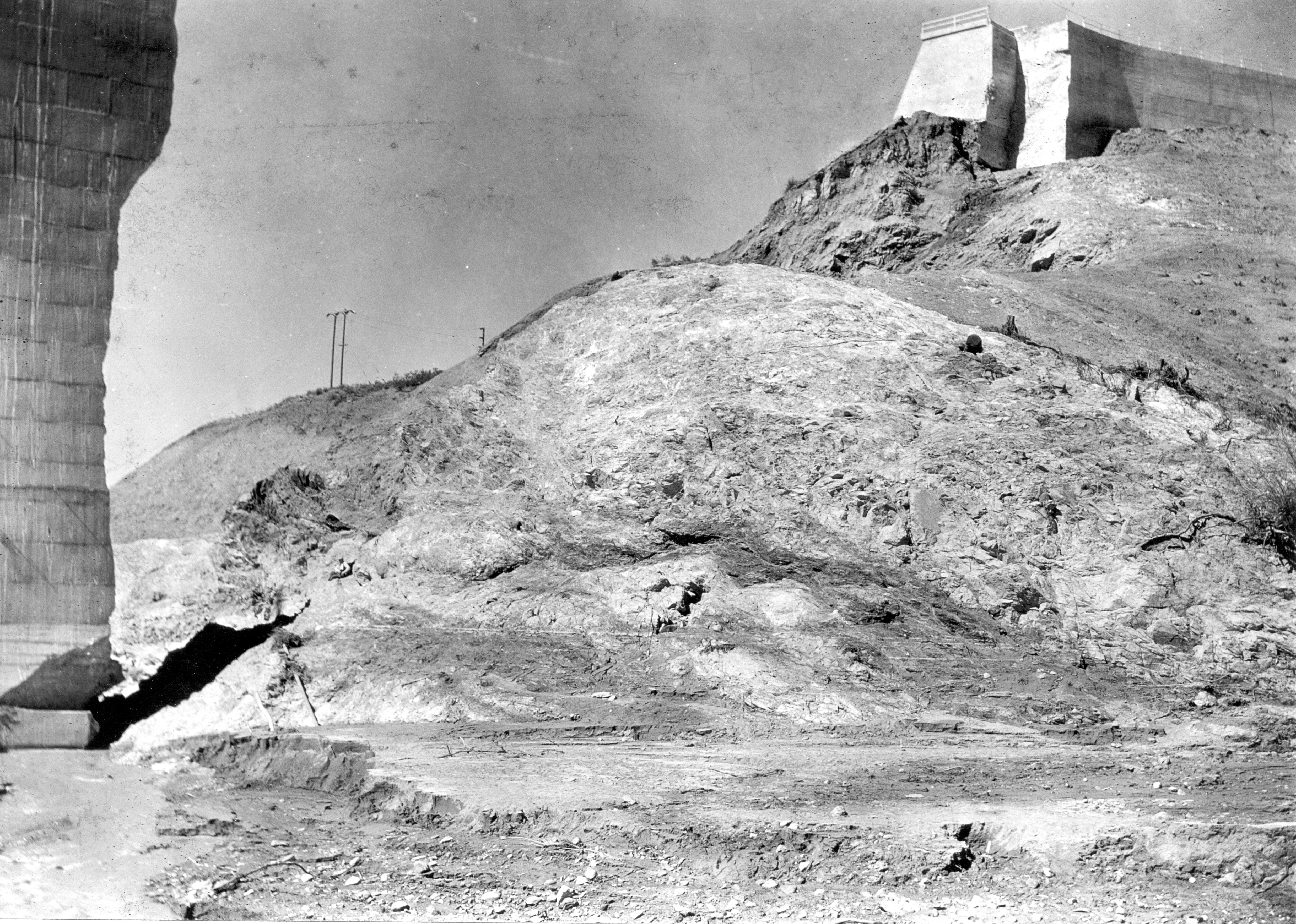
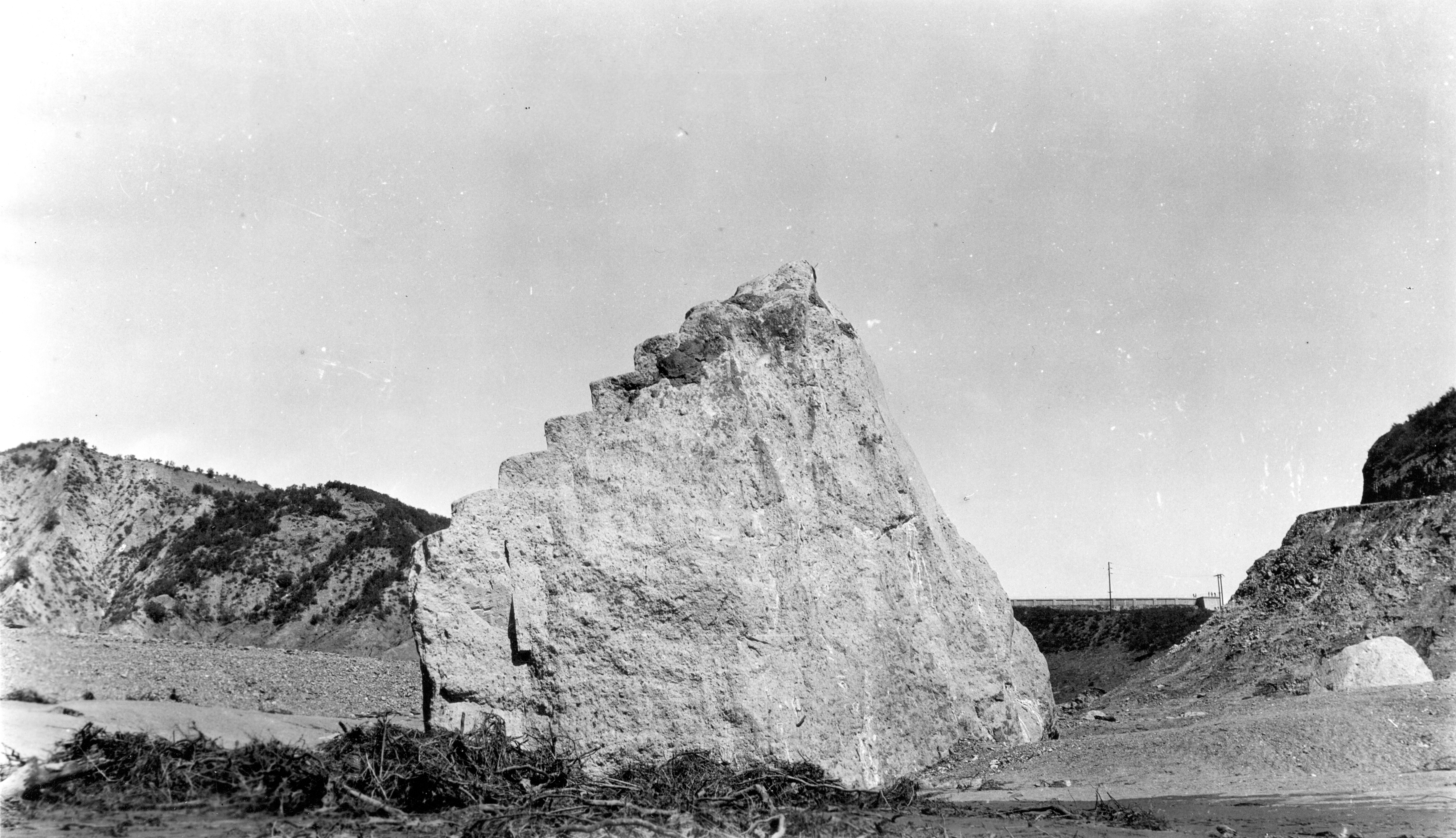
USGS
A concrete block is pictured from the west abutment of the St. Francis Dam. The block is about 63 feet long, 30 feet high, and 54 feet wide. The dam wing wall can be seen in the distance. March 17, 1928.
6/22
Jonathan Lloyd/KNBC-TV
A view of San Francisquito Canyon, site of the March 1928 St. Francis Dam collapse. the dam site is about a half-mile north of a victims memorial off San Francisquito Canyon Road. Photo taken March 2018.
7/22
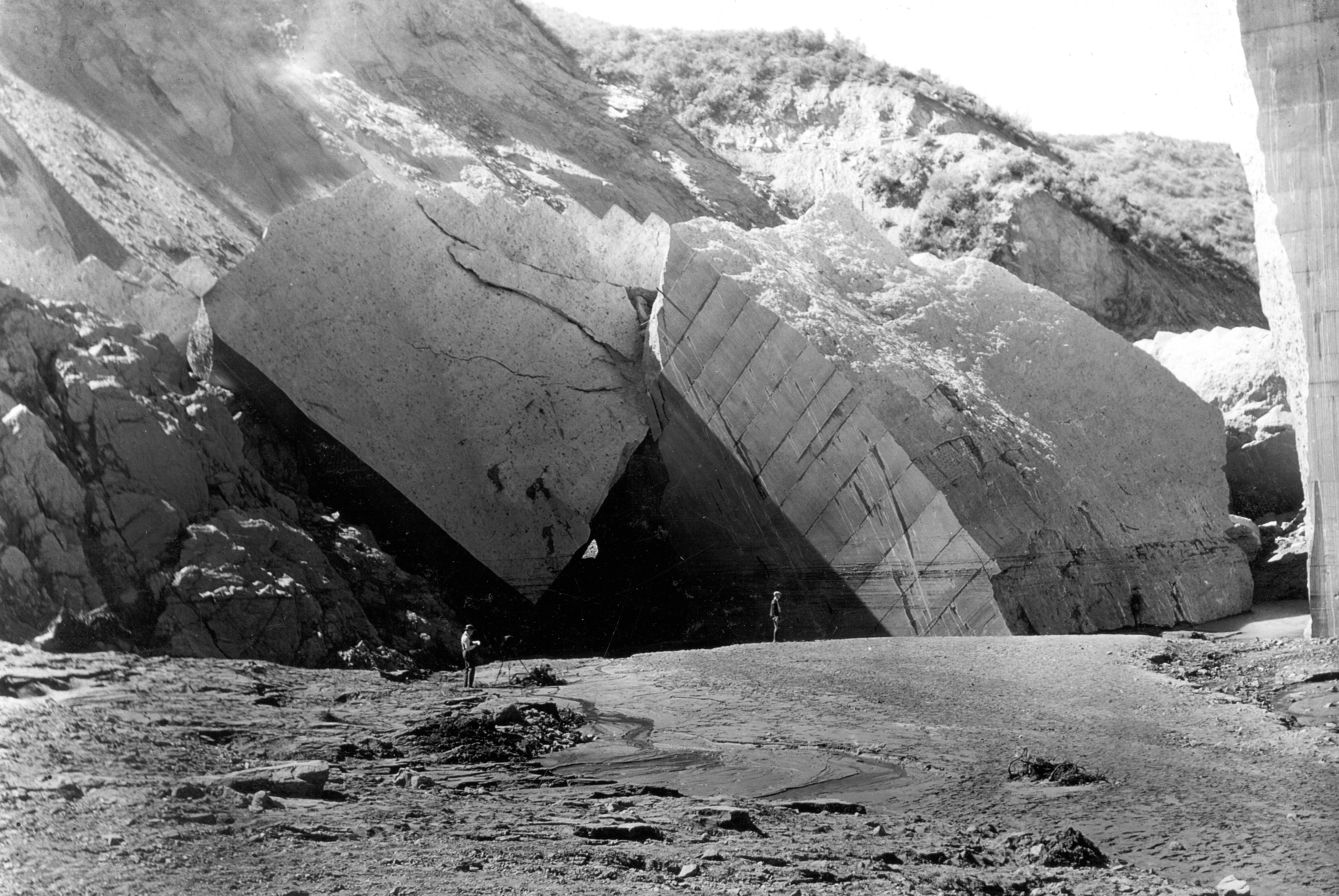
USGS
This March 17, 1928 photo shows a view looking downstream of enormous cement blocks at the base of the St. Francis Dam's east abutment. Dust clouds can be seen in the background from landslides that were still in progress five days after the dam's failure.
8/22
USGS
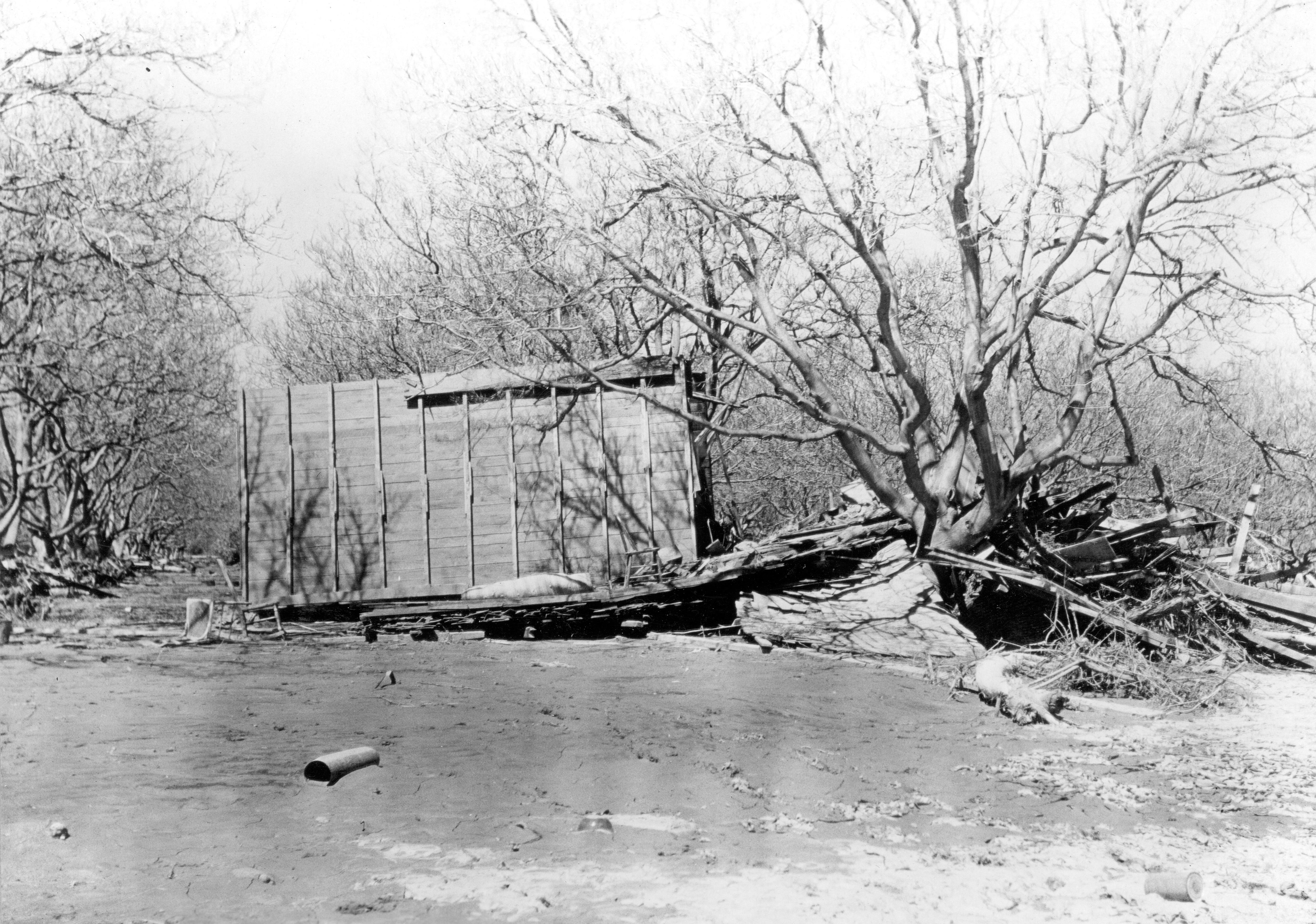
This March 18, 1928 photos whos damage left behind in Santa Paula by water unleashed when the St. Francis Dam collapsed near Santa Clarita March 12, 1928.
9/22
USGS
This March 18, 1928 photo shows damage in Santa Paula, devastated by water after the March 12, 1928 St. Francis Dam collapse north of Santa Clarita, about 30 miles away.
10/22
USGS
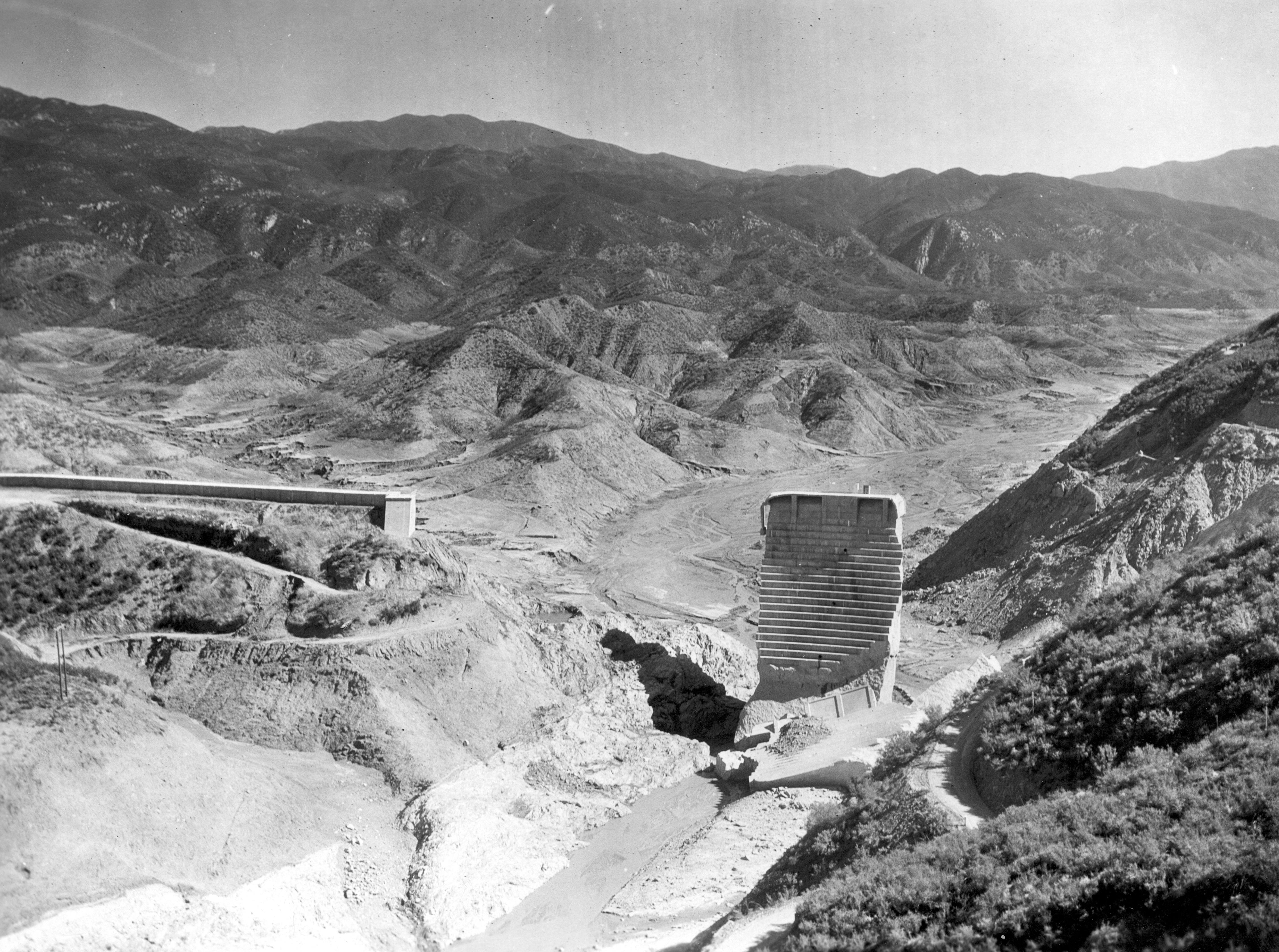
This March 17, 1928 photo shows the remains of the St. Francis Dan and the reservoir floor after the dam collapsed March 12, 1928.
11/22
USGS
This March 18, 1928 photo shows a house pushed onto its side in Santa Paula by water from the collapsed St. Francis Dam, located about 30 miles to the east.
12/22
USGS
This photo taken March 18, 1928 shows a washed out highway between Castaic and Piru after the collapse of the St. Francis Dam in Santa Clarita.
13/22
USGS
Houses and debris are piled up in Santa Paula due to floodwaters that rampaged across the region after the collapse of the St. Francis Dam near Santa Clarita. Photo taken March 18, 1928.
14/22
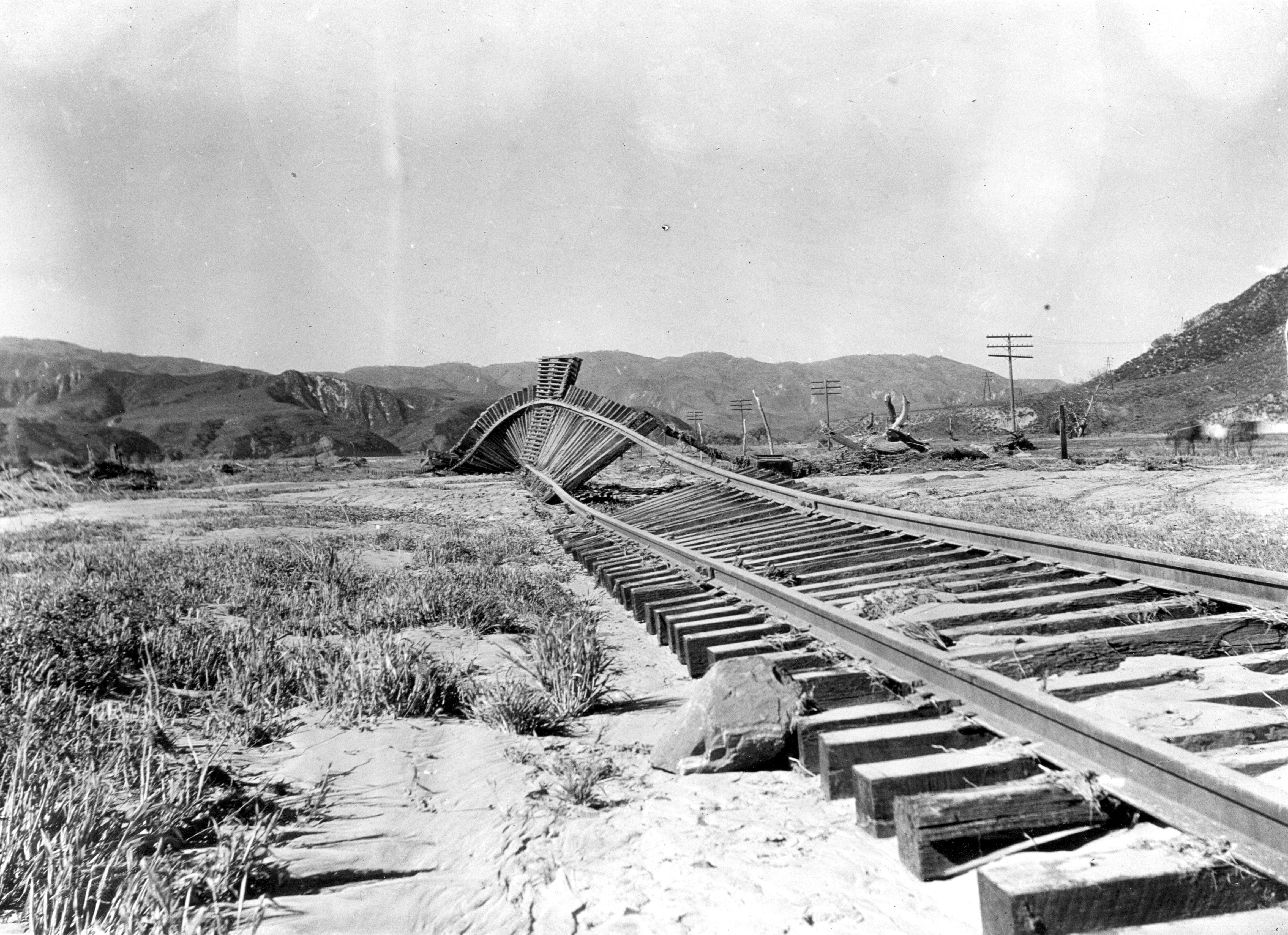
USGS
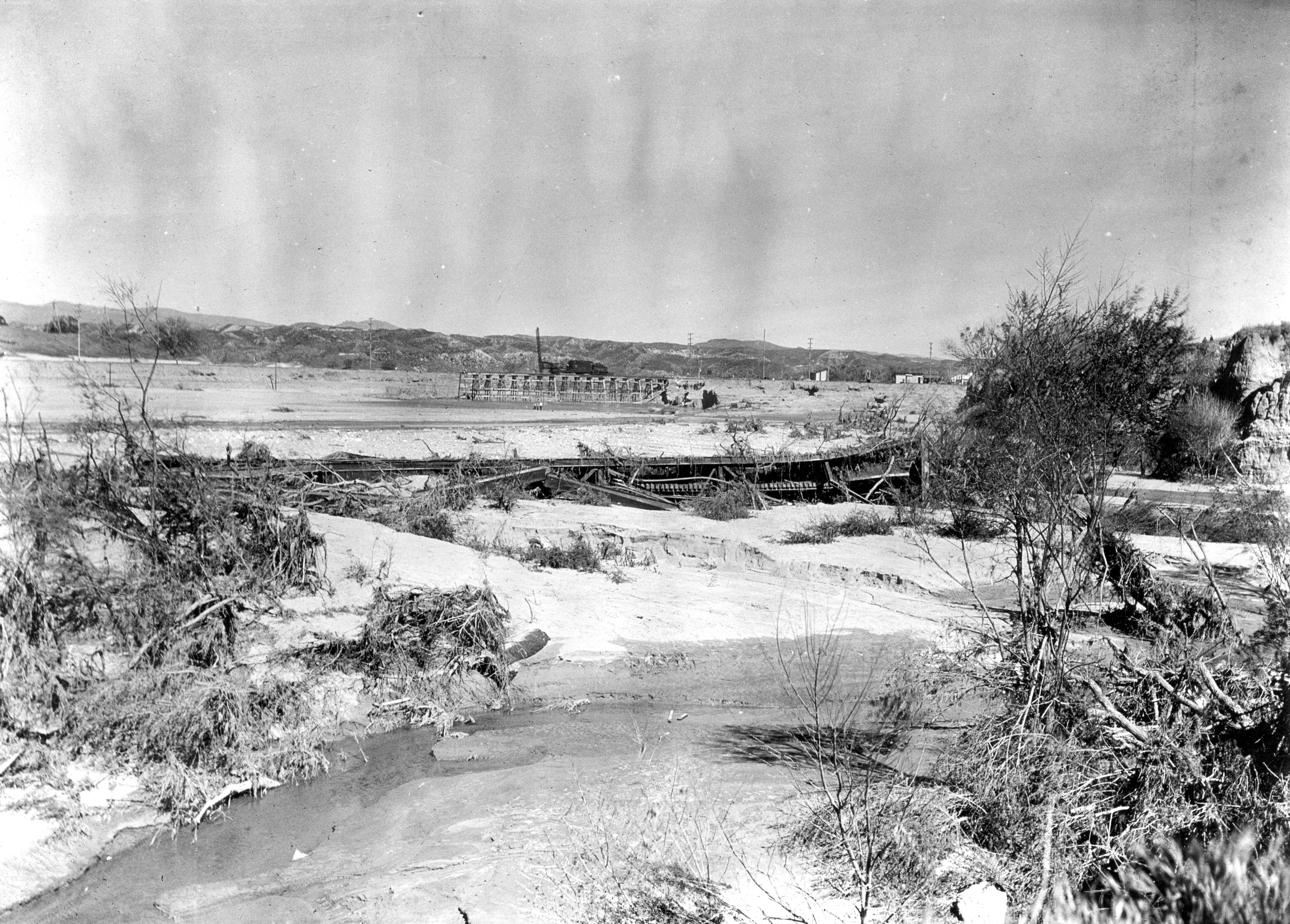
The powerful wall of water that crashed across the region following the St. Francis Dam collapse was strong enough to twist this railroad track between Castiac Junction and Piru. Photo taken March 18, 1928.
15/22
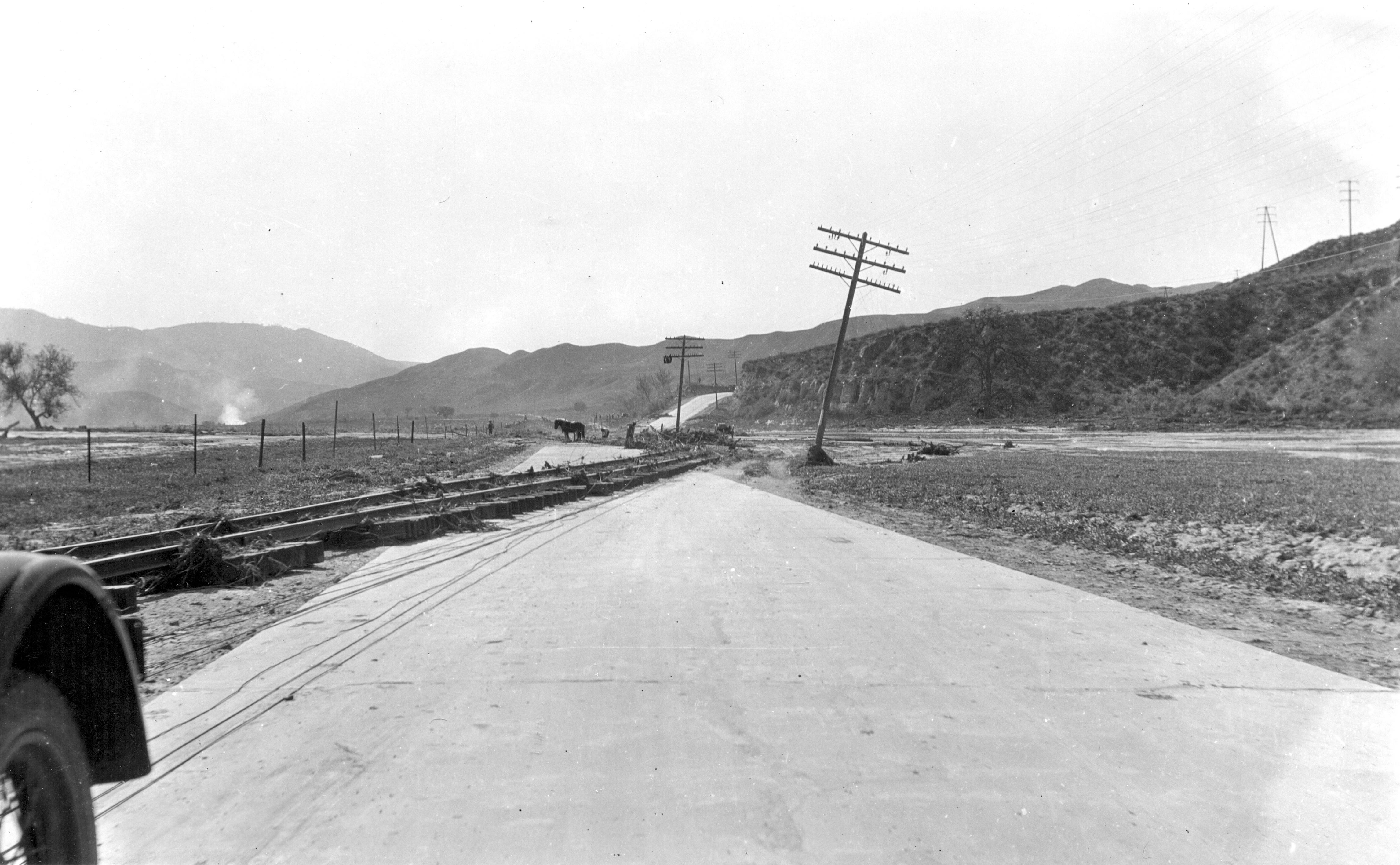
USGS
Powerful floodwaters that swept across the region after the collapse of the St. Francis Dam lifted a railroad track and dropped it on this road between Castaic Junction and Piru. Photo take March 18, 1928.
16/22
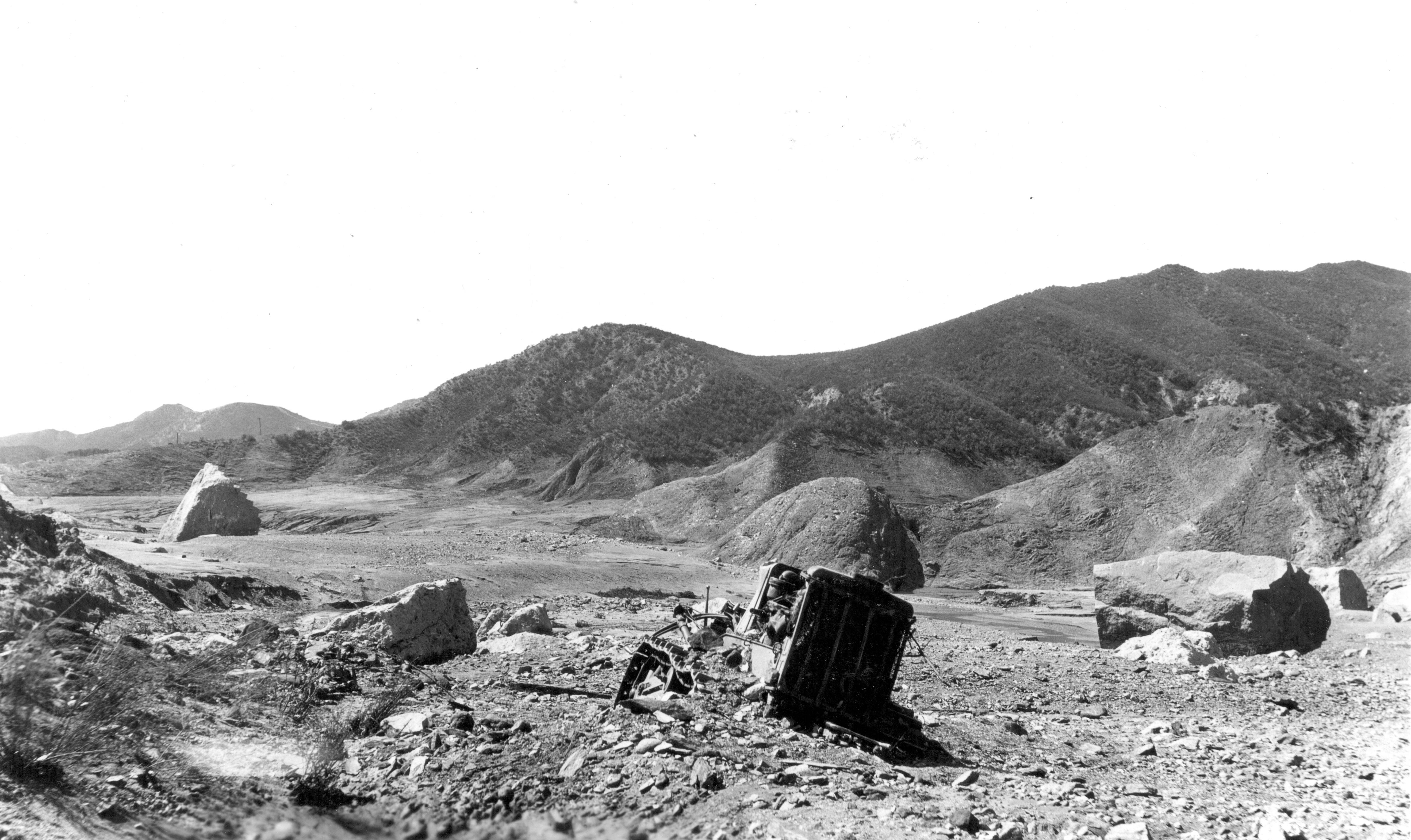
USGS
Large blocks of concrete from the St. Francis Dam were scattered about one-third of a mile downstream after its collapse on March 12, 1928. A tractor can be seen in the foreground. Photo taken March 17, 1928.
17/22
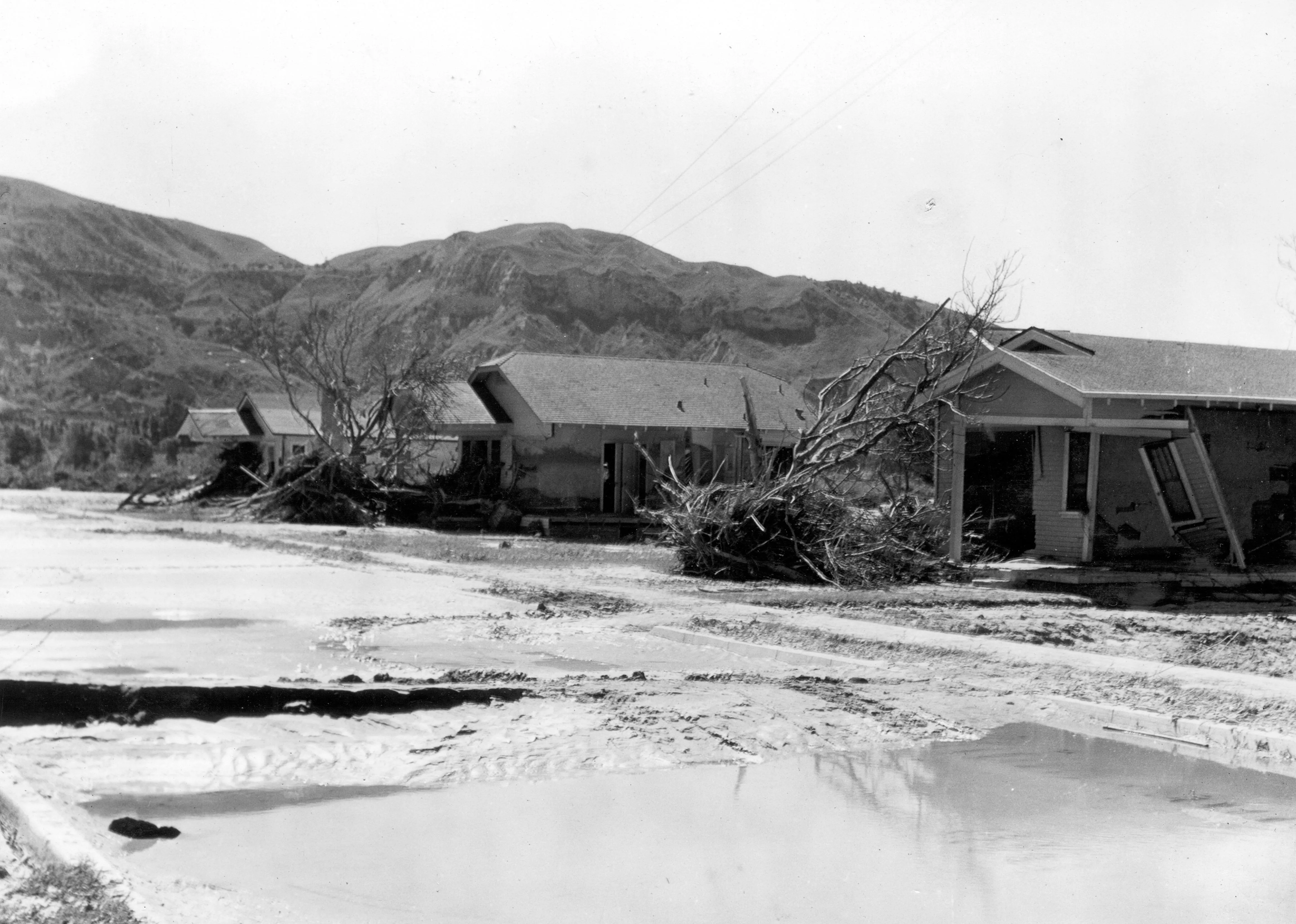
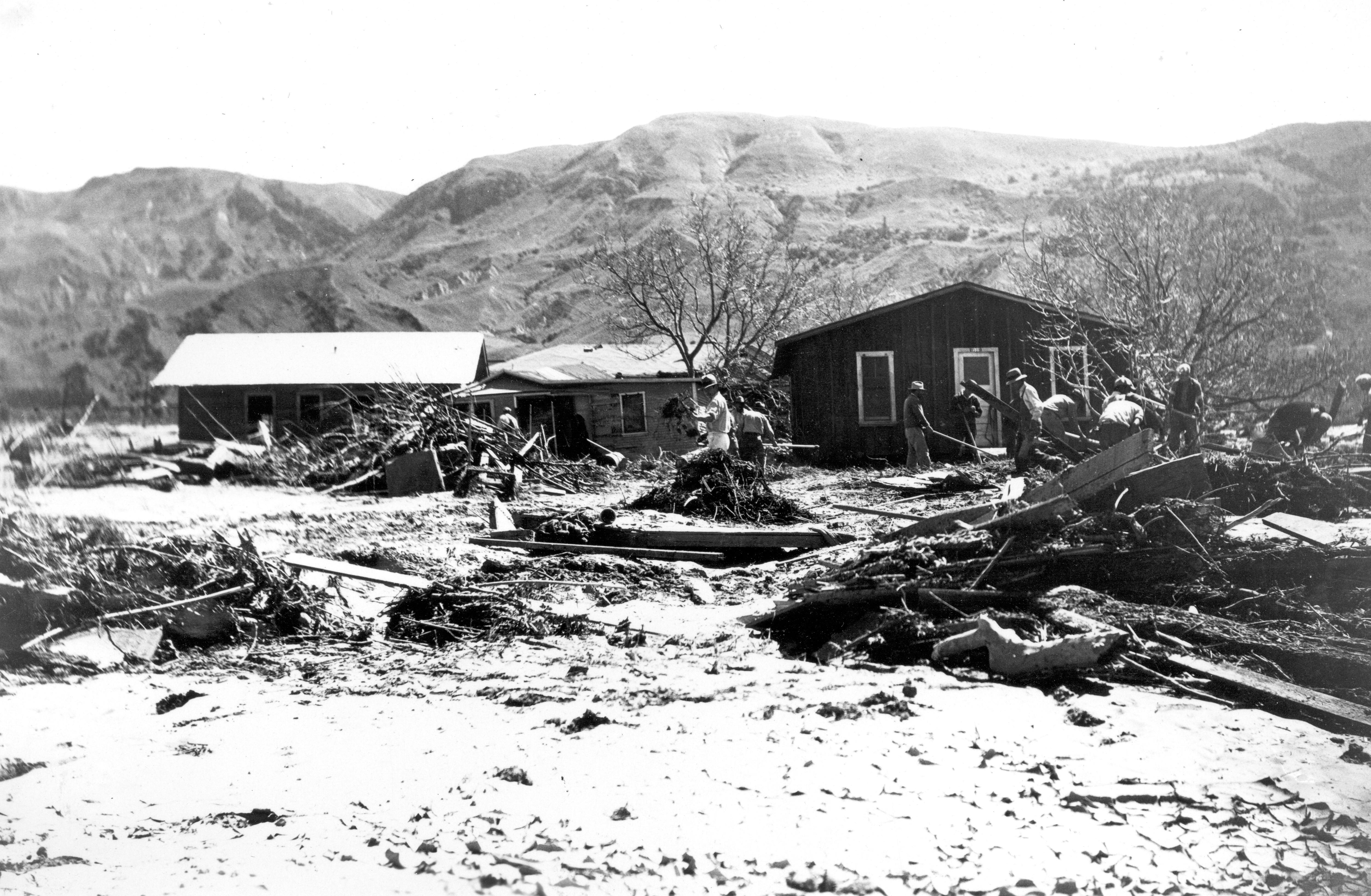
USGS
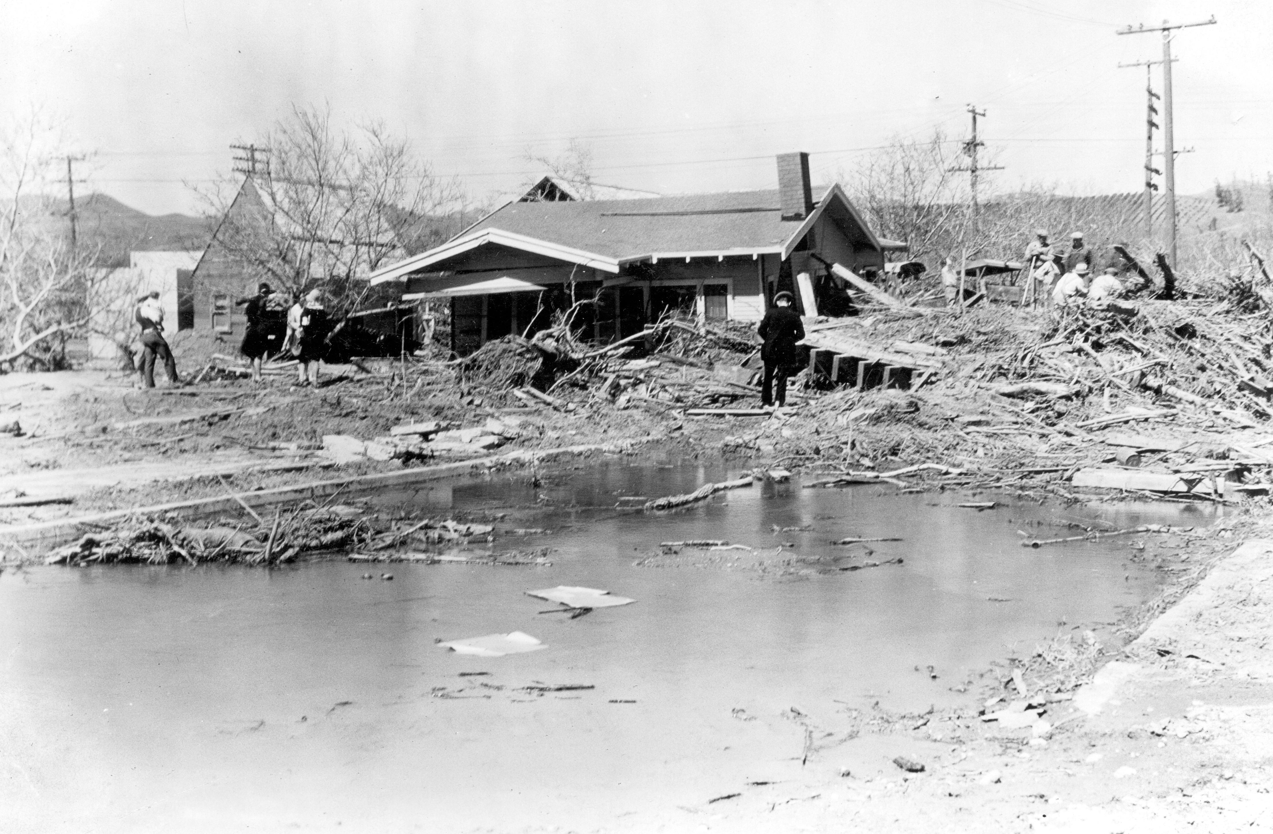
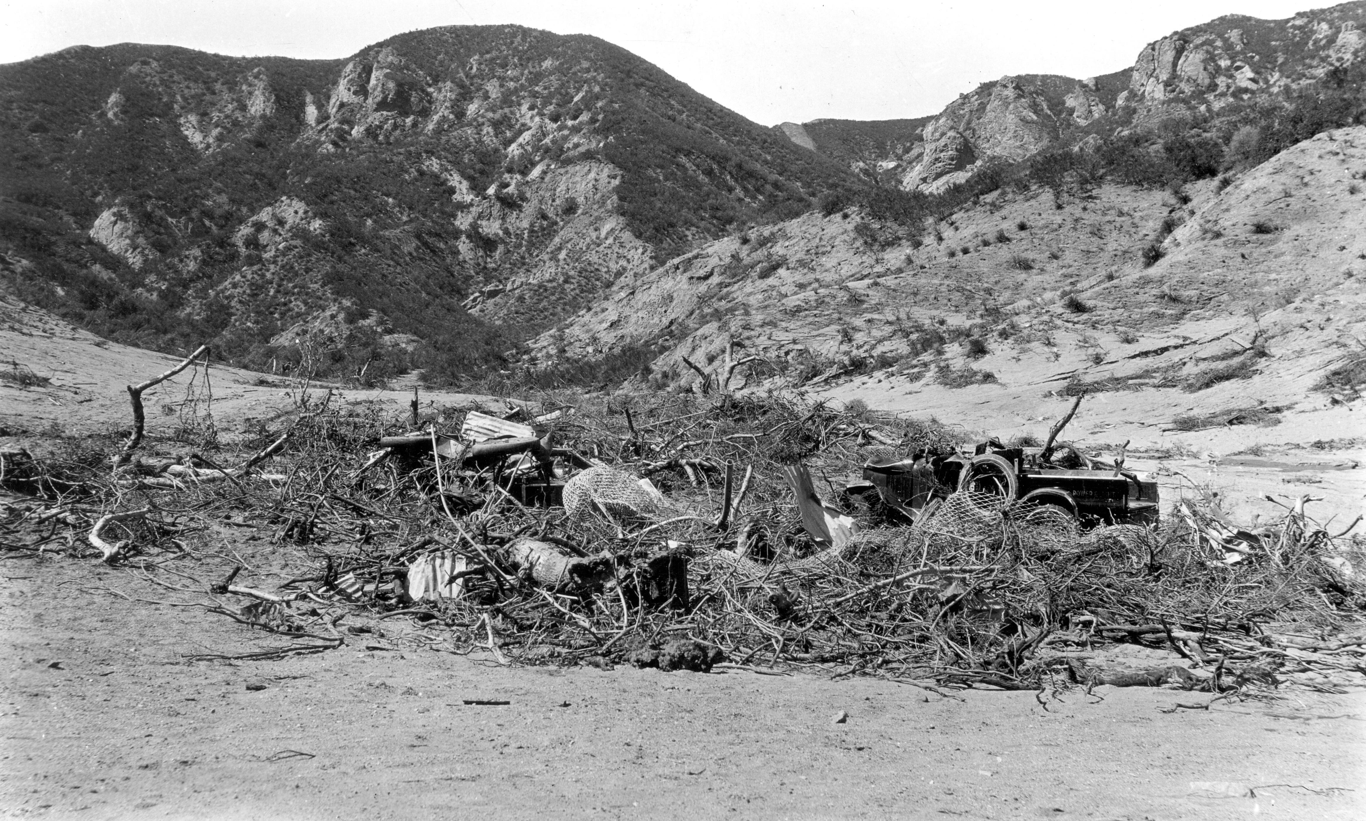
This March 17, 1928 photo shows the remains of homes near Power Plant 2 in a tributary valley of San Francisquito Canyon, site of the March 12, 1928 dam collapse and flood. Eleven bodies were removed from the debris seen here.
18/22
Jonathan Lloyd/KNBC-TV
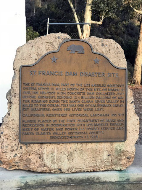
California Historical Landmark No. 919 is about a half-mile south of the site of the St. Francis Dam collapse in March 1928.
19/22
Jonathan Lloyd/KNBC-TV
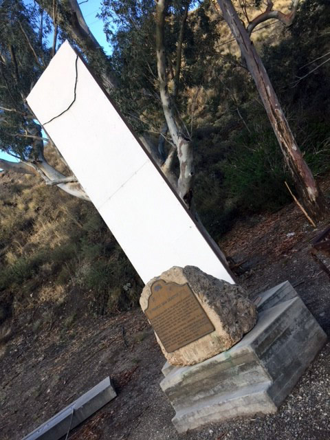
A memorial next to San Francisquito Power Plant No. 2 on San Francisquito Road is dedicated to the victims of the March 1928 St. Francis Dam collapse.
20/22
Jonathan Lloyd/KNBC-TV
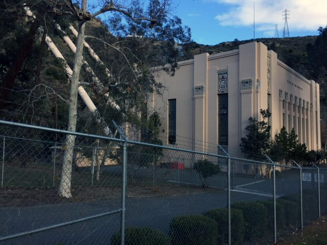
San Francisquito Power Plant No. 2 is part of the water system that brings water from the eastern Sierra Nevada Mountains to Southern California. Pipes can be seen behind the station.
21/22
Jonathan Lloyd/KNBC-TV
A view of a memorial for the March 1928 St. Francis Dam collapse victims as seen off San Francisquito Road north of Santa Clarita.
22/22
USGS/Jonathan Lloyd/KNBC-TV
A memorial next to San Francisquito Power Plant No. 2 on San Francisquito Road is dedicated to the more than 450 victims of the March 12, 1928 St. Francis Dam disaster.