
A winter storm delivered a final round of cold and snow in the mountains Wednesday as it slowly moved out of Southern California.
Ice and snow from the late February storm forced the closure of the 5 Freeway north of Los Angeles early Wednesday morning. The road was closed around 6:30 a.m. and reopened at about midday, but the backup extended for miles.
The CHP reported as many as 3,000 vehicles might have been stuck on the road, which was closed on a 30-miles stretch near the Los Angeles and Kern county line.
Video showed big rigs lined up on the shoulder of the road for miles.
Get top local stories in Southern California delivered to you every morning. >Sign up for NBC LA's News Headlines newsletter.
Snow levels dropped to 1,500 feet Wednesday morning in what was the first significant precipitation of a predominantly dry spell for Southern California since late December.
The mountains could see snow accumulating up to 3 inches, with 5 inches possible in some localized areas and the snow level falling as low as 2,000 feet Wednesday.
The snowy conditions will be accompanied by winds gusting up to 45 mph. Gusts reached 68 mph in Sierra Pelona West and 62 mph at the Ford Observatory. They were 58 mph in Lake Palmdale and 56 mph at Katee Lane in the Antelope Valley on Tuesday.
The Antelope Valley could receive as much as an inch of snow on the valley floor, with up to 2 inches falling in the foothills. Winds will also gust through that area, reaching up to 40 mph.
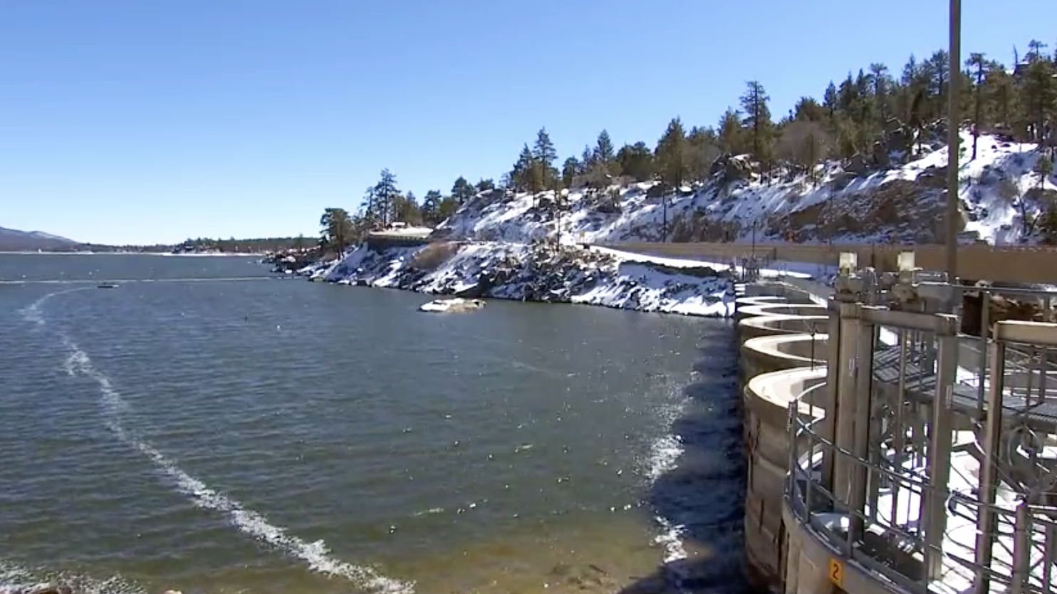
In Big Bear City, 5 to 8 inches of snow was recorded at 1 a.m. In Arrowbear, 5 to 7 inches of snow was recorded at 7:30 p.m. Tuesday. In Snow Valley and Green Valley Lake, 5 inches of snow was recorded at 6:30 p.m. Tuesday.
At Live Oaks Dam, .36 of an inch of rain was recorded on Tuesday. San Dimas Dam recorded .34 of an inch and Antelope Acres recorded .27 of an inch.

In Orange County, a wind advisory will also in place until 6 p.m. for Orange County coastal and inland areas, while a winter weather advisory will be in effect until noon in the Santa Ana Mountains and foothills.
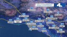
This is the coldest storm that we have seen so far this winter season. During the overnight and early Thursday, temperatures in the 20s and 30s will be widespread.
A hard freeze warning goes into effect Wednesday night for parts of the Inland Empire, where temperatures will be in the low 20s.
"If you think it's cold this morning, it's going to be near freezing Thursday morning," said De Leon.
Drier weather is expected on Thursday, along with a slight warming trend that will
last into the weekend.