
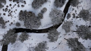
California's statewide snowpack level is more than 200 percent above normal for this time of year after powerful December storms blanketed the Sierra Nevada Mountains with snow.
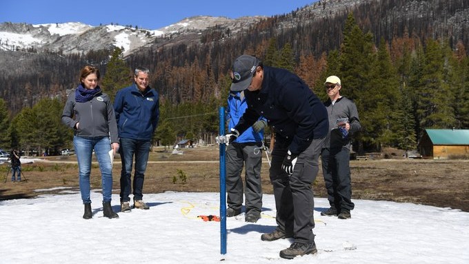
The statewide snowpack, a critical measurement for water resources managers, reached 223 percent of normal for Monday. On Tuesday, that figure was at 213 percent of normal, according to California Department of Water Resources data.
One year ago, statewide snowpack was at a dismal 22 percent to normal.
Get top local stories in Southern California delivered to you every morning. >Sign up for NBC LA's News Headlines newsletter.
Much of California’s water comes from melting snow in the Sierra Nevada Mountains. In an ideal scenario, storms blanket the mountains with snow during winter, building up the natural reservoir. That snow then melts in late spring and early summer, replenishing the state's water system.
California recorded its driest first three months of the year on record to start 2022. In the last manual snowpack survey of last season in April, snowpack was at 38 percent of normal.
Last week's US Drought Monitor map shows nearly all of the state in moderate drought. Severe and extreme drought persists through the central part of the state and into north-central California.
LA County has swaths of moderate and severe drought with a pocket of extreme drought in the northwest corner of the county.
Conditions have changed little over the past three months, according to the report released Thursday.
The winter storm behind the hefty snowpack closed mountain highways in the Sierra Nevada and is moving across the United States, reaching the Plains by mid-week.
The Heavenly ski resort at Lake Tahoe shut down some operations when the brunt of the storm hit Saturday. The resort posted video of lift chairs swaying violently because of gusts that topped 100 mph, along with a tweeted reminder that wind closures are "always for your safety."
To the south, Mammoth Mountain reported that more than 20 inches (51 cm) of snow fell Saturday, with another 2 feet possible as the tail end of the system moved through the eastern Sierra.
The southern Sierra snowpack was at 257 percent of normal Monday.
The UC Berkeley Central Sierra Snow Lab in Soda Springs, California reported Sunday morning that more than 43 inches had fallen in a 48-hour span.
A 70-mile stretch of eastbound U.S. Interstate 80 was closed Saturday “due to zero visibility” from the northern California town of Colfax to the Nevada state line, transportation officials said. Chains were required on much of the rest of I-80 and other routes in the mountains from Reno toward Sacramento.
Many other key roads were closed because of heavy snow, including a stretch of California Highway 89 between Tahoe City and South Lake Tahoe, the highway patrol said.
The U.S. Forest Service issued an avalanche warning for the backcountry in the mountains west of Lake Tahoe where it said “several feet of new snow and strong winds will result in dangerous avalanche conditions.”
Gusts up to 50 mph (80 kph) that sent trees into homes in Sonoma County north of San Francisco on Saturday could reach 100 mph (160 kph) over Sierra ridgetops on Sunday, the National Weather Service said.
Heavy rain was forecast through the weekend from San Francisco to the Sierra crest with up to 2 inches (5 cm) in the Bay Area and up to 5 inches (13 cm) at Grass Valley northeast of Sacramento.
Warnings and watches were also up across Southern California, as heavy rain caused localized flooding in greater Los Angeles.
“Significant travel delays possible with accumulating snow on several mountain roads. This could include the Tejon Pass and Grapevine area of Interstate 5,” the National Weather Service's LA-area office said in a statement.
Forecasters in Arizona issued a winter storm watch for northern and central Arizona beginning Sunday evening for areas above 5000 feet (1,525 meters) including Flagstaff, Prescott and the Grand Canyon, where icy temperatures and up to a foot of snow was predicted.