
What to Know
- Two storms are on track to bring rain, historic snowfall and strong wind gusts late Wednesday and into Saturday.
- A blizzard warning goes into effect Friday into Saturday for LA and Ventura county mountains.
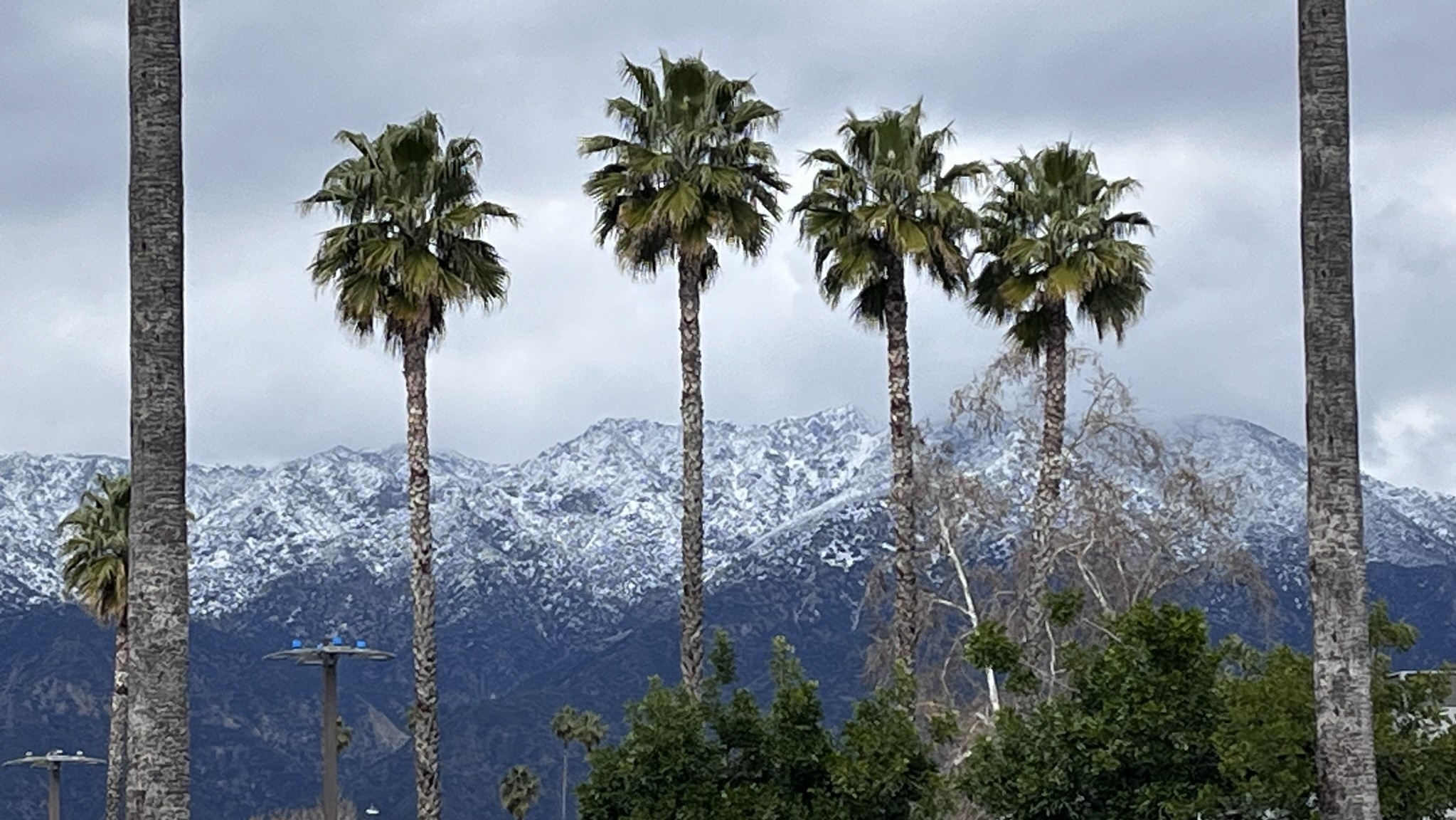
- Snow levels are expected to drop to 1,500 feet.
A blizzard warning will go into effect Friday for Los Angeles County mountains as back-to-back cold storms move into Southern California.
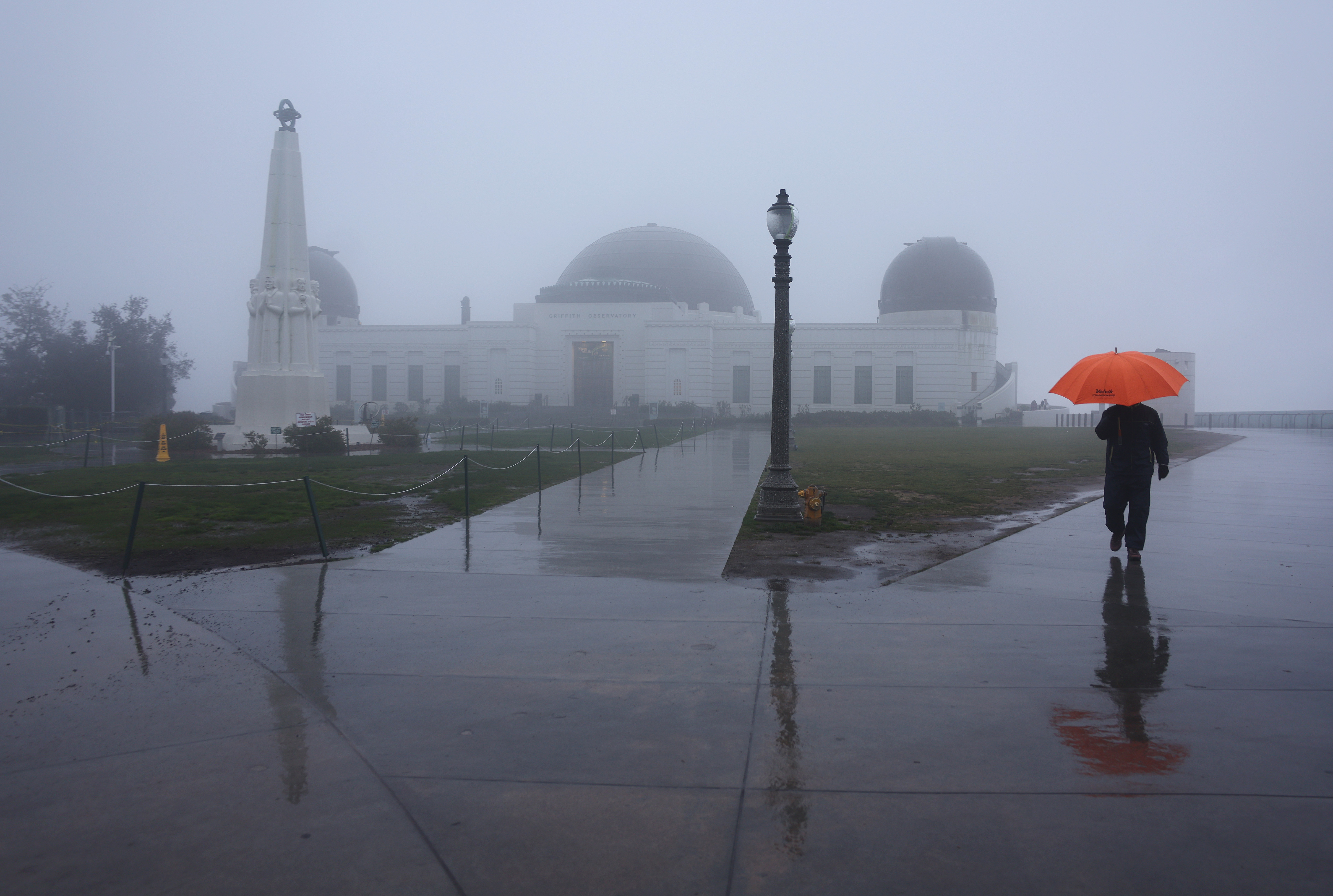
The late February storms will bring unprecedented snowfall, rain, powerful winds and well below-normal temperatures. The first of the two storms arrived Wednesday with a second stronger system on track to move in Thursday.
"The heaviest snow-making days are going to be Thursday and Friday, and here's the reason why," said NBC4 forecaster Belen De Leon. "(On Thursday), another storm is going to slide behind this one and take a more westerly route over the ocean water. This system already has some cold air. It's going to tap into an atmospheric river with tropical moisture and channel that right into Southern California."
Get top local stories in Southern California delivered to you every morning. >Sign up for NBC LA's News Headlines newsletter.
Atmospheric rivers are plumes of moisture in the sky over the ocean. Once storms draw moisture from the rivers in the sky, they're capable of producing long periods of significant precipitation. The weather phenomenon is behind some of the wettest winters on record in California.
In a tweet, the National Weather Service-Los Angeles said the blizzard warning for the region is the first of which the agency is aware.
Here's what to know about the blizzard warning and the timing of this week's winter storms.
When will the storms arrive in Southern California?
The first storm moved in Wednesday with wind, chilly temperatures, rain and snow continuing into Saturday.
The cold front moved over Southern California Wednesday morning and produced scattered showers Wednesday evening into Thursday.
Several inches of snow could fall Wednesday on the 5 Freeway in northern Los Angeles County. Scattered rain and snow showers will continue Thursday with the snow levels around 2,500 feet.
Temperatures in most areas will remain in the 50s into Friday.
Click here to send us your storm photos and videos.
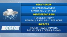
Rain and snow will intensify Thursday night through early Saturday. Some areas will see rainfall rates of a half-inch to 1 inch per hour.
"We're going to see some major travel impacts, especially Friday and Saturday, with the potential for some flooding, rockslides and debris flows," said NBC4 forecaster Belen De Leon.
Los Angeles County coasts and valleys could get a total of 2 to 4 inches of rain. Some foothill areas might receive 4 to 6 inches.
Blizzard warning in Southern California mountains
Snow at unusually low elevations could make for historic snowfall amounts.
A blizzard warning was issued for Los Angeles and Ventura county mountains. The rare warning will be in effect from 4 a.m. Friday to 4 p.m. Saturday with snow totals reaching up to 5 feet at elevations above 4,000 feet by Saturday night.
Some areas could get as much as 7 feet.
"Blizzard warning for extremely dangerous mountain conditions coming," the National Weather Service tweeted. "Mountain travel will be a mess."
The blizzard warning does not include the Santa Monica Mountains.
The warning was extended Thursday to the San Bernardino County mountains.
Snow accumulations of 6 to 12 inches are possible by Saturday night at elevations as low as 2,000 feet. Drivers should expect significant snowfall in most mountain passes.
The Antelope Valley will be under a less severe winter weather advisory from 4 a.m. Wednesday to 4 a.m. Friday. Three to 6 inches of snow are possible in foothill communities and 1 to 3 inches on the valley floor.
It's the second blizzard warning issued since 1989 for LA County mountains.
What is a blizzard warning?
A blizzard warning generally indicates winter weather conditions that include snow, blowing snow, reduced visibility, strong sustained winds. It is a more severe weather warning that a winter storm warning.
Here's how the National Weather Service defines a blizzard warning.
The following conditions are occurring or expected within the next 12 to 18 hours.
- Snow and/or blowing snow reducing visibility to 1/4 mile or less for 3 hours or longer
and - Sustained winds of 35 mph or greater or frequent gusts to 35 mph or greater.
Note that there is no temperature requirement that must be met for blizzard conditions.
A less severe winter storm warning is issued when a combination of hazardous winter weather is occurring or imminent.
Significant and hazardous winter weather is defined by the National Weather Service as a combination of the following.
- Five inches or more of snow/sleet within a 12-hour period or 7 inches or more of snow/sleet within a 24-hour period
and/or - Enough ice accumulation to cause damage to trees or powerlines
and/or - A life threatening or damaging combination of snow and/or ice accumulation with wind.
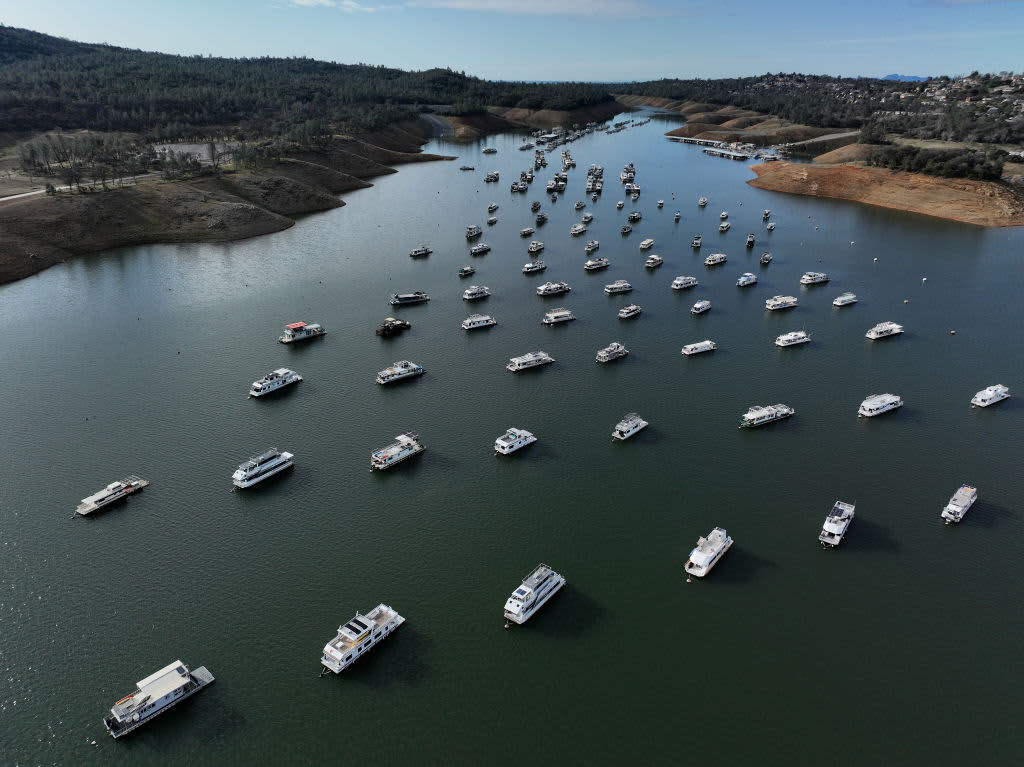
What does the rain mean for California's drought?
The most severe drought conditions that plagued California at the start of the water year in October were wiped out by January's storms, which also were fueled by atmospheric rivers.
In the most recent U.S. Drought Monitor report released Feb. 16, 33 percent of California was in severe drought, the weekly Monitor's third most severe category. At the start of the water year, 94 percent of the state was in severe drought.
Eighty-five percent of the state remains in moderate drought, the report's least severe category. That figure was at 99.76 percent at the start of the water year.
California has spent most of the last 15 years in drought conditions. The current three-year dry spell included one of the driest late winters on record.
The state's normal wet season runs from late fall to the end of winter, but dismal precipitation left about 95 percent of California in severe drought at the start of spring. By September, nearly all of California was in drought.
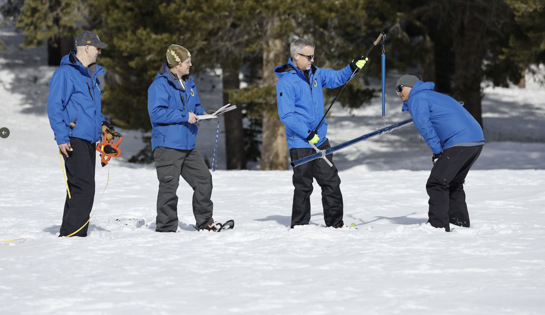
Much of California’s water comes from melting snow in the Sierra Nevada Mountains. In an ideal scenario, storms blanket the mountains with snow during winter, building up the natural reservoir. That snow then melts in late spring and early summer, replenishing the state's water system. Snowpack was far below normal in Spring 2022, but rebounded during January's storms.