
A slow-moving storm that brought rain Sunday afternoon in Southern California continued to drench the region overnight at the start of a wet holiday week.
More than an inch of rain fell by Monday morning in Los Angeles, and there's more wet weather ahead.
"We start off the holiday week with a lot of rain," said NBC4 forecaster Shanna Mendiola. "Right behind it, we have a chance of lighter showers."
The rain was forecast to taper off to showers in the afternoon with a chance of thunderstorms that could produce small hailstones. Mountains could receive up to 1 1/2 inches of rain with 2-6 inches of snow from 5,000 to 7,000 foot elevations and 6-12 inches above 7,000 feet, Smith said.
Southern California Mountain Snow Days
Moderate to locally heavy rain over the Sepulveda Pass including the Getty Burn Area and across southern LA County including Rolling Hills and Redondo Beach.
High temperatures along the coast were forecast to be in the mid-50s to about 60, with lows in the mid-40s to around 50. Inland and valley temperatures were expected in the low to mid-50s with lows in the low to mid-40s.
Weather
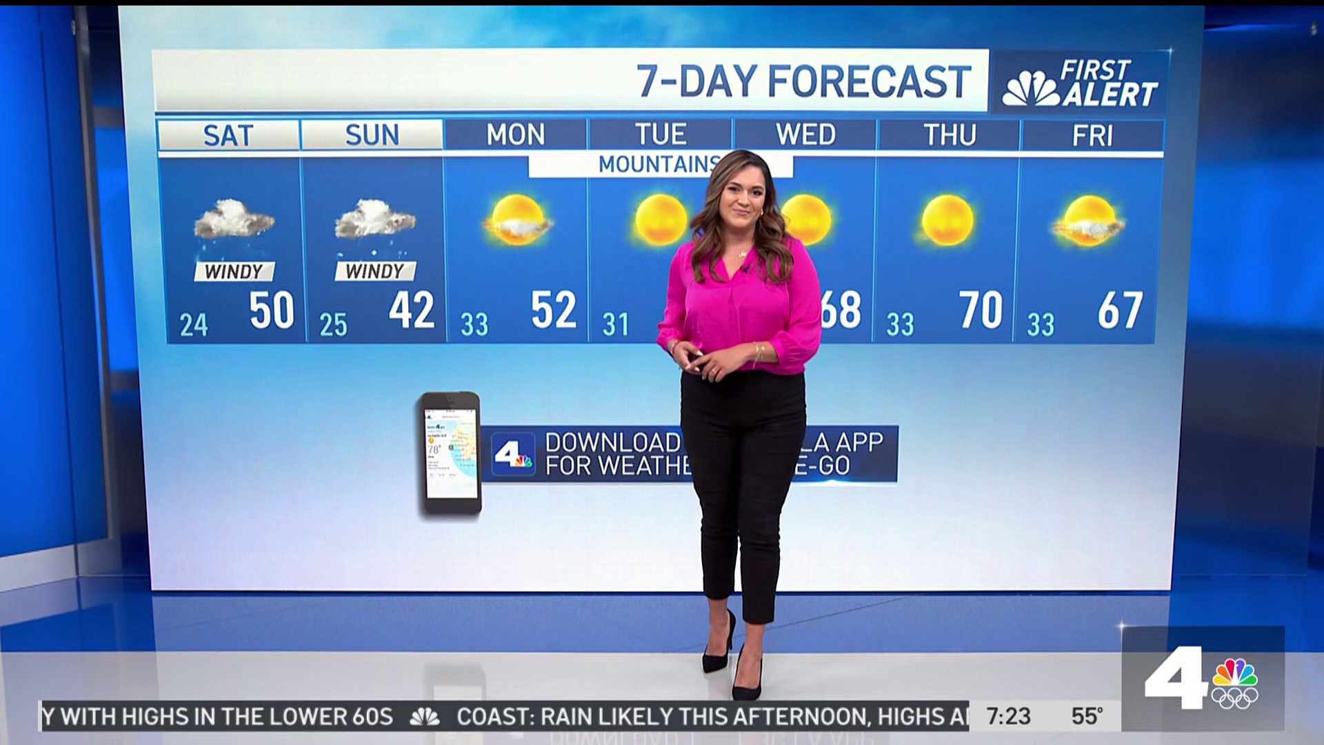
Tuesday will be mostly dry, but some isolated showers are possible.
A cold air mass is expected to move over the area Wednesday leading to a colder rain storm and lower snow level. There is a chance that rain will begin Wednesday morning, but it is more likely to start Wednesday afternoon and continue into Thursday.
The snow level could drop to 4,000 feet or lower from the mid-week storm.
