Finally, Severe Drought Gets the Boot From All of LA, Ventura, Santa Barbara Counties
At this time last year, 83 percent of California was in severe drought during a punishing five-year dry spell
By Jonathan Lloyd ••
Conditions have improved in a small swath of Southern California that was one of the last areas of severe drought still standing during a wet winter for the record books.
Santa Barbara, Ventura, and Los Angeles counties are no longer under severe drought, according to this week's U.S. Drought Monitor report. Recent rainfall improved the outlook for groundwater in the region, accounting for the improvement, the Monitor report said.
Only 1 percent of California, a small portion in the extreme southeast corner of Imperial County, remains in severe drought this week.
California Department of Water Resources
The results of California's annual snowpack surveys in the Sierra Nevada Mountains have been mixed over the decades.
NBC10 Boston
The California Department of Water Resources conducts a snow survey to measure the snowpack in the Sierras in El Dorado County in Northern California. Photo taken sometime during 1958.
California Department of Water Resources
California Department of Water Resources snow survey team right, Ray Barsch and Christopher Carr cross country ski to the Alpha test site, 7600 feet elevation in the Sierra Nevada mountain range near Forni Ridge and Lyons Creek in El Dorado County north of U.S. Highway 50. The water runoff from this area is part of the American River Watershed in Northern California. Photo taken April 11, 1967. Paul Weber / California Department of Water Resources, FOR EDITORIAL USE ONLY
California Department of Water Resources
Center, Frank Gehrke, chief of the California Cooperative Snow Surveys Program for the Department of Water Resources prepares for the monthly snow survey at Phillips Station in El Dorado County in the Sierra Nevada mountains. Photo taken March 2, 2009.
Telemundo
Right, Frank Gehrke, chief of the California Cooperative Snow Surveys Program for the Department of Water Resources leads the way to conducts the monthly snow survey during a snow storm at Phillips Station in El Dorado County in the Sierra Nevada mountains. Photo taken March 3, 2010.
Kelly Grow / California Department of Water Resources
Frank Gehrke conducts California Department of Water Resources monthly snow survey at Phillips Station near Echo Summit on December 30th, 2014.
California Department of Water Resources
The mountains at Phillips Station near Echo Summit on January 3, 2014.
CADWR
Frank Gehrke (DWR Chief of Snow Surveys) addresses the media during a snow survey at Phillips Station on April 1, 2015. The black tag on the pole is where the snow was in the drought year of 1977, the yellow tag is where the snow was the year before, and the green tag is where the snow is on an average year.
The Department of Water Resources (DWR) conducts a snow survey at Phillips Station on April 1, 2015. Measurements in Phillips began in 1942, and this report marked the first time there was zero snow for an April 1 measurement. Below-normal precipitation, combined with unusually warm weather, produced meager snowfall during the traditional wet season.
California Department of Water Resources
Right, Frank Gehrke, chief of the California Cooperative Snow Surveys Program for the Department of Water Resources, conducts the monthly snow survey at Philips Station.
California Department of Water Resources
Members of the California Council on Science and Technology Science Policy Fellows left to right, Michael Peterson, Julianne McCall and Mikel Shybut assist Frank Gehrke Chief of the California Cooperative Snow Surveys Program with the second snow survey of the 2017 snow season at Phillips Station in the Sierra Nevada Mountains. The survey site is approximately 90 miles east of Sacramento off Highway 50 in El Dorado County. Photo taken February 2, 2017.
Dale Kolke / California Department of Water Resources
The third snow survey of the 2017 snow season at Phillips Station in the Sierra Nevada Mountains. The survey site is approximately 90 miles east of Sacramento off Highway 50 in El Dorado County. Photo taken March 1, 2017.
California Department of Water Resources
A snow-covered Sierra Nevada mountain peak to the northwest from the Phillips Station meadow where the California Department of Water Resources conducted its third snow survey of the winter 2017 season. Photo taken March 1, 2017.
California DWR
A view of the Phillips Station site on Jan. 3, 2018 before the first snow survey of the season.
California DWR
A view of Phillips Station in the Sierra Nevada Mountain Feb. 1, 2018 during the second snowpack survey of the year.
CA DWR
A view of Phillips Station in the Sierra Nevada Mountains ahead of the third manual snow survey of 2018. The same meadow had just 7 percent of its usual snowfall a couple of weeks ago. A big winter storm a week earlier brought that up to 39 percent.
California Department of Water Resources
Frank Gehrke, Chief of the California Cooperative Snow Surveys Program leads the way to conduct the fourth snow survey of 2018 at Phillips Station in the Sierra Nevada Mountains. The survey site is approximately 90 miles east of Sacramento off Highway 50 in El Dorado County. Photo taken April 2, 2018.
California Department of Water Resources
John King, Water Resource Engineer, of the California Department of Water Resources, prepares to insert the long aluminum snow depth survey pole into the snow for the third media snow survey of the 2019 season at Phillips Station in the Sierra Nevada Mountains. The manual survey recorded 113 inches of snow depth and a snow water equivalent of 43.5 inches -- more than double the previous month.
California Department of Water Resources
John King, Water Resource Engineer, DWR Snow Survey Section, leads the fourth snow survey of water year, followed by team of members of DWR's excecutive staff. The survey showed snow water equivalent at 200 percent of average for the site.
California DWR
The third snow survey of the season is conducted March 2, 2021.
California DWR
California’s Jan. 3, 2023 snow survey in the Sierra Nevada Mountains.
At this time last year, 83 percent of California was in severe drought during a punishing five-year dry spell. This season's record rainfall has knocked out drought in 92 percent of California. In early March 2016, 97 percent of the state was in some type of drought.
Moderate drought continues across all of Santa Barbara and Ventura counties, the northern part of LA County, Orange County and portions of Imperial and eastern San Diego counties -- a dramatic turnaround over the last year.
California is in the middle of one of its wettest winters in decades, but remains under a drought emergency. Gov. Jerry Brown is expected to review the drought declaration sometime after the rain ends.
Local
Get Los Angeles's latest local news on crime, entertainment, weather, schools, COVID, cost of living and more. Here's your go-to source for today's LA news.
What's good for drought conditions has brought misery for some Californians. Rivers and creeks have overflowed their banks in Northern California, where San Jose residents faced some of the most severe flooding. Gov. Brown asked Tuesday for federal assistance with the infrastructure damage from late January storms that caused flooding, mudslides and power outages.
The request follows two other petitions for federal help that President Donald Trump's administration granted last month to assist with earlier storm damages and the emergency at Oroville Dam, where an eroding spillway raised flood concerns.
Brown's office said Tuesday the governor also declared a state of emergency for 53 of the state's 58 counties due to late January storms.
Getty Images, CA Department of Water Resources, KNTV
Aerial photos show flooding in San Jose and Elk Grove, California.
Kelly M. Grow/ California Department of Water Resources
This aerial view looks north toward the confluence of the Feather and Yuba Rivers just south of Marysville, California on the border of Sutter County on the left, and Yuba County on the right. Record rainfall and snow has caused high water levels along the rivers. Photo taken February 26, 2017.
Kelly M. Grow/ California Department of Water Resources
An aerial view looking northwest toward the Thermalito Afterbay part of the California State Water Project, background, and the Feather River, about six miles downstream from Oroville, California in Butte County. Record rainfall and snow has caused high water levels in the river. Photo taken February 26, 2017.
AFP/Getty Images
Floodwaters surround a play structure on February 22, 2017, in San Jose, California.nThousands of people were ordered to evacuate their homes in the northern California city as floodwaters inundated neighborhoods and forced the shutdown of a major highway.
Florence Low / California Department of Water Resources
After the recent storms, the Cosumnes River has flooded the area around Twin Cities Road, east of Interstate 5 in Elk Grove, Calif. on January 13, 2017.
NBC BAY AREA
Floodwaters surround cars Feb. 22, 2017 in San Jose, California.
Getty Images
Oroville Lake, the emergency spillway and a damaged main spillway are seen from the air on February 13, 2017 in Oroville, California. Almost 200,000 people were ordered to evacuate the northern California town after a hole in the emergency spillway in the Oroville Dam threatened to flood the surrounding area. (Photo by Elijah Nouvelage/Getty Images)
California Department of Water Resources
The California Department of Water Resources suspended flows from the Oroville Dam spillway after a concrete section eroded on the middle section of the spillway. Photo taken February 7, 2017.
NBC Bay Area
Horses are stranded in San Jose floodwaters Feb. 22, 2017.
AFP/Getty Images
Floodwaters surround a home on February 22, 2017, in San Jose, California.nThousands of people were ordered to evacuate their homes early Wednesday in the northern California city of San Jose as floodwaters inundated neighborhoods and forced the shutdown of a major highway. / AFP / NOAH BERGER (Photo credit should read NOAH BERGER/AFP/Getty Images)
KNBC-TV
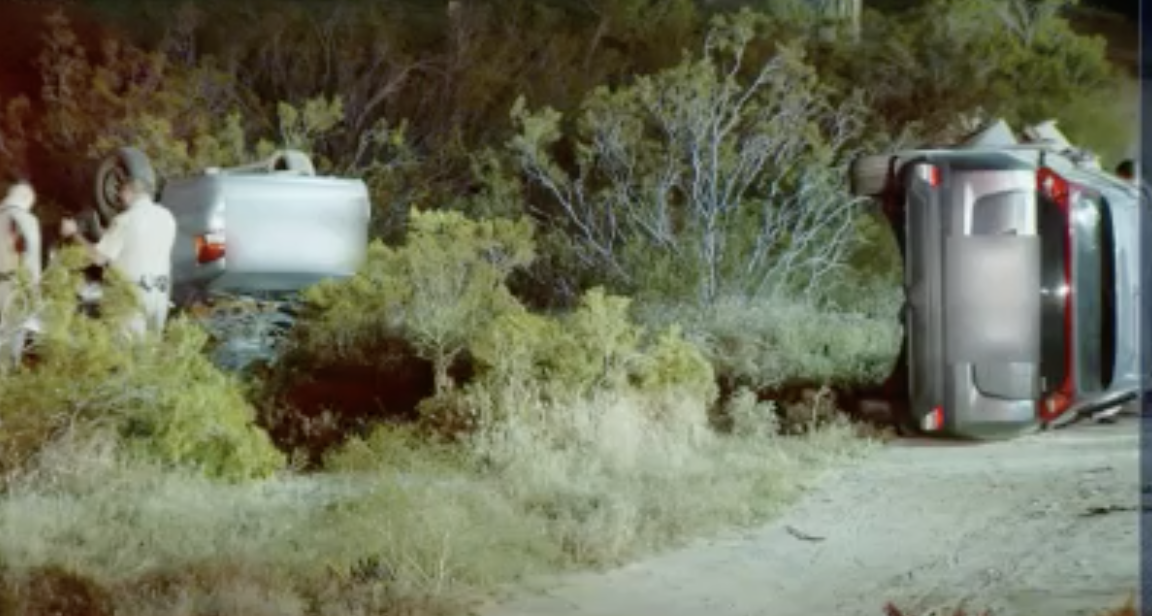
Laurel Canyon Boulevard was partially back open to traffic Monday, Feb. 20, 2017, after a sinkhole opened up and swallowed two cars during a monster storm three days earlier. No serious injuries were reported.
Florence Low / California Department of Water Resources
California Department of Water Resources staff employ overtop protection on the levees at Grizzly Island in Solano County, Calif, January 13, 2017.
Florence Low / California Department of Water Resources
Flooding is occurring at both Grizzly Island on the left, and Wheeler Island on the right, located in the Sacramento San-Joaquin Delta in California, January 13, 2017.
Florence Low / California Department of Water Resources
Reclamation District 563 builds a muscle wall on the levee for overtop protection along Tyler Island near Walnut Grove, Calif. January 13, 2017.
California Department of Water R
At right, Sacramento County Sheriff crews fill sandbags at Tyler Island, located in Sacramento-San Joaquin Delta in California, January 13, 2017. Florence Low / California Department of Water Resources
California Department of Water R
Reclamation District 563 builds a muscle wall on the levee for overtop protection along Tyler Island near Walnut Grove, Calif. January 13, 2017. Florence Low / California Department of Water Resources
Florence Low / California Department of Water Resources
Due to recent storms, Fremont Weir in Knights Landing, Calif. is overtopping, January 13, 2017. The Fremont Weir Wildlife Area is 1,461 acres at the north end of the Yolo Bypass floodway along the Sacramento River in Sutter and Yolo counties.
Florence Low / California Department of Water Resources
Water is released from Folsom Lake and Dam in Sacramento County as a precaution against flooding, January 13, 2017. The lake's water storage is being reduced to save room for coming storms and snowmelt.
Florence Low / California Department of Water Resources
Recent storms flood a building in Elk Grove, California, on January 13, 2017.
Florence Low / California Department of Water Resources
A white vehicle is submerged during a flood on Twin Cities Road in Elk Grove, California, due to recent storms, January 13, 2017.
Florence Low / California Department of Water Resources
After the recent storms, the Cosumnes River has flooded Twin Cities Road, east of Interstate 5 in Elk Grove, Calif. on January 13, 2017.
Florence Low / California Department of Water Resources
Cache Creek Settling Basin Weir in Yolo County near Woodland, Calif. Jan. 13, 2017. The Cache Creek Settling Basin is located east of Woodland, near where Cache Creek flows into the Yolo Bypass.
Florence Low / California Department of Water Resources
Water is released from Lake Natoma at Nimbus Dam in Rancho Cordova, Calif., as a precaution against flooding, January 13, 2017. Lake Natoma's water storage is being reduced to save room for coming storms and snowmelt. Lake Natoma is an intermediate lake along the American River, located between Folsom Dam and Nimbus Dam in Sacramento County, Calif. The lake is located within the Folsom Lake State Recreation Area.
NASA
For a view of the reason behind the storms, we offer and even higher perspective This NASA satellite imagery shows the weather pattern that is responsible for this winter's steady stream of storms -- an atmospheric river. The systems draw moisture up from the tropics, unleashing a series of storms on the West Coast.