The blaze burned 13,139 acres, destroyed 12 buildings and damaged five others near Idyllwild.
•
State Routes 74 and 243 in the Cranston Fire burn area re-opened at noon Saturday to Idyllwild, Mountain Center, Apple Canyon and Hemet, officials said.
Motorists will be escorted by pilot vehicles on state Route 74 between Lake Hemet and Mountain Center, as well as from Mountain Center to Hemet, and were advised to expect delays of up to 45 minutes to allow pilot vehicles to take traffic in one direction of travel, then return. There will be no restrictions on state Route 243.
Meghan Reyes/KNBC-TV
Images show the day after the Cranston Fire began burning Thursday, July 26, 2018.
Kevin Tidwell/California Interagency Incident Management Team 1
A thank-you sign is seen in July 2018 during the Cranston fire in Riverside County.
Kevin Tidwell/California Interagency Incident Management Team 1
A thank-you sign is seen in a business window in July 2018 during the Cranston fire in Riverside County.
Smoke blankets the area of the Cranston fire in July 2018 in Riverside County.
Toni Guinyard/KNBC-TV
A smoke plume rises over Riverside County Friday July 27, 2018 from the Cranston fire.
Toni Guinyard/KNBC-TV
A smoke plume rises over Riverside County Friday July 27, 2018 from the Cranston fire.
Toni Guinyard/KNBC-TV
Red fire retardant covers a Riverside County property Friday July 27, 2018 during the Cranston fire.
Toni Guinyard/KNBC-TV
Red fire retardant covers a Riverside County property Friday July 27, 2018 during the Cranston fire.
Toni Guinyard/KNBC-TV
Firefighters attend a morning briefing Friday July 27, 2018 before another day of battling the Cranston fire in brutal heat.
Toni Guinyard/KNBC-TV
A view of the Cranston fire burn area Friday July 27, 2018 in Riverside County.
Toni Guinyard/KNBC-TV
A view of the Cranston fire burn area Friday July 27, 2018 in Riverside County.
Toni Guinyard/KNBC-TV
A view of the Cranston fire burn area Friday July 27, 2018 in Riverside County.
Toni Guinyard
Images show the smokey skies over the Cranston Fire Thursday, July 26, 2018.
Toni Guinyard
Images show the smokey skies over the Cranston Fire Thursday, July 26, 2018.
Frank Lopez
The view from Palm Springs facing west toward Idyllwild.
Matt Spencer
A view of the Cranston fire Wednesday July 26, 2018 from Palm Springs.
Toni Guinyard/KNBC-TV
A view of the Cranston fire burn area Thursday July 26, 2018 in Riverside County.
Toni Guinyard/KNBC-TV
A view of the Cranston fire burn area Thursday July 26, 2018 in Riverside County.
Toni Guinyard/KNBC-TV
A view of the Cranston fire burn area Thursday July 26, 2018 in Riverside County.
Toni Guinyard/KNBC-TV
A view of the Cranston fire burn area Thursday July 26, 2018 in Riverside County.
Meghan Reyes
NewsChopper4 shows an aerial view of the smoke above the destructive Cranston blaze Thursday, July 26, 2018.
Meghan Reyes
Aerial images in NewsChopper4 show the sun rising over the Cranston Fire Thursday, July 26, 2018.
Meghan Reyes
Smoke and the sun rising over the Cranston Fire Thursday, July 26, 2018, the morning after the blaze began.
KNBC-TV
A still smoking husk of a home is all that remains of this property in the Cranston Fire Thursday, July 26, 2018.
KNBC-TV
A home burned in the Cranston blaze Thursday, July 26, 2018.
KNBC-TV
A bike burned along with a home in the Cranston Fire Thursday, July 26, 2018.
KNBC-TV
The Cranston Fire was at 4,700 acres and 5 percent contained the morning of Thursday, July 26, 2018.
KNBC-TV
The Cranston Fire near the Idyllwild area continues to burn a day after the fire may have been intentionally set Thursday, July 26, 2018.
KNBC-TV
Residents under evacuation in the Cranston Fire Thursday, July 26, 2018.
KNBC-TV
A home was still smoking a day after the Cranston Fire ripped through the area Thursday, July 26, 2018.
John Weaver
A view of smoke from the Cranston fire as seen Wednesday July 26, 2018 from Temecula.
Elizabeth Anne King
A view of smoke from the Cranston fire as seen Wednesday July 25, 2018 from the Beaumont-Banning area.
KNBC-TV
Bright red fire retardant was dropped near and on homes in the path of the Cranston fire Thursday July 26, 2018 in Riverside County.
Toni Guinyard/KNBC-TV
Fire trucks are seen at the staging site for the Cranston fire burning Thursday July 26, 2018 in Riverside County.
KNBC-TV
A line of vehicles can be seen during evacuations due to the Cranston fire Wednesday July 25, 2018 in Riverside County.
KNBC-TV
Smoke blankets mountains due to the Cranston fire Thursday July 26, 2018 in Riverside County.
Gil Leyvas/KNBC-TV
Aerial Footage of the Cranston Fire on the evening of July 25, 2018.
Gil Leyvas/KNBC-TV
Aerial Footage of the Cranston Fire on the evening of July 25, 2018.
Gil Leyvas/KNBC-TV
Aerial Footage of the Cranston Fire on the evening of July 25, 2018.
KNBC-TV
A house burns near Idyllwild during the Cranston fire on July 25, 2018.
KNBC-TV
The fire was burning "with a rapid rate of spread," according to the U.S. Forest Service.
KNBC-TV
Mandatory evacuations have been ordered for residents of southwest Idyllwild, as well as Mountain Center along McGaugh and McCall Park roads.
KNBC-TV
"Leave the area immediately," a USFS Twitter post advised.
KNBC-TV
Authorities have also issued a smoke advisory for the region, advising that winds could bring smoke into various parts of Riverside County.
KNBC-TV
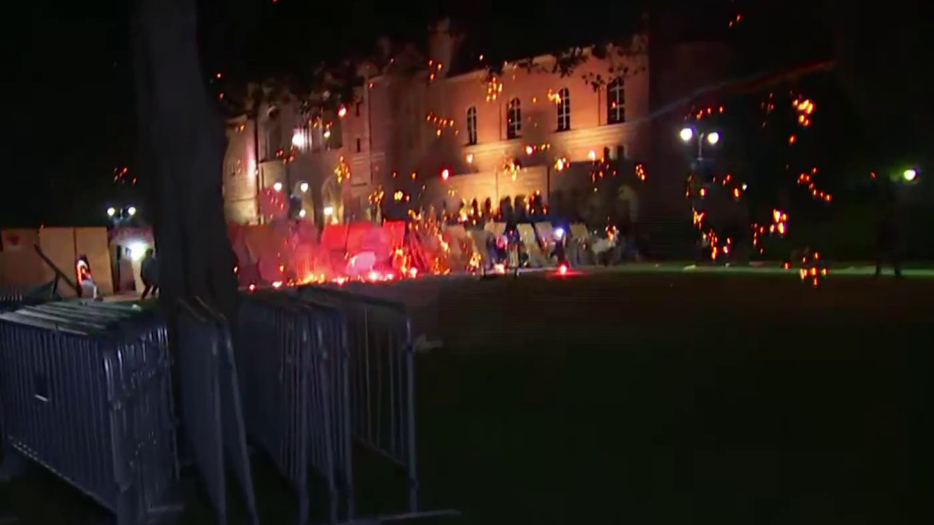
Flames rush up a ridge in the San Bernardino National Forest during the Cranston Fire on July 25, 2018.
KNBC-TV
A nearby resident prepares to evacuate from the Cranston Fire on July 25, 2018.
KNBC-TV
A car is loaded as residents prepare to evacuate from the Cranston Fire on July 25, 2018.
KNBC-TV
Road closures include state Route 74 between the Cranston Fire Station and Lake Hemet, as well as state Route 243 between the communities of Pine Cove and Mountain Center, where authorities say flames jumped the highway near the Idyllwild Grinding Facility.
KNBC-TV
KNBC-TV
KNBC-TV
Authorities have established an evacuation center for residents and campers at Banning High School, 100 W. Westward Ave.
KNBC-TV
KNBC-TV
KNBC-TV
Flames threaten a neighborhood during the Cranston Fire on July 25, 2018.
KNBC-TV
KNBC-TV
KNBC-TV
AL ROJO VIVO
LA Metro
Alex Vasquez/KNBC-TV
A house near Idyllwild "completely burned to the ground," per NBC4's Alex Vasquez.
Alex Vasquez/KNBC-TV
The Cranston Fire burns near Idyllwild on July 25, 2018.
Kitty Alvarado
"When a fire has a lot of heat and instability available, like the Cranston Fire does this kind of cloud, called a pyrocumulonimbus cloud, can form.n nThe intense upward motion moved these clouds 50,000 feet into the sky and there were several lightning strikes we tracked on our First Alert Radar Network.n nThink back to the Thomas Fire last year. The Santa Ana winds were too strong to allow the clouds to grow up so all of the smoke was pushed to the Pacific Ocean. It was also cold so there wasn’t much instability." -NBC4 Meteorologist Anthony Yanez
Toni Guinyard
Images show the smokey skies over the Cranston Fire Thursday, July 26, 2018.
Toni Guinyard
Images show the smokey skies over the Cranston Fire Thursday, July 26, 2018.
Matt Spencer
A view of the Cranston fire Wednesday July 26, 2018 from Palm Springs.
Fewer than 200 firefighters and other personnel remained assigned to the Cranston Fire that burned 13,139 acres, destroyed 12 buildings and damaged five others near Idyllwild.
The fire, which broke out on July 25, was 96 percent contained and all evacuation orders have been lifted. Full containment is expected Thursday.
The blaze broke out off Highway 74 in the San Jacinto Mountains between Hemet and Mountain Center, just east of the Cranston Fire Station. Three firefighters were injured last week battling the fire, which authorities believe was deliberately set by a Temecula man who's also accused of setting eight other fires.
Local
Get Los Angeles's latest local news on crime, entertainment, weather, schools, COVID, cost of living and more. Here's your go-to source for today's LA news.
Brandon N. McGlover, 32, was arrested near Newport Road and State Street in Hemet about 12:30 p.m. the day the fire broke out and charged two days later with 15 felony counts. He pleaded not guilty and is being held in lieu of $3.5 million bail pending a Sept. 24 felony settlement conference.
The cost of fighting the fire has been estimated at $20 million, with the final cost projected at $23 million, officials said.
"Vista Grande Hotshots hiked into the South Ridge portion of the fire today to inspect the fire line and found no threats to the containment line," according to a Forest Service statement Friday that said residents may see glowing embers at night and minor smoke from smoldering heavy fuels in the interior portions of the fire.
"Please do not notify authorities of this situation as fire personnel are monitoring all portions of the fire," officials said.
Repairs to electrical infrastructure are complete and Southern California Edison and the Anza Electric Co-op were working to re-energize lines and Caltrans continues to replace guard rails and traffic signs along state Routes 243 and 74.
All U.S. Forest Service lands in the San Jacinto Ranger District and the adjacent Santa Rosa and San Jacinto Mountains National Monument were ordered closed to public entry.
However, a new order that went into effect Friday reopened "the majority of popular hiking trails, campgrounds and roads on the district and national monument," according to the forest service.
Some sites that will remain closed include the South Ridge Trail, the South Ridge Road and a portion of the Pacific Crest Trail.
The public can call 909-383-5688 for information on the closures.