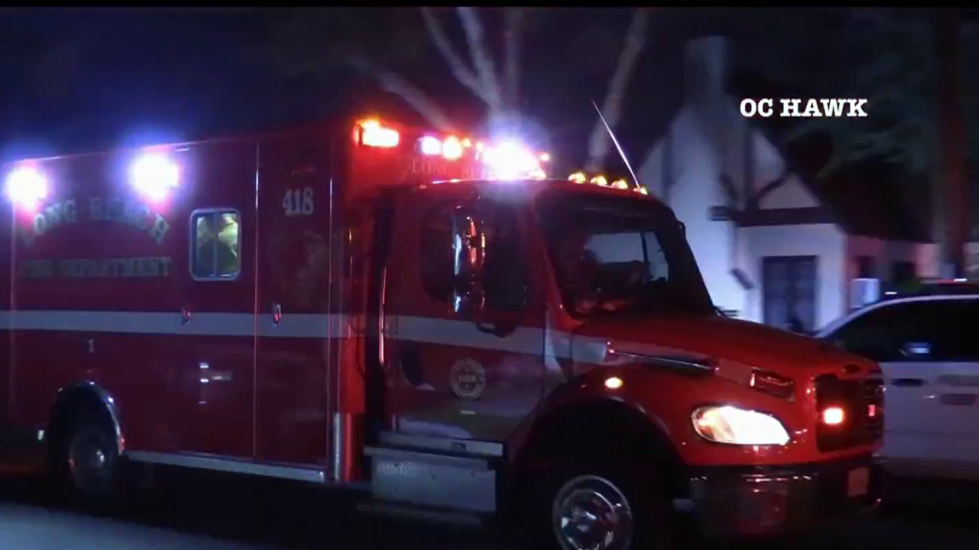
West Coast's Earthquake Warning System Gets $4.9M Boost
The ShakeAlert system is designed to give residents several seconds of advance warning of an earthquake
By City News Service ••
A new study suggests that “The Big One” could trigger more large earthquakes on other fault lines. Gadi Schwartz reports for the NBC4 News at 11 p.m. on Wednesday, April 22, 2015.
Caltech and six other institutions were awarded a total of $4.9 million in funds by the U.S. Geological Survey Monday for the development of an earthquake warning system on the West Coast.
The agency also announced the purchase of about $1 million in sensor equipment to be used in the ShakeAlert system, which is designed to give residents several seconds of advance warning of an earthquake, allowing them to quickly seek shelter or take precautionary actions to limit damage.
Caltech was awarded funds along with Central Washington University, UC Berkeley, the universities of Oregon, Washington and Nevada-Reno, and UNAVCO, a geological-science research nonprofit.
AP
FILE - In this Jan. 17, 1994 file photo, Interstate 10, the Santa Monica Freeway, split and collapsed over La Cienega Boulevard following the Northridge quake in the predawn hours in Los Angeles. Twenty-five years ago this week, a violent, pre-dawn earthquake shook Los Angeles from its sleep, and sunrise revealed widespread devastation, with dozens killed and $25 billion in damage. (AP Photo/Eric Draper, File)
AP
FILE - This Jan. 17, 1994 file photo shows bricks and debris surrounding a building housing Ara's Pastry on Hollywood Boulevard in the Hollywood section of Los Angeles, following the Northridge earthquake. Twenty-five years ago this week, on Jan. 17, 1994, a violent, pre-dawn earthquake shook Los Angeles from its sleep, and sunrise revealed widespread devastation, with dozens killed and $25 billion in damage. (AP Photo/Rene Macura, File)
AP
FILE - In this Jan. 17, 1994, file photo, the covered body of Los Angeles Police Officer Clarence Wayne Dean lies near his motorcycle which plunged off the State Highway 14 overpass that collapsed onto Interstate 5, after a magnitude-6.7 Northridge earthquake in Los Angeles. Twenty-five years ago this week, a violent, pre-dawn earthquake shook Los Angeles from its sleep, and sunrise revealed widespread devastation, with dozens killed and $25 billion in damage. (AP Photo/Doug Pizac, File)
AP
FILE - This Feb. 14, 1994 file photo shows California State University, Northridge students walking past a parking structure at the Los Angeles campus that collapsed in the Jan. 17 earthquake. Twenty-five years ago this week, a violent, pre-dawn earthquake shook Los Angeles from its sleep, and sunrise revealed widespread devastation, with dozens killed and $25 billion in damage. (AP Photo/Mark J. Terrill, File)
AP
FILE - In this Jan. 17, 1994 file photo, gas from a ruptured supply line burns as water from a broken water main floods Balboa Boulevard in the Granada Hills area of Los Angeles. The fire from the gas main destroyed two homes, right. Twenty-five years ago this week, the violent, pre-dawn earthquake shook Los Angeles from its sleep, and sunrise revealed widespread devastation, with dozens killed and $25 billion in damage. (AP Photo/Lenny Ignelzi, File)
AP
FILE - This Jan. 17, 1994 file photo shows California State Route 118 in Simi Valley, Calif., that collapsed during the Northridge earthquake. Twenty-five years ago this week, a violent, pre-dawn earthquake shook Los Angeles from its sleep, and sunrise revealed widespread devastation, with dozens killed and $25 billion in damage. (AP Photo/Reed Saxon, File)
AP
FILE - This Feb. 16, 1994 file photo shows the Northridge Meadows apartment complex in which 16 people died when the upper floors collapsed onto the so-called soft story ground floor. Twenty-five years ago this week, a violent, pre-dawn earthquake shook Los Angeles from its sleep, and sunrise revealed widespread devastation, with dozens killed and $25 billion in damage. At 4:31 a.m. on Jan. 17, 1994, a hidden fault lurking under the city’s San Fernando Valley neighborhoods unleashed a magnitude 6.7 earthquake. (AP Photo/Nick Ut, File)
AP
FILE - This Jan. 17, 1994 file photo shows a portion of the Bullock's department store in Los Angeles' Northridge Fashion Center that collapsed in the Northridge earthquake. Twenty-five years ago this week, a violent, pre-dawn earthquake shook Los Angeles from its sleep, and sunrise revealed widespread devastation, with dozens killed and $25 billion in damage. (AP Photo/Reed Saxon, File)
AFP/Getty Images
With help from a friend, Tigran Daniyelyan (L) carries his television from his apartment complex that was destroyed by the Northridge earthquake. Officials are placing the death toll at 28. (TIM CLARY/AFP/GettyImages)
UIG via Getty Images
A Santa Monica apartment building was destroyed by the Northridge earthquake in 1994 (Photo by Visions of America/UIG via Getty Images)
AFP/Getty Images
Aeria view of wrecked cars littered the connector ramp from Interstate 5 to Highway 14 following the Northridge earthquake, on Jan. 17, 1994, in Northridge, California. (CARLOS SCHIEBECK/AFP/Getty Images)
KNBC-TV
The 5 Freeway and 14 Freeway interchange was split in half after the earthquake struck.
KNBC-TV
Just hours after the quake struck, a good Samaritan in the city of San Fernando began evacuating neighbors in a school bus.
KNBC-TV
Fireballs erupted from a ruptured gas line, and streets flooded from a water main break at Rinaldi Street and Balboa Boulevard in Granada Hills.
KNBC-TV
A law enforcement officer is killed when the 14 Freeway collapsed near the quake.
KNBC-TV
Houses caught fire and were captured by NBC4 helicopter footage around 8:16 a.m. on the day of the quake.
KNBC-TV
President Clinton speaks on television just less than six hours after the Northridge earthquake struck. "We intend to do everything we possibly can to help the people ofnLos Angeles and Southern California to deal with the earthquake and its aftermath," Clinton said.
KNBC-TV
A 64-car freight train carrying hazardous material derailed in the Chatsworth/Northridge area. The footage was captured about 9:30 a.m.
KNBC-TV
Dozens of emergency room patients waited for treatment in the Granada Hills Community Hospital parking lot around 10 a.m., about six hours after the quake shook the area.
KNBC-TV
NBC4's Conan Nolan holds up a seismograph reading of the magnitude 6.6 earthquake. The quake was officially named "Northridge Earthquake" several hours after it struck.
KNBC-TV
Fire crews spent hours trying to rescue a man from a collapsed Northridge parking structure. Crews lowered airbags to lift the rubble. Salvador Pena was eventually was rescued and survived the deadly quake.
KNBC-TV
Firefighters battled a blaze at a home on Normandie Avenue north of Martin Luther King Jr Boulevard around 1:50 p.m.
KNBC-TV
Several cars were crushed when an apartment building collapsed in Sherman Oaks.
KNBC-TV
An influx of drivers crowded the Arco station at Sherman Way and Balboa Boulevard around 3:45 p.m. trying to get gas to leave the area.
KNBC-TV
Panicked residents cleared water, food and other supplies from the shelves of a Ralph's supermarket in Panorama City.
KNBC-TV
Fire crews battled an intense fire in Granada Hills around 6 p.m.
KNBC-TV
The 10 Freeway at La Cienega buckled as a result of the earthquake that struck Northridge around 4:30 a.m.
KNBC-TV
Police permitted some 1,000 residents to camp at a park on 1st Stree and Park Avenue in San Fernando after the destruction caused by the Northridge Earthquake.
UIG via Getty Images
A destroyed apartment building near the epicenter of the Northridge earthquake in 1994 (Photo by Visions of America/UIG via Getty Images)
UIG via Getty Images
An overpass collapsed on the 10 Freeway in the Northridge/Reseda area at the epicenter of the earthquake (Photo by Visions of America/UIG via Getty Images).
Getty Images
A man bicycled through a flooded road Jan. 17, 1994 caused by the Northridge earthquake in the greater Los Angeles. The Northridge earthquake was the first earthquake to strike directly under an urban area of the United States since the 1933 Long Beach earthquake. (Photo by David Hume Kennerly/Getty Images)
Getty Images
Pedestrians walked along a flooded road caused by the Northridge earthquake. (Photo by David Hume Kennerly/Getty Images)
AFP/Getty Images
Smashed cars were stranded by the collapsed Interstate 5 connector just a few hours after Northridge earthquake in Sylmar, California. Federal officials said freeways suffered at least $100 million in damage. (JONATHAN NOUROK/AFP/Getty Images)
AFP/Getty Images
Firemen carried a janitorial worker who was rescued from a collapsed garage at the Northridge Mall after the earthquake. (DENIS POROY/AFP/Getty Images)
Alex Matthews
A rescue worker sits on curb in front of the heavily-damaged Northridge Meadows Apartments after a 14th body was removed following Northridge earthquake. (CHRIS WILKINS/AFP/Getty Images)
AFP/Getty Images
A resident and a cameraman looked at damage to the Kaiser Permanente Building following the Northridge earthquake. (HAL GARB/AFP/Getty Images)
UIG via Getty Images
A car at a Mazda dealership was crushed in the Northridge earthquake. (Photo by Visions of America/UIG via Getty Images)
AFP/Getty Images
At night, a gas main on fire throws flames into the air after it broke and exploded destroying nearby homes following the Northridge earthquake. There were a total of 466 fires reported on Jan. 17, three of them simultaneously broke out immediately following the earthquake and were due of the rupture of natural gas valves and/or mains. (HAL GARB/AFP/Getty Images)
LA City Emergency Management Department
A view of the collapsed 5 Freeway connector Jan. 17, 2019 in Sylmar following the Northridge earthquake.
UIG via Getty Images
A demolished building at Olympic Blvd after the Northridge earthquake in 1994 (Photo by Visions of America/UIG via Getty Images)
UIG via Getty Images
An apartment building burned as a result of the Northridge earthquake. (Photo by Visions of America/UIG via Getty Images)
Rep. Adam Schiff, D-Burbank, hailed the USGS funding, saying it "brings us one step closer to fully deploying this technology which can save lives in the event of a major earthquake."
"We know that it is a matter of 'when' not 'if' a major earthquake will strike the West Coast, and a fully operational early warning system will help us be ready," he said.
The system was in danger earlier this year of losing funding in the federal budget, but an outcry from West Coast legislators led to $10.2 million in funds for the program's development.
Local
Get Los Angeles's latest local news on crime, entertainment, weather, schools, COVID, cost of living and more. Here's your go-to source for today's LA news.
Getty Images
CALIPATRIA, CA - JUNE 30: Mud boils violently in steam vents that, until recently, were underwater on the floor of the Salton Sea, on June 30 near Calipatria, California. Scientists have discovered that human-created changes effecting the Salton Sea appear to be the reason why California's massive "Big One" earthquake is more than 100 years overdue and building up for the greatest disaster ever to hit Los Angeles and Southern California. Researchers found that strands of the San Andreas Fault under the 45-mile long rift lake have have generated at least five 7.0 or larger quakes about every 180 years. This ended in the early 20th century when authorities stopped massive amounts of Colorado River water from periodically flooding the into this sub-sea level desert basin. Such floods used to regularly trigger major quakes and relieve building seismic pressure but the last big earthquake on the southern San Andreas was about 325 years ago. Dangerous new fault branches that could trigger a 7.8 quake have recently been discovered under the Salton Sea. (Photo by David McNew/Getty Images)
necn
Scientists have warned that after more than 300 years with very little slippage, the southern end of the 800-mile-long San Andreas fault north and east of Los Angeles has built up immense pressure and could produce a massive earthquake at any time. Such a quake could produce a sudden lateral movement of 23 to 32 feet.
Martinez, Natalie
A roadside attraction dinosaur towers over the desert near the San Andreas Fault in Cabazon.
AP
A natural spring-fed desert oasis is one of many supporting thousands of palm trees that line the San Andreas earthquake fault northeast of Palm Springs.
Getty Images
Carbon dioxide gas escaping from underground fissures bubbles up from geothermal mudpots, or ''boiling mud pots'', near the southern end of the San Andreas Fault at the Sonny Bono Salton Sea National Wildlife Refuge on July 2, 2006 near Calipatria, California. The mudpots which only are to be boiling hot are located over the Salton Sea Geothermal Field where temperatures measured in wells drilled for geothermal brines reach 360 degrees Celsius at depths of 1,500 to 2,500 meters.
Getty Images
Steam rises as a geothermal power plant taps into energy produced by underground pressures near the southern end of the San Andreas Fault.
Getty Images
Residents attend a peewee baseball game south of the San Andreas Rift Zone. Experts have predicted that a quake of magnitude-7.6 or greater on the southern San Andreas would kill thousands of people and cause many billions of dollars in damages.
rocky7814
A freight train passes diagonally-shifted layers of earth as it crosses the San Andreas Rift Zone. A magnitude-7.6 quake along the fault would dwarf the 1994 Northridge disaster near Los Angeles that killed 72 people, injured more than 9,000 and caused $25 billion in damage.
Getty Images
Cars and trucks travel Interstate 10 near the San Andreas Fault, the main traffic and freight route from Los Angeles-area cities toward Arizona.
Google Earth
San Bernardino City Hall, located 6.8 miles south of the San Andreas earthquake fault and 3.7 miles east of the San Jacinto Fault.
KNBC-TV
Recently built homes are seen in suburban neighborhoods under construction on top of the San Andreas Rift Zone.
Getty Images
Wind-power generators are seen near the San Andreas Fault near Palm Springs.
Getty Images
Recently built homes are seen in suburban neighborhoods under construction on top of the San Andreas Rift Zone.
Getty Images
A tractor passes diagonally-shifted layers of earth as it crosses the San Andreas Rift Zone, the system of depressions in the ground between the parallel faults of the San Andreas earthquake fault, while working on the heavily-used railroad tracks in Cajon Canyon.
Getty Images
A large crack in the earth is seen in the San Andreas Rift Zone, the system of depressions in the ground between the parallel faults of the San Andreas earthquake fault, west of San Bernardino.
Getty Images
The east branch of the California Aqueduct, which imports water from the Sierra Nevada Mountains, crosses the San Andreas Rift Zone.
Getty Images
Palm Desert, in the Coachella Valley, where desert cities such as Palm Springs may be threatened by a major earthquake on the southern San Andreas Fault, is seen before dawn.
Getty Images
A natural spring-fed desert oasis is one of many supporting thousands of palm trees that line the San Andreas earthquake fault.
NBC 5 News
Calculations released in 2008 revealed a 99.7 percent chance that a magnitude 6.7 quake or larger will strike by 2037, according to the first-ever statewide temblor forecast released by the scientists of the United States Geological (USGS), Southern California Earthquake Center and California Geological Survey
NBC10
Palm Springs
Getty Images
The San Andreas Rift Zone, the system of depressions in the ground between the parallel faults of the San Andreas earthquake fault, runs along the north side of San Bernardino.
Tom Lynch
The San Andreas Fault is where the Pacific and the North American tectonic plates of the Earth's crust collide.
NBC Connecticut
The east branch of the California Aqueduct, which imports water from the Sierra Nevada Mountains, crosses the San Andreas Rift Zone.
KNBC
An opening in the earth is seen in the San Andreas Rift Zone.
NBC 5 News
Saint Bernadine Hospital, one of many that could be overwhelmed by victims of a massive quake on the San Andreas earthquake fault, is seen in San Bernardino.
Getty Images
San Bernardino City Hall
Getty Images
Red Hill, one of the four Salton Buttes, small volcanoes on the southern San Andreas Fault, at the Salton Sea is seen near Calipatria, California.
Getty Images
A geothermal energy plant taps deep underground heat from the southern San Andreas Fault rift zone near the Salton Sea near Calipatria, California.
Getty Images
Native palms are seen at San Andreas Spring, one a several where the southern San Andreas Fault pushes water to the surface, supporting tiny endangered pupfish and other wildlife near the Salton Sea.
Getty Images
MECCA, CA - JULY 3: A valley filled with the swirled shapes of earth layers that were deformed by the collision of the Pacific and North American tectonic plates along the southern San Andreas Fault north of the Salton Sea.
Getty Images
Layers of earth are pushed into vertical positions by the collision of the Pacific and North American tectonic plates along the southern San Andreas Fault north of the Salton Sea.
Getty Images
Foundations of buildings of an early 20th century resort that was used before the rising waters of the Salton Sea turned this hill into Mullet Island, one of the four Salton Buttes, small volcanoes on the southern San Andreas Fault.
Getty Images
Foundations of buildings of an early 20th century resort that was used before the rising waters of the Salton Sea turned this hill into Mullet Island, one of the four Salton Buttes, small volcanoes on the southern San Andreas Fault, near Calipatria, California.
Getty Images
Steam rises from thermal vents that, until recently, were underwater on the floor of the Salton Sea, near Calipatria, California.
Getty Images
Steam rises from thermal vents that, until recently, were underwater on the floor of the Salton Sea, Calipatria, California.
Getty Images
Small mud volcanoes grow above the southern San Andreas Fault near the Salton Sea on Calipatria, California.
Getty Images
An area of rock quarry activity is seen on Red Hill, one of the four Salton Buttes, small volcanoes on the southern San Andreas Fault at the Salton Sea, near Calipatria, California.
Getty Images
A road sign that was once flooded by the rising Salton Sea stands on ground dried by evaporation near Calipatria, California.
Getty Images
A road sign that was once flooded by the rising Salton Sea stands on ground dried by evaporation near Calipatria, California.
Getty Images
A bridge near Red Hill Marina stands on ground dried by evaporation near Calipatria, California.
Getty Images
Outhouses and an old lifeguard stand are stored on Red Hill, one of the four Salton Buttes, small volcanoes on the southern San Andreas Fault at the Salton Sea, is seen near Calipatria, California.
Getty Images
Buildings of an apparent hot mineral spring spa on a mud flat in the thermal fields of the southern San Andreas Fault at the Salton Sea have fallen down, near Calipatria, California.
Getty Images
Mud boils violently in steam vents that, until recently, were underwater on the floor of the Salton Sea, near Calipatria, California.
The USGS estimated in 2014 that completing the warning system that has been under development since 2006 will require about $38.3 million in capital investment, and $16.1 million per year to operate and maintain.