Around the country, people rely on these piles of snow for their water supply. What is a snowpack, and how else does it impact you?
The snowpack covering California's mountains is off to one of its best starts in 40 years, raising hopes that the drought-stricken state could soon see relief in the spring when the snow melts and begins to refill parched reservoirs.
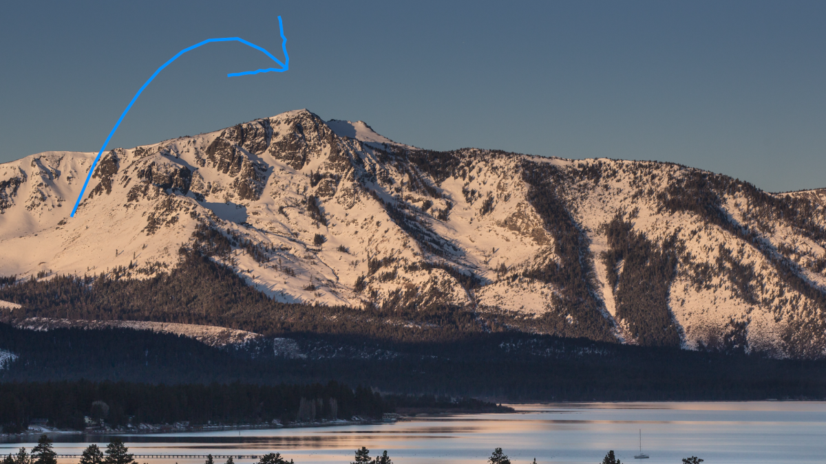
Roughly a third of California's water each year comes from melted snow in the Sierra Nevada, a mountain range that covers the eastern part of the state. The state has built a complex system of canals and dams to capture that water and store it in huge reservoirs so it can be used the rest of the year when it doesn't rain or snow.
That is why officials closely monitor how deep the snow is in the mountains — and Tuesday was the first formal snow survey of the winter, a sort of Groundhog Day event where Californians get their first glimpse of how helpful the winter might be. Statewide, snowpack is at 174% of the historical average for this year, the third-best measurement in the past 40 years. Even more snow is expected later this week and over the weekend, giving officials hope for a wet winter the state so desperately needs.
But a good start doesn't guarantee a good finish. Last year, the statewide snowpack was at 160% of average at the first survey. What followed where the three driest months ever recorded in California. By April 1 — when the Sierra snowpack is supposed to be at its peak — the snow was just 38% of historic average.
It’s always great to be above average this early in the season, but if January through March of 2023 turn out to be similar to last year, we would still end the water year in severe #drought. - Sean de Guzman, DWR #SnowSurvey2023pic.twitter.com/Y5SqBNw3zc
That history prompted muted optimism from state officials on Tuesday.
“While we see a terrific snowpack — and that in and of itself may be an opportunity to breathe a sigh of relief — we are by no means out of the woods when it comes to drought,” Karla Nemeth, director of the California Department of Water Resources, said Tuesday after a ceremonial snow measurement in the community of Phillips, just west of Lake Tahoe.
California Department of Water Resources
The results of California's annual snowpack surveys in the Sierra Nevada Mountains have been mixed over the decades.
NBC10 Boston
The California Department of Water Resources conducts a snow survey to measure the snowpack in the Sierras in El Dorado County in Northern California. Photo taken sometime during 1958.
California Department of Water Resources
California Department of Water Resources snow survey team right, Ray Barsch and Christopher Carr cross country ski to the Alpha test site, 7600 feet elevation in the Sierra Nevada mountain range near Forni Ridge and Lyons Creek in El Dorado County north of U.S. Highway 50. The water runoff from this area is part of the American River Watershed in Northern California. Photo taken April 11, 1967. Paul Weber / California Department of Water Resources, FOR EDITORIAL USE ONLY
California Department of Water Resources
Center, Frank Gehrke, chief of the California Cooperative Snow Surveys Program for the Department of Water Resources prepares for the monthly snow survey at Phillips Station in El Dorado County in the Sierra Nevada mountains. Photo taken March 2, 2009.
Telemundo
Right, Frank Gehrke, chief of the California Cooperative Snow Surveys Program for the Department of Water Resources leads the way to conducts the monthly snow survey during a snow storm at Phillips Station in El Dorado County in the Sierra Nevada mountains. Photo taken March 3, 2010.
Kelly Grow / California Department of Water Resources
Frank Gehrke conducts California Department of Water Resources monthly snow survey at Phillips Station near Echo Summit on December 30th, 2014.
California Department of Water Resources
The mountains at Phillips Station near Echo Summit on January 3, 2014.
CADWR
Frank Gehrke (DWR Chief of Snow Surveys) addresses the media during a snow survey at Phillips Station on April 1, 2015. The black tag on the pole is where the snow was in the drought year of 1977, the yellow tag is where the snow was the year before, and the green tag is where the snow is on an average year.
The Department of Water Resources (DWR) conducts a snow survey at Phillips Station on April 1, 2015. Measurements in Phillips began in 1942, and this report marked the first time there was zero snow for an April 1 measurement. Below-normal precipitation, combined with unusually warm weather, produced meager snowfall during the traditional wet season.
California Department of Water Resources
Right, Frank Gehrke, chief of the California Cooperative Snow Surveys Program for the Department of Water Resources, conducts the monthly snow survey at Philips Station.
California Department of Water Resources
Members of the California Council on Science and Technology Science Policy Fellows left to right, Michael Peterson, Julianne McCall and Mikel Shybut assist Frank Gehrke Chief of the California Cooperative Snow Surveys Program with the second snow survey of the 2017 snow season at Phillips Station in the Sierra Nevada Mountains. The survey site is approximately 90 miles east of Sacramento off Highway 50 in El Dorado County. Photo taken February 2, 2017.
Dale Kolke / California Department of Water Resources
The third snow survey of the 2017 snow season at Phillips Station in the Sierra Nevada Mountains. The survey site is approximately 90 miles east of Sacramento off Highway 50 in El Dorado County. Photo taken March 1, 2017.
California Department of Water Resources
A snow-covered Sierra Nevada mountain peak to the northwest from the Phillips Station meadow where the California Department of Water Resources conducted its third snow survey of the winter 2017 season. Photo taken March 1, 2017.
California DWR
A view of the Phillips Station site on Jan. 3, 2018 before the first snow survey of the season.
California DWR
A view of Phillips Station in the Sierra Nevada Mountain Feb. 1, 2018 during the second snowpack survey of the year.
CA DWR
A view of Phillips Station in the Sierra Nevada Mountains ahead of the third manual snow survey of 2018. The same meadow had just 7 percent of its usual snowfall a couple of weeks ago. A big winter storm a week earlier brought that up to 39 percent.
California Department of Water Resources
Frank Gehrke, Chief of the California Cooperative Snow Surveys Program leads the way to conduct the fourth snow survey of 2018 at Phillips Station in the Sierra Nevada Mountains. The survey site is approximately 90 miles east of Sacramento off Highway 50 in El Dorado County. Photo taken April 2, 2018.
California Department of Water Resources
John King, Water Resource Engineer, of the California Department of Water Resources, prepares to insert the long aluminum snow depth survey pole into the snow for the third media snow survey of the 2019 season at Phillips Station in the Sierra Nevada Mountains. The manual survey recorded 113 inches of snow depth and a snow water equivalent of 43.5 inches -- more than double the previous month.
California Department of Water Resources
John King, Water Resource Engineer, DWR Snow Survey Section, leads the fourth snow survey of water year, followed by team of members of DWR's excecutive staff. The survey showed snow water equivalent at 200 percent of average for the site.
California DWR
The third snow survey of the season is conducted March 2, 2021.
California DWR
California’s Jan. 3, 2023 snow survey in the Sierra Nevada Mountains.
Drought Improvement After Powerful Storms
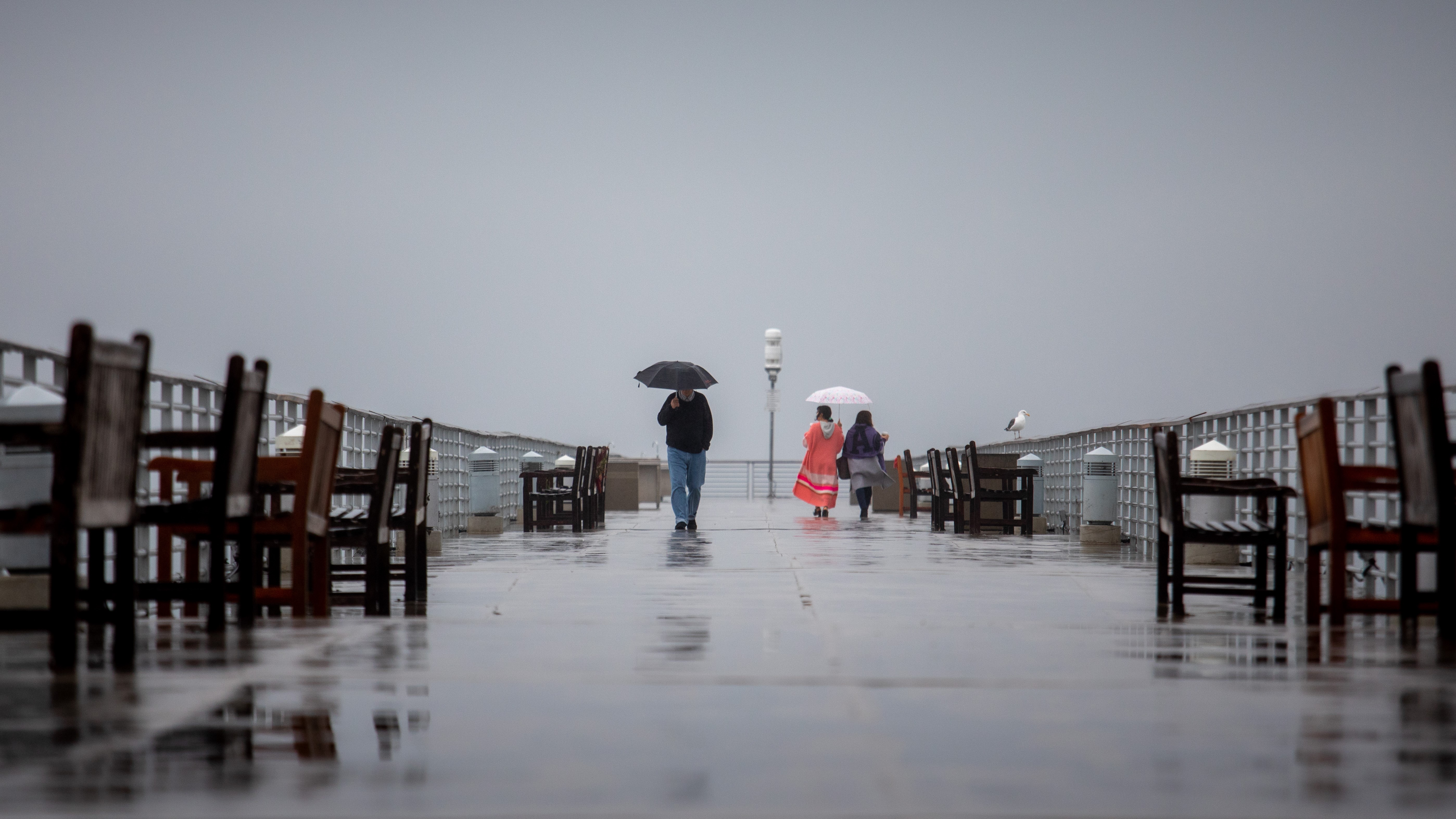
This winter's promising start was aided by a spate of strong storms last month, most notably on New Year's Eve, when much of the state was drenched in heavy rain causing floods that killed one person and damaged a levee system in Sacramento County.
That storm was warmer, so it brought more rain than snow. Two more powerful storms are expected to hit the state this week, and these will be much colder. The National Weather Service says the mountains could get up to 5 feet (1.52 meters) of snow between the two storms.
While the precipitation seemed out-of-character for the parched state, it reflects the type of rainfall the state would expect to see during a normal winter but that has been absent in recent drought-driven years.
In Southern California, weather forecasters said “all systems go” for a major storm to sweep over the area Wednesday and Thursday, with peak intensity occurring from midnight to noon Thursday.
Strong winds will add to impressive storm dynamics “setting the stage for a massive rainfall event” across south-facing coastal mountains, especially the Santa Ynez range in Santa Barbara and Ventura counties, forecasters said.
That could cause dangerous conditions. On Jan. 9, 2018, the community of Montecito on the foothills of the Santa Ynez Mountains was ravaged by a massive debris flow that killed 23 people when a downpour fell on a fresh wildfire burn scar.
As California braced for more wet days ahead, heavy snow and freezing rain dumped on the upper Midwest on Tuesday, prompting the closure of the Sioux Falls Regional Airport in South Dakota and closing parts of Interstates 90 and 29. Meanwhile, heavy rain and thunderstorms threatened to cause flash flooding in Mississippi.
Are the Storms Enough to End California's Drought?
The storms in California still aren't enough to officially end the drought, now entering its fourth year. The U.S. Drought Monitor showed that most of the state is in severe to extreme drought. Most of the state's reservoirs are still well below their capacity, with Lake Shasta 34% full and Lake Oroville just 38% full. It takes even longer for underground aquifers to refill, with groundwater providing about 38% of the state's water supply each year.
“We know that it'll take quite a bit of time and water to recover this amount of storage, which is why we don't say that the drought is over once it starts raining,” said Jeanine Jones, drought manager for the California Department of Water Resources.