Belen De Leon has your First Alert Forecast Feb. 28, 2023.
What to Know
- Rain will arrive in waves through Wednesday.
- San Bernardino County declared an emergency in the area, so travelers beware - you'll probably be turned away if heading to the snow.
- High winds are expected to start up.
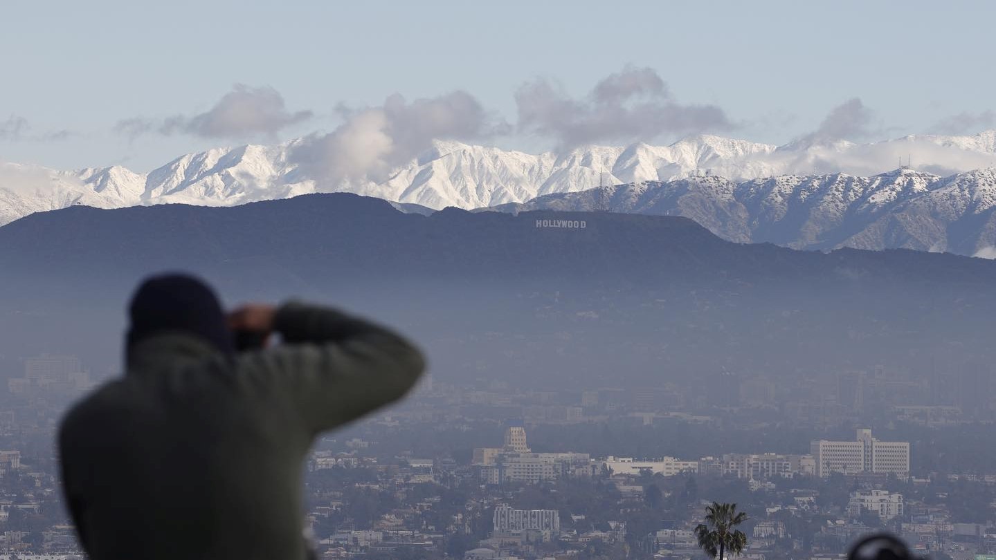
Even though Southern California is still recovering from a major storm, residents can expect a weaker storm to continue to drizzle across the region before it strengthens into a downpour, while residents in the Inland Empire are either snowed in or snowed out.
San Bernardino County declared an emergency in the area, and roads are closed.
Get Southern California news, weather forecasts and entertainment stories to your inbox. Sign up for NBC LA newsletters.
The California Highway Patrol's Arrowhead division said Highway 330 and 18 are open for escorts for residents and emergency workers, and residents must show proof of residency.
One resident hasn’t been home in several days, while a San Diego resident drove out to go snowboarding, just to be turned around at the closure.
Timing of the Storm
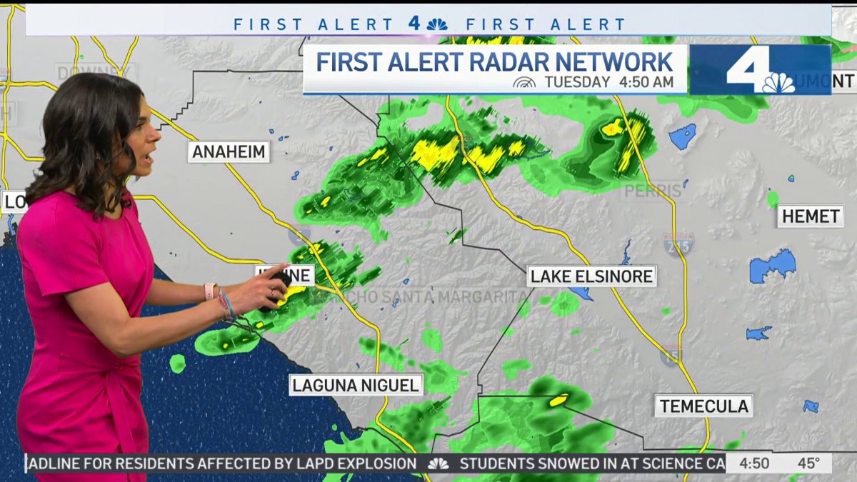
SoCal residents woke up to rain in Orange County and in the Inland Empire, but meteorologist Belen De Leon says the region will have a brief break from snow and rain until it starts up again.
Winds will increase and an advisory may be issued, a concern for more tree damage considering the saturated soils. Low snow levels are possible again. A rain snow mix could reach some of the lower mountain passes, higher valleys, and foothill communities again.

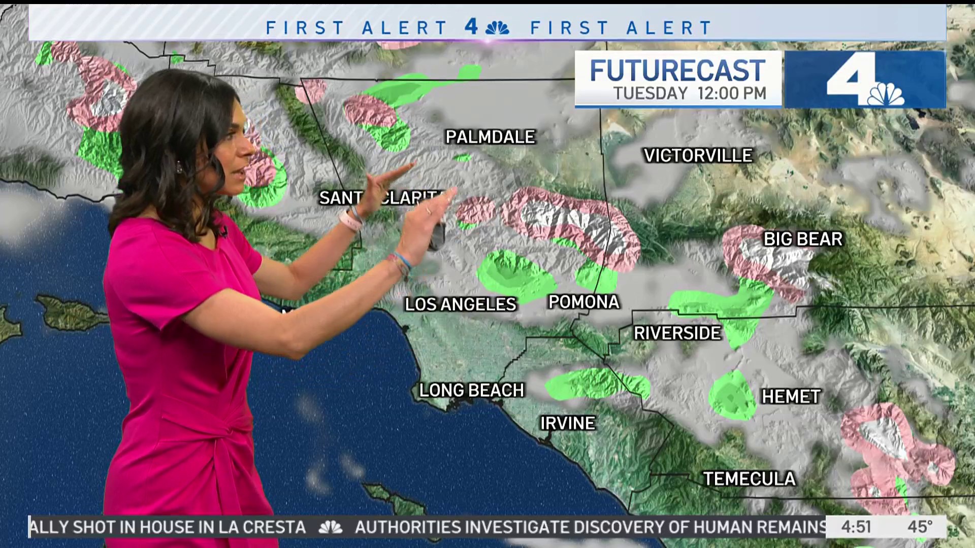
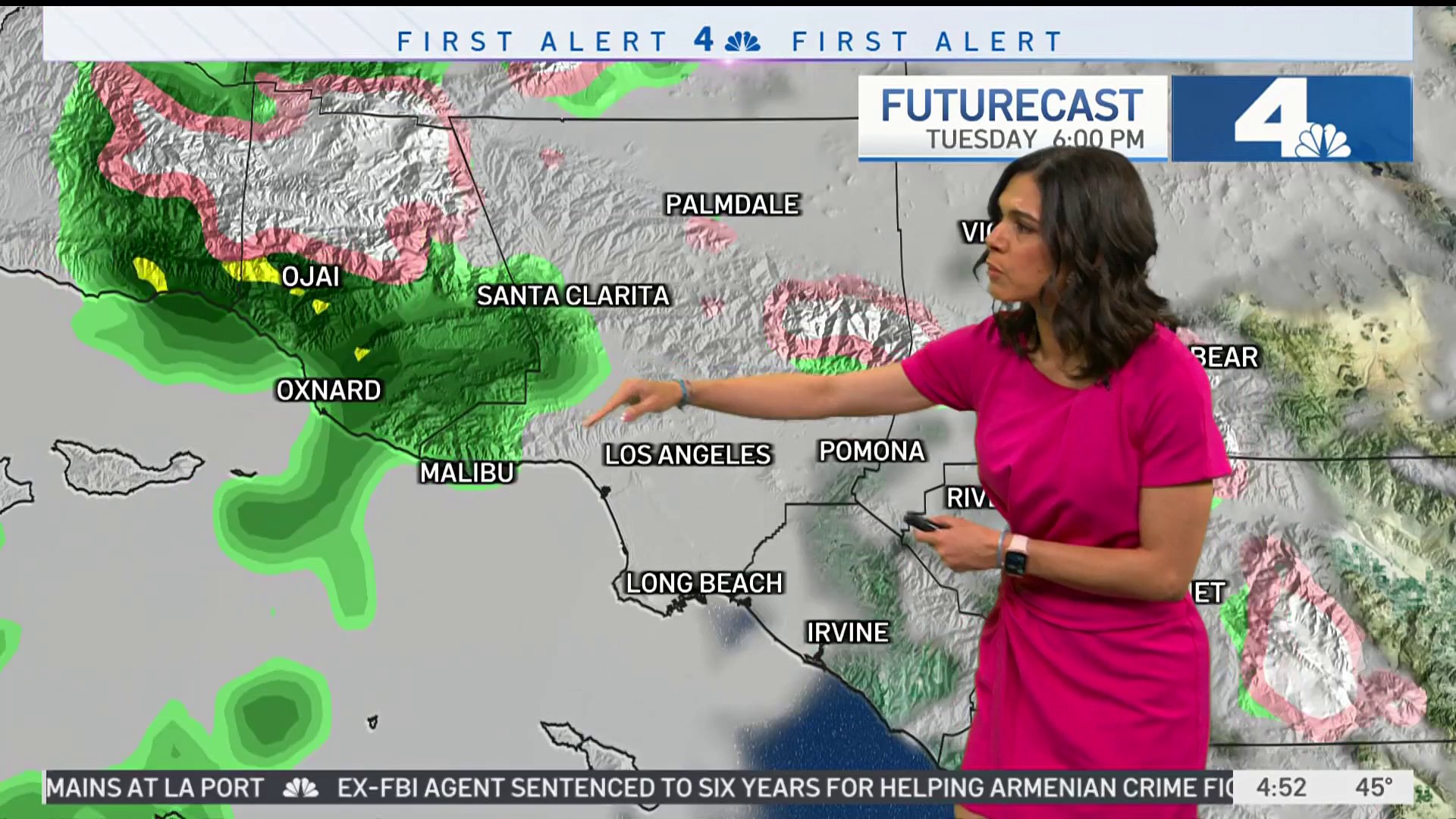
Tuesday at Noon
Residents will see scattered showers inland, and snow in mountains.
5 p.m.
Ventura County residents can expect a wet commute home before the storm sweeps east across SoCal.
10 p.m.
By the evening, rain will begin increasing. It will be a soaking rain in Orange County and Inland Empire cities, streaming in from the west.
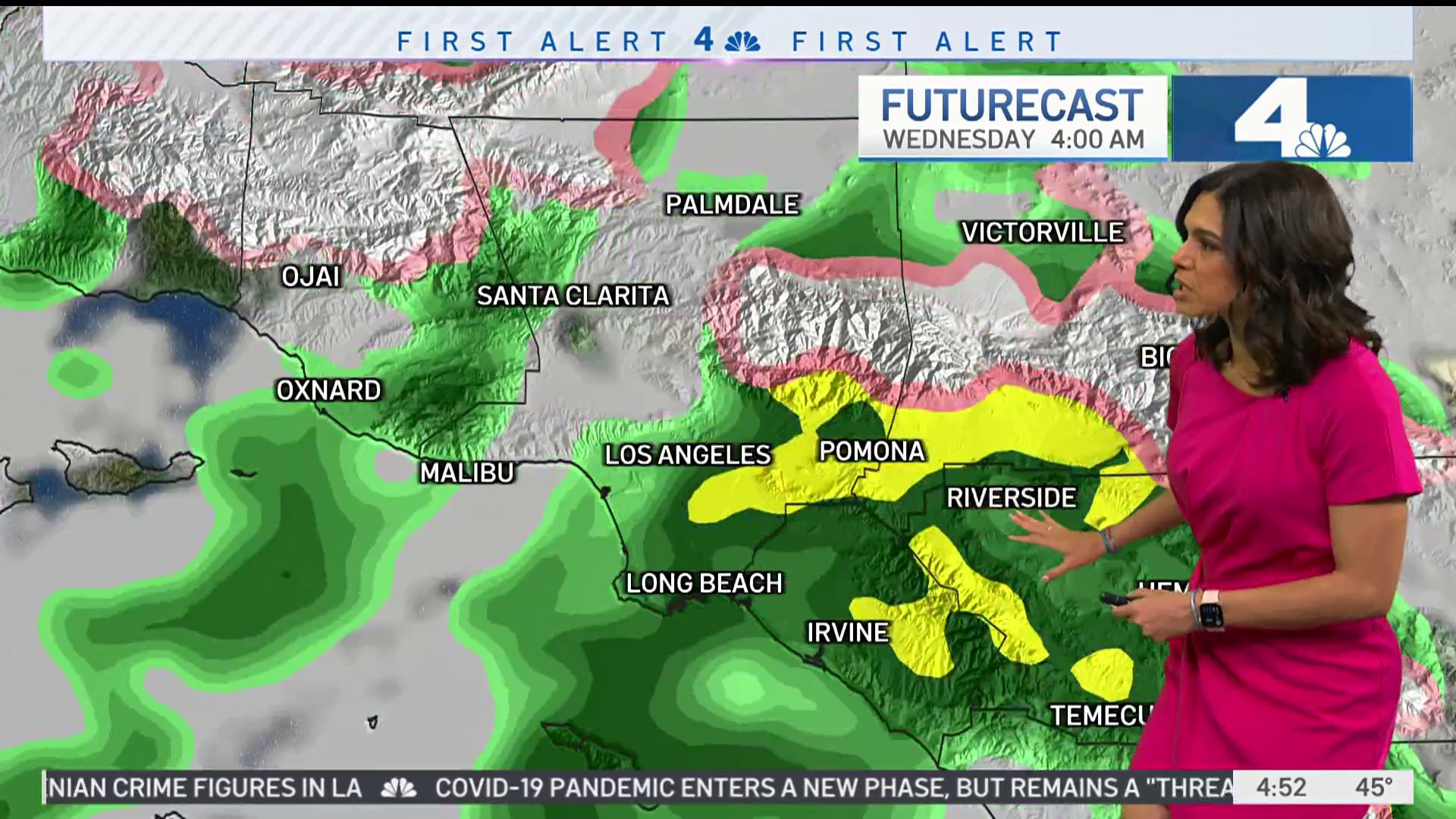
Wednesday Morning
By Wednesday morning at around 4 a.m., more snow in can be expected in the mountains and more rain across the region, with the downpour finally wrapping by Wednesday evening.
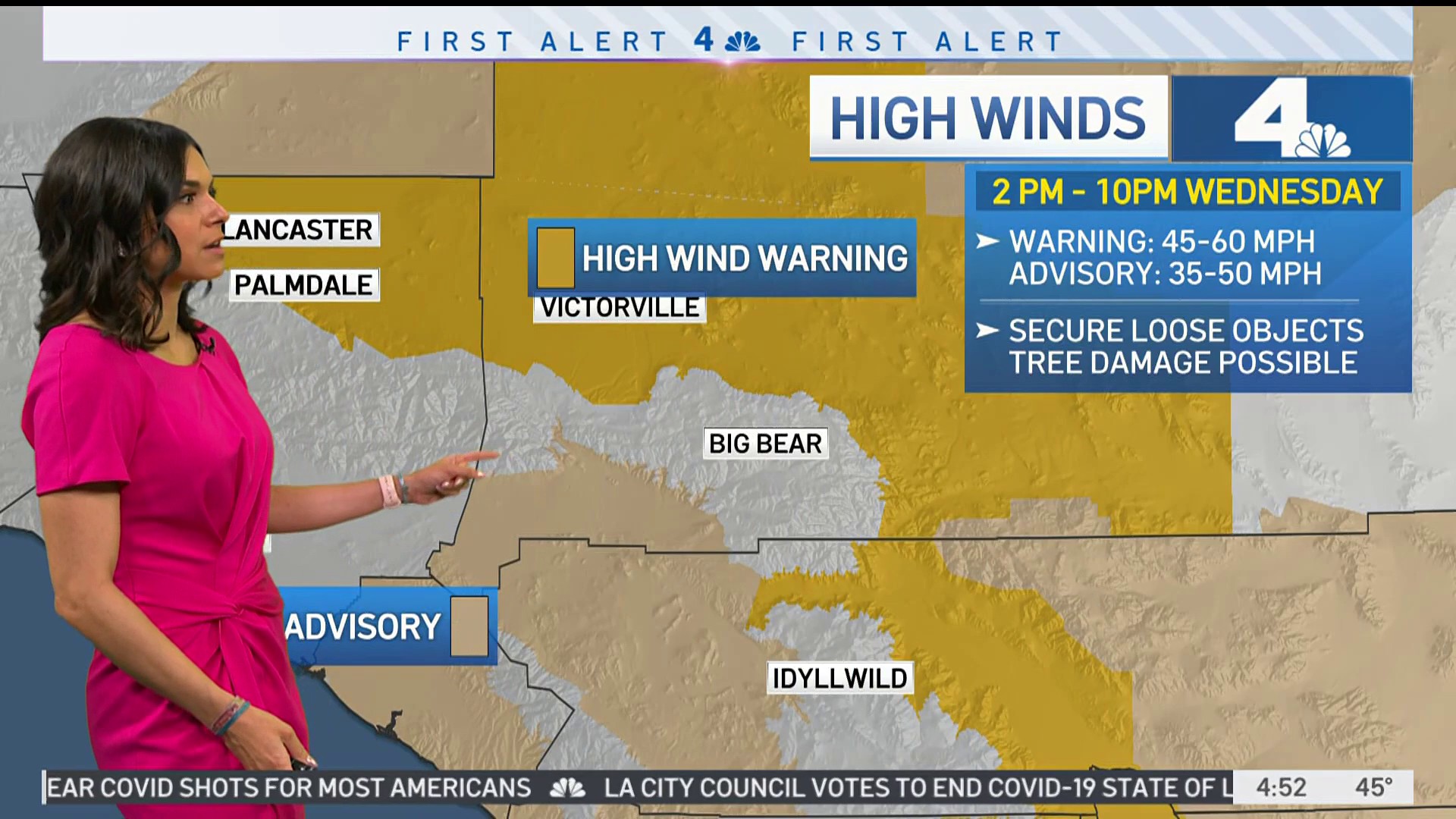
Wind Warning
From 2 to 10 p.m., there will be a high wind warning and difficult travel in the deserts and mountains, in areas like Victorville.
Looking Ahead
The end of the week will be drier with slightly warmer temperatures.
An interesting weather nugget: downtown LA could get to the 60s on Thursday for the first time in eight days, ending one of the coldest periods in downtown Los Angeles since January 2005.
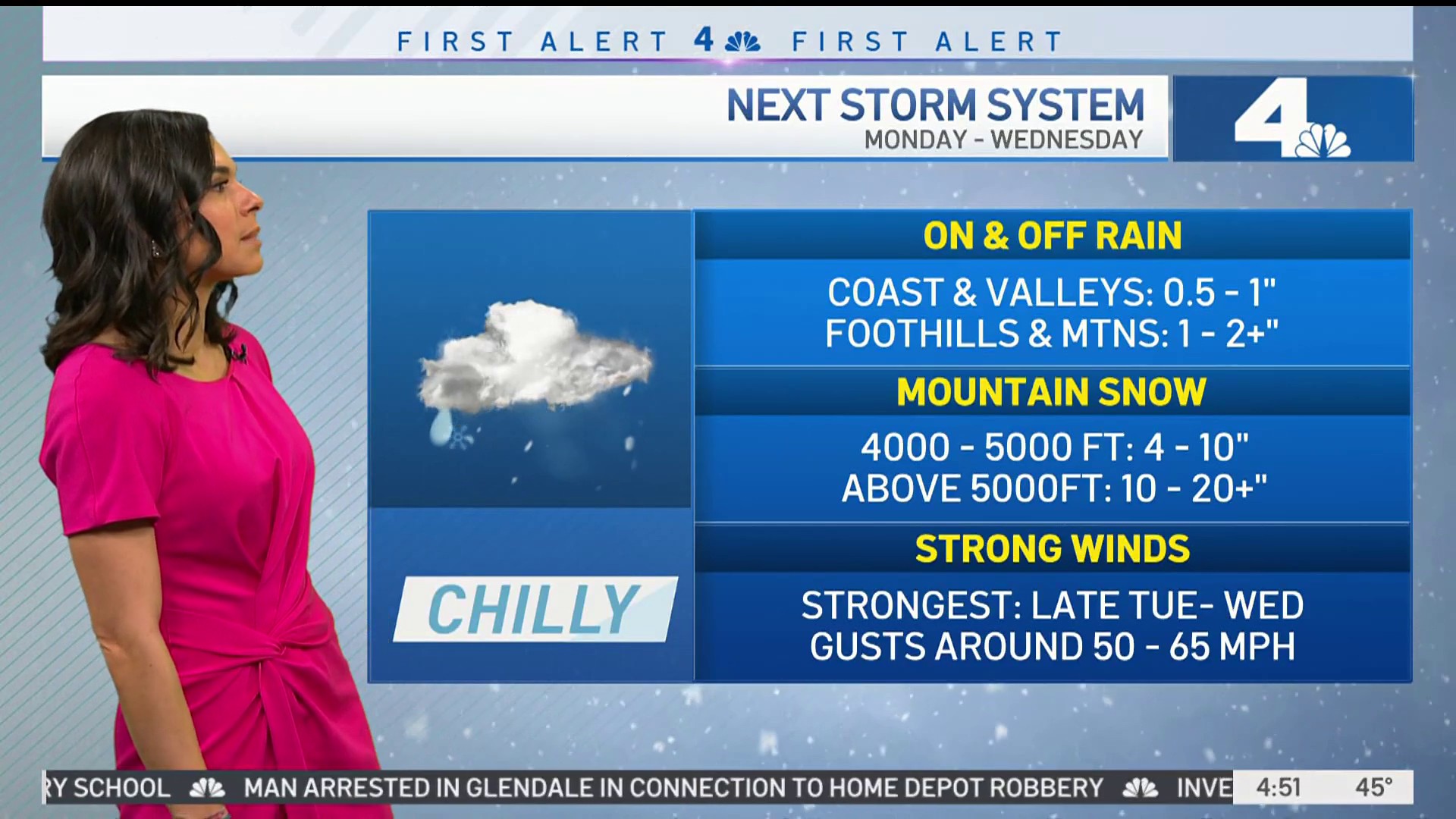
Rain Total Estimates
Rain estimates will range from 0.50-1.00” for coasts/valleys, and 1-3” in the foothills/mountains. Rainfall rates will be around 0.25”/hour, below the USGS threshold for debris flow, but that can’t be ruled out due to the recent rain.
Snow Total Estimates
Snow estimates of 10 to 20” above 5000 feet, with gusts up to 50 mph. Travel through the passes could be affected late Tuesday and Wednesday.