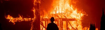
Smoke and Fire From Space: Wildfire Images From NASA Satellites
•
NASA is tracking wildfires globally, offering a view from high above Earth that reveals the scope and size of major fires, some of which produce smoke plumes that stretch for miles.
79 photos
1/79
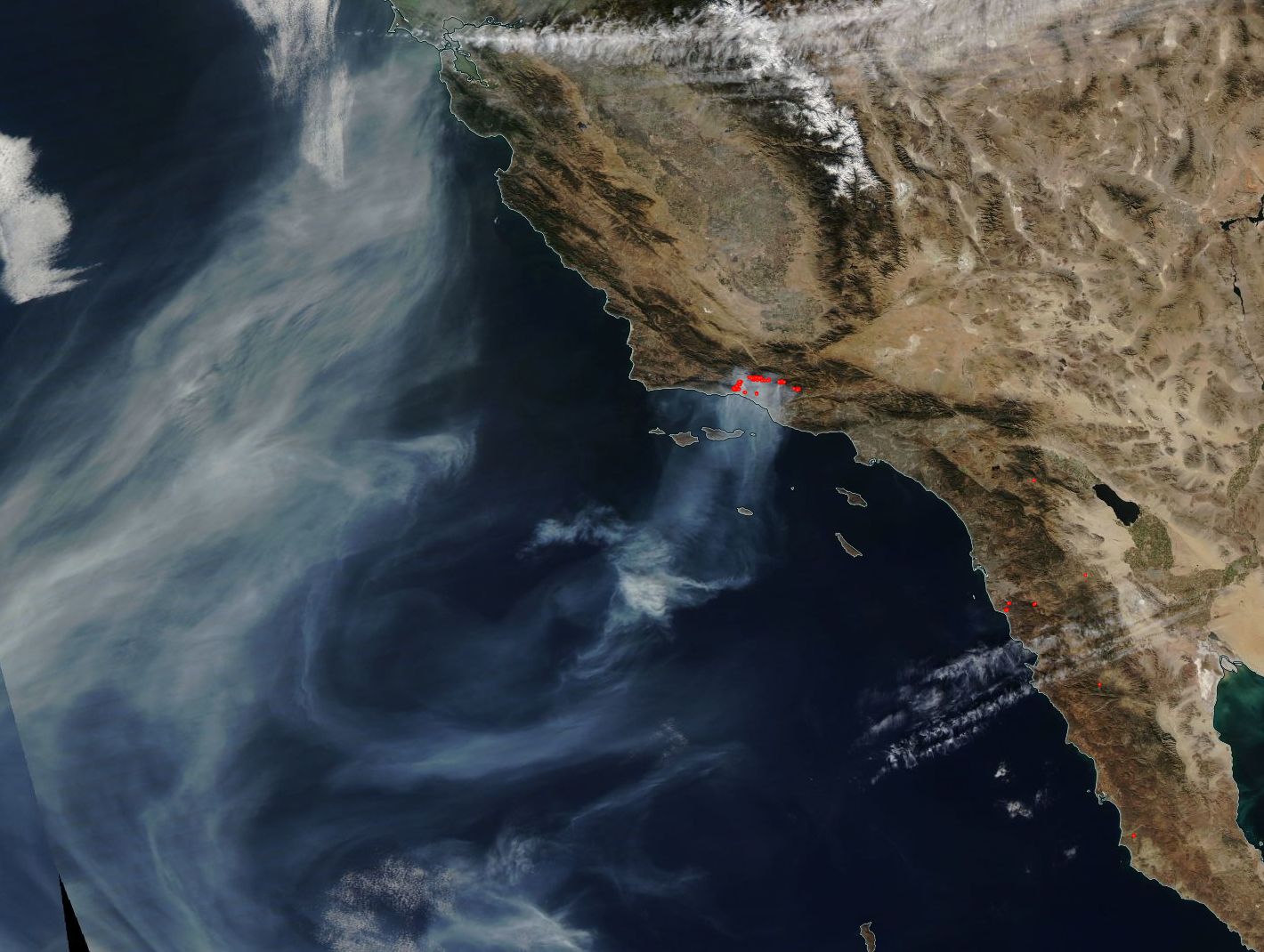
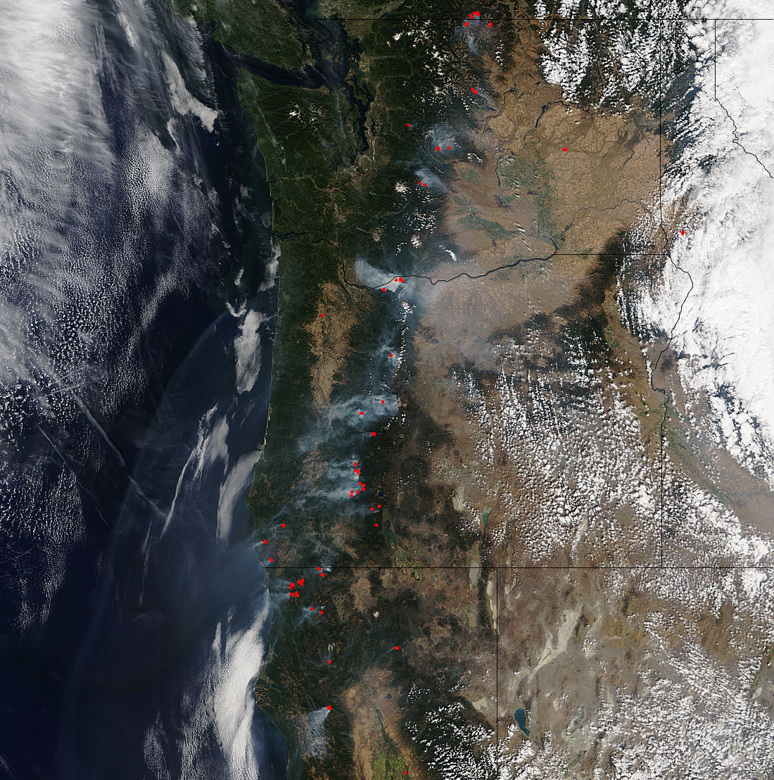
NASA
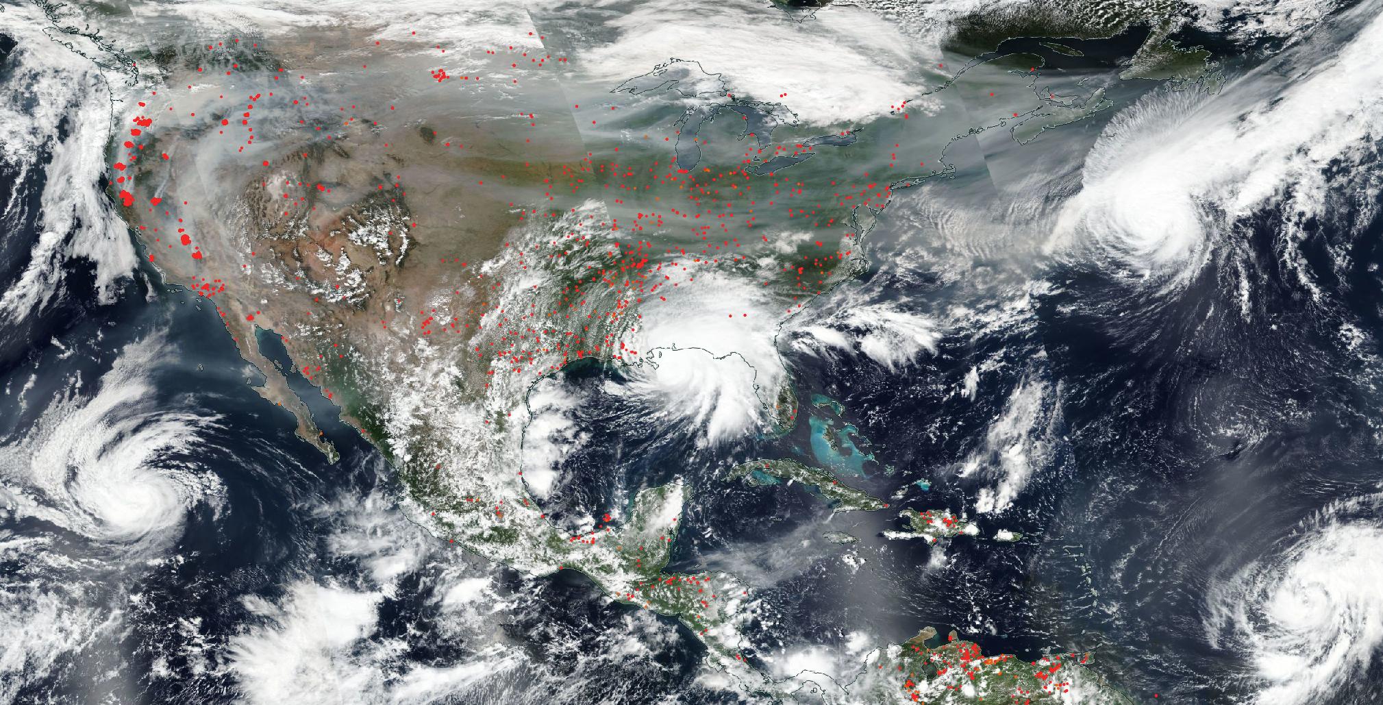
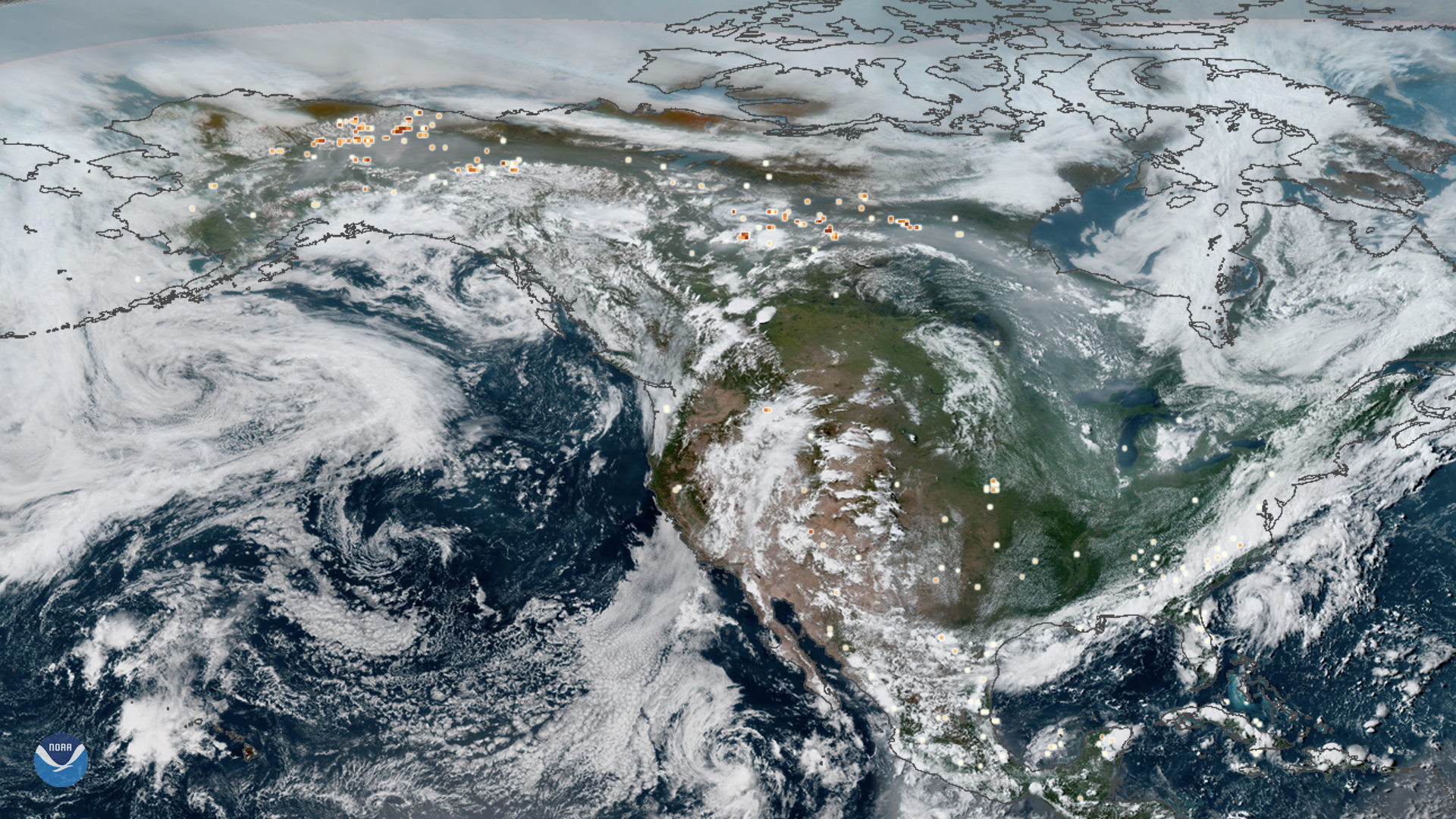
NASA’s Aqua satellite captured this image of Earth Sept. 15 show fires in the U.S. West, smoke from those fires drifting eat, and several hurricanes, including Sally on the Gulf Coast. The red dots represent areas with a heat spike, indicative of wildfires. Karina which is moving away from the Baja California area.
2/79
NASA
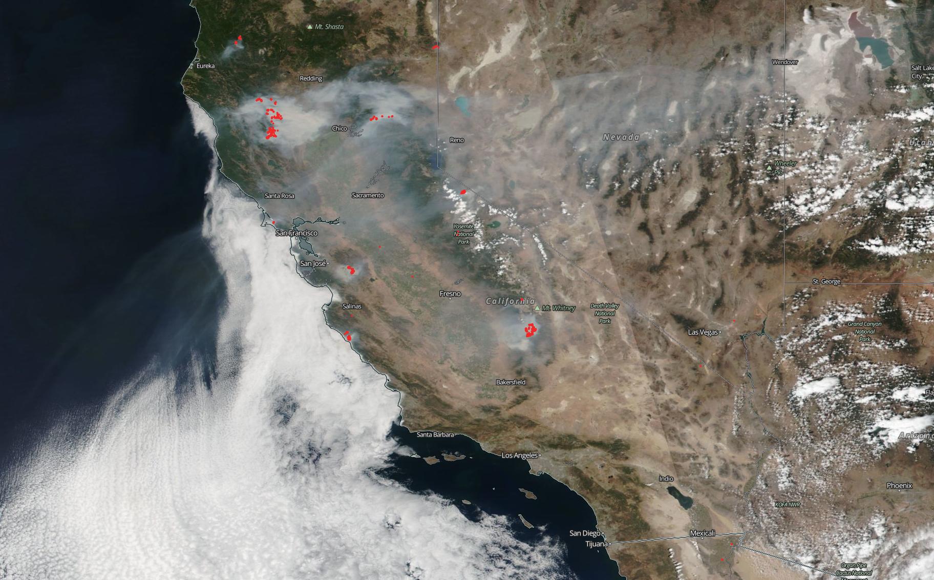
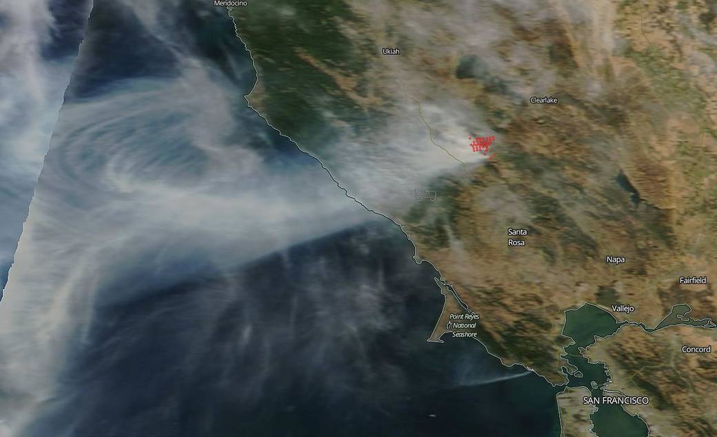
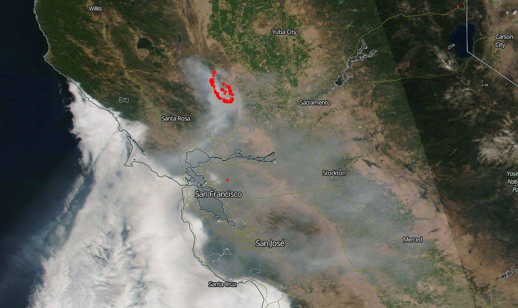
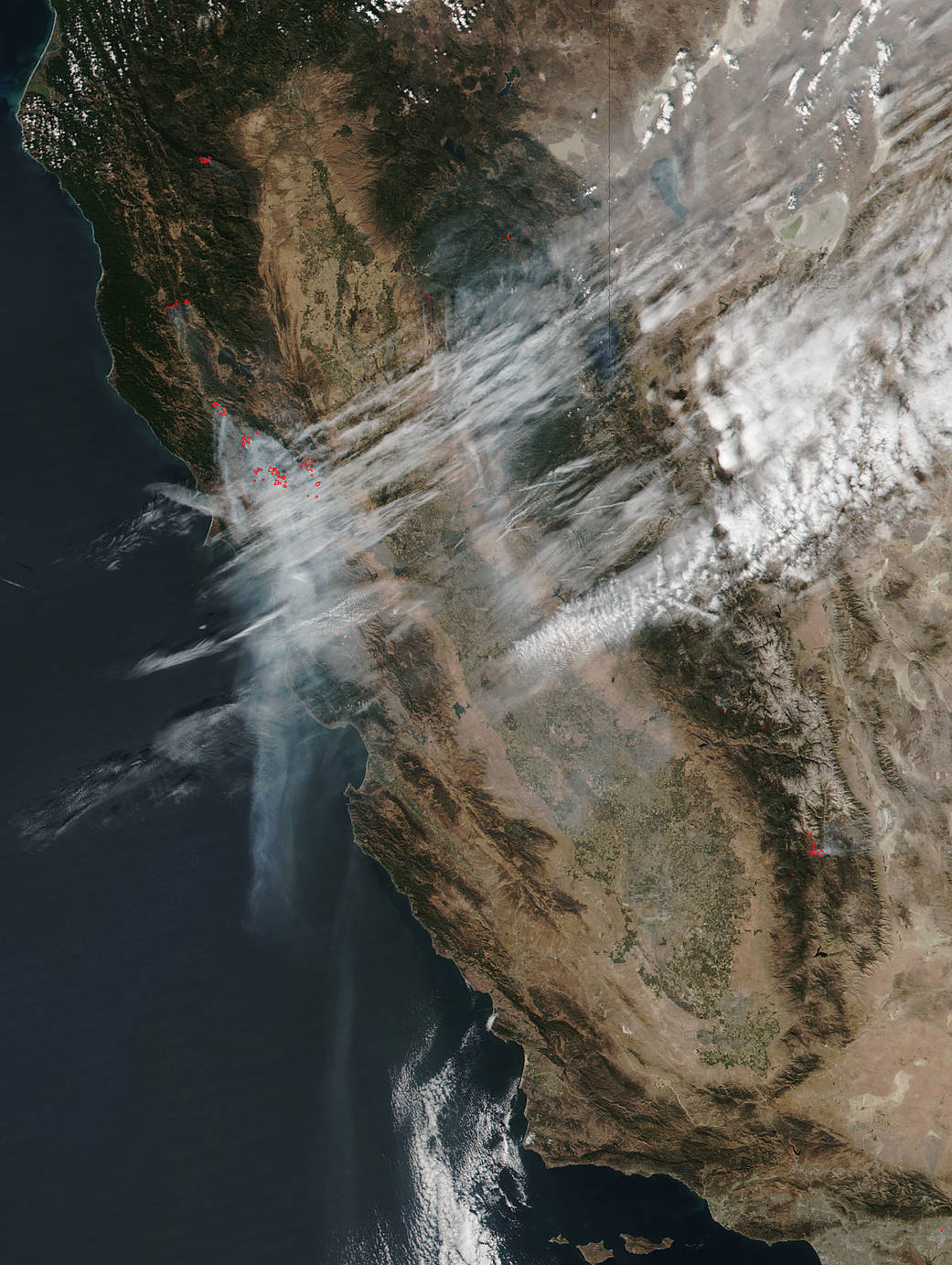
This image taken by Suomi NPP on August 30, 2020 of the smoke and fires in California.
3/79
NASA
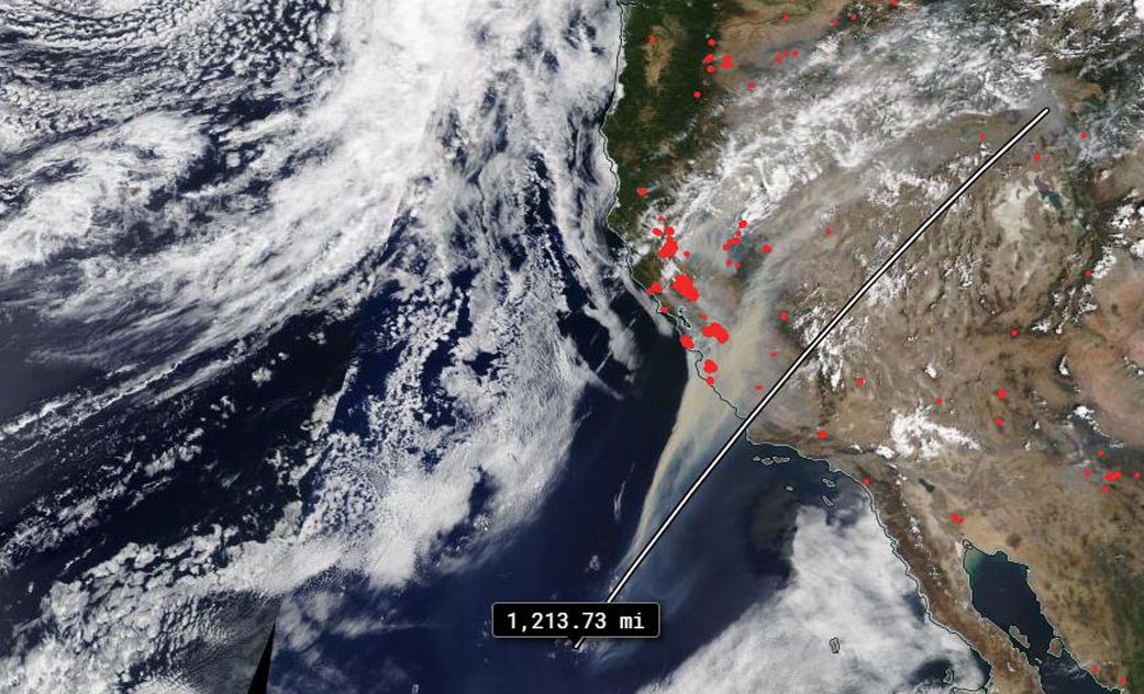
NASA’s Terra satellite captured the huge swath of smoke that has been generated by the California wildfires and dispersed by the winds surrounding those fires on August 20, 2020. This plume was estimated at about 1,200 miles long.
4/79
NASA/GOES
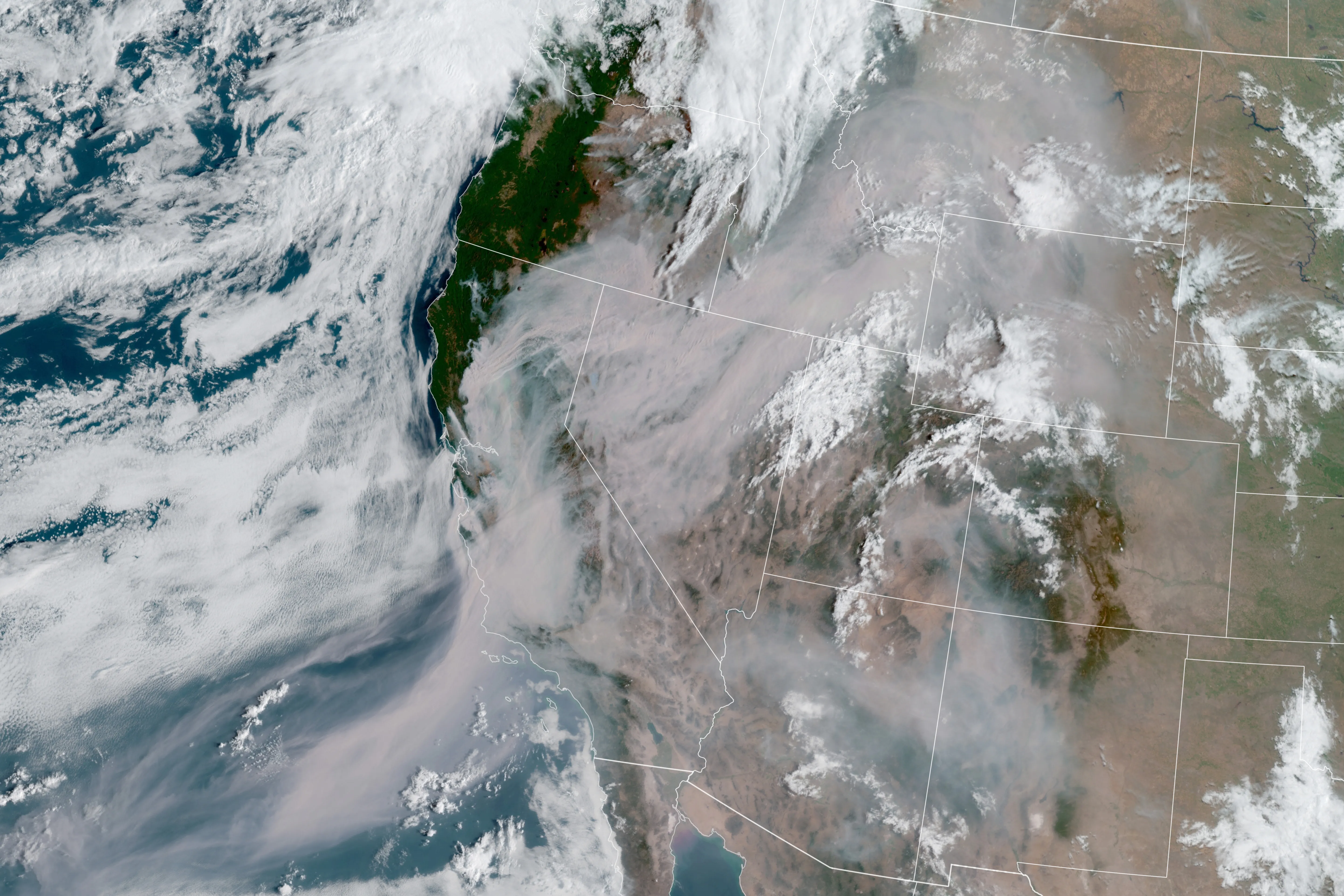
A satellite image captured Thursday Aug. 20, 2020 shows smoke from those fires shrouding most of California and much of the U.S. West
5/79
NASA
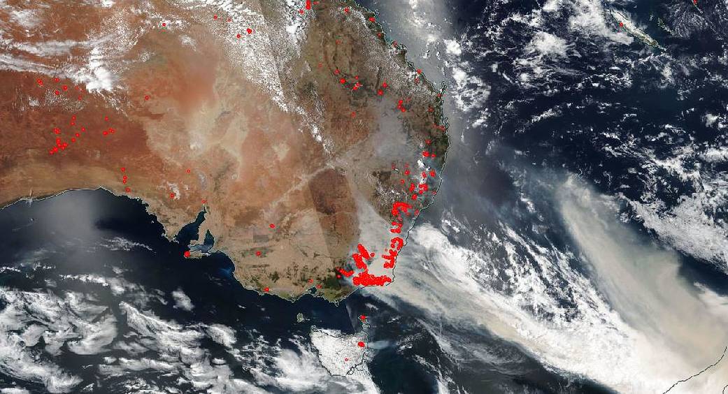
Smoke from Australia’s bushfires can be seen in this NASA image from Jan. 4, 2020.
6/79
NASA
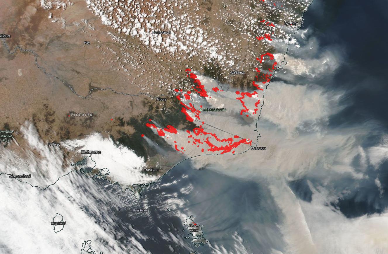
The brushfire outlook is grim at the start of the new year. This photo shows fire, represented by red dots, and smoke plumes Jan. 1, 2020.
7/79
NASA
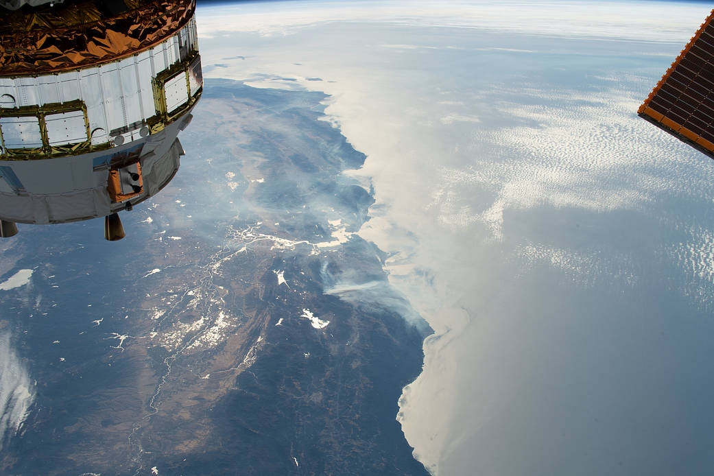
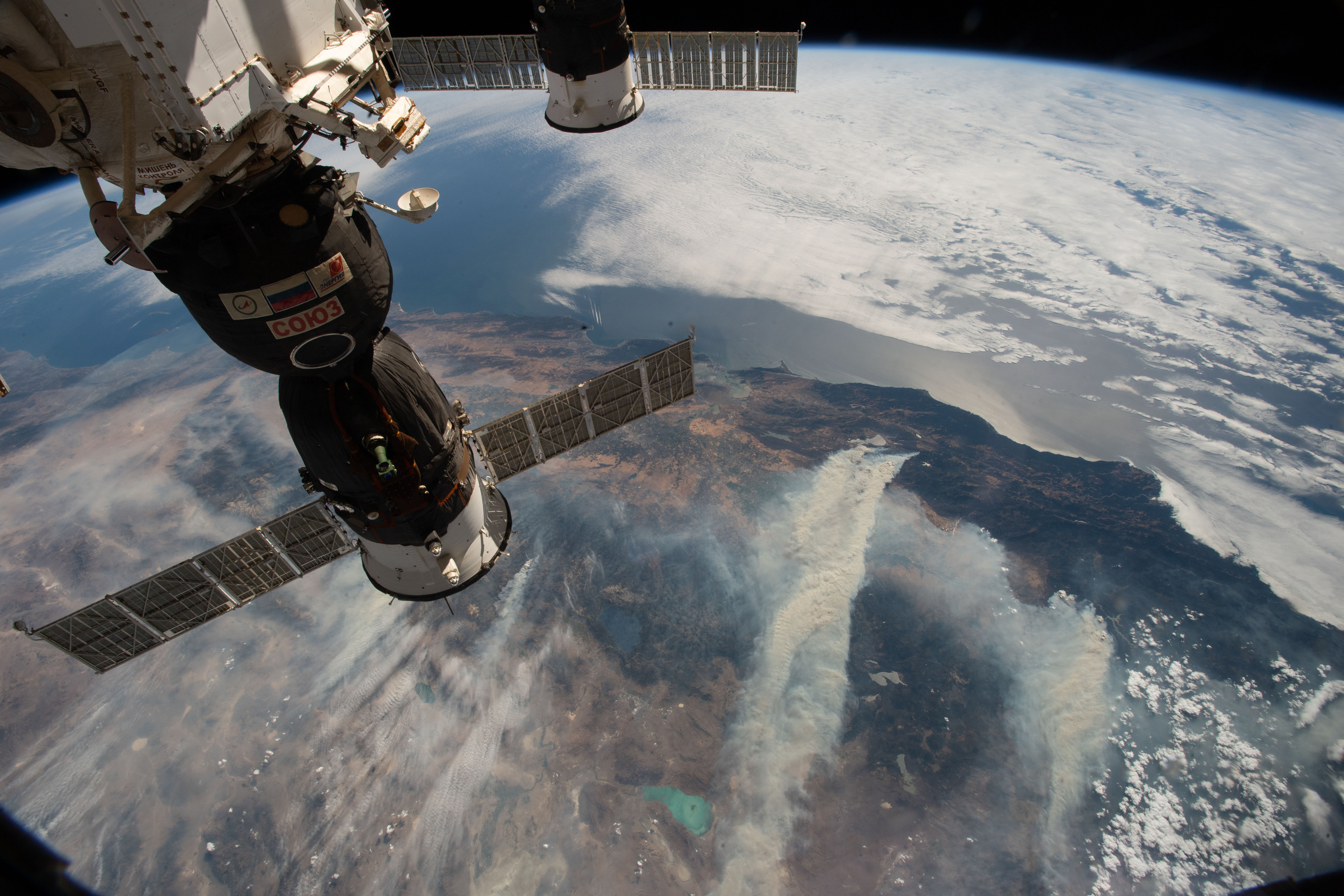
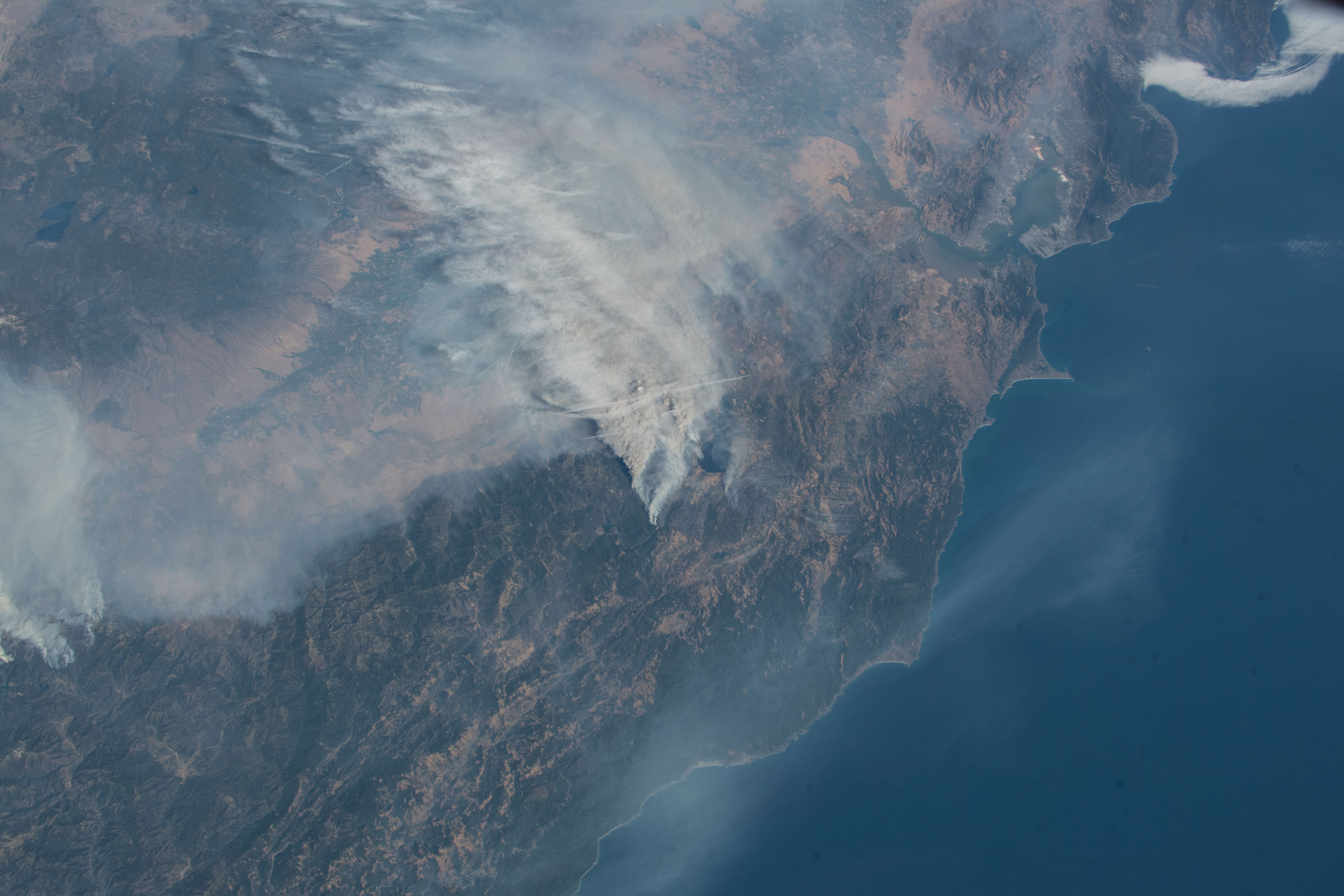
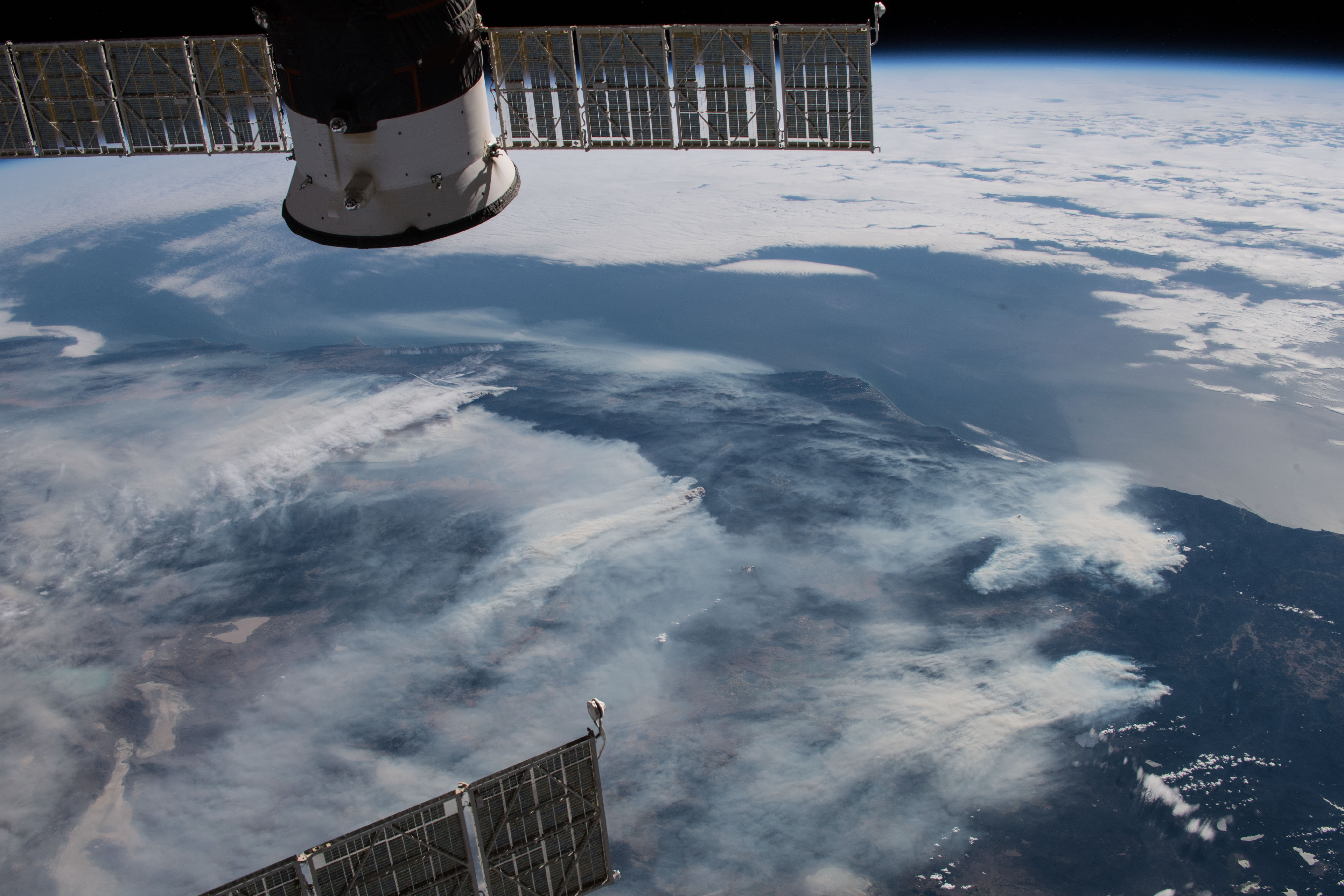
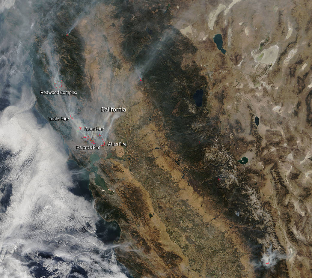
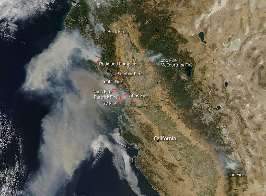
Wildfires north of the Bay Area are seen Nov. 1, 2019 from the Space Station.
8/79
NASA
Wildfires north of the Bay Area can be seen from 254 above the Golden State in this photo captured by a crew member aboard the International Space Station.
9/79
NASA
Wildfires north of the Bay Area can be seen in this photo from NASA astronaut Andrew Morgan aboard the International Space Station.
10/79
NASA
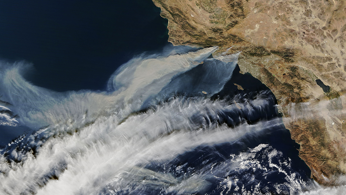
The NASA Terra satellite captured the Getty Fire with its smoke plume drifting off the coast of California on Oct. 30, 2019
11/79
NASA Worldview, Earth Observing System Data and Information System (EOSDIS)
A NASA satellite captured this smoke plume from the Getty Fire shortly after the fire started early Oct. 28, 2019 in the hills overlooking the 405 Freeway through Los Angeles' Sepulveda Pass. The fire forced evacuations and destroyed eight structures.
12/79
NASA Worldview, Earth Observing System Data and Information System (EOSDIS)
NASA's Terra satellite captured a image of the Kincaid wildfire located in Northern California's Sonoma County which broke out on Wednesday night and has grown to over 20,000 acres in less than 48 hours.
13/79
NASA Worldview, Earth Observing System Data and Information System (EOSDIS)
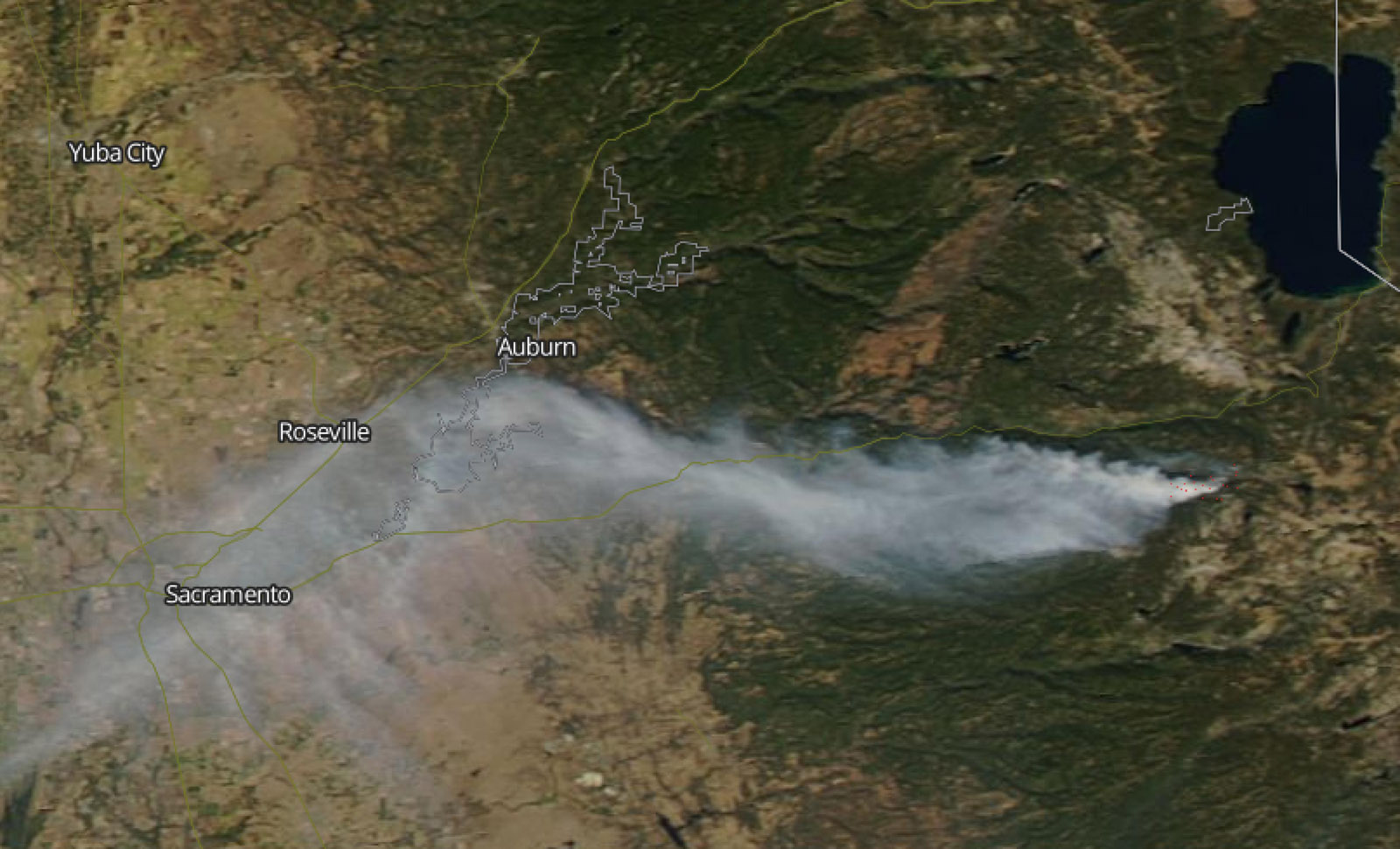
A smoke plume from a fire in Eldorado National Forest stretched from southwest of Lake Tahoe to over 100 miles west, reaching Sacramento. The fire was captured Oct. 10, 2019 in this image from NASA's Aqua satellite.
14/79
NASA Worldview, Earth Observing System Data and Information System (EOSDIS)
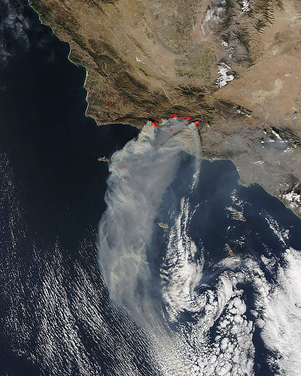
The Tenaja Fire burns Sept. 4, 2019 in Riverside County. The fire grew quickly from 25 to 900 acres in about a day, then jumped to 2,000 acres.
15/79
NASA Worldview, Earth Observing System Data and Information System (EOSDIS)
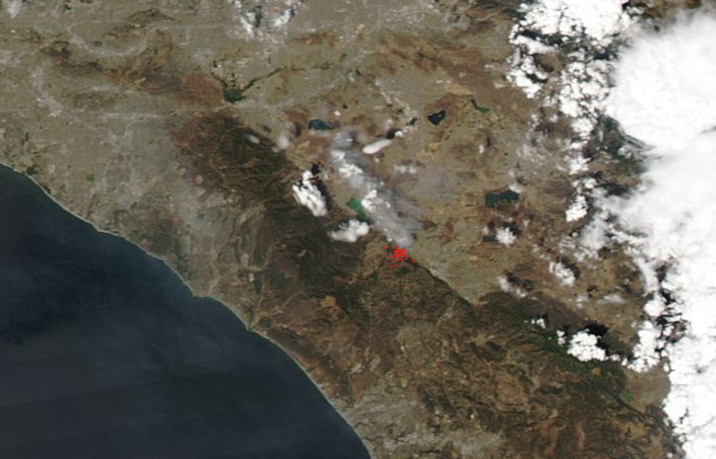
A view of California's Walker Fire, which burned in Plumas National Forest in September 2019.
16/79
NASA/NOAA
17/79
NASA Worldview, Earth Observing System Data and Information System (EOSDIS)
18/79
NASA Worldview, Earth Observing System Data and Information System (EOSDIS)
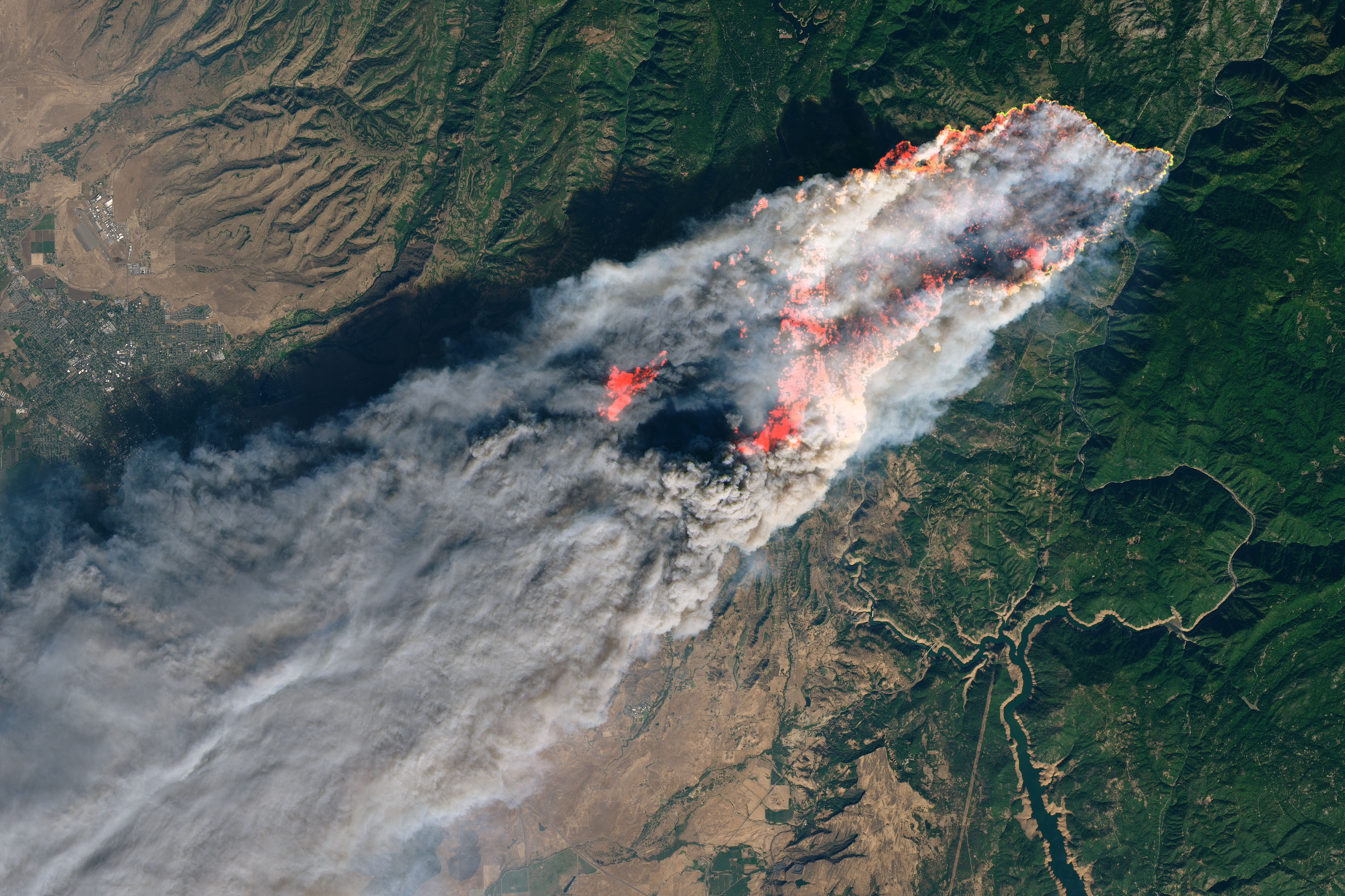
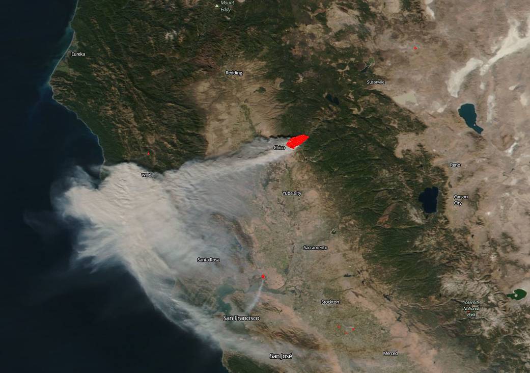
The burn scar from the deadliest and most destructive wildfire on record in California is visible in this photo from NASA's Terra satellite on Nov. 26, 2018. The burn area near Paradise, northeast of Sacramento, can be seen in dark red. It is estimated to have burned an area about the size of Chicago.
19/79
NASA
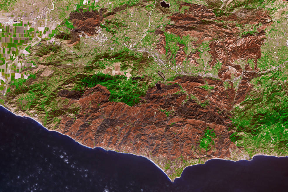
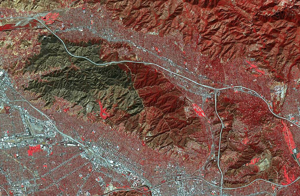
This Nov. 18, 2018 image shows the vast amount of land in the Santa Monica Mountains burned by the 152-square-mile Woolsey Fire.
20/79
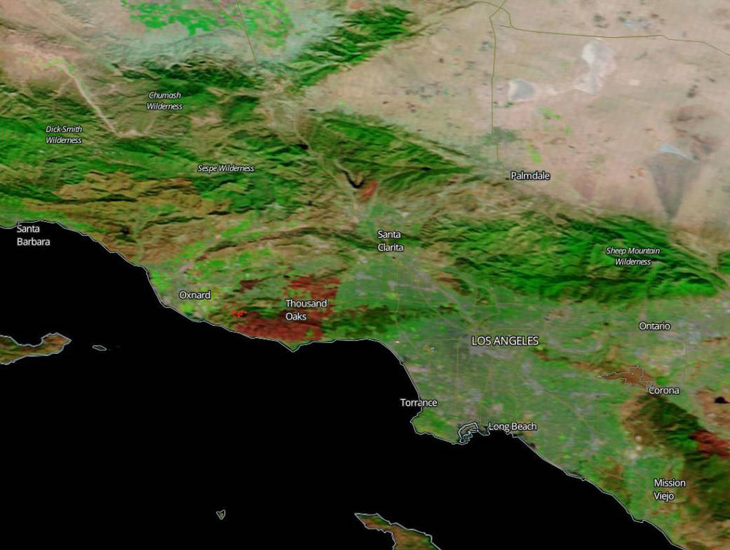
NASA
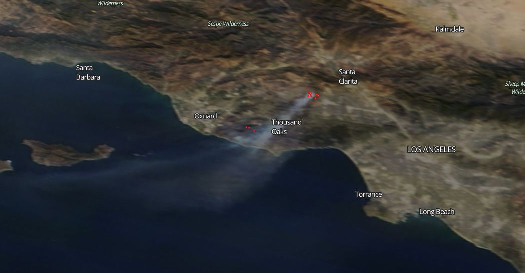
NASA's Terra satellite captured this image of the Woolsey Fire burn scar Nov. 14, 2018 in Ventura and Los Angeles counties. The red areas near Thousand Oaks and south to Malibu indicate the burn area. The brighter red spot between Oxnard and Thousand Oaks denotes an area of active fire. n
21/79
NASA
A view of the Camp Fire Tuesday Nov. 13, 2018 in Northern California. At this point, the 125,000-acre fire was only 30-percent contained after it started Nov. 8.
22/79
NASA
A view of the Southern California Woolsey Fire Nov. 12, 2018. The fire started Nov. 8 in Ventura County and quickly burned south, jumping the 101 Freeway and heading into Malibu.
23/79
NASA Earth Observatory
A view of the Camp Fire (above) in Northern California and the Hill and Woolsey fires in Southern California as seen on Nov. 9, 2018.
24/79
NASA Earth Observatory
A view of the Camp Fire in Butte County, California on the day it began Nov. 8, 2018.
25/79
NASA
The Camp Fire and its giant smoke plume can be seen in this NASA image on Nov. 8, 2018. This image shows the town of Paradise, California and the surrounding region.
26/79
NASA
Dark brown areas in this Aug. 30, 2018 NASA satellite image showed the scorched landscape left behind by California's largest wildfire on record.
27/79
NASA
This image show the largest fire in California history burning Aug. 12, 2018. Smoke from the Mendocino Complex fire can be seen as far east as parts of Montana and then up into Canada.
28/79
NASA
An Aug. 4, 2018 image from the International Space Station shows long fingers of smoke from California's wildfires, including the state's largest wildfire on record -- the Mendocino Complex.
29/79
NASA
A view of the Mendocino Complex fires as seen Aug. 3, 2018 from the International Space Station.
30/79
Northern California's wildfires can be seen in this Aug. 3, 2018 image taken about 250 miles above Earth in the International Space Station.
31/79
NASA
It's difficult to see the Earth's surface due to smoke from the Mendocino Complex fires and other large blazes in this image posted Aug. 8, 2018.
32/79
NASA Earth Observatory image by Joshua Stevens, using Landsat data from the U.S. Geological Survey, GEOS-5 data from the Global Modeling and Assimilation Office at NASA GSFC, and fire perimeters from CAL FIRE
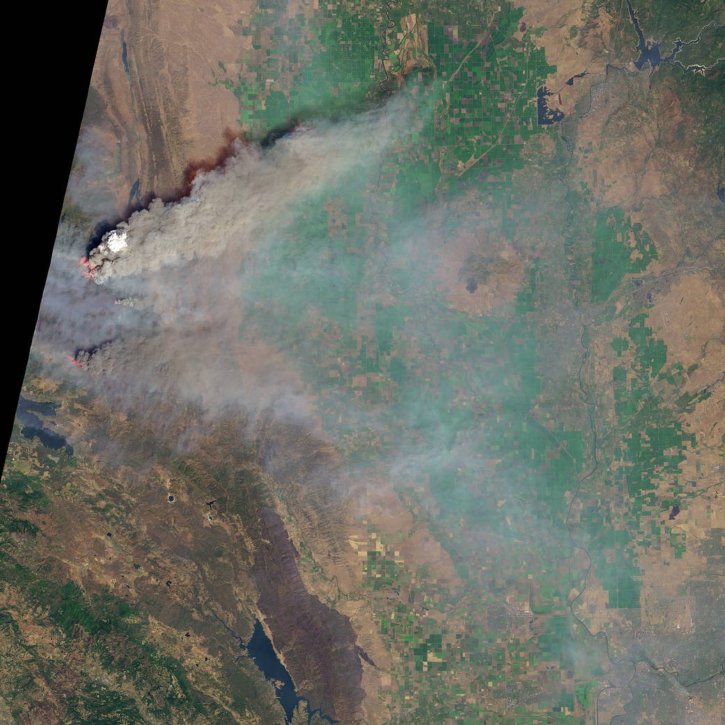
This Aug. 6, 2018 image from Landsat 8 shows the smoke plume rising from Northern California's Ranch fire, part of the Mendocino Complex. The image provides a look at the trees and vegetation, much of it killed during the state's dry spell, that provide fuel to burn.
33/79
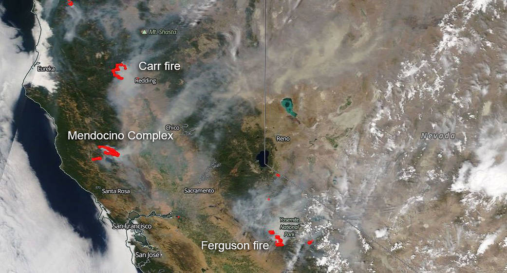
The three large patches of red in this image captured Aug. 2, 2018 show the Ferguson, Mendocino Complex and Carr fires. Over the weekend of Aug.4-5, the Mendocino Complex fire exploded to become on the five-largest fire on record in California.
34/79
NASA
This NASA satellite image shows smoke from several fires, depicted by the red dots, burning in California. The image from the Aqua satellite was captured on July 30, 2018.
35/79
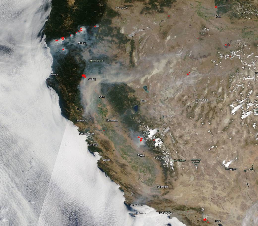
NASA
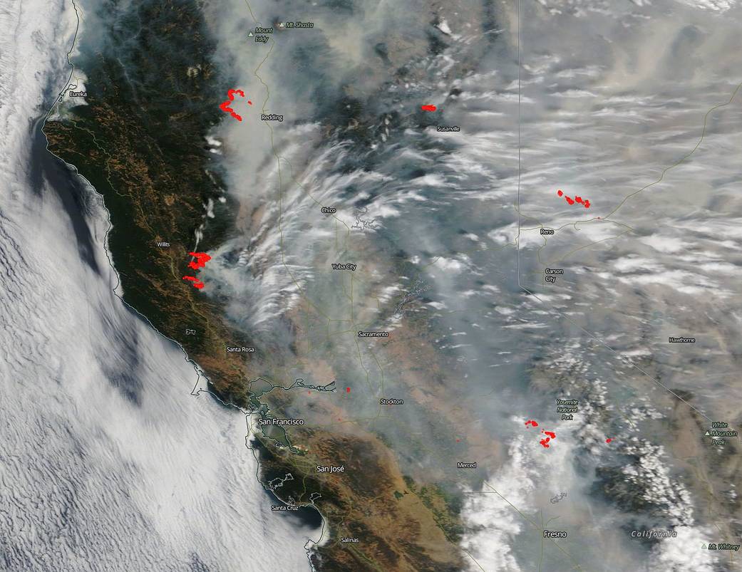
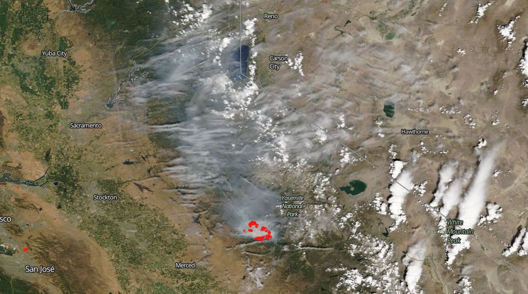
NASA's Terra satellite captured wildfire smoke covering vast parts of California and the U.S. West Coast on July 29, 2018. It shows smoke drifting east into Utah. The red dots indicate fire activity from the Carr fire in Redding, the Ferguson fire near Yosemite National Park, the Cranston fire in Riverside Couty, the River fire in Mendocino County and other burn areas.
36/79
NASA
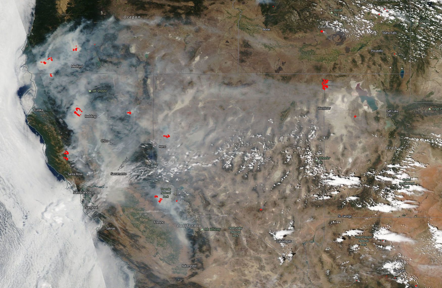
NASA's Terra satellite captured this image of the West Coast of the United States Thursday July 26, 2018. It shows widespread smoke from fires burning from Oregon to the huge smoke plume and fire around Redding and the Ferguson fire near Yosemite. The Cranston fire in Riverside County can be seen at the very bottom edge of the image.
37/79
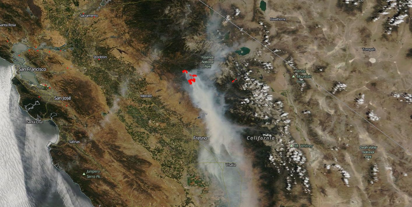
NASA satellite imagery shows the Ferguson fire burning near Yosemite National Park July 26, 2018.
38/79
NASA
NASA satellite imagery shows the Ferguson fire burning near Yosemite National Park July 23, 2018.
39/79
NASA
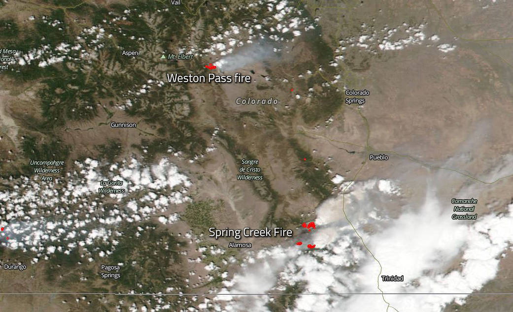
Fires depicted in red in this image started in June and continued into July in Colorado. The West Pass fire near Colorado Springs began June 28, 2018 due to a lightning strike. The Spring Creek Fire south of Colorado Springs began a day earlier.
40/79
NASA
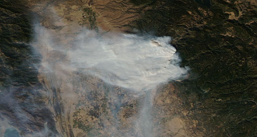
A large plume of smoke from the County Fire near San Francisco can be see in this image. The fire was growing at a rate of about 1,000 acres per hour, growing overnight form 44,000 acres to 70,000 acres.
41/79
NASA
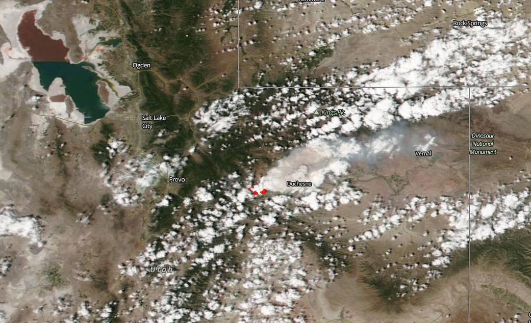
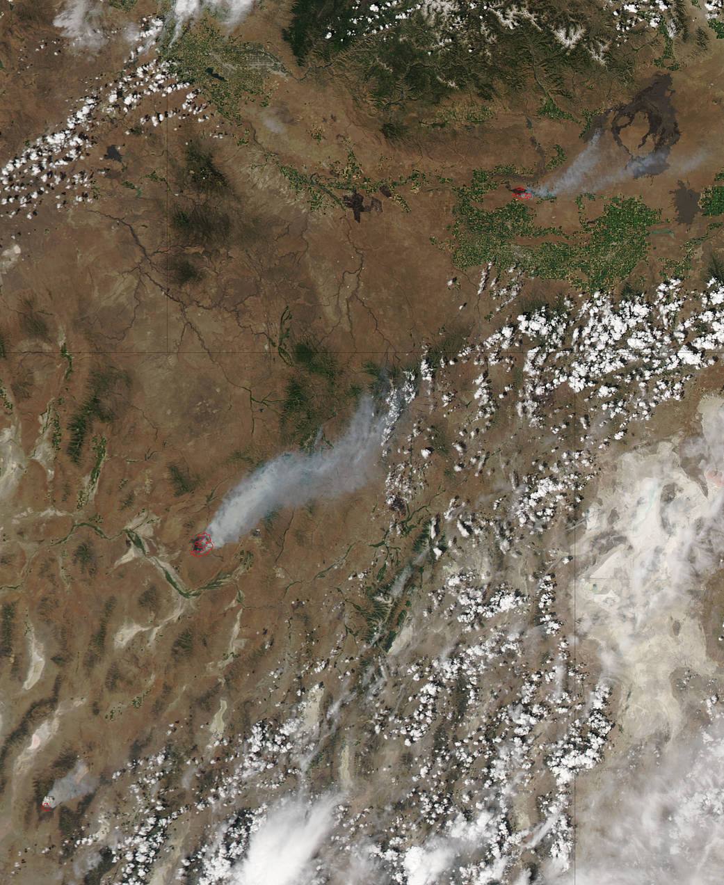
The Dollar Ridge Fire in Utah began July 1, 2018. It quickly grew to more than 7,000 acres. It exploded to 30,000 acres two days later.
42/79
NASA
This satellite image shows where wildfires, outlined in red, are burning in California on Thursday June 14, 2018. On the heels of the most destructive wildfires on record in California, there have already been more than 1,800 fires, as of June 10, 2018, in the state so far in this year.
43/79
NASA
The Rhea Fire started on Thursday April 12, 2018 during a stretch of high fire danger days in the Midwest. It is located in Dewey County, Oklahoma.n
44/79
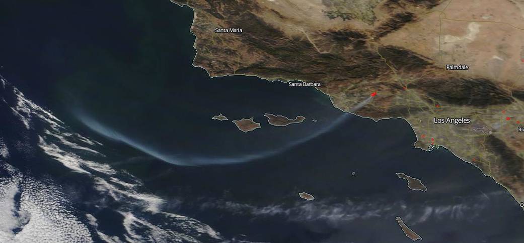
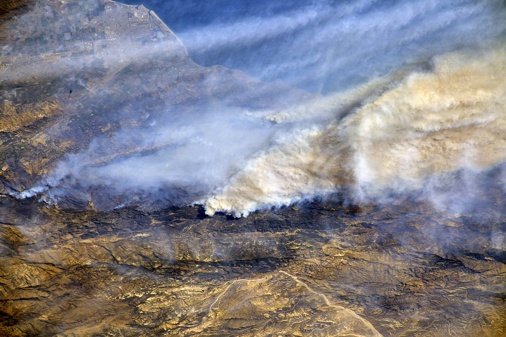
Lynn Jenner/NASA
Blown over a widespread area by strong winds, smoke from the Thomas fire can be seen Dec. 16, 2017. Winds were forecast to die down for a couple of days before picking up again this week.
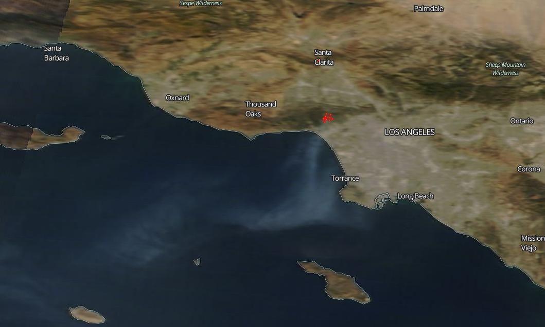
45/79
NASA satellite imagery shows smoke from the Thomas fire as it burned for an 11th day Wednesday Dec. 13, 2017 in Ventura and Santa Barbara counties.
46/79
NASA/Randy Bresnik
This photo was taken Dec. 8 from the International Space Station flyover of Southern California. NASA astronaut Randy Bresnik photographed the plumes of smoke rising from wildfires.
47/79
NASA Earth Observatory
A thick stream of smoke is seen above a ridge of clouds from space in this Dec. 5, 2017, MODIS photo taken by NASA's Terra satellite. The Thomas fire, fed by powerful Santa Ana winds, burned through 55,000 acres in Ventura county.
48/79
NASA/Lynn Jenner
An Oct. 24, 2017 image from the Advanced Spaceborne Thermal Emission and Reflection Radiometer (ASTER) instrument on NASA's Terra satellite shows the expansive fire scar on the landscape of California's wine country due to the October Fire Siege. Burned areas appear in dark gray, vegetation is displayed in red. The image covers and area of 38 by 39 miles.
49/79
NASA
This image captured Wednesday Oct. 11, 2017 shows the deadly and destructive Northern California wildfires after they jumped in size. High cirrus clouds partially obstruct the view of smoke.
50/79
NASA
This image of smoke from Northern California's fires was captured Oct. 10, 2017. Together, the wildfires are among the deadliest and most destructive in the state's history.
51/79
NASA
This image from NASA's Aqua satellite shows more than a dozen fires burning in Northern California Oct. 9, 2017. The fires were fanned by 60-mph winds in California's wine country.
52/79
NASA
This image shows one of Los Angeles' largest wildfires -- the September 2017 La Tuna fire in the foothills north of Los Angeles. In this image from the Advanced Spaceborne Thermal Emission and Reflection Radiometer (ASTER) instrument on NASA's Terra satellite, vegetation is depicted in red -- such as the golf courses visible in the hills above Burbank. Burned area is in dark gray. The image was acquired Oct. 7, 2017.
53/79
NASA Goddard MODIS Rapid Response Team and the National Forest Service
Fires appear to light up along the Pacific Crest National Scenic Trail, which aligns with the highest parts of the Sierra Nevada and Cascade mountain ranges. The trail runs through California, Oregon and Washington.
54/79
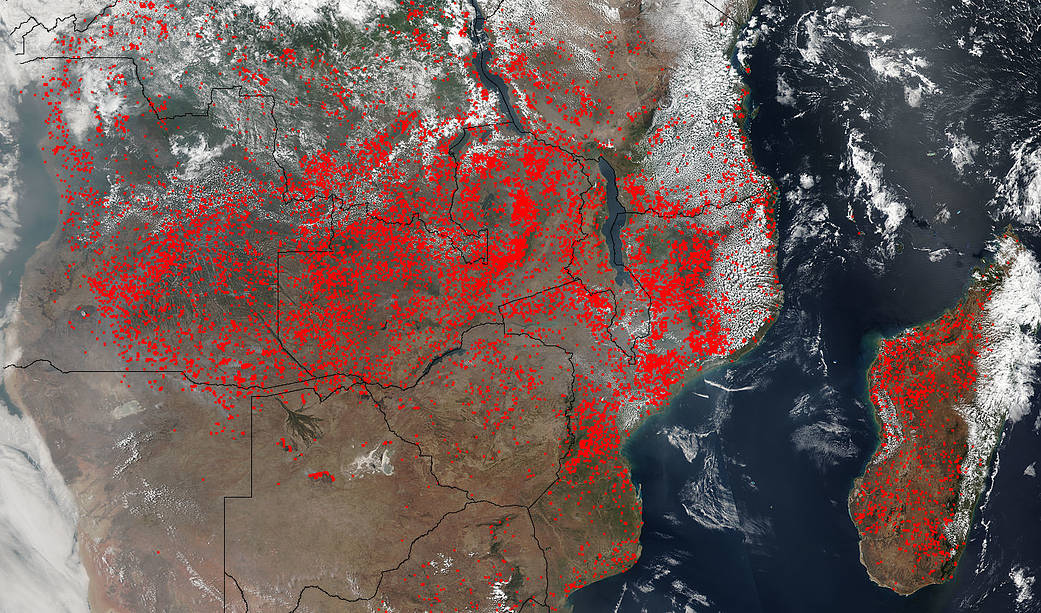
Jeff Schmaltz, MODIS Rapid Response Team
NASA's Suomi NPP satellite imaging system spotted hundreds of fires in southern Africa. You can see them outlined in red. It's likely about half of the fires were deliberately set as part of a slash and burn land management plan. The fires can help improve crops and pastures, but hurt air quality.
55/79
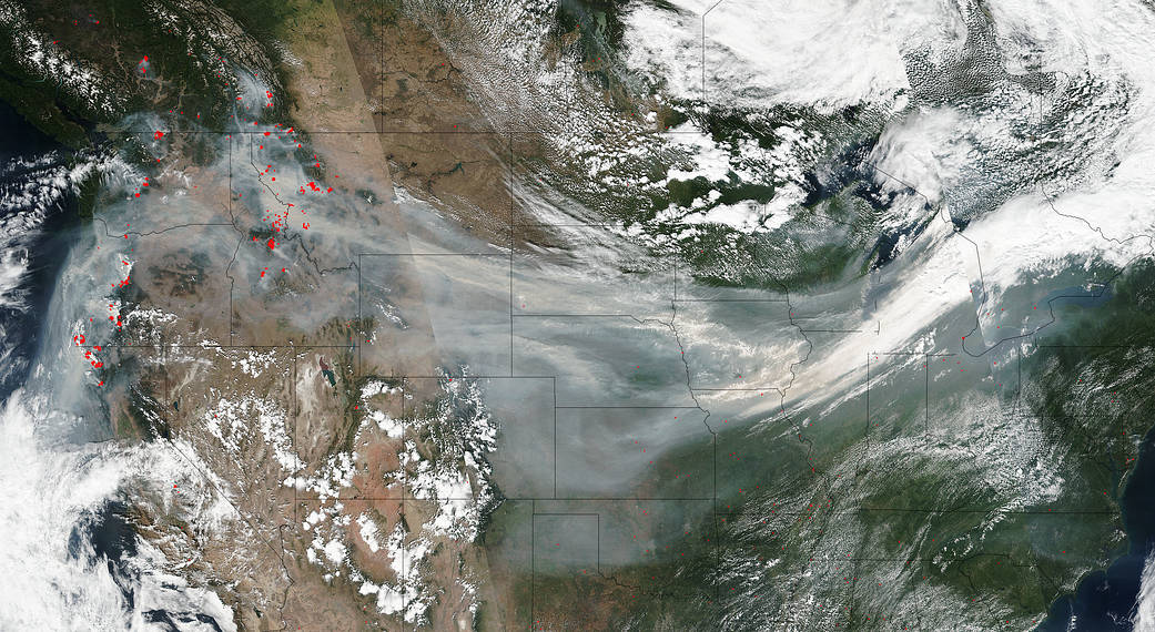
Jeff Schmaltz LANCE/EOSDIS MODIS Rapid Response Team, GSFC
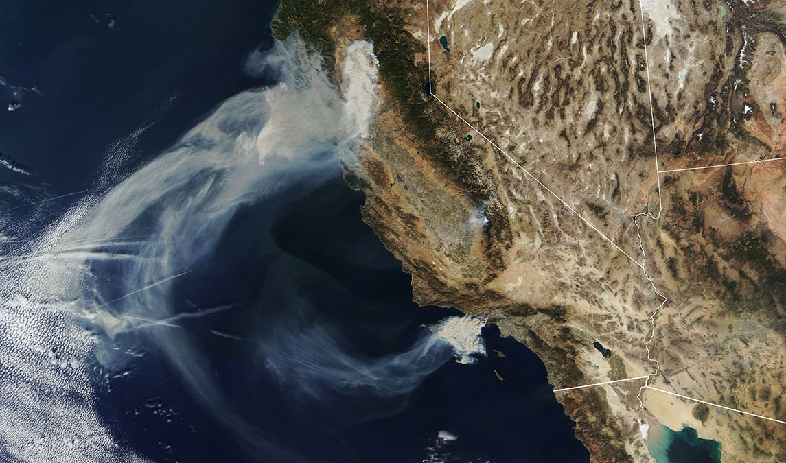
This is what happens when smoke from large wildfires gets caught up in the jet stream. NOAA-NASA's Suomi NPP satellite captured this image of smoke from West Coast fires drifting thousands of miles across the United States. If smoke remains in the jet stream, air quality impacts are minimal, but the particles can create unhealthy conditions if they descend. A red or orange sunset is a sign that smoke might be in the atmosphere -- the smoke particles allow longer wavelength colors, such as red or orange, to pass through, but block shorter wavelengths like yellow, blue and green.
56/79
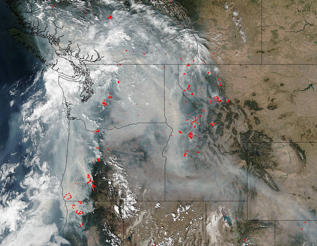
Jeff Schmaltz, MODIS Rapid Response Team
This image from the Suomi NPP satellite offers a look at just how much of the Northwest is affected by smoke from wildfires in Washington, Oregon, Northern California, Idaho and other states in the region. The smoke is carrying soot and other fine particles that pose health problems.
57/79
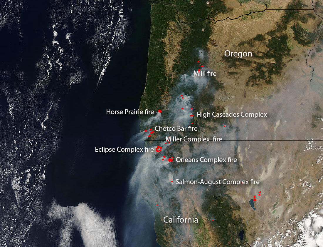
This Sept. 1, 2017 image from NASA's Aqua satellite shows seven Pacific Northwest fire complexes -- fires that are make up of several fires that form together. The Chetco Bar fire began in July after a lightning strike along the Rogue River-Siskiyou National Forest. It has grown to more than 131,000 acres. The High Cascades Complex began Aug. 13 due to a lightning strike and burned more than 26,000 acres in Rogue River-Siskiyou and Crater Lake National Park. The Milli Fire began two days earlier and burned more than 22,000 acres, forcing evacuations. Four large fire complexes are labeled in California. Note: Not all wildfires depicted in this image are labeled.
58/79
NASA image courtesy Jeff Schmaltz LANCE/EOSDIS MODIS Rapid Response Team, GSFC. Caption by Lynn Jenner
This image shows smoke from wildfire across several Canadian provinces. The smoke is lifted by the jetstream, spreading across British Columbia, Alberta, Saskatchewan, and Manitoba. The natural-color image if from the Aqua satellite's Moderate Resolution Imaging Spectroradiometer -- or just MODIS.
59/79
NASA
Dozens of wildfires can be seen in this Terra satellite image taken on Aug, 27, 2017.
60/79
NASA
The Moderate Resolution Imaging Spectroradiometer (MODIS) on NASA’s Terra satellite captured this image of wildfires in Oregon. The largest in this image is the Chetco Bar fire, which burned more than 100,000 acres after it was ignited by a lightning strike in mid-July.
61/79
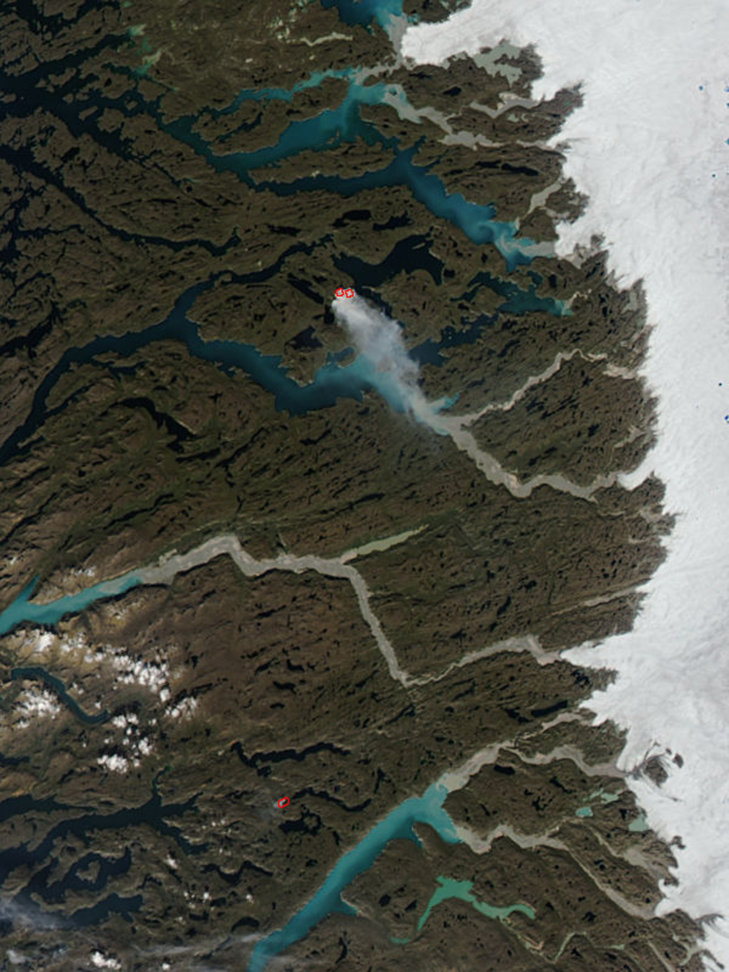
Most of Greenland is covered in icy, but the outer regions closer to the sea are not. You can see smoke from a wildfire burning in this image from NASA's Aqua satellite.
62/79
NASA
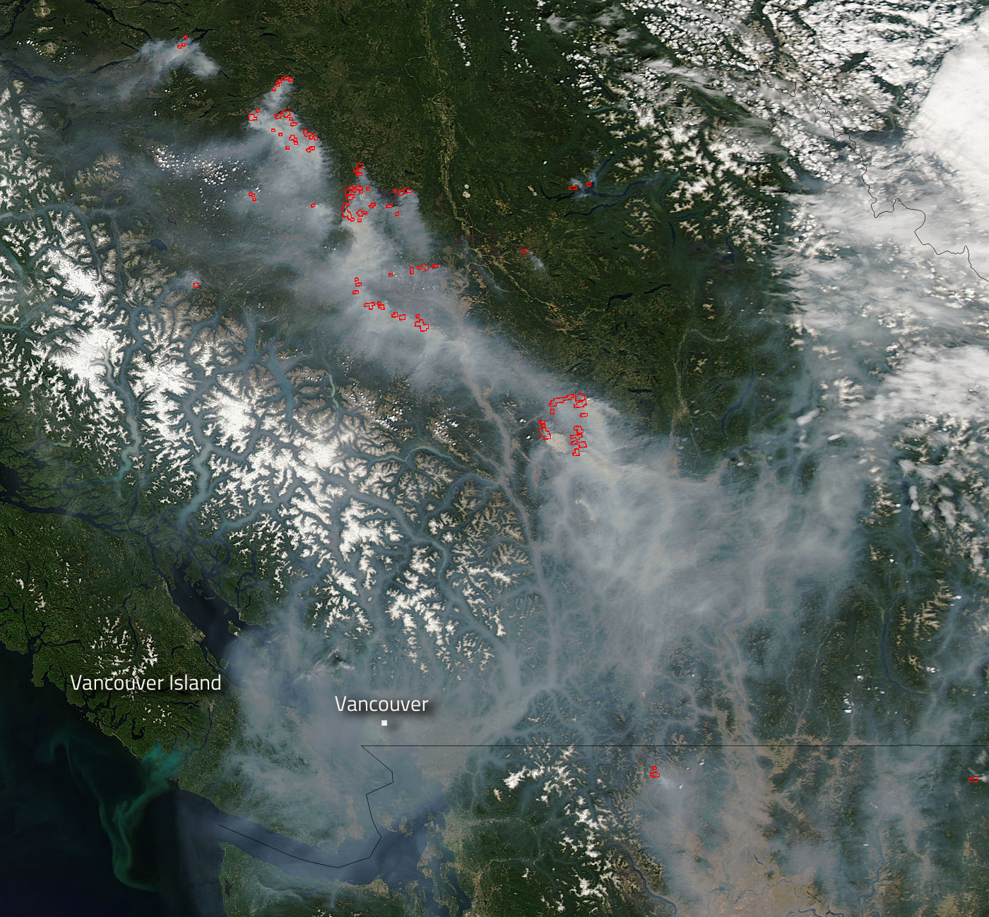
A shift in wind direction pushed smoke from fires in British Columbia toward the coast, as shown in this Aug. 1, 2017 image.
63/79
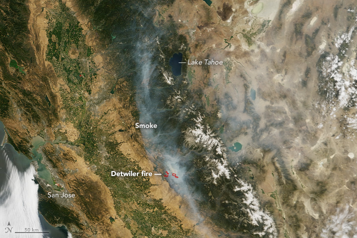
NASA
This image shows the Detweiler Fire burning July 20, 2017 in Northern California near Mariposa.
64/79
NASA
This Thermal Infrared Sensor (TIRS) image from the Landsat 8 satellite shows the amount of heat, or thermal energy, radiating from the Detweiler Fire in Northern California. The cooler areas are in dark, warmer areas are bright. The fire can be seen in the lower left of the image.
65/79
NASA
This July 10, 2017 image from NASA's Aqua satellite shows plumes of smoke from the Drew, Rooster's Comb and Antelope fires in the western United States. The large red spot in the middle of the image represents Nevada's Rooster's Comb fire. The Drew fire in Nevada is seen in the bottom left. The smoke at the top of the image is from the Antelope fire in Idaho.
66/79
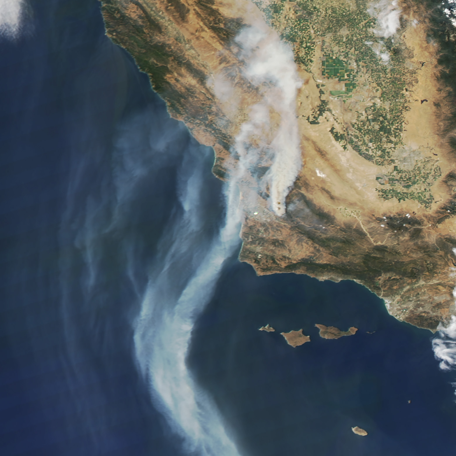
NASA
NASA's Terra satellite captured smoke from the Alamo fire July 9, 2017. At the time, the fire in Santa Barbara County was the largest fire burning in California during a summer of high fire danger.
67/79
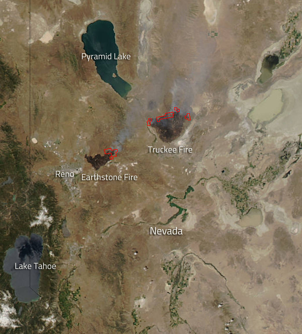
NASA's Aqua satellite captured this image of Nevada's Earthstone and Truckee fires burning July 4, 2017 in Nevada.
68/79
NASA
Smoke streams across Canada's Yukon and Northewest Territory on July 9, 2017.
69/79
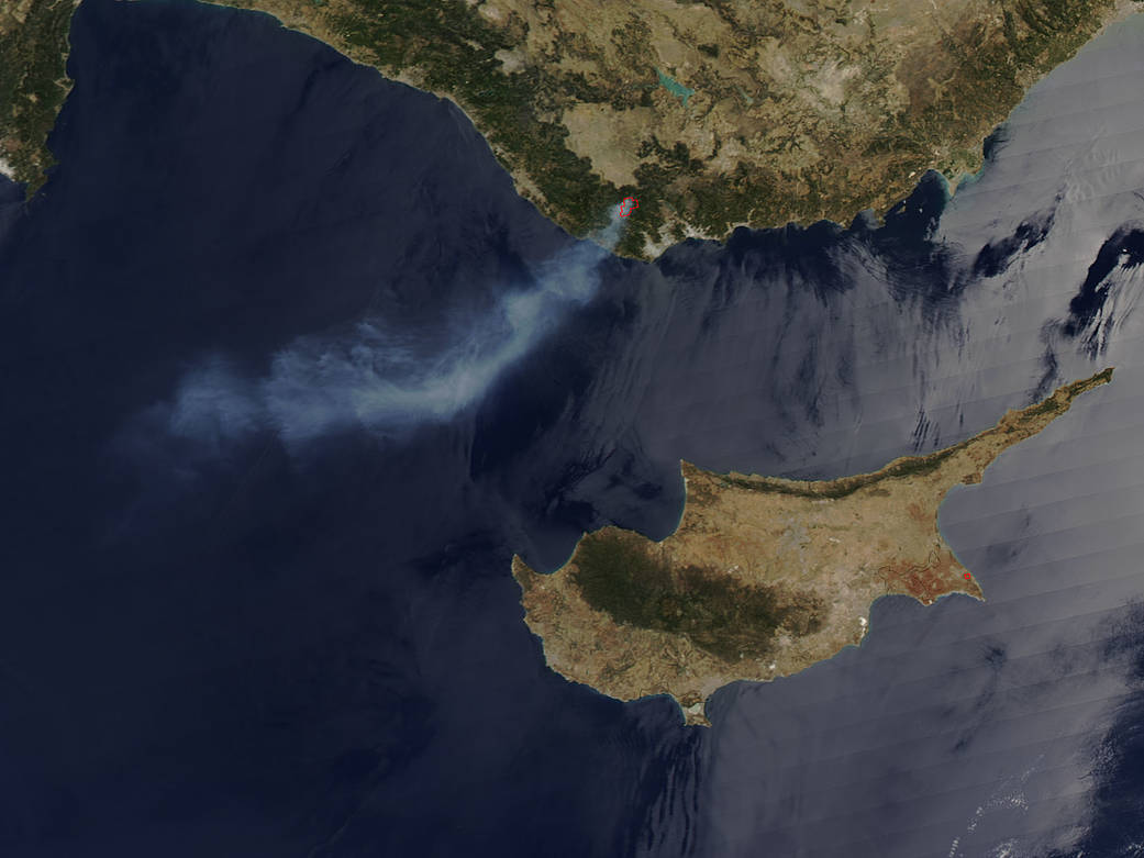
NASA
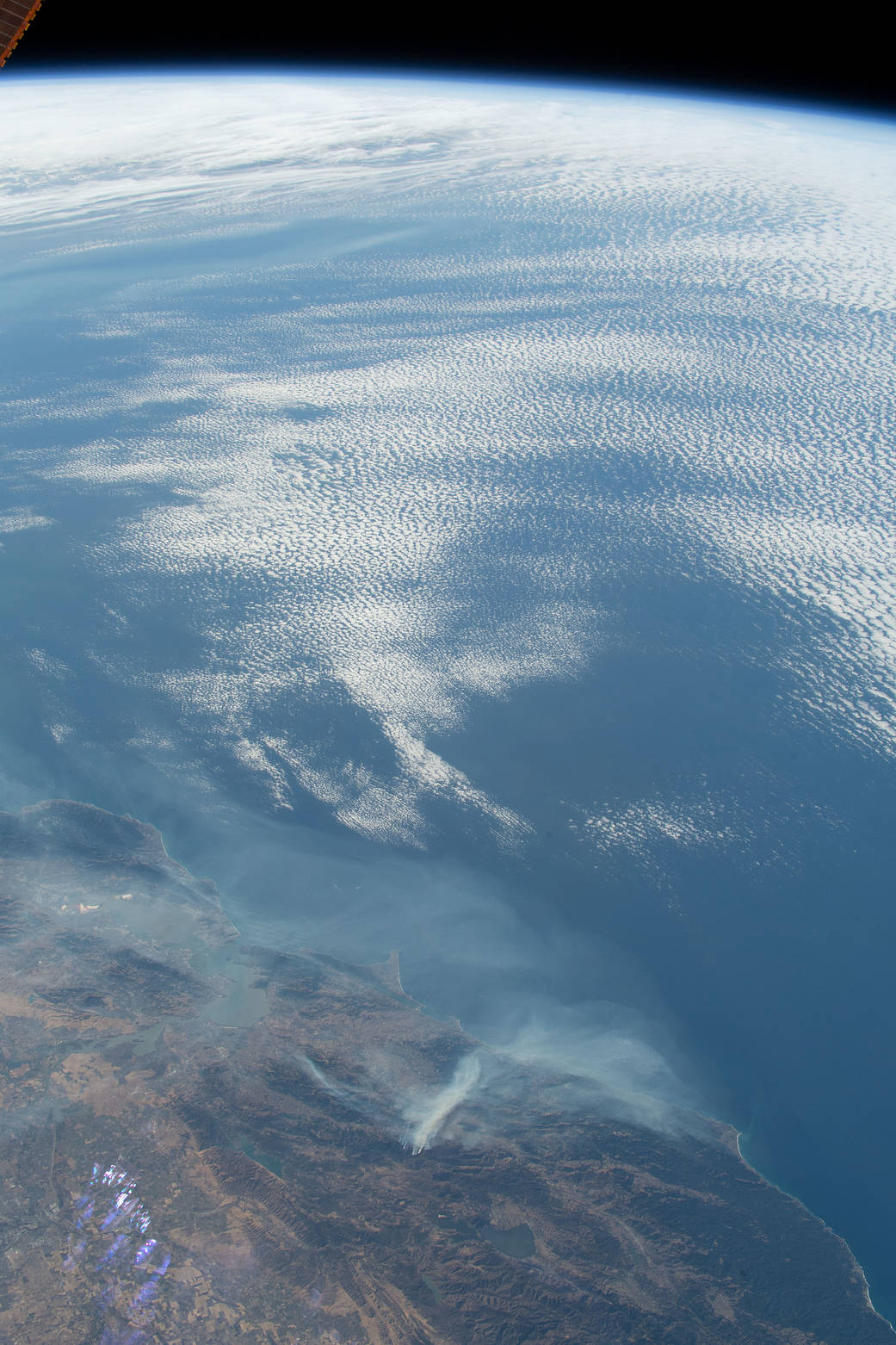
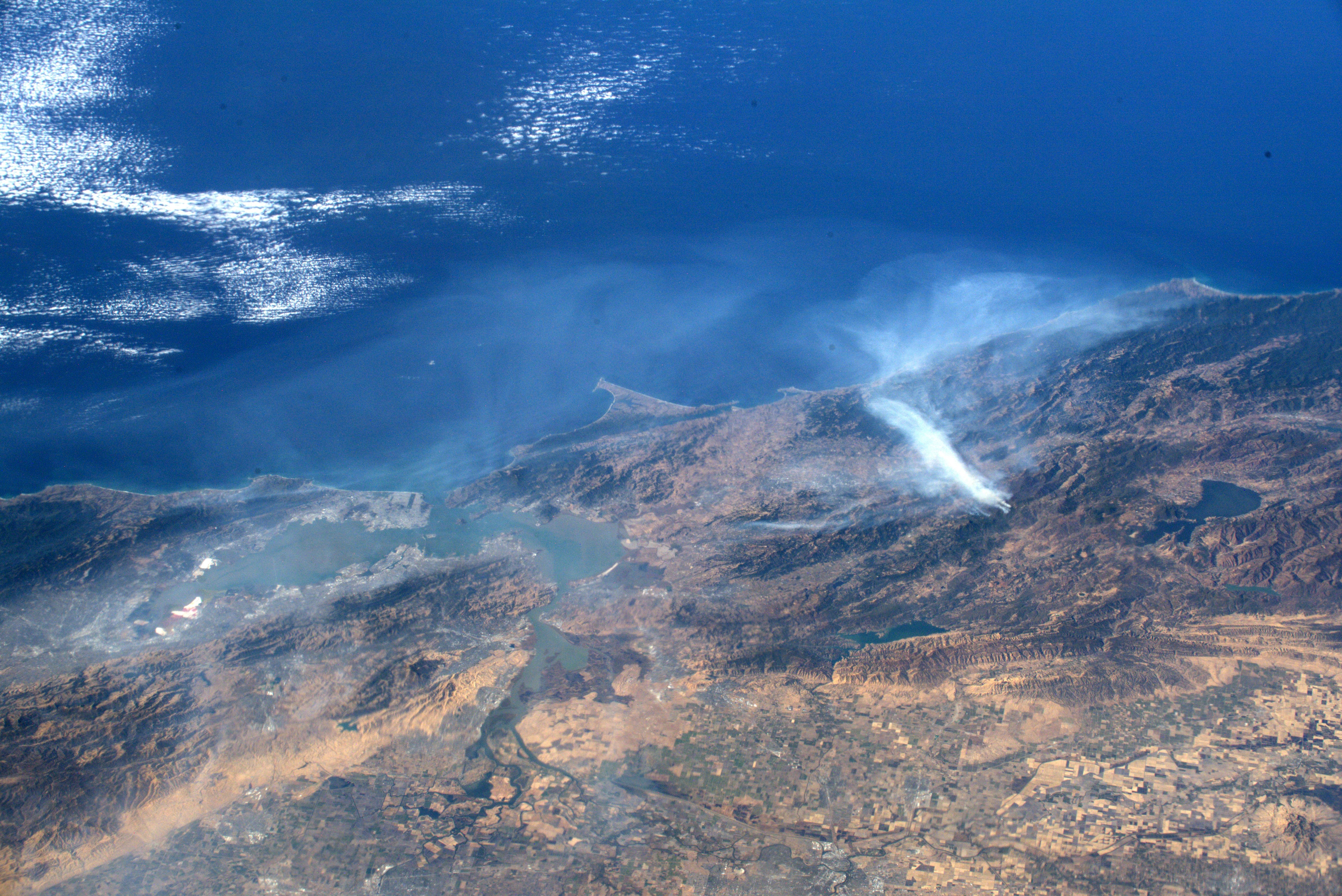
A smoke plume from a wildfire drifts over the sea south of Turkey. The image over the Toros Mountains was captured July 3, 2017.n
70/79
NASA
NASA'S Suomi NPP satellite captured a line of fires burning July 6, 2017 in Kazahkstan. The active burn areas are identified by the red outlines.
71/79
NASA
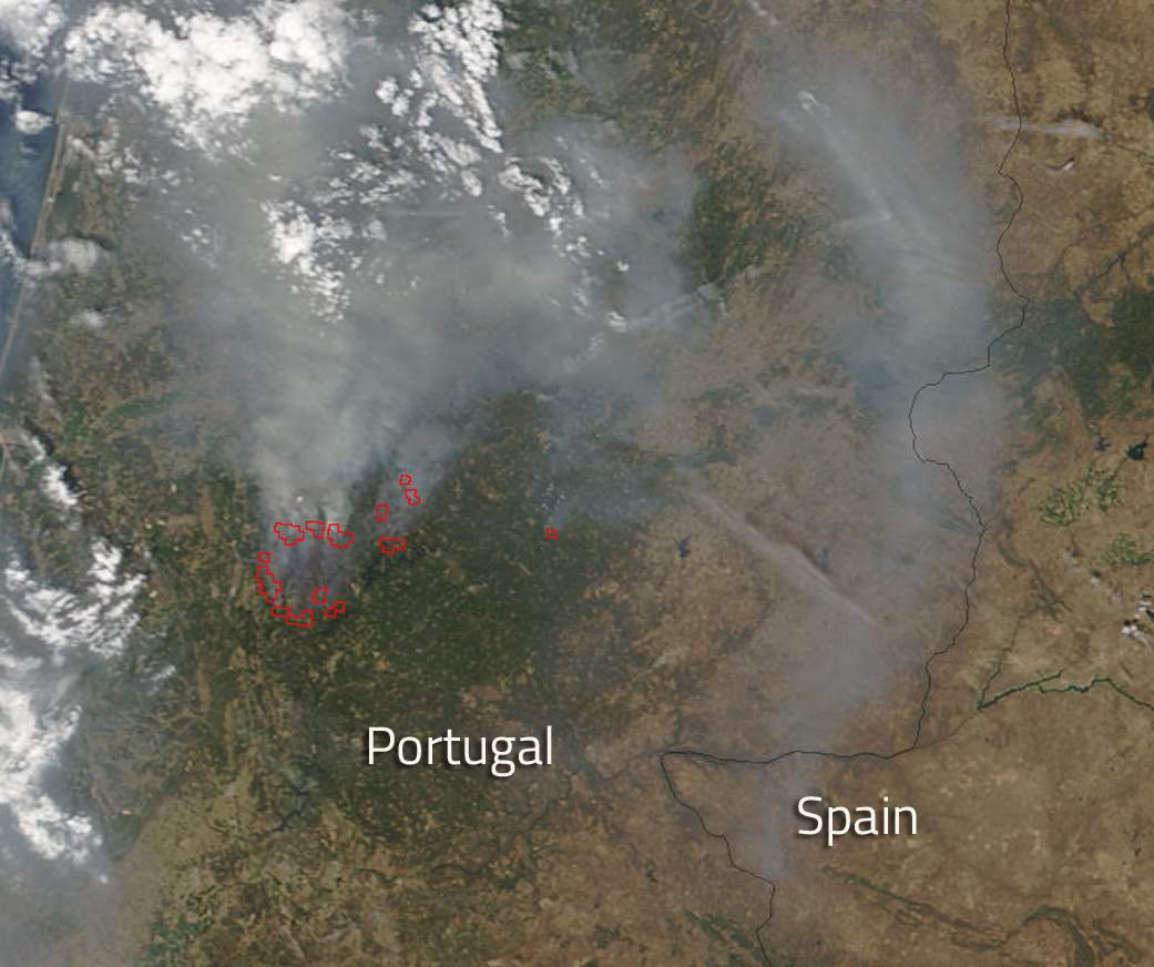
A large forest fire burns June 19, 2017 in Portugal.
72/79
NASA
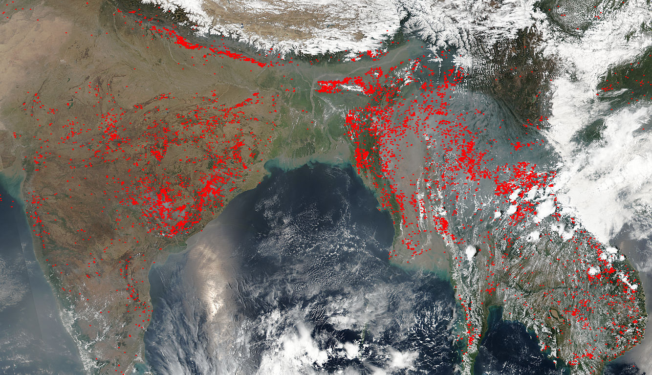
This image shows agricultural fires dotting much of the southern Asian landscape on April 12, 2017.
73/79
NASA
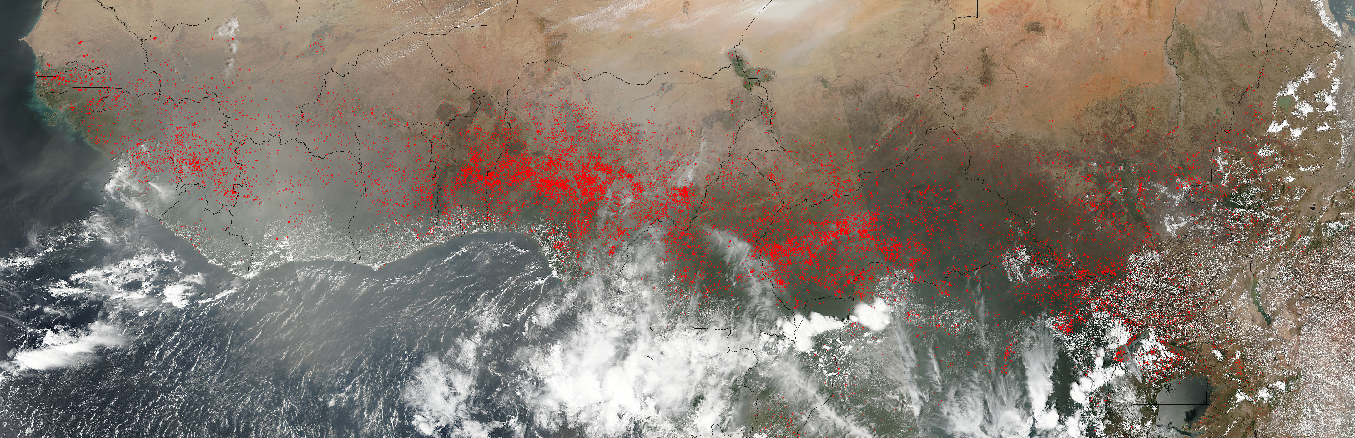
The Suomi NPP satellite detected hundreds of fires burning in western and central Africa Feb. 6, 2017.
74/79
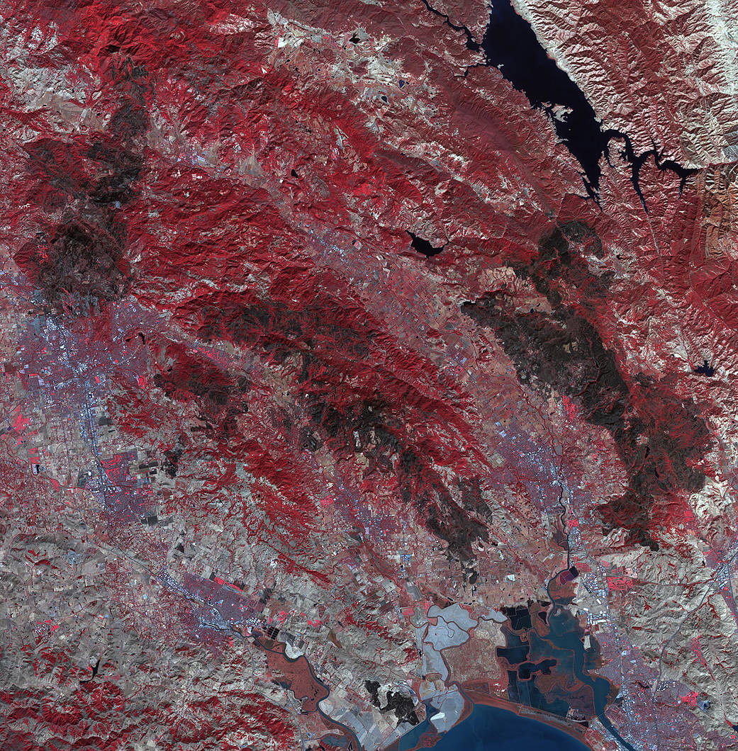
NASA
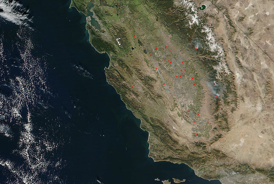
This image shows fires, many of which are likely prescribed, burning in the Central Valley region of California in November 2016.
75/79
NASA
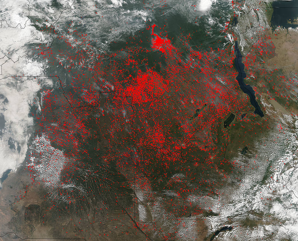
Part of central Africa appears covered in fire in this June 27, 2017 image from NASA's Suoimi NPP satellite.
76/79
NASA
The Brian Head fire started June 17, 2017 in Utah. The Aqua satellite captured this image of the fire when it was at more than 42,800 acres.
77/79
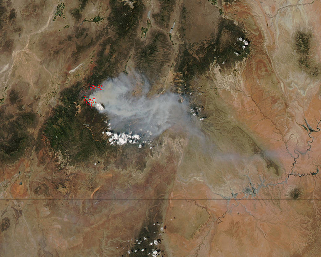
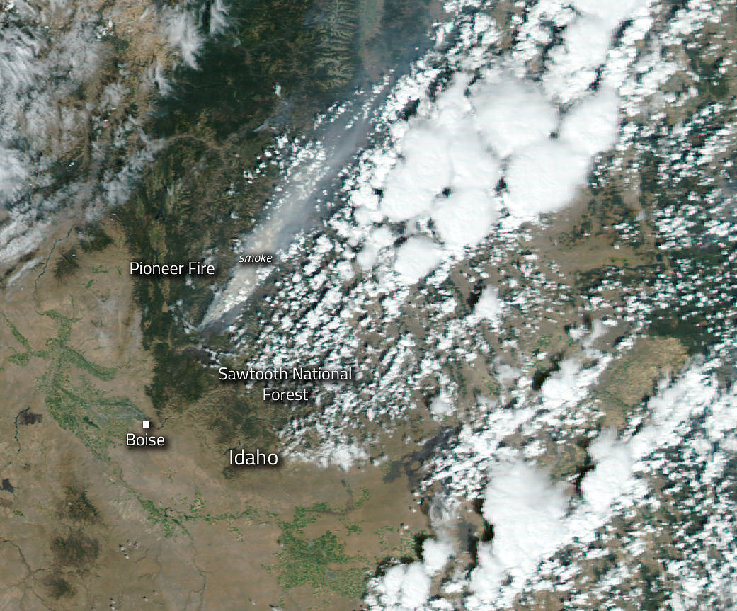
NASA
The Pioneer fire in Idaho was at 180,000 acres when this image was taken Sept. 1, 2016.
78/79
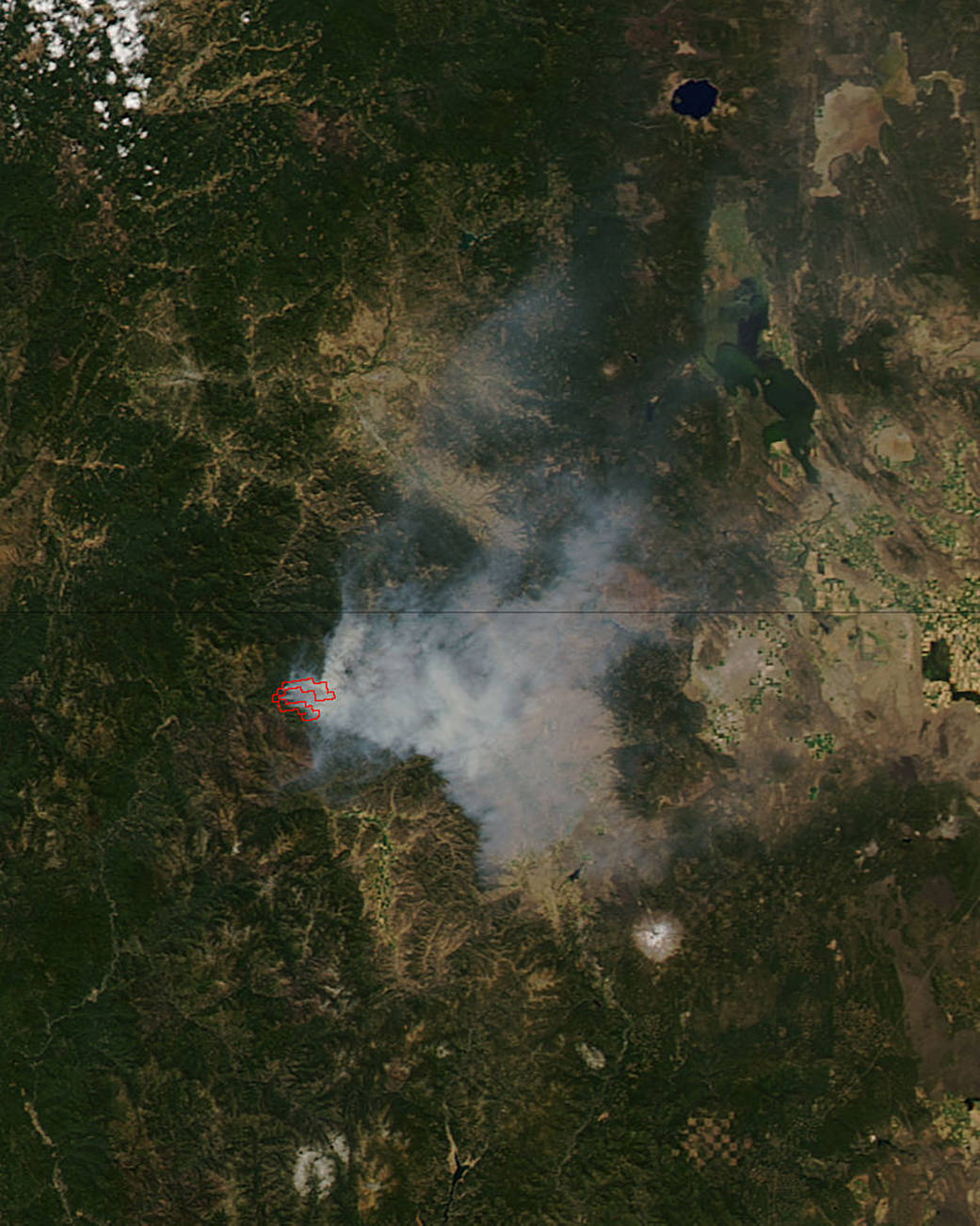
NASA
The Gap fire in Northern California burned nearly 40,000 acres by the time if was fully contained in September 2016. At the time of this Aug. 31, 2016 image, the fire was only 1,120 acres, but generating a large smoke plume due to heavy fuels and strong winds.
79/79
NASA
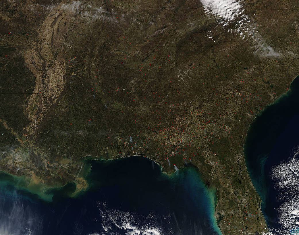
This image shows wild and prescribed fires burning in the southeastern United States in February 2017. Prescribed fires are set deliberately by wildland fire management agencies to remove underlying brush and dead grass, giving firefighters some help in fire containment.