


Heavy rain and snow conditions are on the way for the weekend bringing the heaviest rainfall Sunday.
What to Know
- Dry conditions are in the forecast early Saturday before rain and snow arrive late.
- Sunday will be the wettest day of the weekend.
- Snow might impact travel in the mountains, including through the Grapevine section of the 5 Freeway north of LA.
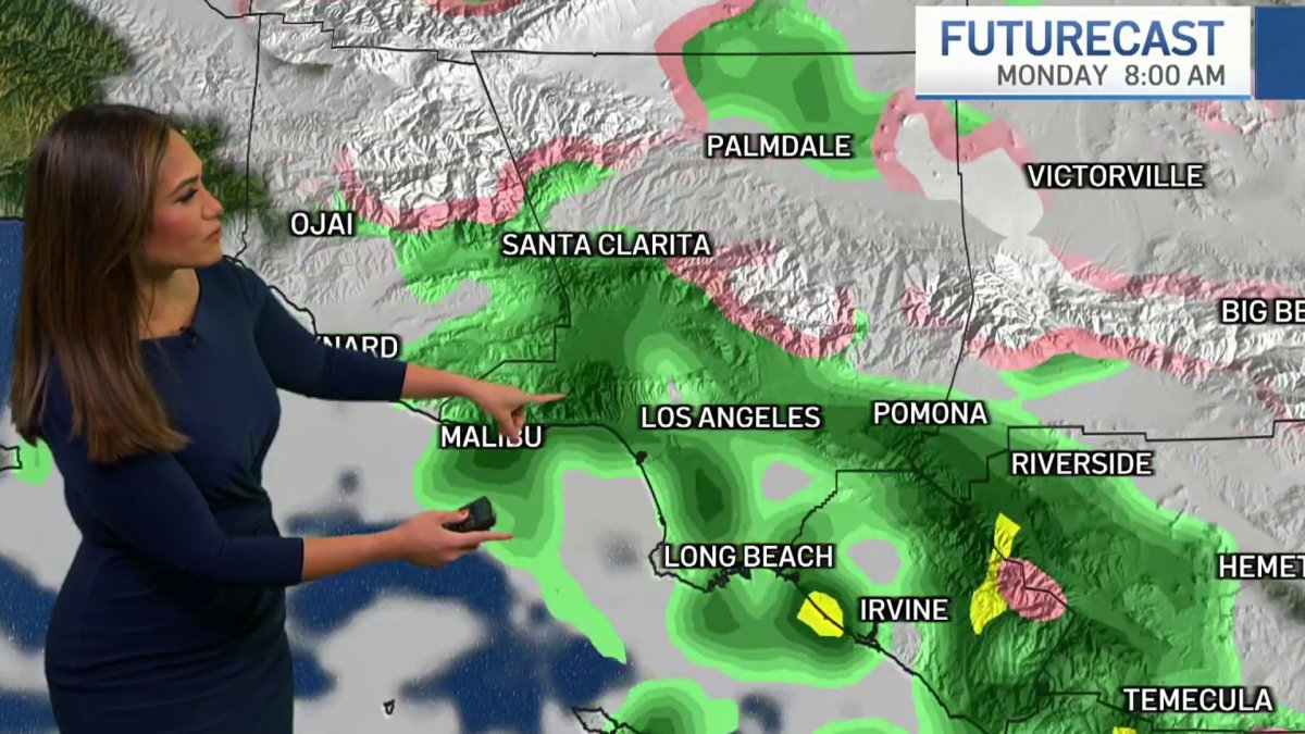
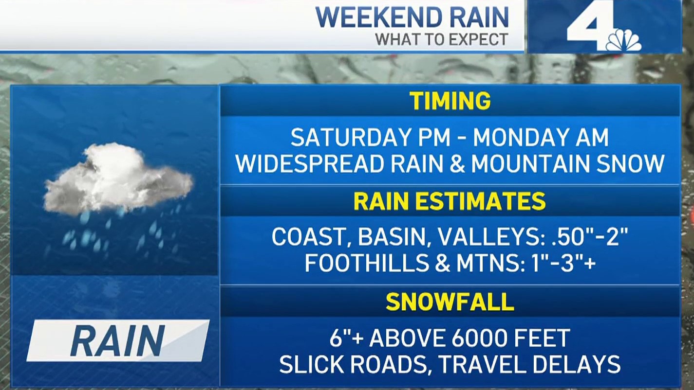
Widespread rain and mountain snow, including enough to create hazardous travel conditions on the 5 Freeway north of Los Angeles, are in the weekend forecast for Southern California.
Most areas can expect periods of rain starting Saturday night and continuing through Monday morning. The coast, Los Angeles basin and valley areas will receive .50 to 2 inches. One to 3 inches are possible in the foothills and mountains.
"We have three days of busy weather," said NBC4 forecaster Shanna Mendiola. "Widespread rain from the coast to inland, even some mountain snow."
Get Southern California news, weather forecasts and entertainment stories to your inbox. Sign up for NBC LA newsletters.

SoCal will wake up to dry conditions Saturday before the storm moves in, bringing light rain around 7 p.m. for most of the region. Temperatures will be in the 50s and 60s.
"It picks up as we go to bed (Saturday) night into Sunday with the heaviest amounts Sunday morning," said Mendiola.
By mid-day Sunday, most of the heavy rain will shift east toward the Inland Empire and into Orange County. Isolated showers will continue for other areas through Sunday evening.
Travel conditions will likely worsen this weekend in the mountains, where areas above 6,000 feet can expect 6 inches of snow. Travel could be affected along the Grapevine section of the 5 Freeway near the Los Angeles-Kern county border.
"I do expect dicey conditions over those higher peaks, througnh the Grapevine, as well," said Mendiola.
There's a chance of light rain Monday morning.
Temperatures will stay in the low 60s and upper 50s in Los Angeles and inland Orange County over the weekend. Mountain communities will dip into the upper 30s


California Drought Update
This week's US Drought Monitor map shows nearly all of the state in moderate drought. Severe and extreme drought persists through the central part of the state and into north-central California.
LA County has swaths of moderate and severe drought with a pocket of extreme drought in the northwest corner of the county.
Conditions have changed little over the past three months, according to the report released Thursday.
California has spent most of the last 15 years in drought conditions. The current three-year dry spell included one of the driest late winters on record. The state's normal wet season runs from late fall to the end of winter, but dismal precipitation left about 95 percent of California in severe drought at the start of spring.
Much of California’s water comes from melting snow in the Sierra Nevada Mountains. In an ideal scenario, storms blanket the mountains with snow during winter, building up the natural reservoir. That snow then melts in late spring and early summer, replenishing the state's water system. Snowpack was far below normal this year.
California recorded its driest first three months of the year on record to start 2022. The dry stretch followed a promising December when storms drenched parts of the state and brought snow to the Sierra Nevada Mountains, California’s natural water reservoir.

