What to Know
- The most intense rain arrived Thursday morning, just in time for the commute.
- Rain will diminish Thursday afternoon with periods of scattered showers.
- Another storm system arrives Sunday with more rain.
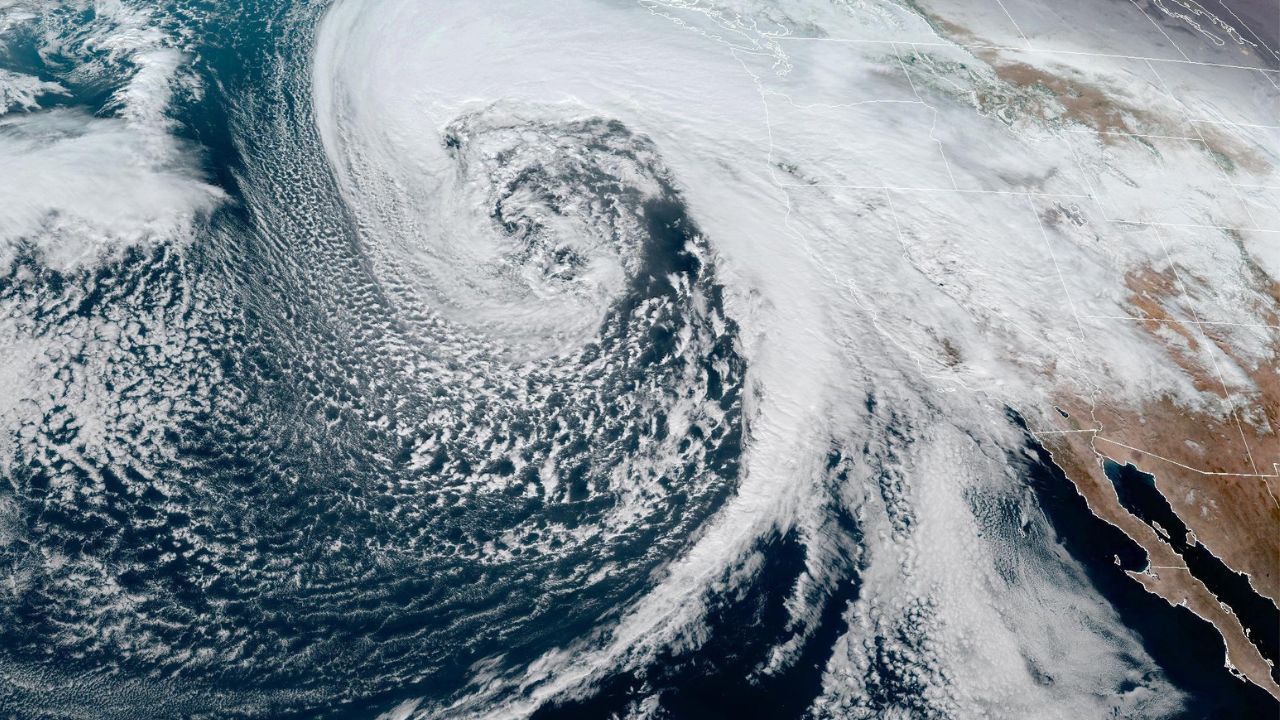
February started with a roar in Southern California as a winter storm delivered hours of steady rain that triggered widespread flash flood warnings.
A flash flood warning was issued until 11:15 a.m. for parts of Los Angeles County, including Long Beach, Palos Verdes, Torrance, Carson, Port of Los Angeles and Harbor City.
In Long Beach, cars were submerged to their rooflines on Willow Street as rain continued to fall mid-morning. On the Palos Verdes Peninsula, Palos Verdes Drive South between Palos Verdes Drive East and Hawthorne Boulevard was closed due to mud and rock slides, but reopened later Thursday morning.
Get Southern California news, weather forecasts and entertainment stories to your inbox. Sign up for NBC LA newsletters.
A flash flood warning also was issued until 11:30 a.m. for parts of Orange, Riverside and San Bernardino counties.
Flood watches and advisories will continue into Thursday afternoon.
The storm delivered showers in Ventura County Wednesday night, then the main rain event arrived during the early morning hours with steady rainfall in Los Angeles.
Making morning commutes more complicated, rain caused flooding on streets and freeways, especially those with poor drainage. Early Thursday, the California Highway Patrol reported at least 50 spinouts and crashes on freeways and roads in the central Los Angeles area.
Flood advisories were in effect for parts of Los Angeles, where some areas received more than an inch of rain by 5:30 a.m., and Ventura counties. As of 4 a.m. Thursday, there was 0.94 inches of rain reported at Leo Carrillo, 0.74 inches in Agoura Hills, 0.37 inches in Calabasas, 0.28 inches in Newhall and 0.43 inches in Hungry Valley.
A flood watch was in effect for inland Orange County and parts of Riverside and San Bernardino counties.
Gusty winds may create dangerous situations as well with a high wind watch that is set to go into effect Wednesday night through Thursday afternoon. Some parts of the Inland Empire and Orange County could see gusts up to 45 mph.
The windy conditions mixed with heavy moisture could lead to tree damage and create hazardous conditions for high-profile vehicles on the road, particularly through the Grapevine.
Widespread parts of Los Angeles County from the coast to inland areas, including downtown Los Angeles, were under a wind advisory. The wind advisory is in place until 2 p.m.
By Thursday afternoon, the rain system will gradually move out of the region, bringing scatters showers. Friday may see some light showers, but by Saturday, dry but cloudy conditions are forecast for the area.
The total rainfall will be the heaviest in the Santa Monica Mountains and foothill areas with 1 to 3 inches of rain. Click here to find a list of sandbag pickup locations in Los Angeles County.
For this storm system, the snow levels will fall from 7000 feet to 4000 feet, bringing over a foot of fresh snow to ski resorts. San Bernardino and Riverside County mountains may see 5 to 8 inches of snow while San Gabriel mountains will likely get light snow of 3 inches.

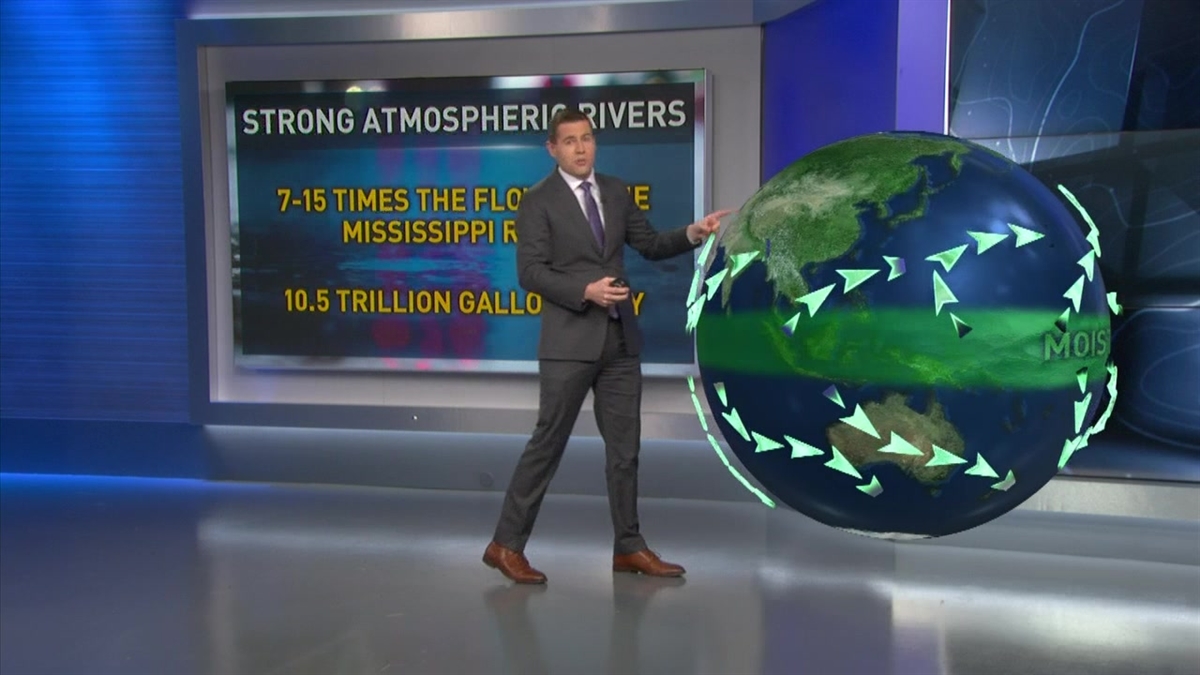
The storm is fueled by an atmospheric river, a long and wide band of moisture in the sky over the ocean that carries water from tropical regions. Atmospheric rivers have contributed to some of the wettest winters on record in California.
Rain will diminish by Thursday afternoon, but scattered showers are likely to continue into Thursday evening or possibly Friday morning in northern areas of Los Angeles County. Another strong storm is in the forecast, possibly arriving Sunday and bringing significant rainfall early next week.
The February storms arrive the same week as California's second manual snowpack survey of the season, which showed conditions remain far below normal. Statewide mountain snowpack, a key factor in drought conditions in California, was just over half the normal average for this time of year.
The state remained drought-free in the U.S. Drought Monitor Report released last week.