Remnants of the Mother Road: Sights Along Historic Route 66
•
Known as the Main Street of America, Will Rogers Highway and the Mother Road, Route 66 was one of the original routes in the United States' highway system and one of the most famous roads in the country.
66 photos
1/66
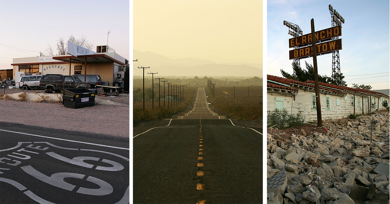
Getty
Some of what remains of historic Route 66.
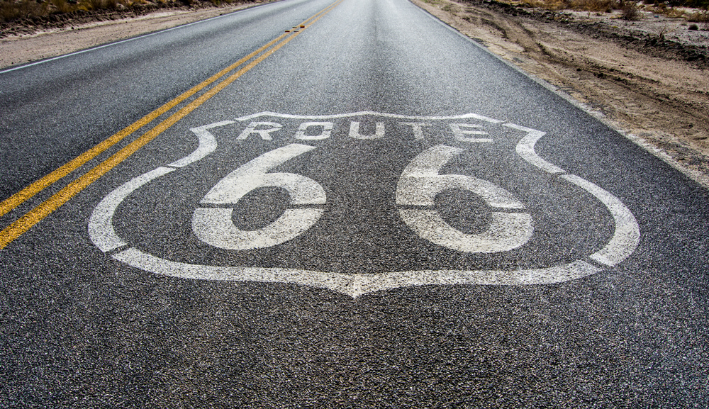
2/66
Film & Pixels
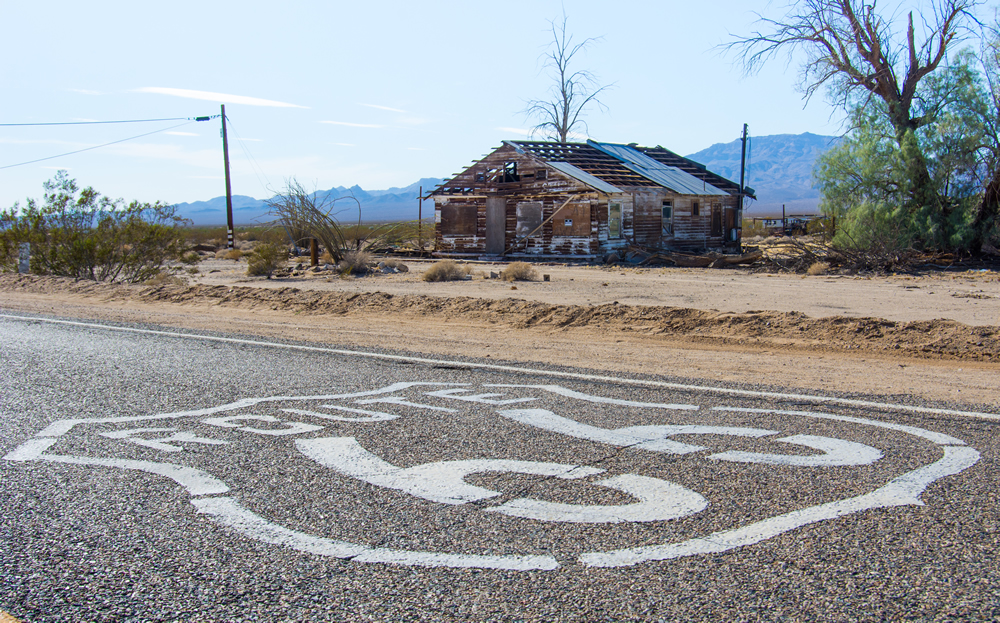
The Route 66 badge on a lonely stretch of road.
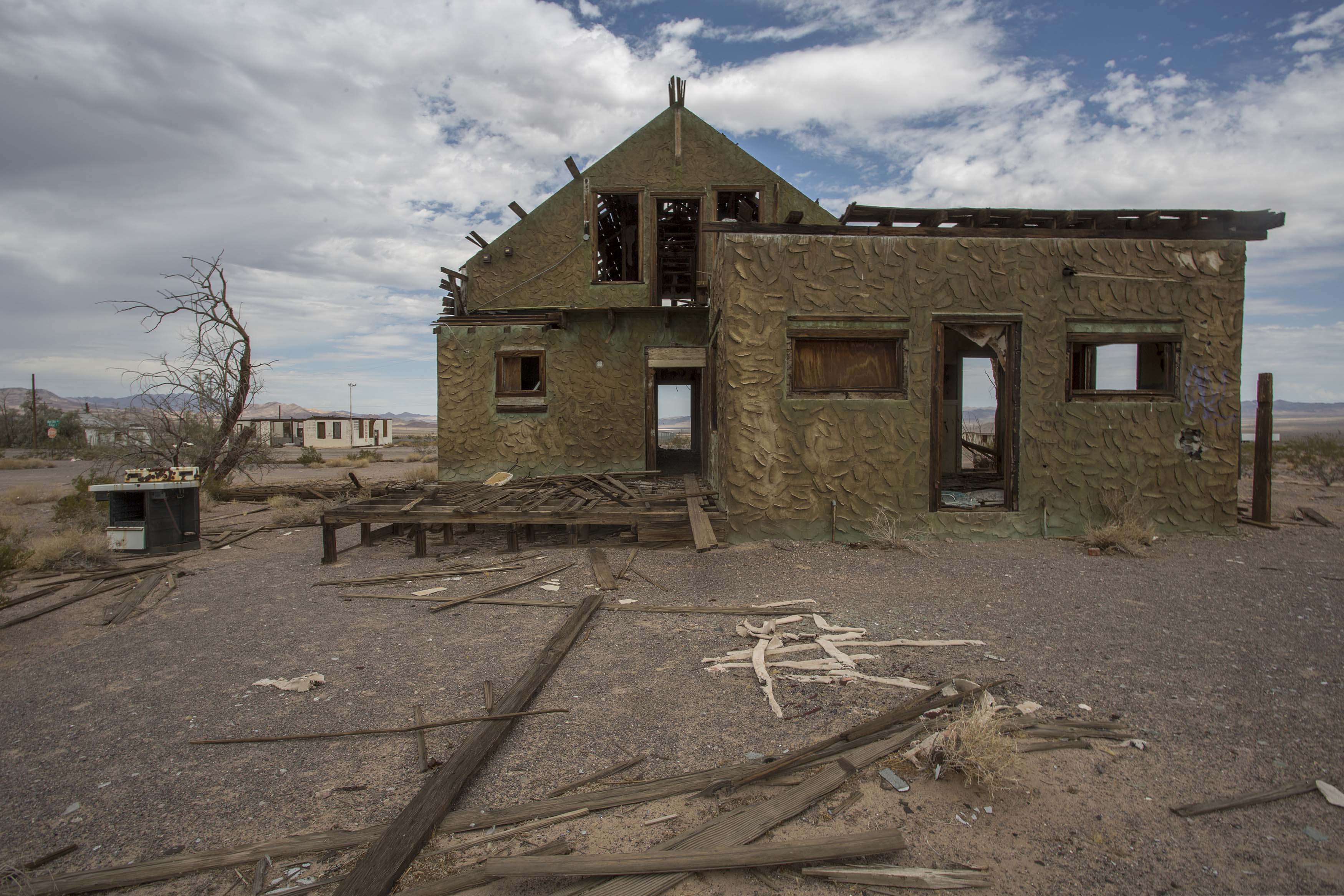
3/66
Getty Images
A house decays in a ghost town that once was a railway stop along historic Route 66, which runs through Mojave Trails National Monument, are seen at night on August 28, 2017 in Ludlow, California.
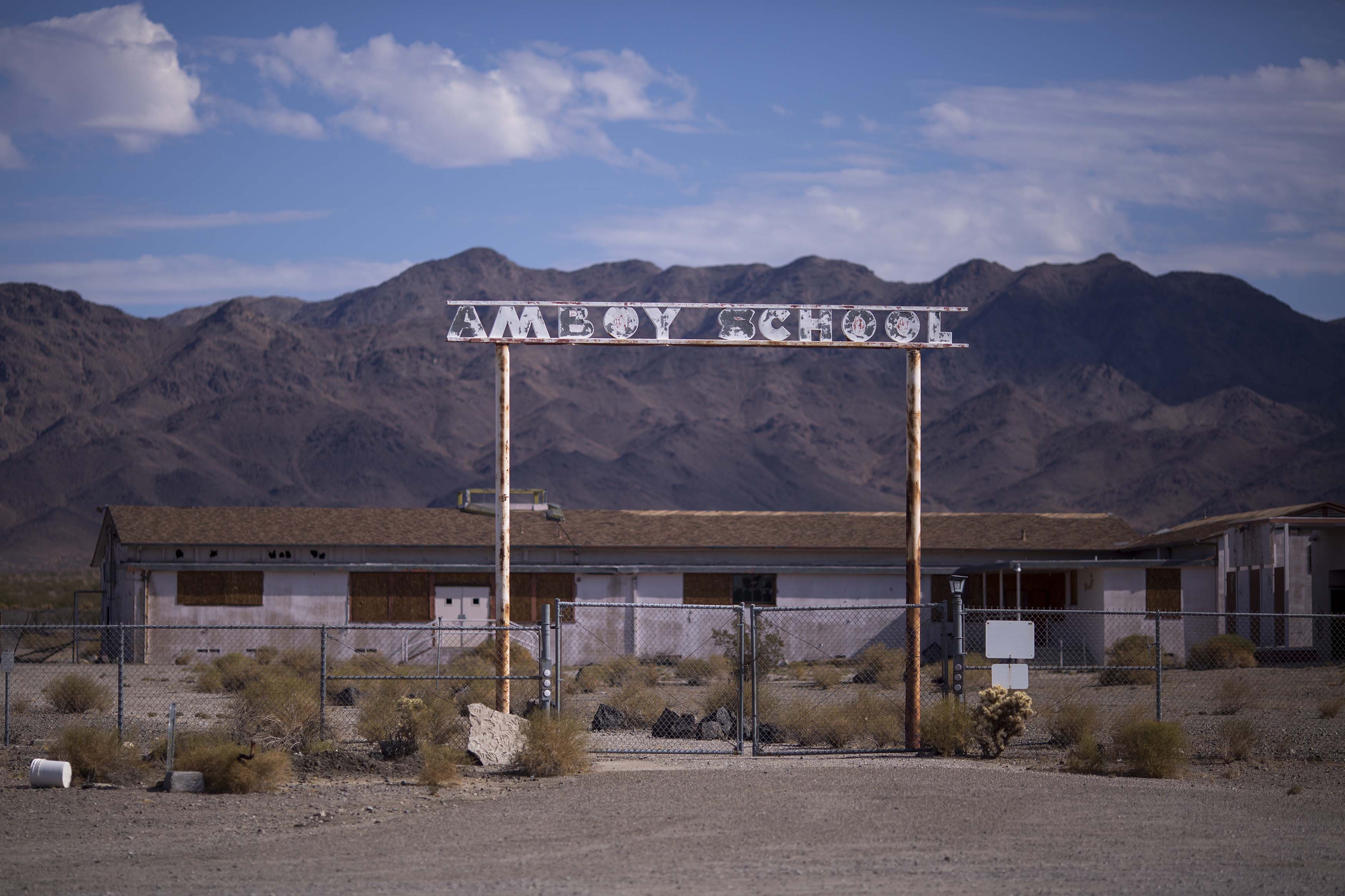
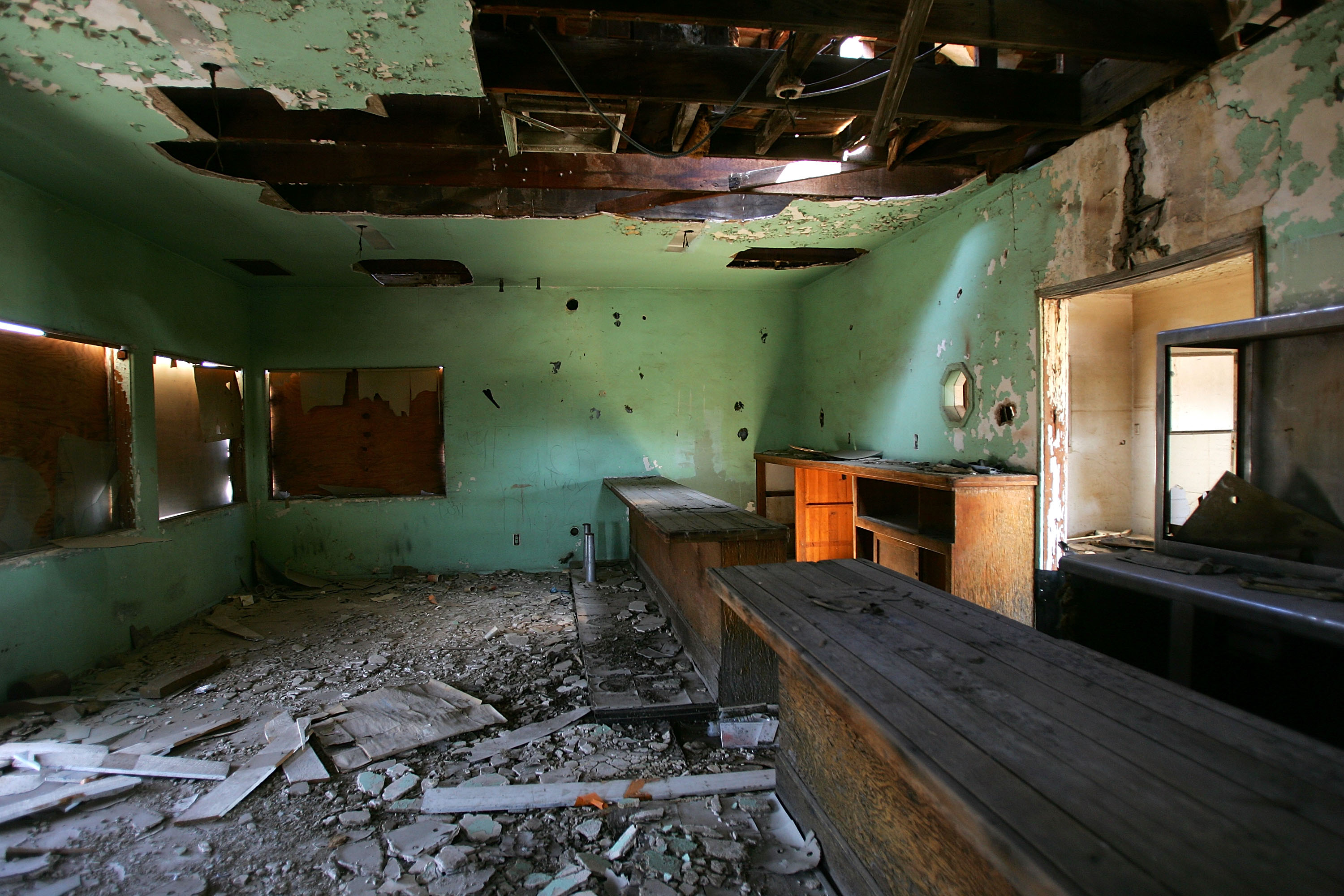
4/66
Getty Images
The ruins of Amboy School are seen in Amboy along historic Route 66 at Mojave Trails National Monument on August 27, 2017 near Essex, California.
5/66
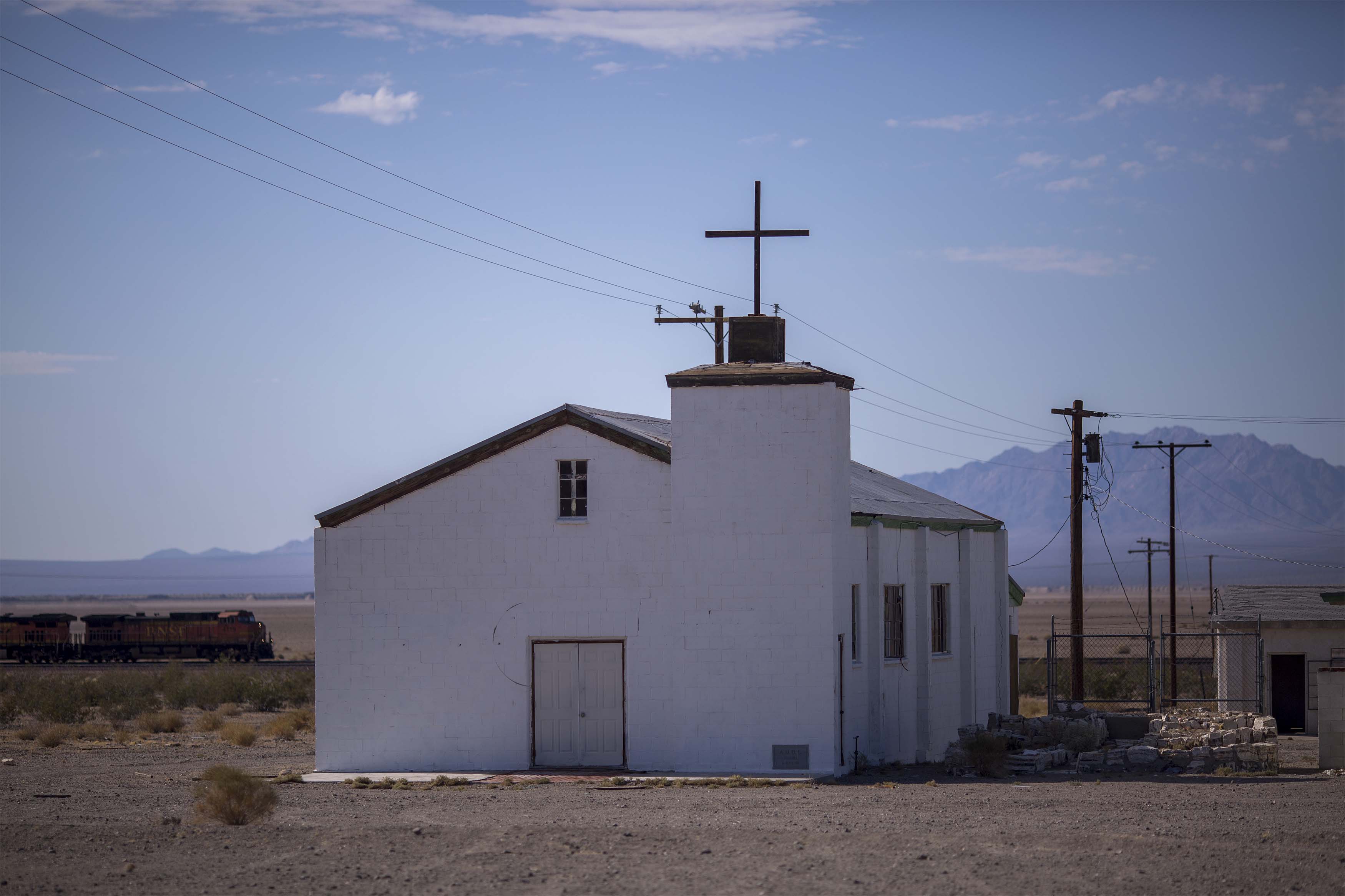
Getty Images
A freight train passes the old church in Amboy along historic Route 66 at Mojave Trails National Monument on August 27, 2017 near Essex, California.
6/66
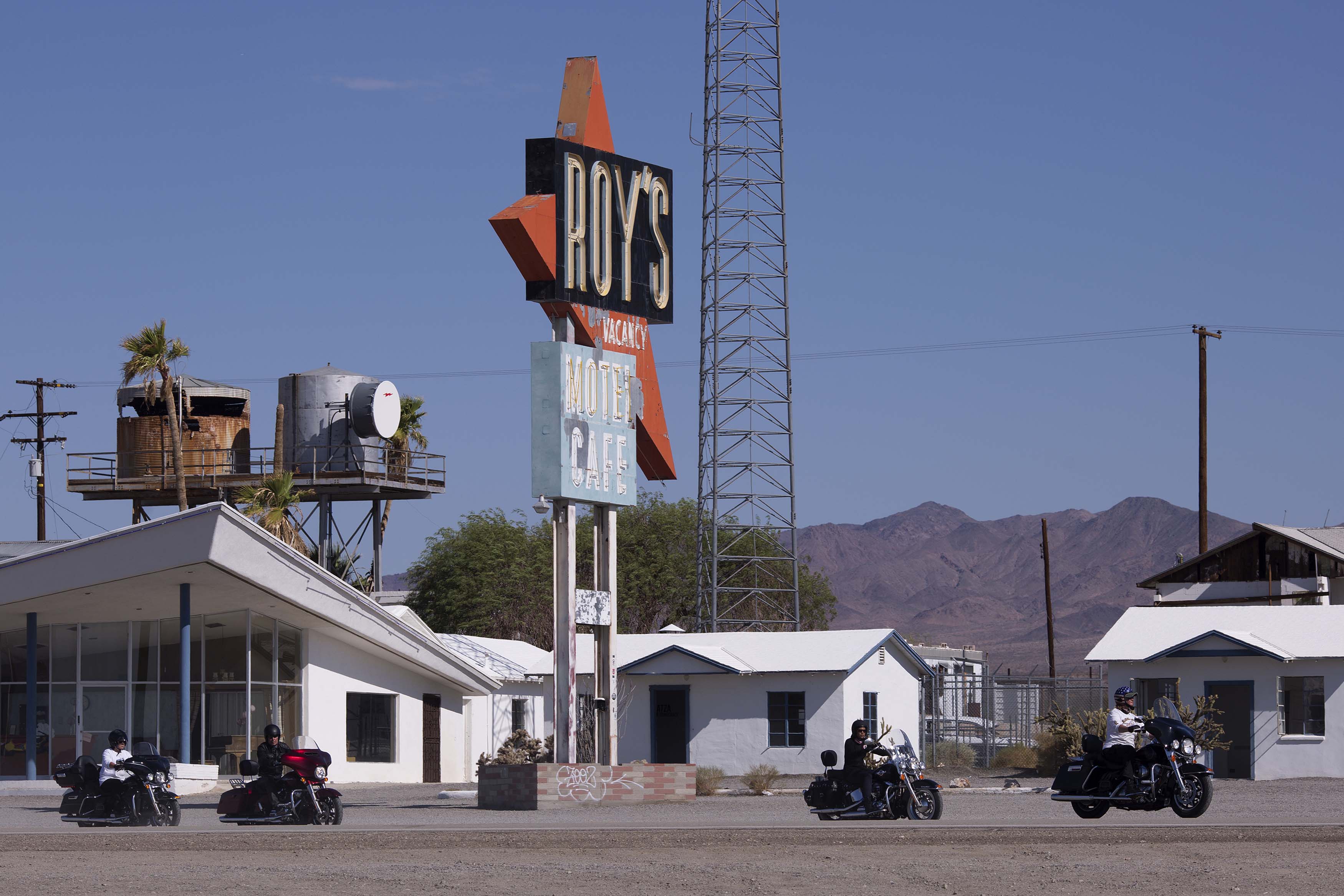
Getty Images
Motorcyclists ride through Amboy on historic Route 66 on August 27, 2017 near Essex, California.
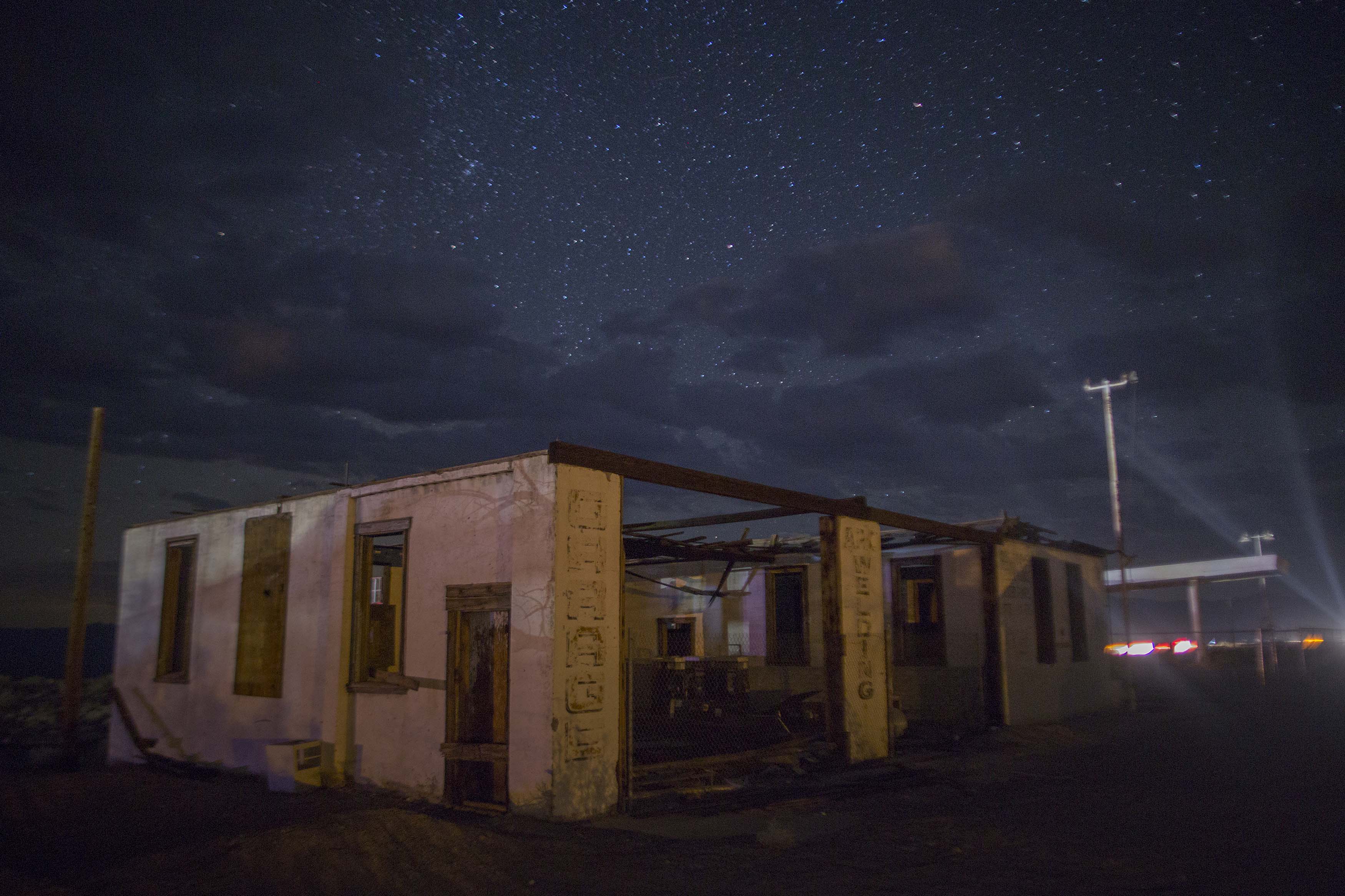
7/66
The ruins of an auto repair garage on historic Route 66 are seen at night on August 26, 2017 in Ludlow, California.
8/66
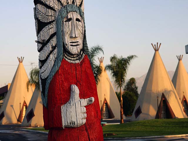
Kumar Patel
The office of the Wigwam Motel along Route 66 in San Bernardino.
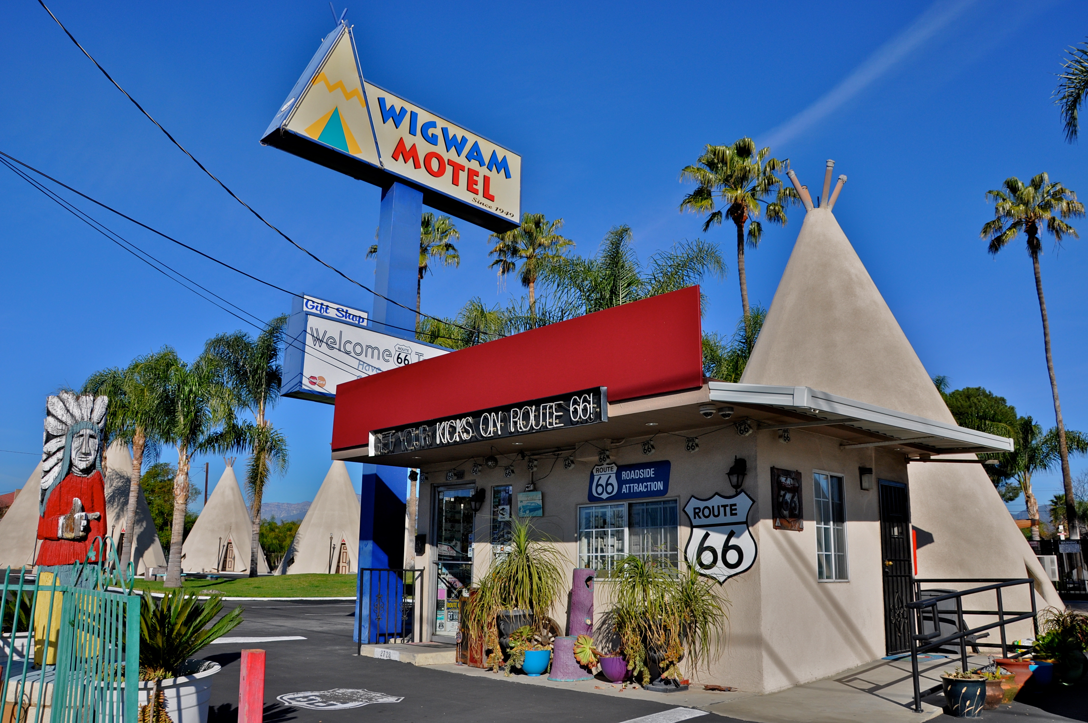
9/66
NBC Bay Area
The Wigwam Motel, built in 1949 on old Route 66, consists of teepee-shaped individual rooms in Rialto, California.
10/66
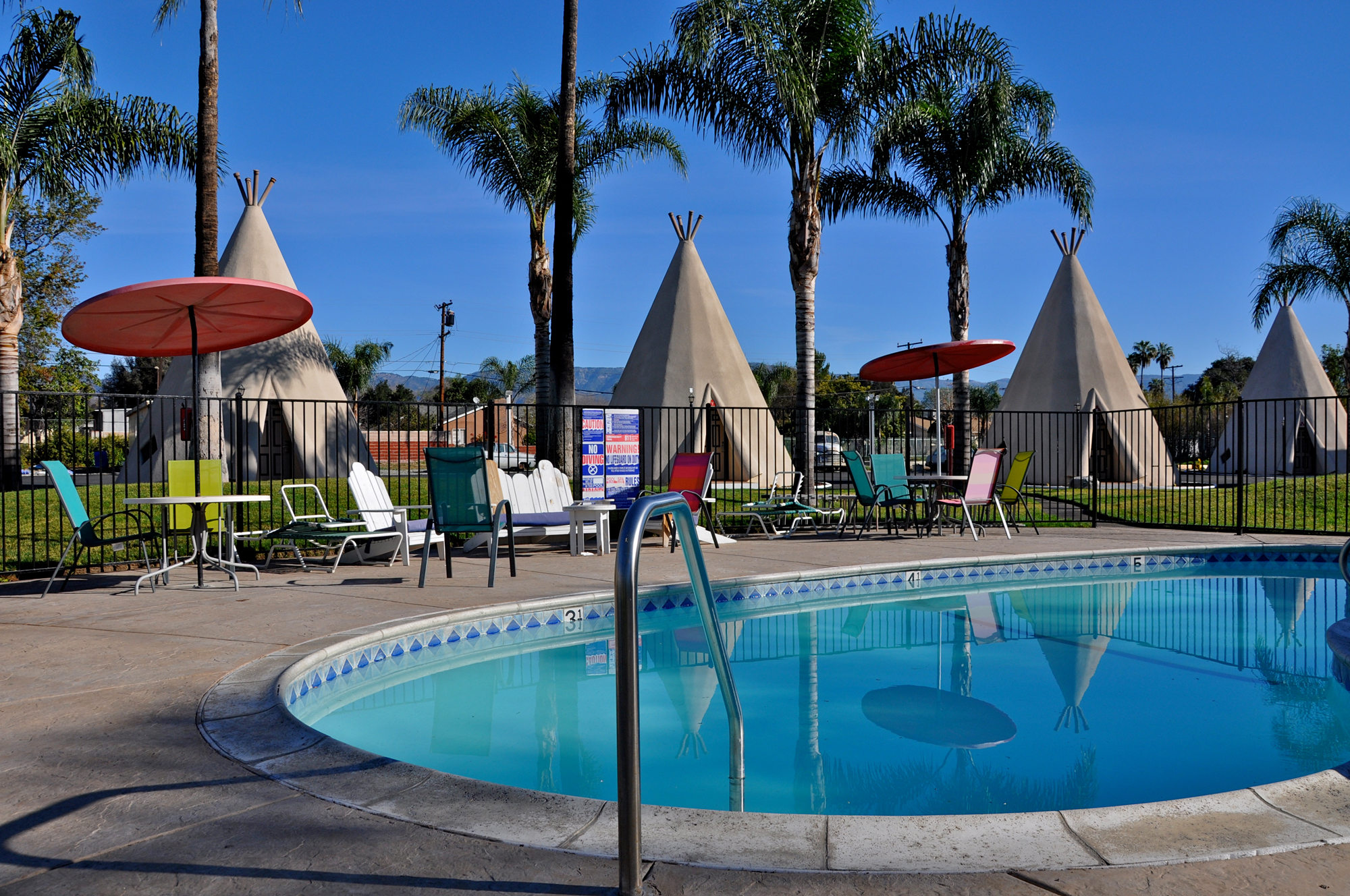
Kumar Patel
A poolside at the Wigwam Motel along Route 66 through San Bernardino.
11/66
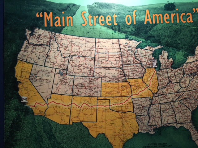
CeCe
Pictured, the Route 66 "map" from the Route 66 Museum in Clinton, Oklahoma.
12/66
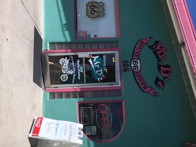
CeCe
Pictured here, Mr. D'z Route 66 Diner in Kingman, Arizona.
13/66
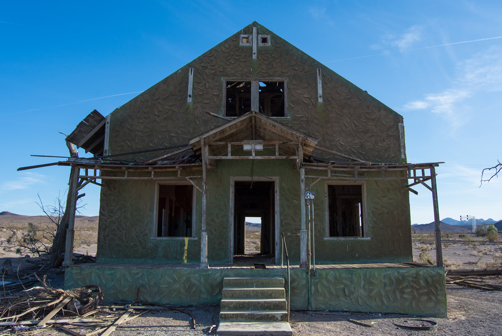
John Yeski, Film & Pixels
An abandoned house on Route 66 in a vast stretch of desert.
14/66
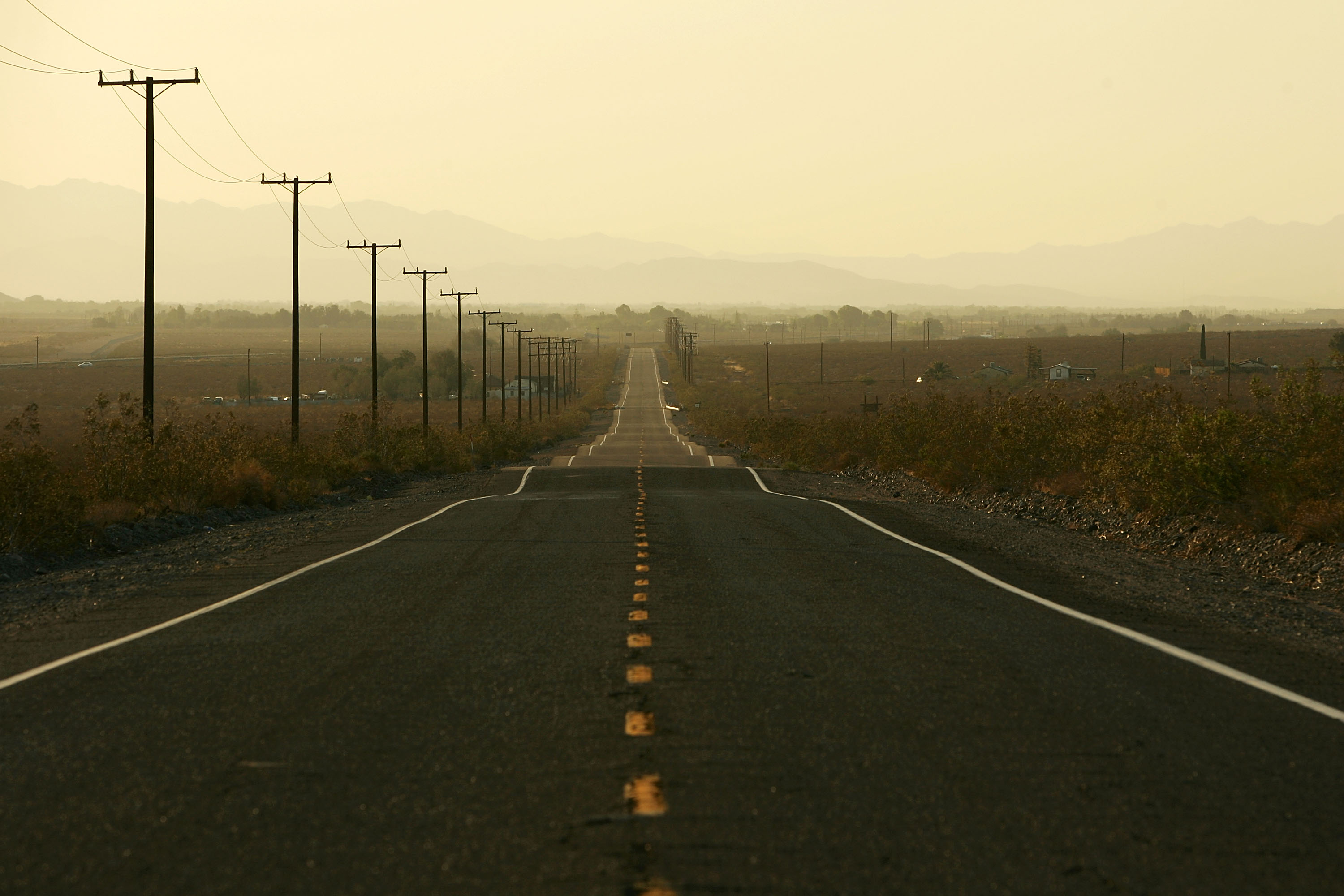
Getty Images
Route 66 carries little traffic on June 16, 2007 east of Daggett, California.
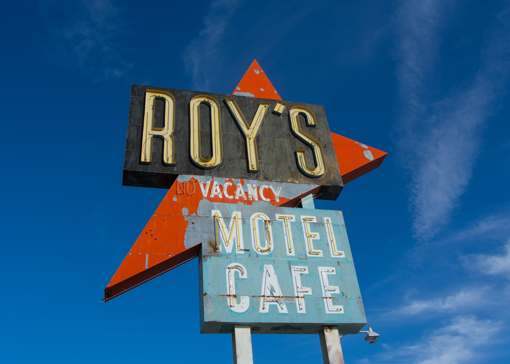
15/66
John Yeski, Film & Pixels
The Roy’s Motel & Cafe sign in Amboy along Route 66.
16/66
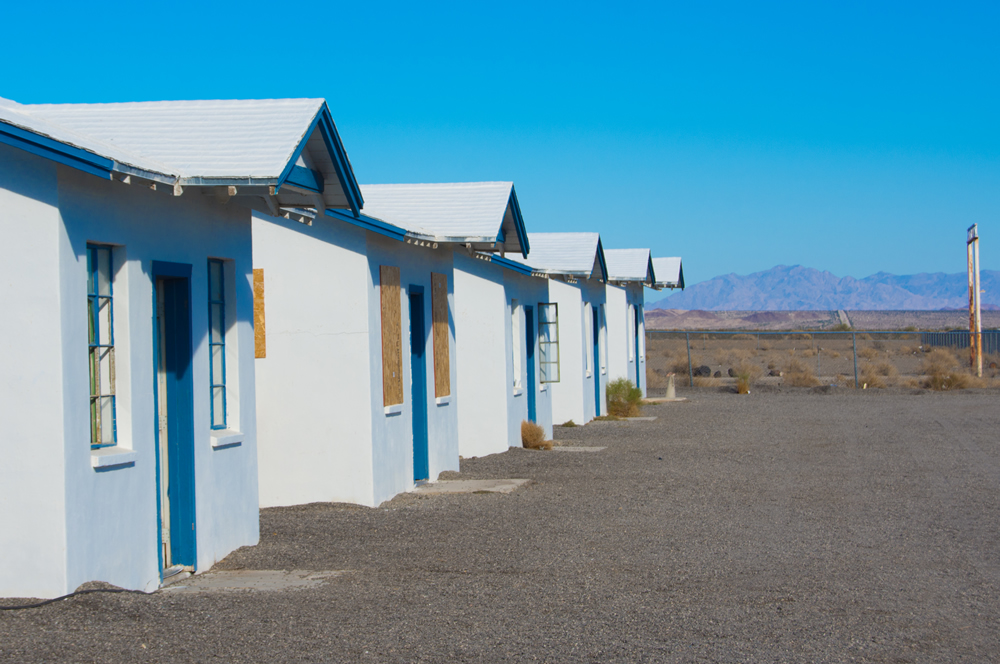
John Yeski, Film & Pixels
Old motel cabins at Roy’s in Amboy.
17/66
John Yeski, Film & Pixels
An abandoned house on Route 66.
18/66
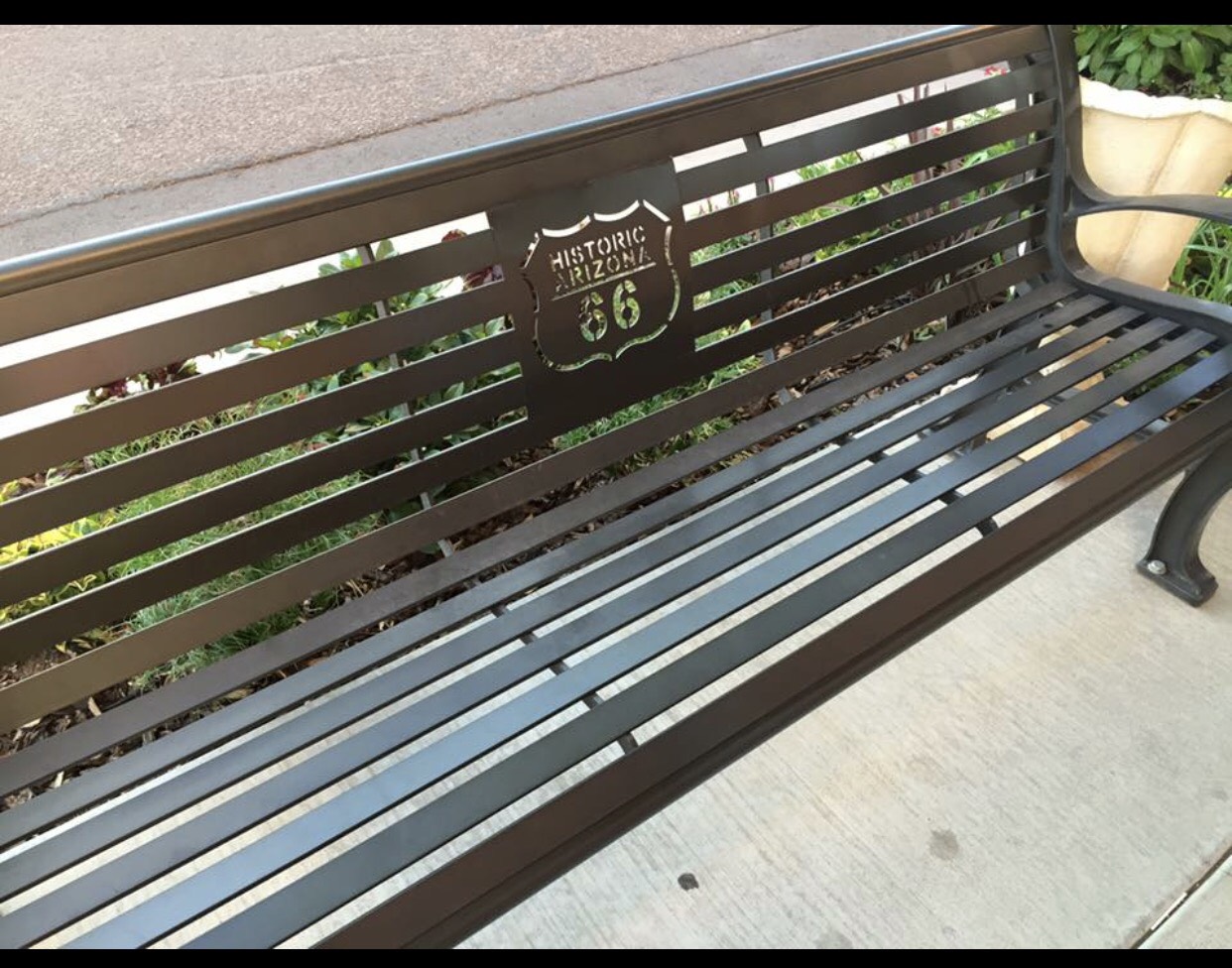
Marisela C. Chavez
A bench with the Route 66 badge.
19/66
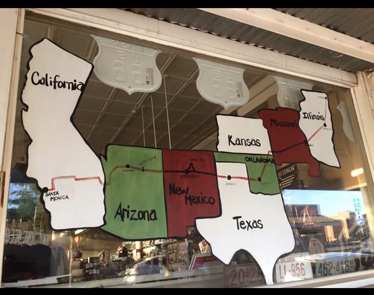
Marisela C. Chavez
A Route 66 map displays the historic road's route in a window.
20/66
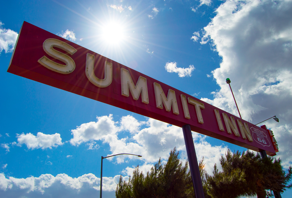
John Yeski, Film & Pixels
The Summit Inn sign, taken a few months before it was destroyed by fire. The Inn at the summit of the Cajon Pass was destroyed by the Blue Cut fire in August 2016.
21/66
Marisela C. Chavez
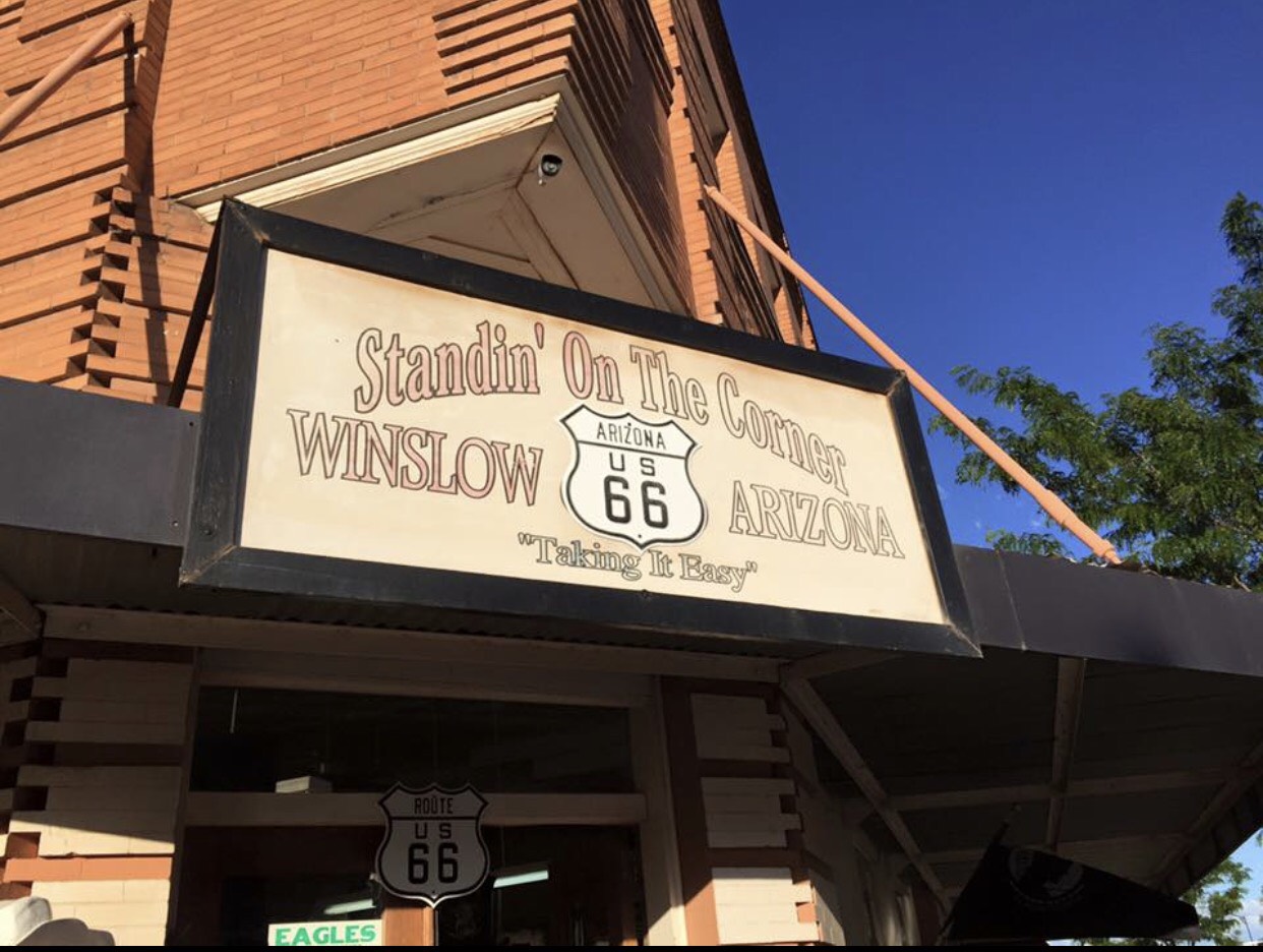
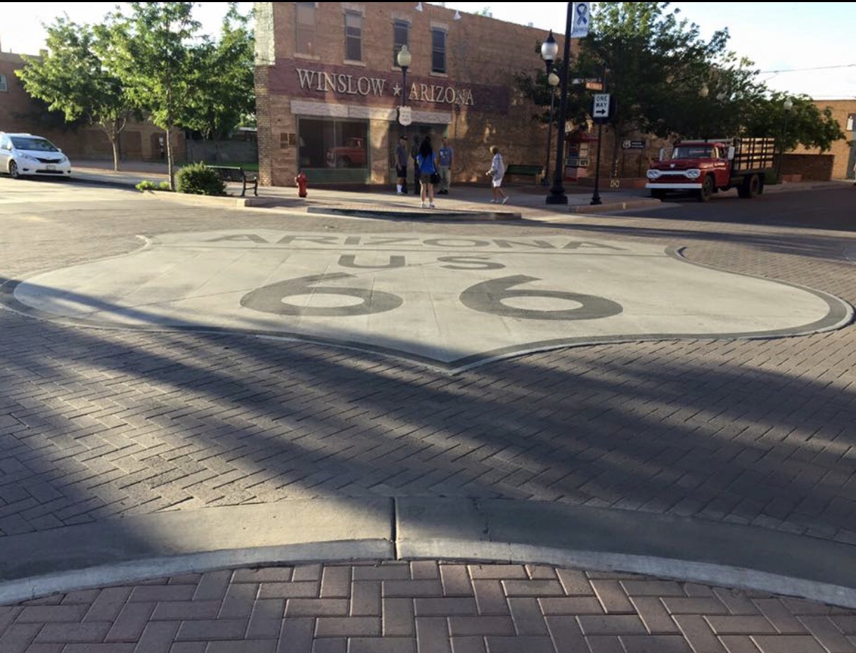
Taking it easy in Winslow, Arizona, such a fine sight to see along Route 66.
22/66
April Watkins
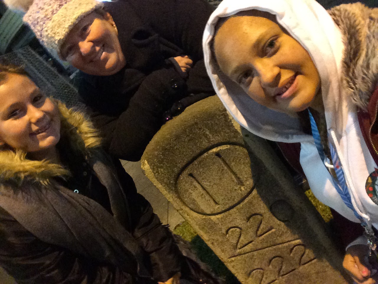
It looks like a grave marker in the grass, but this is actually a milepost in Pasadena. It's based on the Bancroft system, which helped drivers locate homes, businesses, property boundaries and postal delivery addresses. The circled 11 tells you you're 11 miles from the system's locus in Pasadena at the old LA County Courthouse. The block numbers below it represent how far the driver is along Mile 11.
23/66
Marisela C. Chavez
A view of Route 66.
24/66
April Watkins
A view of Route 66 near Dagett .
25/66
Tisha Thompson, News4
Pedestrians cross Jackson Boulevard at the intersection of Michigan Avenue in Chicago.
26/66
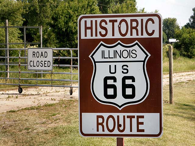
Getty Images
A gate blocks off a closed section outside Lexington, Illinois.
27/66
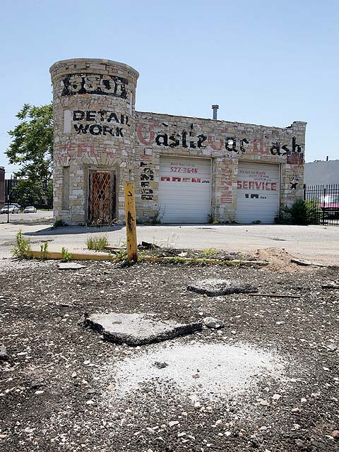
Getty Images
The Castle Car Wash building, constructed in 1925, sits empty and decaying along Ogden Avenue in Chicago. This stretch of Ogden on Chicago's Westside is part of the historic U.S. Route 66.
28/66
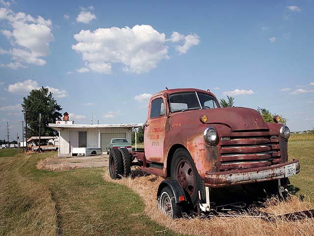
Adam Polaski/Family Photo
A rusting truck is parked by an old drive-inn restaurant along historic U.S. Route 66 in Lexington.
29/66
NBC via VOD
The iconic Route 66 sign appears on the road.
30/66
WRC
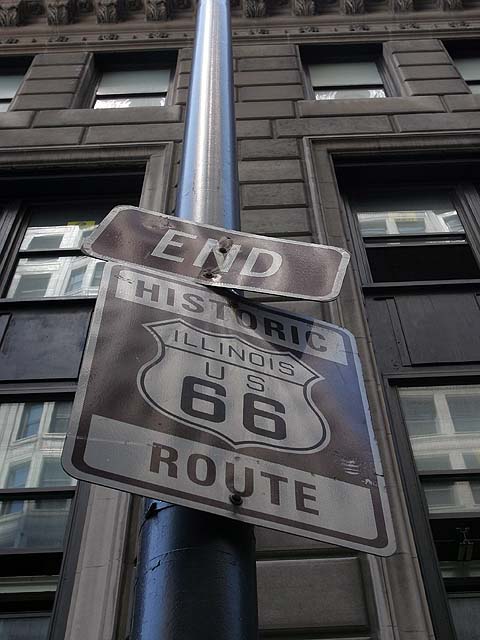
A sign marks the end of U.S. Route 66 on Jackson Boulevard near the intersection of Michigan Avenue in Chicago, Illinois. Route 66 opened in 1926 stretching from Chicago to Los Angeles and became a western migration route for people looking for work during the great depression of the 1930's or to escape the Dust Bowl disaster.
31/66
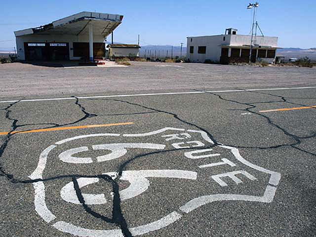
Getty Images
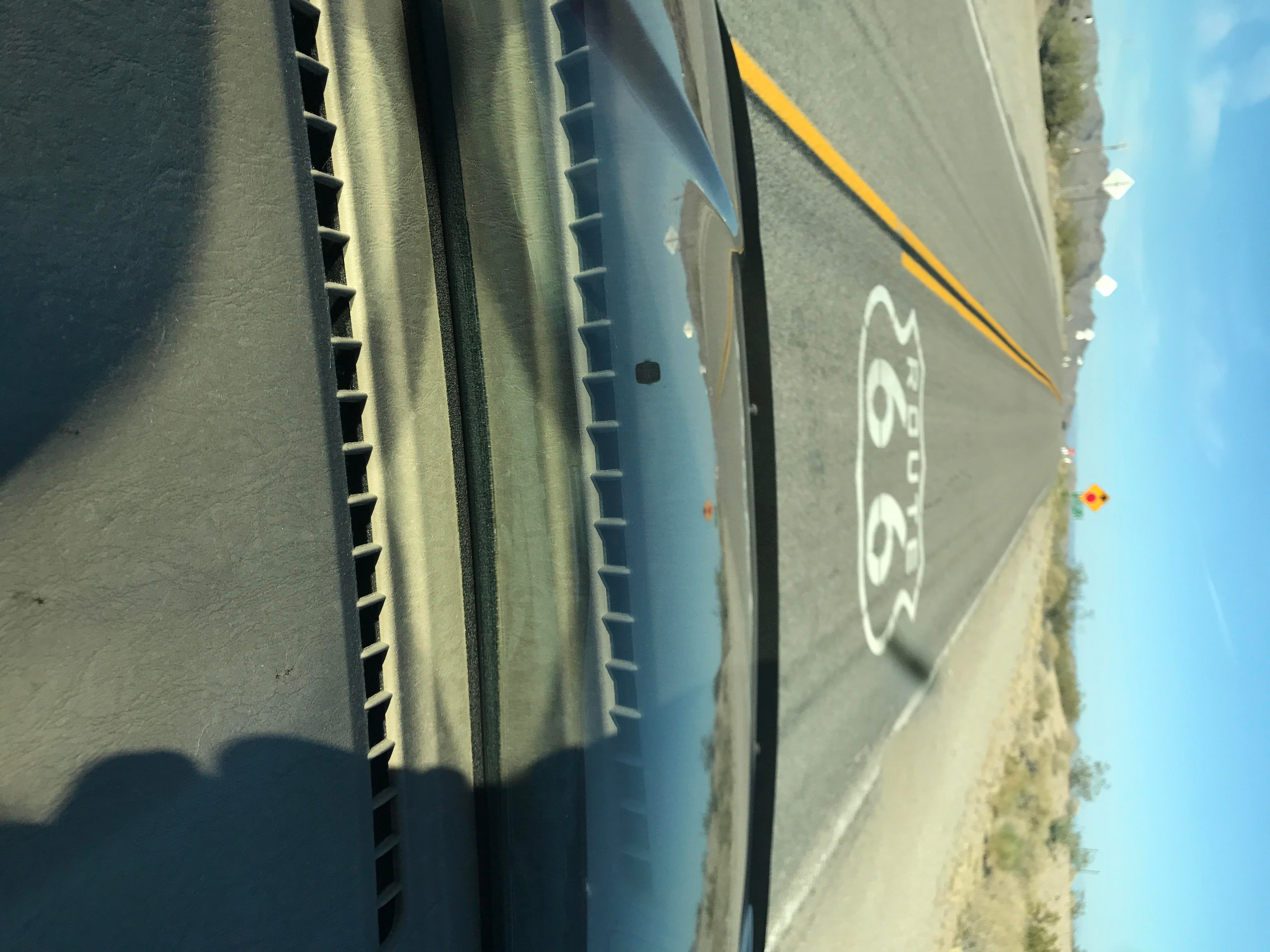
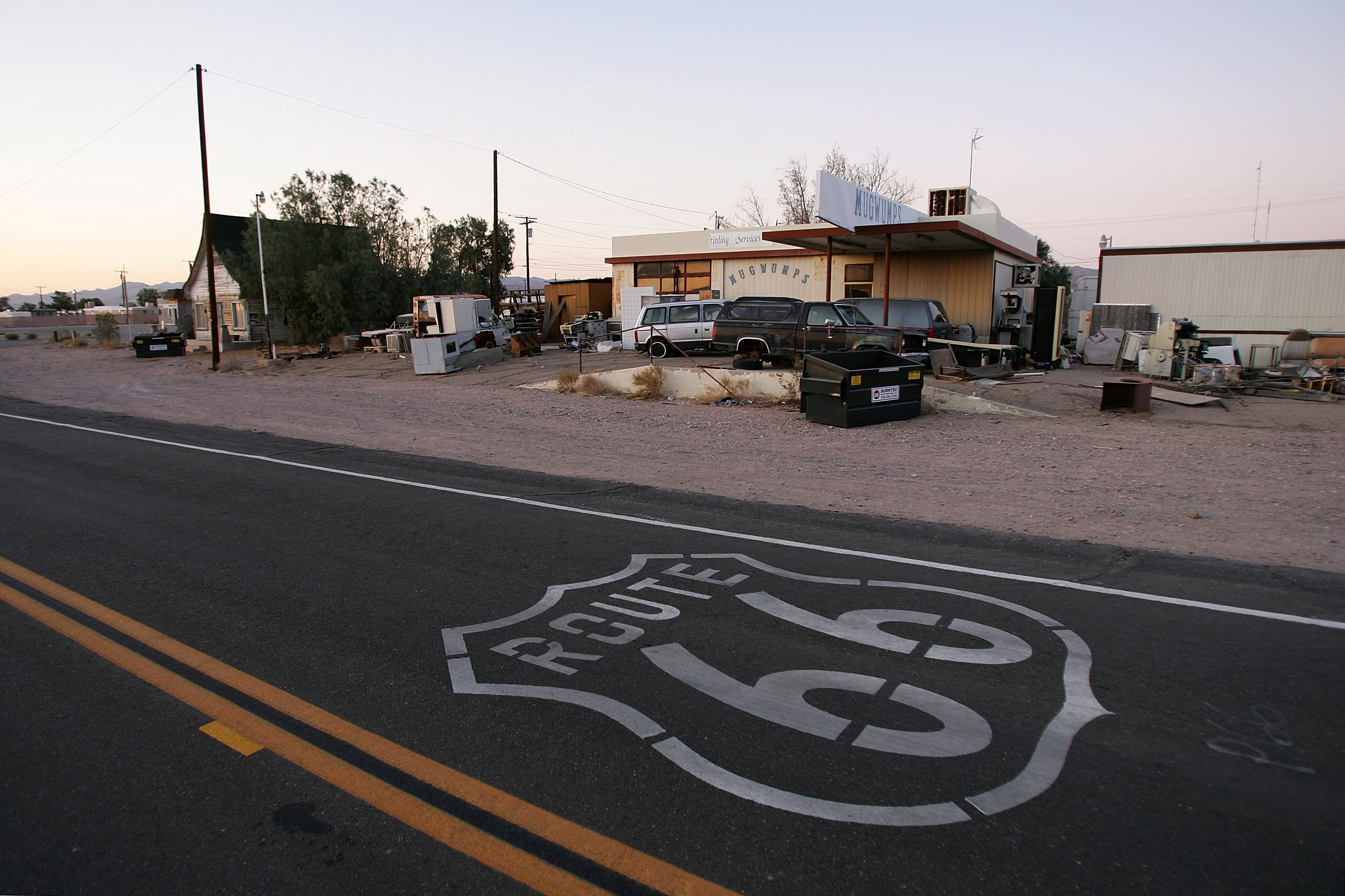
A symbol based on the original Route 66 road signs is seen painted on the highway in Daggett, California.
32/66
Getty Images
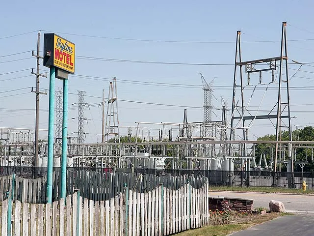
The Skyline Motel along the historic U.S. Route 66 sits across from an electrical transmission station in McCook, Illinois.
33/66
Rachel Manning Hymel
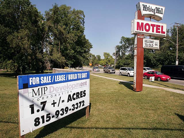
A sign offers for sale the Wishing Well Motel along historic U.S. Route 66 June 12, 2007 in Countryside, Illinois. The motel was built in 1941 as 10 separate cabins and was later converted to a single building.
34/66
Getty Images
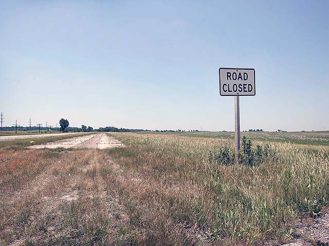
A sign declares an old section of historic U.S. Route 66 closed near Dwight, Illinois.
35/66
Getty Images
A car passes "Gemini Giant," a fiberglass spaceman which marks the location of the Launching Pad restaurant along historic U.S. Route 66 June 12, 2007 in Wilmington, Illinois. The restaurant has been serving travelers along the road since the 1960s.
36/66
Getty Images
A weed grows through a crack in a closed section of the road.
37/66
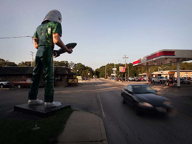
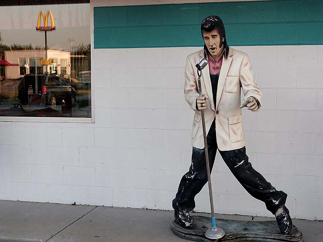
Getty Images
A statue of Elvis strikes a pose as a nearby McDonalds restaurant is reflected in the window outside the Polk-A-Dot diner in Braidwood, Illinois. The restaurant has been serving travelers along the road since 1956.
38/66
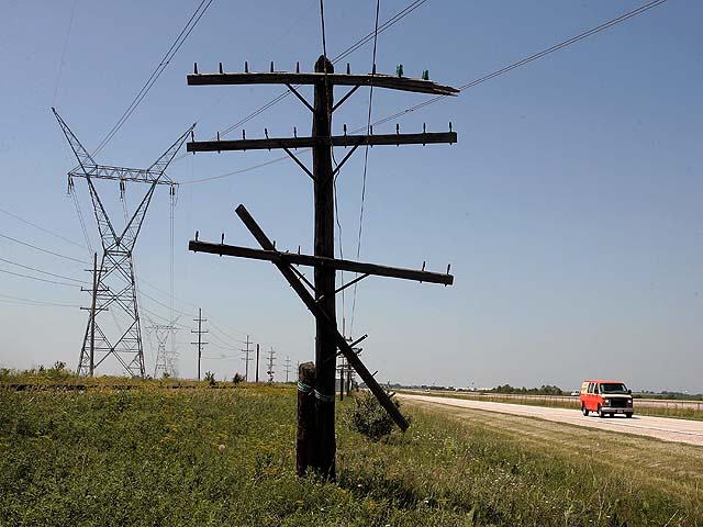
Derek Johnson
A traveler passes by new and old power lines near Dwight, Illinois.
39/66
Getty Images
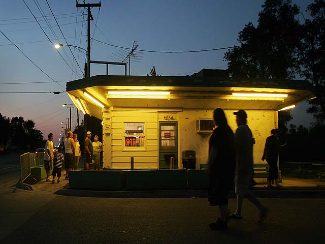
Patrons wait in line for ice cream at the Rich & Creamy stand in Joliet, Illinois.
40/66
Getty Images
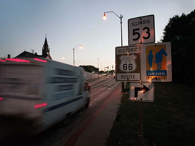
A sign marks the route through Joliet, Illinois.
41/66
Getty Images
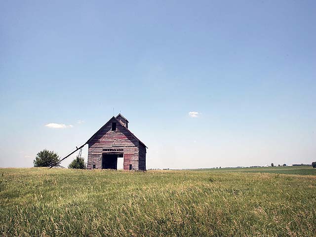
An old corn crib stands above a stretch near Odell, Illinois.
42/66
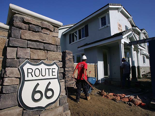
Getty Images
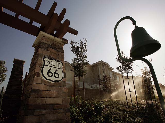
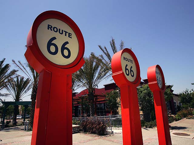
New housing and shopping mall developers use new Route 66 signs as a marketing theme along old Route 66 in Rancho Cucamonga, California.
43/66
Getty Images
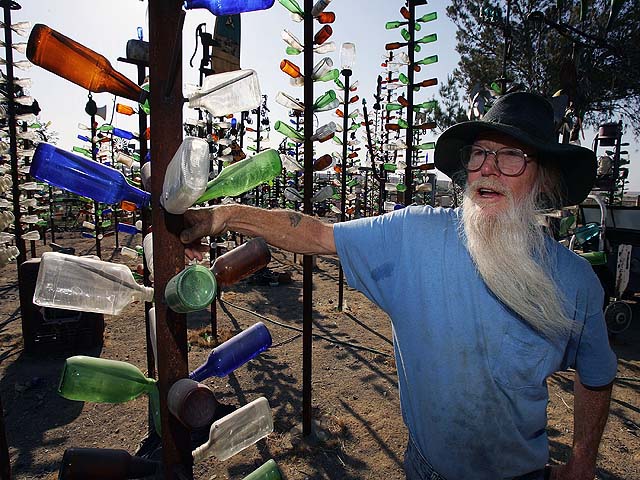
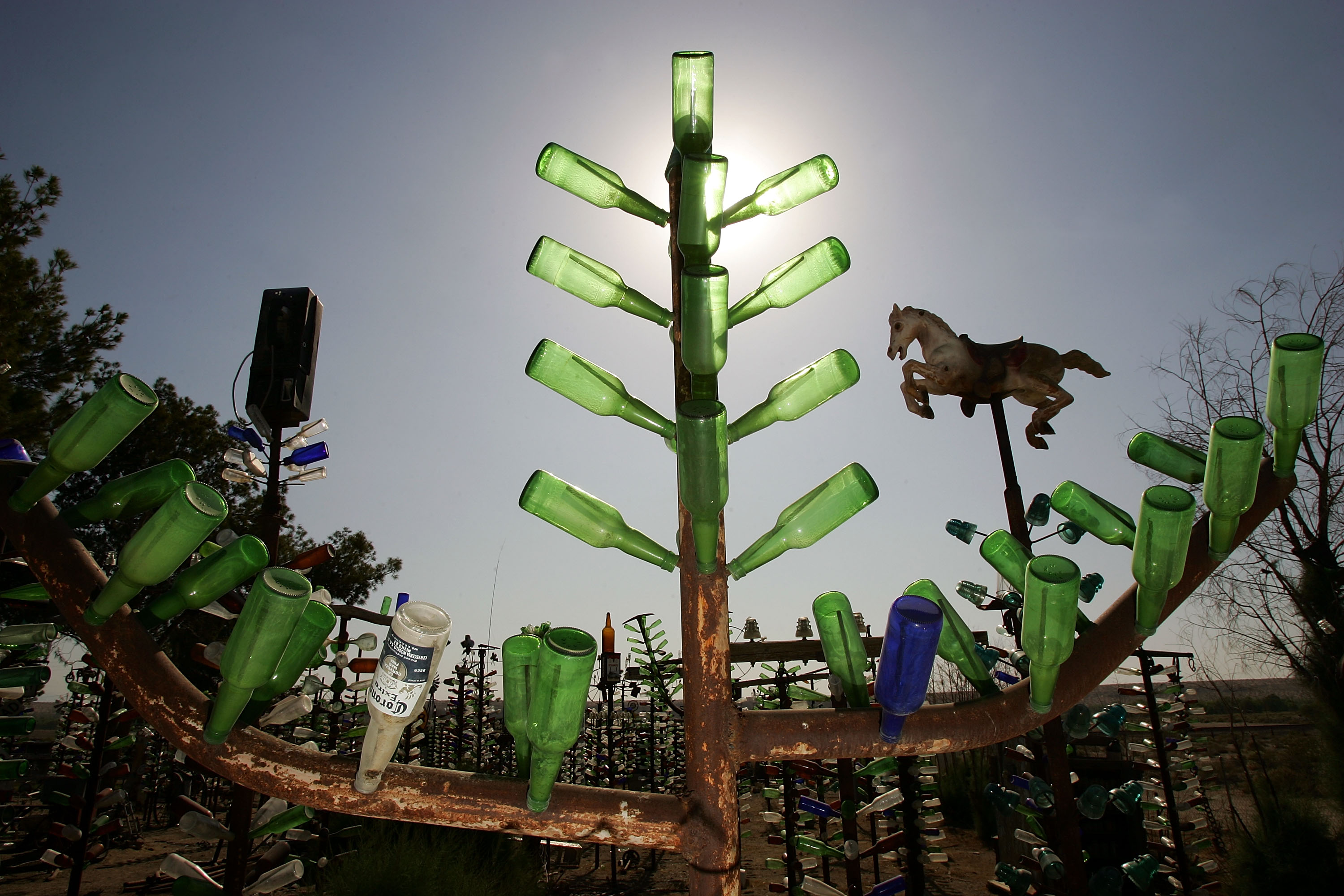
Although collectors of bottles and other items found in the desert have all but gone by the wayside, Elmer Long carries on the tradition with his continual creation of a forest of bottle trees near Oro Grande, California.
44/66
Getty Images
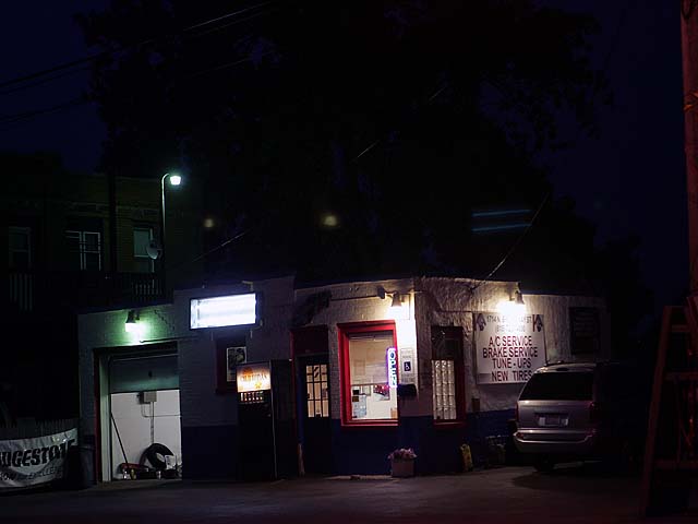
An old gas station, now a mechanic's shop, in Joliet, Illinois.
45/66
Hannah Allen
A car passes a burned out building near Oro Grande, California.
46/66
Hannah Allen
New housing and shopping mall developers use new Route 66 signs as a marketing theme in Rancho Cucamonga, California.
47/66
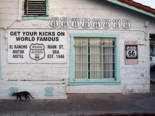
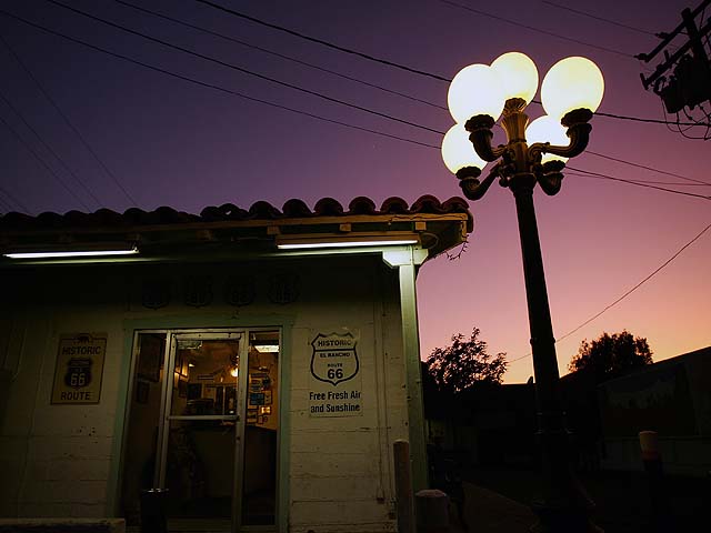
Josh Wray/Visit Mammoth
A cat walks past a Route 66 signs at the El Rancho Motel, once a major Route 66 landmark.
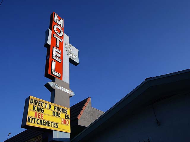
48/66
Getty Images
The El Rey Motel is still open for business on old Route 66 in Rialto.
49/66
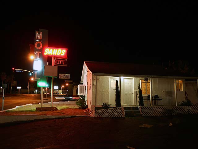
Getty Images
Aging hotels, many used by long-term residents, are seen along old Route 66 in Barstow.
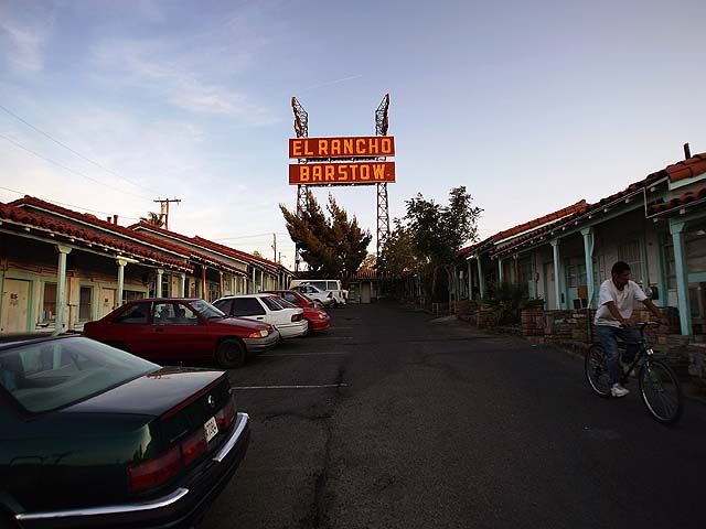
50/66
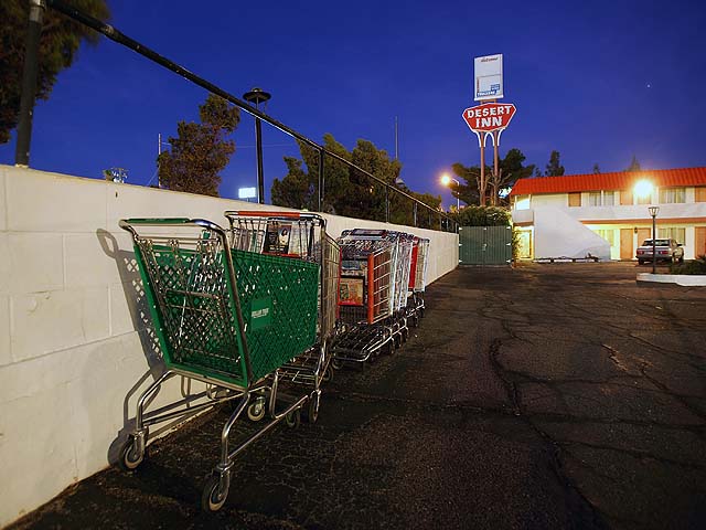
Julie Cilano
The El Rancho Motel in Barstow.
51/66
Getty Images
Shopping carts accumulate in the parking lot of a hotel in Barstow.
52/66
Getty Images
A truck passes an abandoned gas station near Oro Grande.
53/66
Tisha Thompson, News4
Night comes to the El Rancho Motel.
54/66
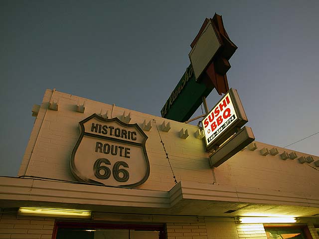
Getty Images
The sign on the El Rancho restaurant.
55/66
File--AP
A construction worker works near a new Route 66 sign used by the new home developer as an ironic marketing theme on old Route 66.
56/66
Getty Images
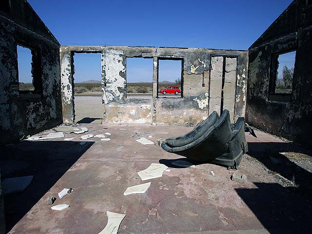
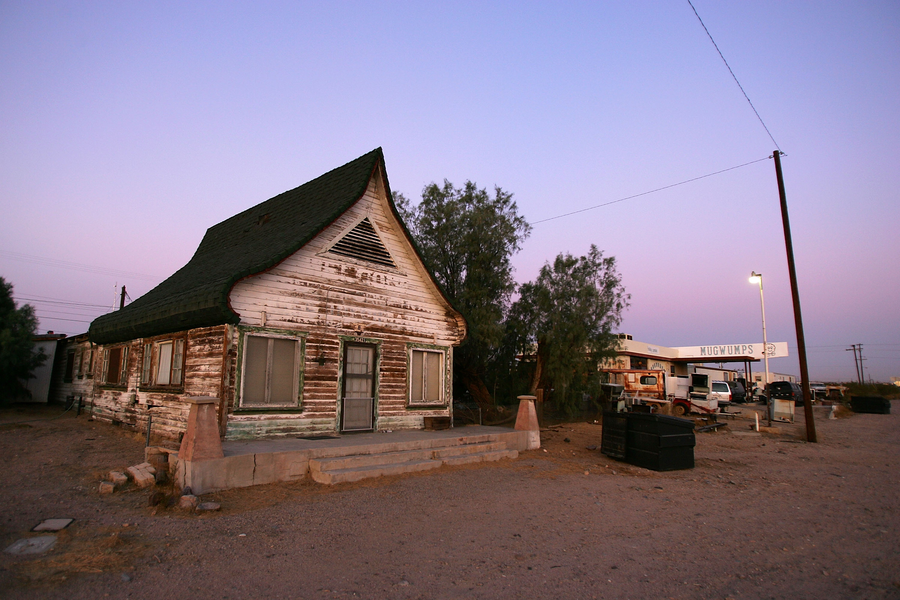
A cafe stands destroyed along old Route 66 on June 16, 2007 in Ludlow, California.
57/66
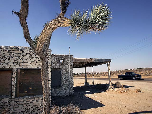
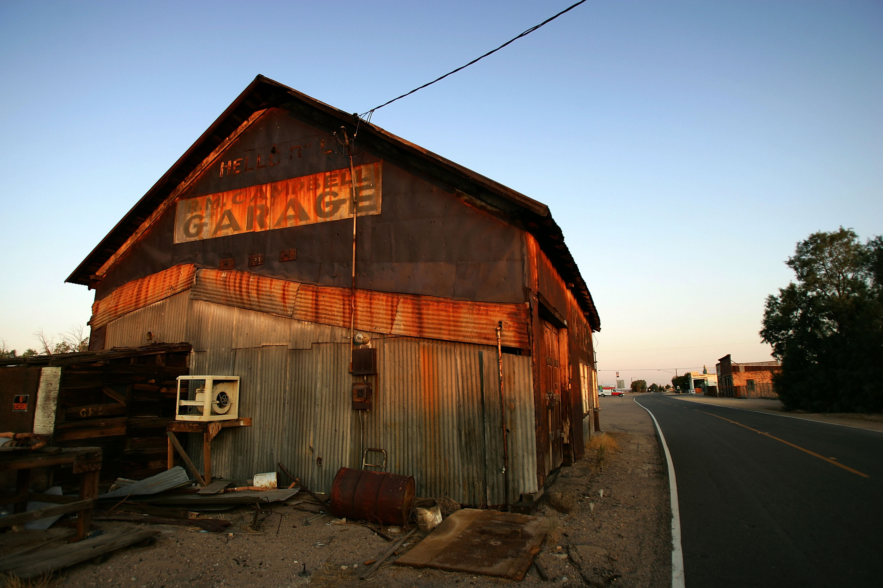
Getty Images
The old Daggett Garage is seen on June 16, 2007 in Daggett, California.
58/66
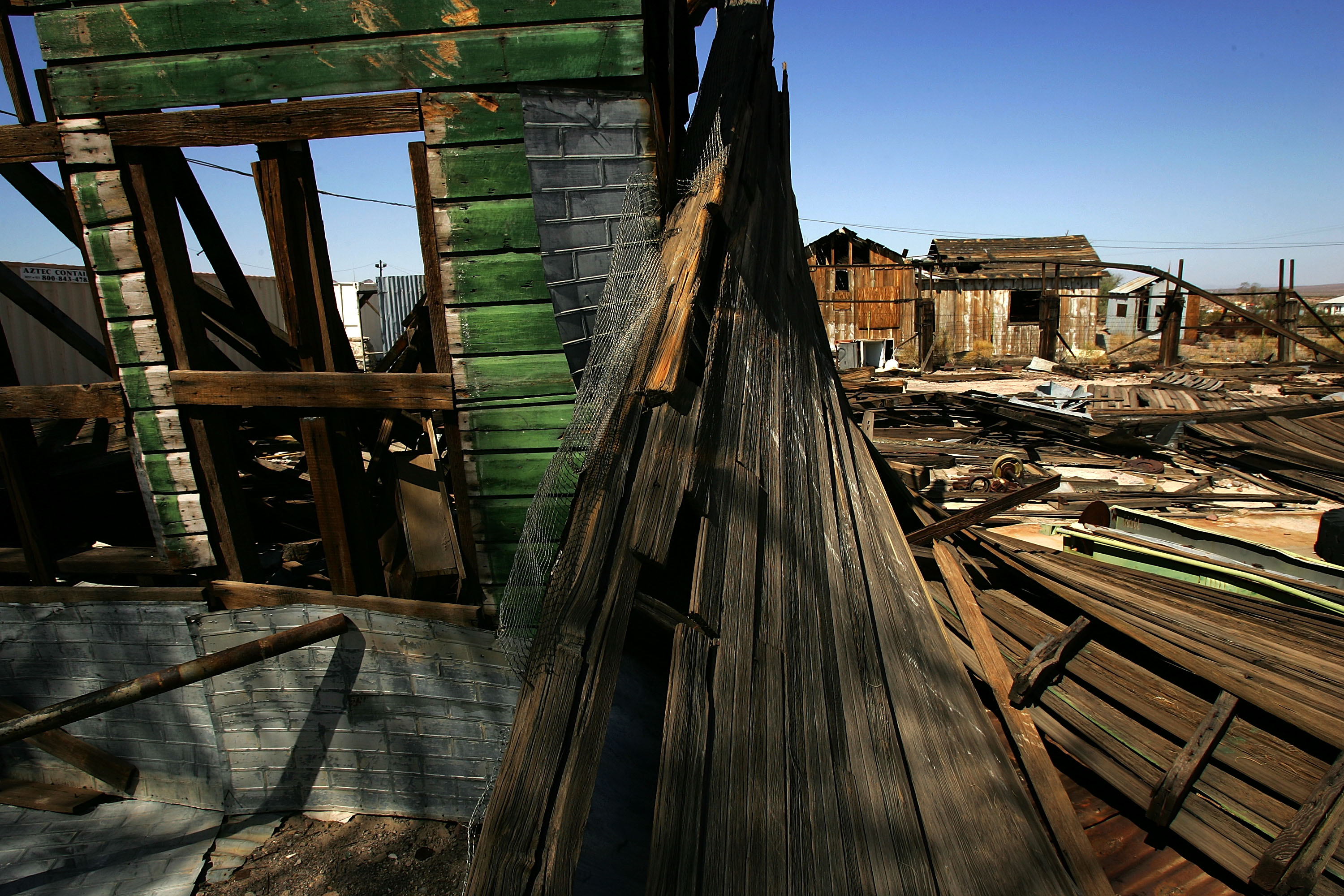
Getty Images
Buildings rot in a ghost town that was established in the 1880s on June 16, 2007 in Ludlow, California.
59/66
Getty Images
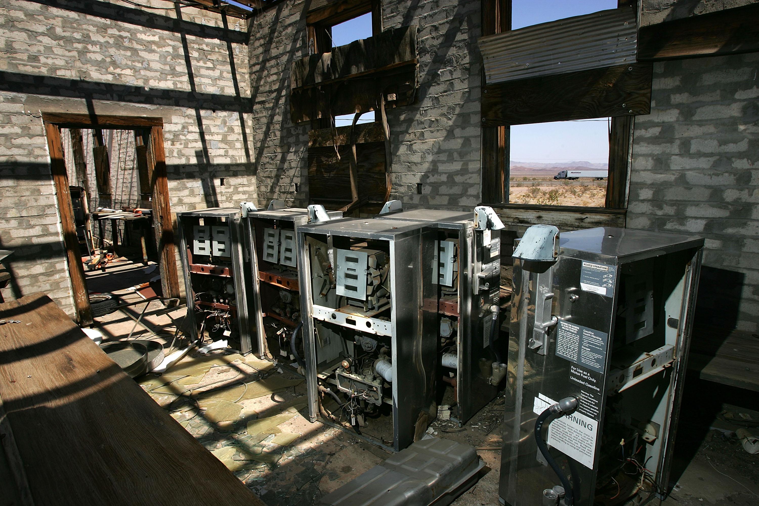
Gas pumps are stored in a damaged garage along old Route 66 on June 16, 2007 in Ludlow, California.
60/66
Getty Images
An old house stands on June 16, 2007 in Daggett, California.
61/66
Getty Images
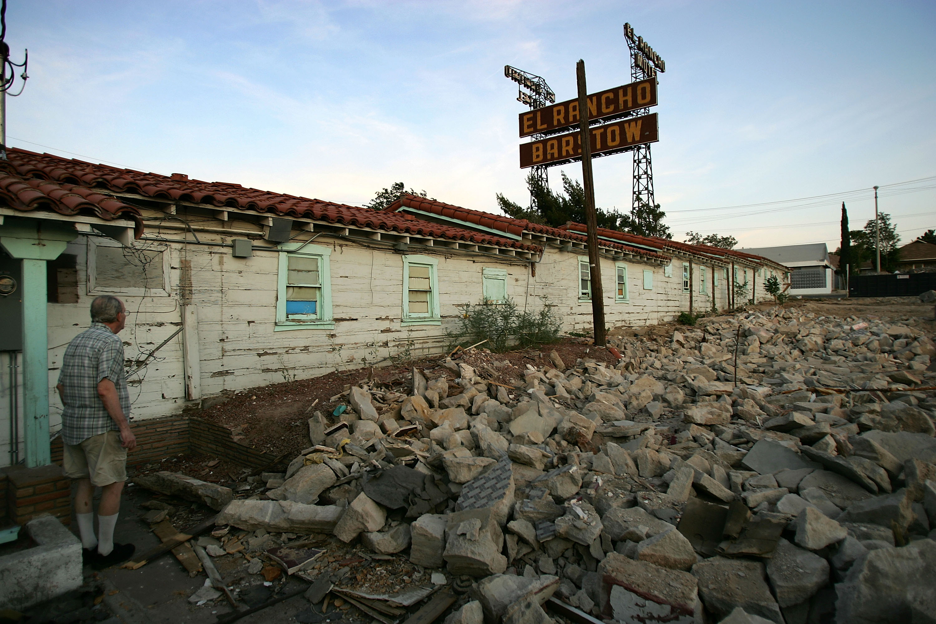
A pile of broken rubble is all that remains of a section of the El Rancho Motel, once a major Route 66 landmark, that burned in an arson fire on June 15, 2007 in Barstow, California.
62/66
Getty Images
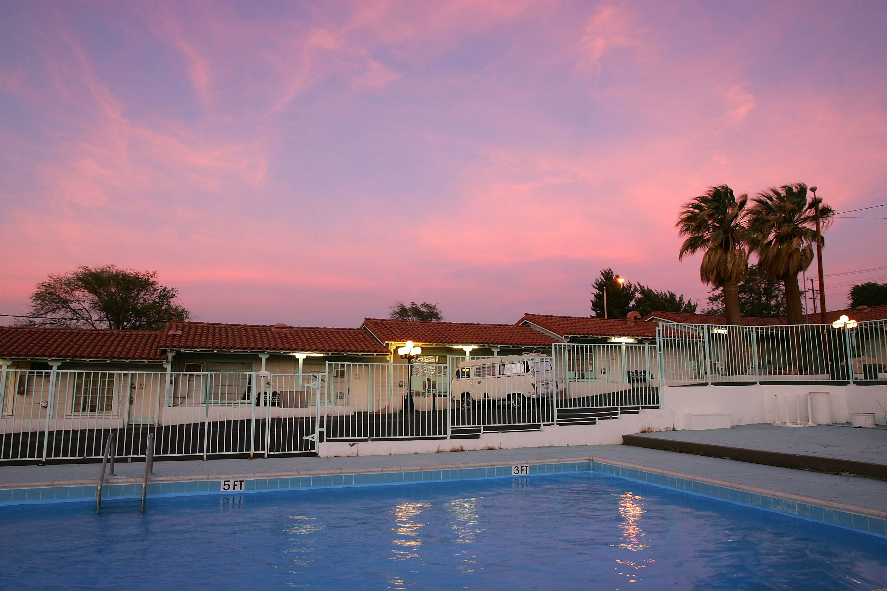
A colorful sunset takes place over the El Rancho Motel, once a major Route 66 landmark but now in a state of decline, on June 15, 2007 in Barstow, California.
63/66
Getty Images
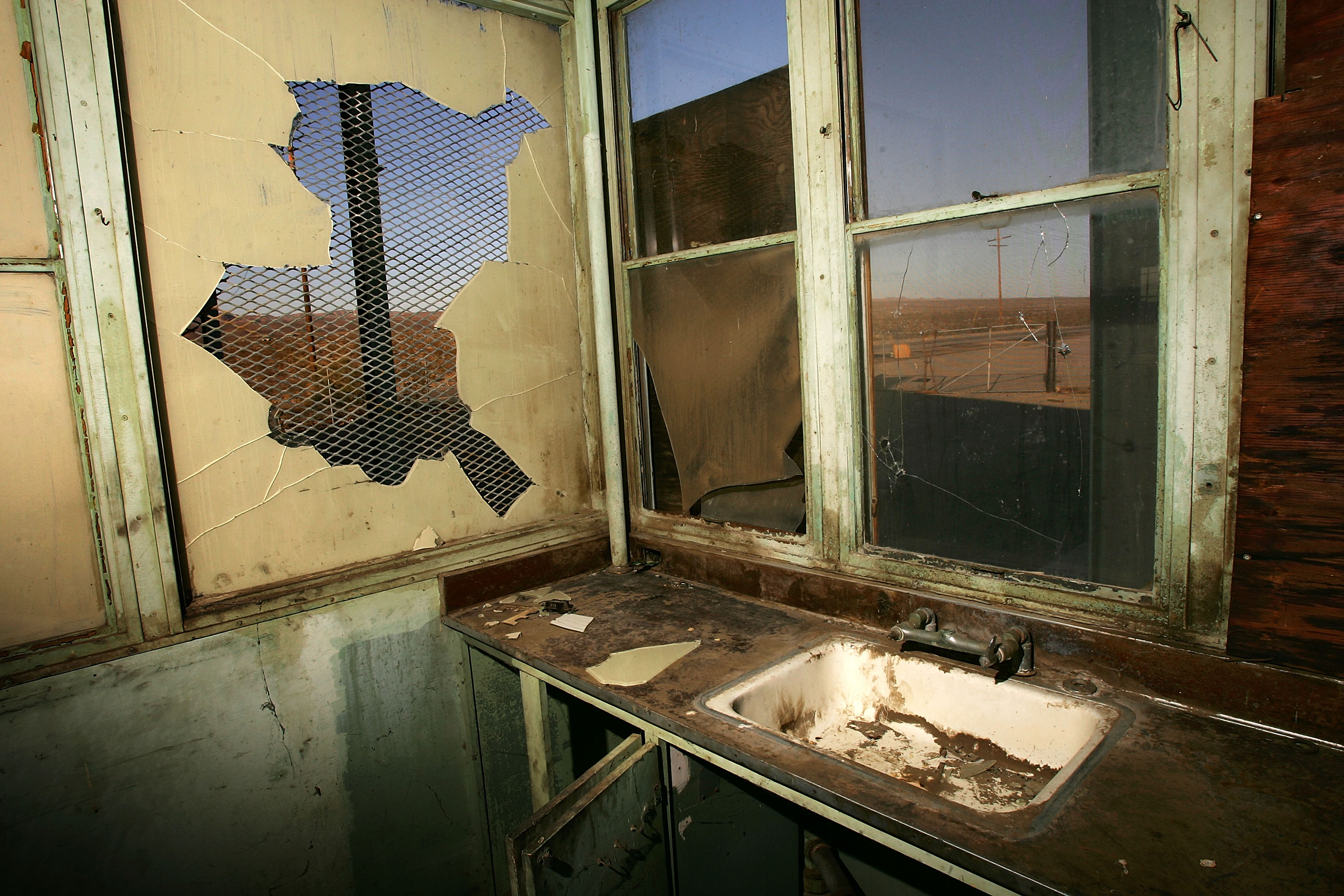
Damage is seen in the old California Inspection Station mentioned in John Steinbeck's 1930 book The Grapes of Wrath and used from 1930 to 1953, on June 16, 2007 east of Daggett, California.
64/66
Getty Images
Although collectors of bottles and other items found in the desert have all but gone by the wayside, Elmer Long carries on the tradition with his continual creation of a forest of bottle trees on old Route 66 on June 15, 2007 near Oro Grande, California.
65/66
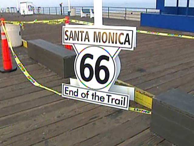
On Nov. 11, 2009, Santa Monica tourism officials and Route 66 enthusiasts unveiled an "End of the Trail" marker at the Santa Monica Pier.
66/66
Marisela C. Chavez
A map of historic Route 66 appears in a window along the route.