
As strong Santa Ana winds formed Wednesday night in Southern California, have you've ever wondered why we get these winds? Take a look at the video below.
Wind moves from high pressure to low pressure. When you add our mountains, canyons and passes that wind can now pick up speed.
Wind strength can also be enhanced by cold air to our east. This cold air charges the atmosphere.
As the air gets to the top of the mountain it races down, like being on a bike with no brakes. The canyons and passes act as a toll road. The wind piles up and once it squeezes through the canyon it races out.
And wind that is moving down a mountain dries as it sinks. It’s more physics than meteorology, but this drying lowers the humidity into the single digits. The combination of dry fuels, low humidity, and strong gusty winds create a critical fire weather threat. If a fire starts it can spread rapidly and behave erratically.
Santa Ana winds occur in the fall lasting through the winter, so this is peak season and getting them now is normal. But what’s not normal is how dry we are.
Not everyone in Southern California gets Santa Ana Winds. The above video shows where they are strongest.

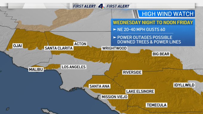
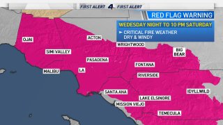
A strong Santa Ana Wind produces Red Flag Warnings and High Wind Watches.
