
Fueled by fierce winds, the Springs Fire consumed more than 12 square miles Thursday, threatening homes, stretching from the 101 Freeway to Pacific Coast Highway in Ventura County, and prompting warnings as firefighters battled a difficult blaze into night.
Updated Article: Fire Burns Toward Malibu
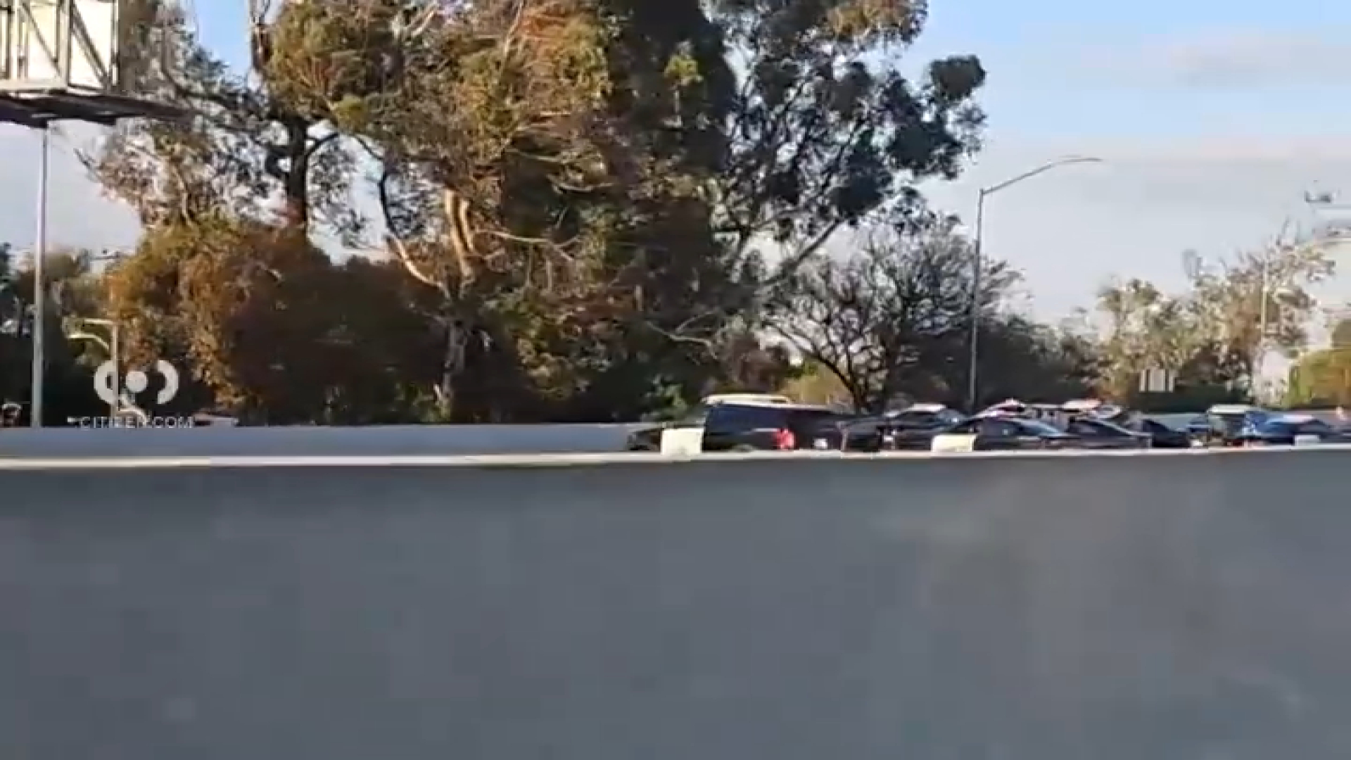
The fire had grown to 8,000 acres by just before 8 p.m., when fire officials said the blaze had threatened some 2,000 homes. Pacific Coast Highway had been shut down for a nine-mile stretch.
By 9 p.m. the still-growing wildfire has reached PCH at Sycamore Canyon Road, according to a Ventura County Sheriff's Department spokesman.
Sycamore Canyon is in Point Mugu State Park, home to some of Southern California's only remaining native grasslands.
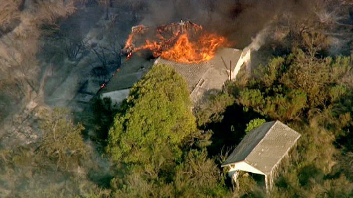
At least one home -- in an isolated, wooded area -- burned on the southern flank of the fire, as seen below. More than 800 people were affected by evacuation orders, according to fire officials.
The blaze quickly consumed brush and vegetation in the steep terrain of southern Ventura County, prompting panic among evacuated homeowners amid record-high temperatures and low humidity.
Local
Get Los Angeles's latest local news on crime, entertainment, weather, schools, COVID, cost of living and more. Here's your go-to source for today's LA news.

The fire was expected to increase in size significantly, and was 10 percent contained as of about 6:30 p.m. Officials said they expected that figure to be revised in the morning as the fire continued to spread late into the night.
Strong Santa Ana winds had died down at that time, but fire officials warned they could pick up and again fan flames.
"We have conditions that are very dramatic, very dangerous for firefighters. This fire is growing," said Tom Kruschke, an information officer with the Ventura County Fire Department.
"We are asking members of the public to be very aware -- this is very dangerous. This is still a moving fire. If you were asked to evacuate, it will be a while before you are allowed in. And if at one point you are uncomfortable, please leave the area. It's not safe to stay,“ Kruschke said.
The fire department had issued a map of the fire's footprint and the evacuation zone, as shown below.
The fire, which broke out at 6:34 a.m. Thursday, had jumped over of Potrero Road and was making its way south toward Pacific Coast Highway and coastal Point Mugu State Park in the late afternoon.
At a news conference at 6:30 p.m., Capt. Mike Lindbery of the Ventura County Fire Department said fire officials were trying to prevent the fire from reaching PCH after it stalled in canyons as Santa Ana winds died down. But the wind could pick up and push the blaze farther south, he said.
"We are not going to call this thing caught till we have a good line around it and that line can hold the conditions that are presenting at the time," he said.
He predicted the region is in for a serious fire season.
"We're having Santa Ana events in May," Lindbery noted, referring to dry Southern California winds that come from inland toward the coast, usually in fall and winter. "An event like this ... it hasn't happened in my career."
The fire initially grew within six hours to more than 6,500 acres, or more than 10 square miles. It began in rugged terrain of the Conejo Grade, just south of the 101 Freeway (map) before spreading rapidly to the southwest, prompting road closures -- including PCH -- and evacuations.
Send NBC4 Your Fire Photos: Send us pictures at isee@nbcla.com or through the NBC4 LA mobile app.
Mandatory evacuation orders were in place as of 6:30 p.m. in Sycamore Canyon, La Jolla Canyon and Broome Ranch.
Residents were being allowed back into homes that had been evacuated in the Camarillo Springs area and the Dos Vientos area of Newbury Park. Residents need identification to return to their homes, Sheriff's Department officials said.
Sheriff's officials initially said an evacuation order was lifted for California State University, Channel Islands, but that was corrected at 7:45 p.m. and the university remained closed.
Burning agricultural buildings near the university had prompted a smoke advisory from the Ventura County Air Pollution Control District, which warned residents to avoid smoke.
Lindbery said firefighters were letting the potentially hazardous material burn because it was not safe to attack with firefighting resources.
For those in the university area, Lindbery advised: "Be mindful, watch out for fire equipement and stay out of the smoke."
Just before 1 p.m., the California Highway Patrol had closed a nine-mile stretch of PCH between Las Posas Road and Yerba Buena Road, which is essentially the Los Angeles County line (map). The crucial coastal highway was reopened just before 3 p.m., with the CHP recommending drivers stay alert while in the area.
The roadway was again closed on the same stretch at about 8 p.m. Yerba Buena Road and Deer Creek Road were also closed.
Firefighters were facing difficult conditions: high winds, hot temperatures and low humidity amid a mountain landscape. The National Weather Service had issued a red flag warning -- indicating high fire danger -- through 5 p.m. Friday.
Conditions were expected to be similarly hot and dry on Friday, Lindbery said.
"We’re chasing it, but we can’t stay ahead of this -- it’s moving so fast," said Lindbery at midday Thursday. “We haven’t seen anything like this in a while. We’ve had a couple of really slow summers. This one’s waking us up really quickly.”
Camarillo resident Zeke Jaquez was among the first to call 911, reporting what would become the Springs Fire.
He was driving from his home to Los Angeles when he saw what he thought was a car on fire off the side of the 101 Freeway.
“We all called 911,” Jaquez said. “It’s unbelievable. It’s this huge monster.”
Others in the surrounding residential areas watched the rapidly spreading flames with concern, as seen in the AP Photo/Ventura County Star image below.
.jpg)
Cal State Channel Islands issued an advisory Thursday afternoon stating the campus would remain closed Friday.
A chemical fire in the area was extinguished with foam. Authorities said it was not immediately known how the blaze started.
About 100 campers and a resident were evacuated from Point Mugu State Park as a precaution, the Associated Press reported.
A group of 120 children and 30 adults who were at a Camp Hess Kramer near Sycamore Canyon and PCH were escorted from the park shortly before midnight, Ventura County Fire's Capt. Dave Wareham said.
Schools in the area of the fire were also evacuated.
The Red Cross has established evacuation centers at Calvary Community Chapel located at 380 Mobil Ave. in Camarillo and at Thousand Oaks Community Center at 2525 N. Moorpark Road in Thousand Oaks.
Public and private animal shelters in Camarillo, Simi Valley and Augora Hills have offered to house evacuated pets.
The statewide California Emergency Management Agency said Thursday that it had activated two operations centers in response to the Springs Fire and the Summit Fire in Riverside County, which began Wednesday. Cal EMA had deployed 10 of its fire engines to the Springs Fire.
The state agency also announced that Gov. Jerry Brown's request had been approved for two Federal Emergency Management Agency assistance grants to pay for fire response.
More than 925 firefighters and law enforcement personnel, along with 96 fire engines, six helicopters, dozens of hand crews and three fixed-wing aircraft were called into service.
Meanwhile, a 98-degree reading recorded in Camarillo -- next to the raging fire -- set a high temperature record for the date. The previous record of 94 degrees was set in 2004. A record was also set nearby in Oxnard at 92 degrees.
Wind gusts reached 70 mph in some areas, according to the National Weather Service.
Fixed-wing air tankers at one point were grounded due to weather conditions.
In addition to the large Springs Fire and the Summit Fire, a 12-acre blaze in Jurupa Valley burned Thursday, destroying multiple structures.
A small fire was reported at about 3:15 p.m. in Calabasas, not far to the east of the Spring Fire, in a wash at Meadow Creek Lane and Lost Hills Road (map). Los Angeles County Fire Department officials said quickly had the blaze contained at a half-acre.
In Northern California, a Tehama County fire spread to 2,000 acres Thursday, and at least three other fires of fewer than 150 acres burned elsewhere in the northern part of the state.

