
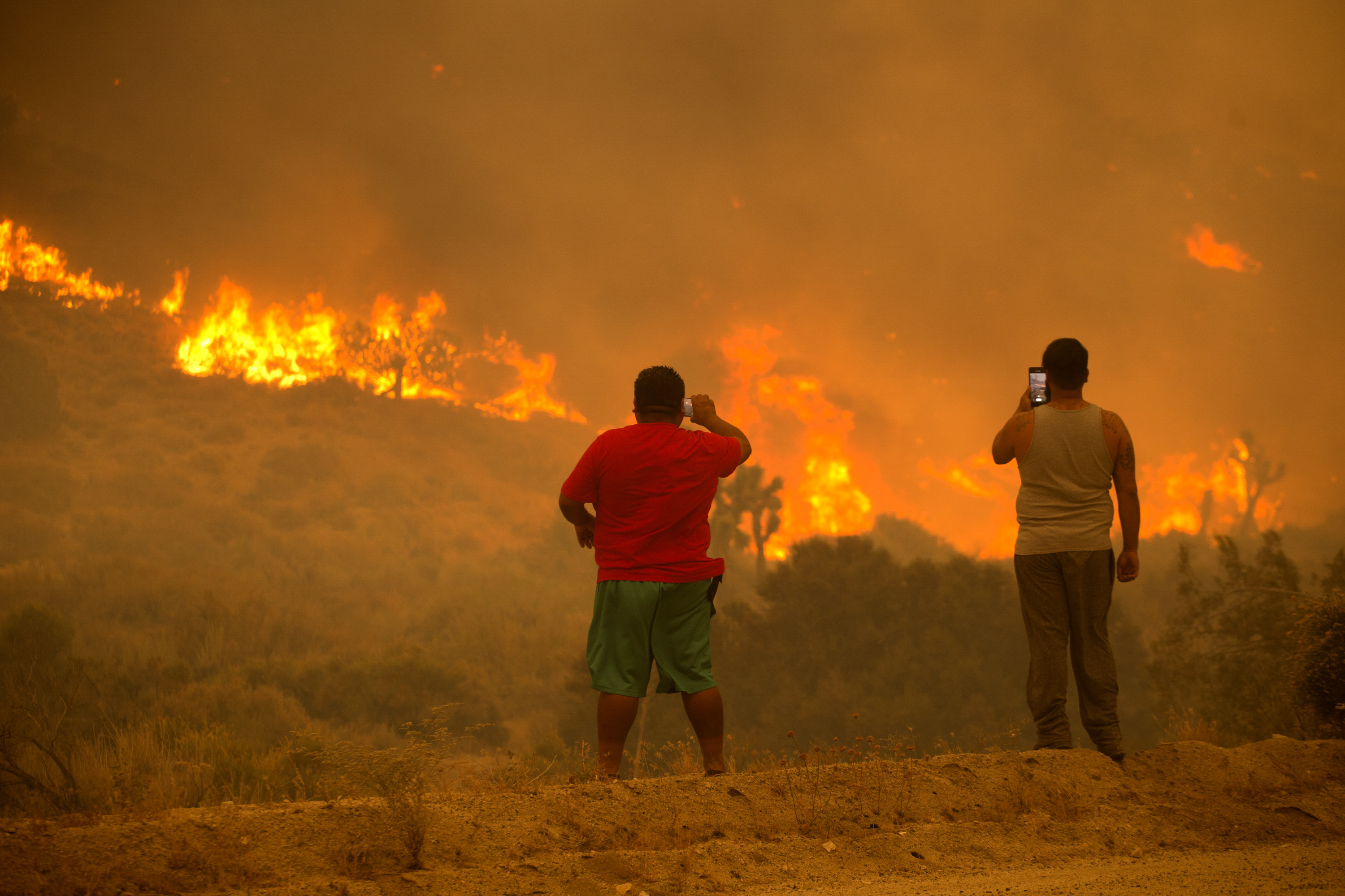
A wind-fanned wildfire doubled in size overnight in Riverside County, where thousands of people are under evacuation orders and at least one home was destroyed.
The brush fire started Monday afternoon in the Aguanga area of Riverside County, about 60 miles southwest of Palm Springs. The origin of the fire is near the junction of highways 79 and 371.
About 1,300 homes and 4,000 residents were under evacuation orders, fire spokesman Jeff LaRusso said Monday.
Get top local stories in Southern California delivered to you every morning. >Sign up for NBC LA's News Headlines newsletter.
CalFire said the Highland Fire, was first reported at 12:37 p.m. between Highland Road and Aguanga Ranchos Road. As of 7:51 p.m., the fire spread to 1,219 acres, but doubled in size to more than 2,200 acres by Tuesday morning.
"We're smelling smoke, we're saying, 'Ok, could be a little fire,'" said Greg Silks, who manages Saddle Up Ranch. "More and more. Bigger smoke in the air. Here comes all the aircraft. Closed the highway down. We said, 'Oh, this thing's coming.'
Silks and others at the ranch evacuated.
At least one home was destroyed in the fire. Several cars also appeared to have been destroyed, transformed into metal carcasses by the wind-driven flames.
No injuries have been reported.
Highway 79, connecting Aguanga with Temecula to the west, was closed to allow access to the area for fire crews.
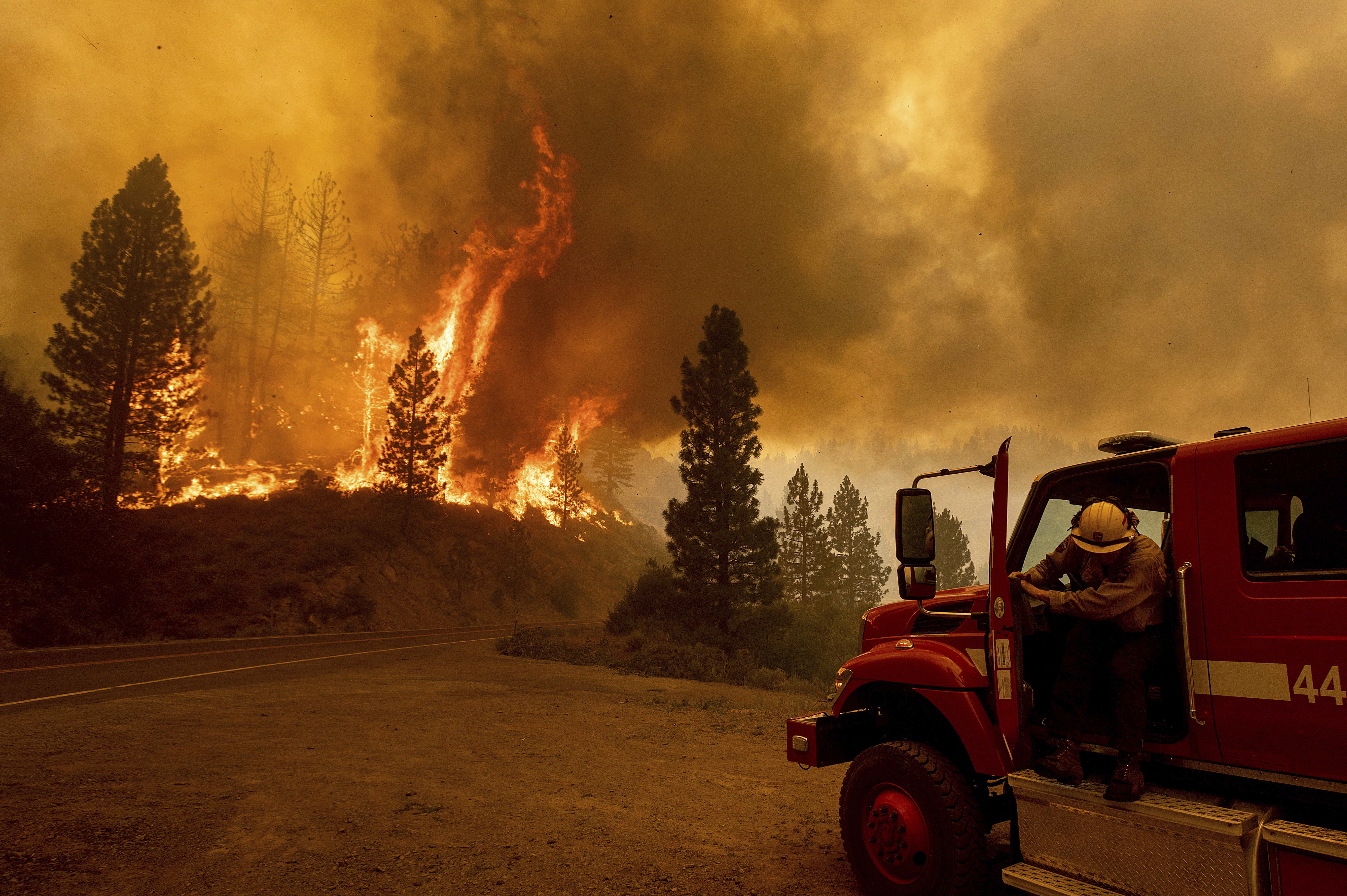
Winds in the area have diminished, which could aid firefighters, but conditions will remain dry and warm. There was no containment as of Tuesday morning as firefighting aircraft, including an air tanker, made drops on the flames. Red fire retardant painted hillsides, limiting the fire's spread.
Several departments responded in assistance to battle the blaze, including fire stations from Corona, Hemet, Murrieta, Palm Springs and the U.S. Forest Service.
Thousands of people were under evacuation orders, which were updated early Tuesday.
Evacuations
Residents in the following areas have been ordered to vacate their homes:
- South of Sage/Golden Eagle Drive
- East of Becker Lane
- West of Boulder Vista
- North of Cottonwood Creek
- South of Highway 371
- West of Soreson
- North of County Line Road
- North of San Diego County line
- South of Highway 79
- East of Forest Route 8S07
- West of Crosley Truck Trail
Meanwhile, an evacuation warning was issued for the following areas:
- East of Vail Lake Resort
- West of Shirley Way
- North of David Street
- South of Pueblo Road/Exa Ely Road
- West of Cahuilla Tribal Reservation Boundary
- North of County Line Road
Shelters
Residents under the order and warning will be able to take shelter at Great Oak High School in Temecula. The address for that center is 32555 Deer Hollow Way.
Those who have large animals can take them to the San Jacinto Animal Shelter for safety. The shelter is located at 581 S. Grand Ave.
Weather
The fire comes as several counties in Southern California are under a red flag warning amid breezy Santa Ana winds. The National Weather Service warned the region of critical fire danger conditions as gusts conditions made way through SoCal.