
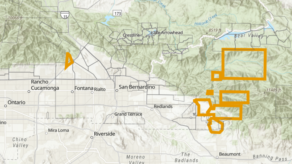
Evacuation orders were in place Tuesday morning for several locations in the Inland Empire, where heavy rain was set to fall on several burn scars from area wildfires, creating a risk of debris flows and mudslides.
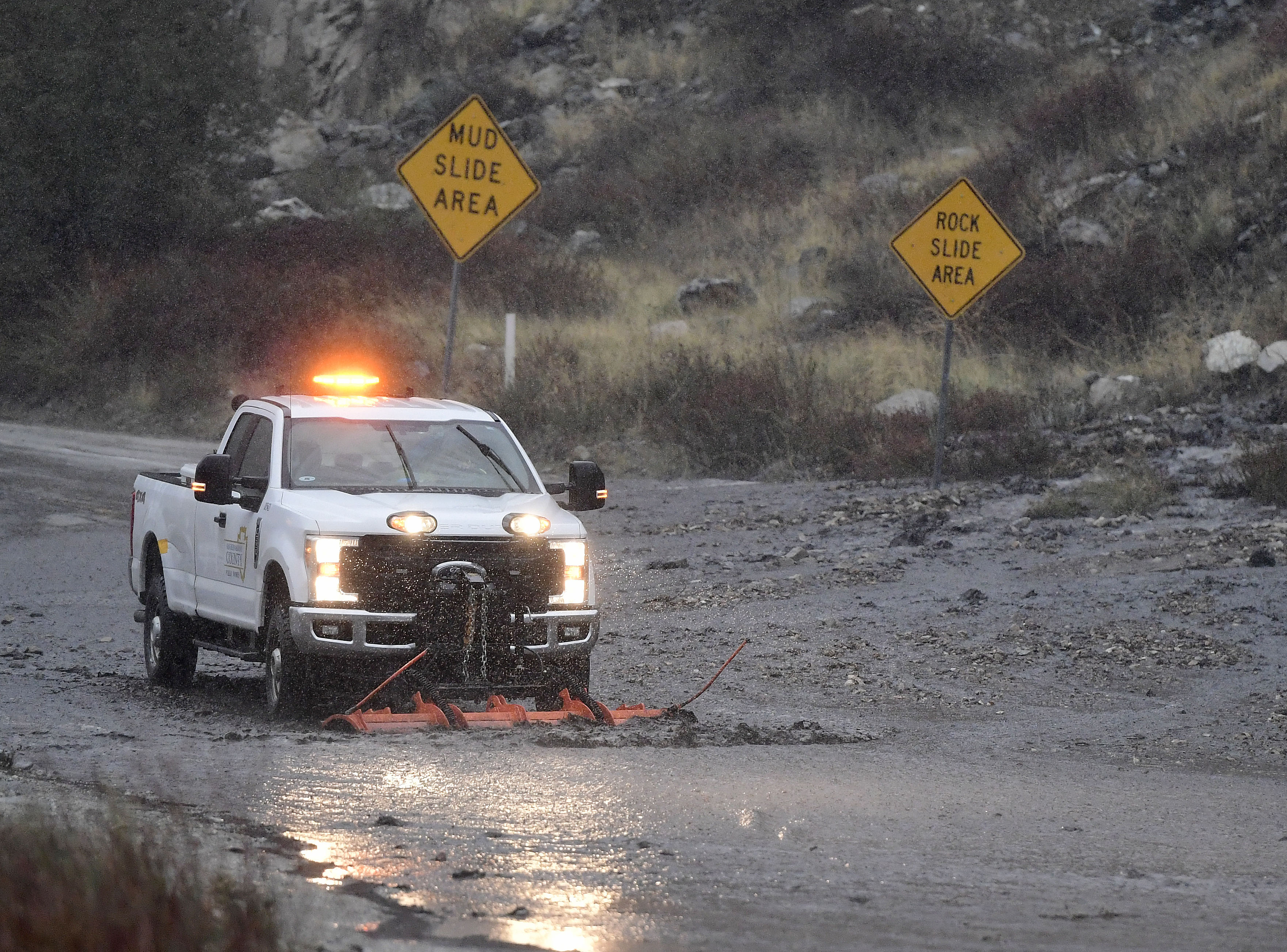
As the wind started to pick up and rain started to go sideways, the captain of the San Bernardino County Fire Department said resources were being staged all over the county.
Those resources included rescue personnel, heavy equipment and engines, in the event of debris flow.
Get Southern California news, weather forecasts and entertainment stories to your inbox. Sign up for NBC LA newsletters.
The captain was on his way to the Lytle Creek burn scar area Tuesday morning.
"Bare soil with no vegetation on it can only handle so much water at a time," said Captain Kyle Hauducoeur. "Once it decides it's gonna move -- we've set those thresholds, we're continuing to monitor them -- but once that debris begins to move, it's unstoppable. It'll lift up cars, it'll move houses."
Evacuations were in place for the Lytle Creek area, with orders in place for residents just north of Lytle Creek due to the South fire burn scar.
Evacuation orders were also in place for those in communities near the El Dorado burn scar:
- Oak Glen,
- Forest Falls,
- Mountain Home Village,
- northeast Yucaipa, and
- Highway 38, from Bryant to Angeles Oaks.
Designated evacuation centers included:
- Redlands East Valley High School,
- the Jessie Turner Community Center.
Those in the area with larger animals requiring shelter can bring their animals to:
- San Bernardino County Animal Care and Control, and
- Devore Animal Center
See an interactive map of evacuation zones from San Bernardino County here.
Riverside County also issued evacuation orders, for areas near the 2020 Apple fire burn scar. That included communities north of Beaumont and Banning.
Highway 38 was closed to visitors through Forest Falls, only open to residents at the time.
The rain also created hazards on the road, with low visibility along the 15 Freeway around 6:30 a.m. Tuesday. Traffic backups were present on the road.
Some who live in the area got a glimpse of the damage heavy rainfall can cause during storms back in October, when there was far less rain than Tuesday's storm.
