
Southern California’s awful air quality is finally showing signs of improvement.
Air quality maps showed better conditions early Thursday into Friday, with a large swath of moderate air quality for Los Angeles and Riverside counties. Unhealthy levels are still reported near the Bobcat Fire in the San Gabriel Mountains, but skies filled with smoke earlier this week appeared to be clearing in some communities near the fire that has burned for nearly two weeks.
Wildfire smoke and high levels of ozone trapped by high pressure added up to atrocious air quality all around Southern California, which has had some of the worst conditions in world over the past week.
Here’s a look at what’s been behind the problem and why conditions are about to improve.
As smoke and ash billowed from Bobcat Fire in the mountains northeast of Los Angeles for nearly two weeks, a trouble-making ridge of high pressure has been sitting over the Four Corners. That has trapped pollution close to the surface.
Weather
“That’s kept us with poor air quality, and it’s kept us warm,” said NBC4 forecaster David Biggar.
As that high pressure remained parked, an area of low pressure has been sitting off the coast of the Pacific Northwest. It appears that it will finally dislodge the area of high pressure as the weather pattern changes over the next few days.
“This area of low pressure is really trying to help out,” said Biggar. “It’s trying to usher this area of high pressure off to the east. And, as it does, there’s a dip in the jet stream.”
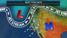
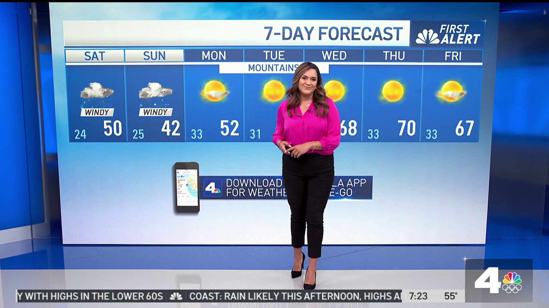
That dip allows winds to come out of the southwest and over Southern California, removing smoke as they blow through. The changes also mean some gradual cooling over the next few days.
By the weekend, temperatures might drop by 5 to 10 degrees. By next week, the area of high pressure will be so far to the east that it will feel more like fall, which starts Tuesday.
